File:Geibikei Gorge Aerial photograph.1977.jpg
Jump to navigation
Jump to search
Size of this preview: 800 × 350 pixels. Other resolutions: 320 × 140 pixels | 640 × 280 pixels | 1,024 × 448 pixels | 1,280 × 560 pixels | 4,198 × 1,837 pixels.
Original file (4,198 × 1,837 pixels, file size: 9.76 MB, MIME type: image/jpeg)
Captions
Captions
Add a one-line explanation of what this file represents
Summary[edit]
| Description |
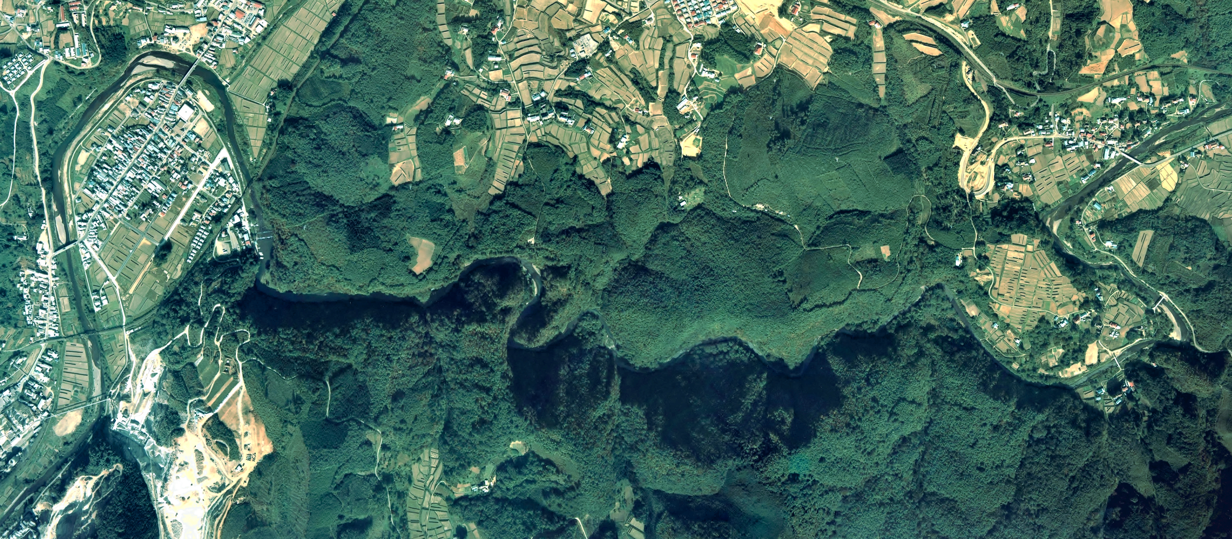
English: Geibikei Gorge Aerial photograph.1977
日本語: 猊鼻渓(岩手県一関市)付近の空中写真。Cto-77-9_c1の4,5、合計2枚を合成作成。 |
| Date | |
| Source | 国土情報ウェブマッピングシステム |
| Author | 国土交通省 |
Licensing[edit]

|
The copyright holder of this file, the Ministry of Land, Infrastructure, Transport and Tourism of Japan, allows anyone to use it for any purpose, provided that the copyright holder is properly attributed. Redistribution, derivative work, commercial use, and all other use is permitted. |
Attribution:
Copyright © National Land Image Information (Color Aerial Photographs), Ministry of Land, Infrastructure, Transport and Tourism
|
 |
This image is copyrighted by the Ministry of Land, Infrastructure, Transport and Tourism of Japan. For terms of use, see the stipulation to use of National Land Information (in Japanese) and message from MLIT (in Japanese and English). When you display this image on an article, include the following phrase in the description: "Made based on National Land Image Information (Color Aerial Photographs), Ministry of Land, Infrastructure, Transport and Tourism".
|
File history
Click on a date/time to view the file as it appeared at that time.
| Date/Time | Thumbnail | Dimensions | User | Comment | |
|---|---|---|---|---|---|
| current | 08:47, 24 October 2017 | | 4,198 × 1,837 (9.76 MB) | Togabi (talk | contribs) | Color adjustment. |
| 06:10, 11 December 2013 |  | 4,198 × 1,837 (6.22 MB) | さかおり (talk | contribs) | {{Information |Description ={{en|1=Geibikei Gorge Aerial photograph.1977}} {{ja|1=猊鼻渓(岩手県一関市)付近の空中写真。Cto-77-9_c1の4,5、合計2枚を合成作成。}} |Source =国土情報ウェブマッピングシス... |
You cannot overwrite this file.
File usage on Commons
The following page uses this file:
File usage on other wikis
The following other wikis use this file:
- Usage on ja.wikipedia.org