File:GF-Map-Page-2.pdf
Jump to navigation
Jump to search

Size of this JPG preview of this PDF file: 800 × 562 pixels. Other resolutions: 320 × 225 pixels | 640 × 450 pixels | 1,024 × 719 pixels | 1,280 × 899 pixels | 2,456 × 1,725 pixels.
Original file (2,456 × 1,725 pixels, file size: 1.04 MB, MIME type: application/pdf)
Captions
Captions
Add a one-line explanation of what this file represents
Summary[edit]
| Description |
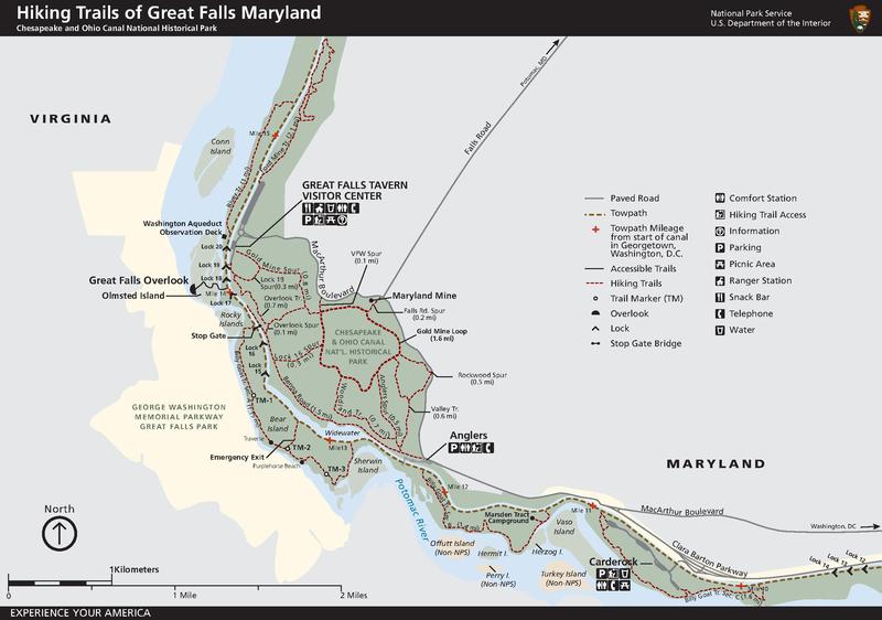
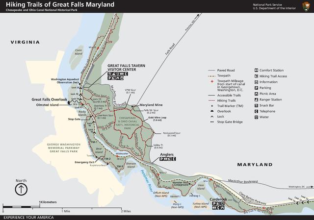
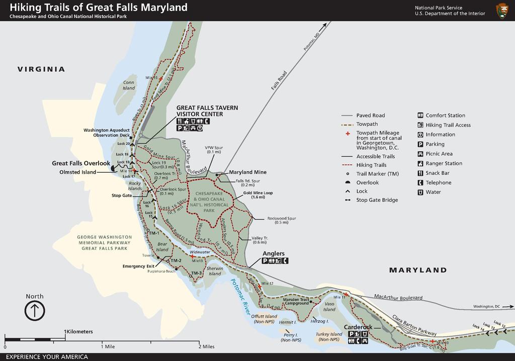
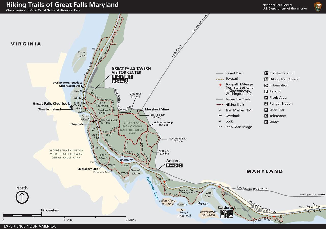
English: Map of trails in the Great Falls area, from NPS. |
| Source | http://www.nps.gov/choh/planyourvisit/upload/GF-Map-Page-2.pdf |
| Author | [1] US National Park Service |
| Other versions |
.jpg)
Licensing[edit]
| This image or media file contains material based on a work of a National Park Service employee, created as part of that person's official duties. As a work of the U.S. federal government, such work is in the public domain in the United States. See the NPS website and NPS copyright policy for more information. |
File history
Click on a date/time to view the file as it appeared at that time.
| Date/Time | Thumbnail | Dimensions | User | Comment | |
|---|---|---|---|---|---|
| current | 00:26, 26 April 2013 |  | 2,456 × 1,725 (1.04 MB) | Bonnachoven (talk | contribs) | {{Information |Description ={{en|1=Map of trails in the Great Falls area, from NPS. }} |Source =http://www.nps.gov/choh/planyourvisit/upload/GF-Map-Page-2.pdf |Author =[http://www.nps.gov/choh/] US National Park Service |Date ... |
You cannot overwrite this file.
File usage on Commons
The following page uses this file: