File:France (orthographic projection).svg
Jump to navigation
Jump to search

Size of this PNG preview of this SVG file: 600 × 600 pixels. Other resolutions: 240 × 240 pixels | 480 × 480 pixels | 768 × 768 pixels | 1,024 × 1,024 pixels | 2,048 × 2,048 pixels | 792 × 792 pixels.
Original file (SVG file, nominally 792 × 792 pixels, file size: 2.94 MB)
Captions
Captions
Add a one-line explanation of what this file represents
Summary[edit]
| Description |
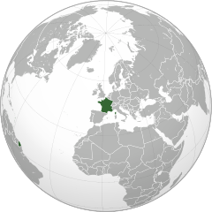
English: Orthographic Projection Map of France
Français : Carte en projection orthographique de la France |
||
| Date | |||
| Source | Ssolbergj's work, Natural Earth countries dataset 110m | ||
| Author | Damouns, Ssolbergj | ||
| Other versions |
.svg)
|
.svg)
.svg)
.svg)
.svg)
.svg)
.svg)
.svg)
.svg)
.svg)
.svg)
.svg)
.svg)
.svg)
.svg)
.svg)
.svg)
.svg)
.svg)
.svg)
.svg)
.svg)
.svg)
.svg)
.svg)
.svg)
.svg)
.svg)
.svg)
.svg)
.svg)
.svg)
.svg)
.svg)
.svg)
.svg)
.svg)
.svg)
.svg)
.svg)
.svg)
.svg)
.svg)
.svg)
.svg)
.svg)
.svg)
.svg)
.svg)
.svg)
.svg)
.svg)
.svg)
.svg)
.svg)
.svg)
.svg)
.svg)
.svg)
.svg)
.svg)
.svg)
.svg)
.svg)
.svg)
.svg)
.svg)
.svg)
.svg)
.svg)
.svg)
.svg)
.svg)
.svg)

.svg)

.svg)

.svg)
.svg)
.svg)
.svg)
.svg)
.svg)
.svg)


.svg)
.svg)
.svg)
.svg)
.svg)
.svg)
.svg)

.svg)
.svg)
.svg)
.svg)
.svg)
.svg)
.svg)
.svg)
.svg)

.svg)
.svg)
.svg)
.svg)
.svg)
.svg)
.svg)
_without_national_boundaries.svg)
.svg)
.svg)
.svg)
.svg)
.svg)
.svg)

.svg)
.svg)
.png)
.svg)
.svg)
.svg)
.svg)

.svg)
.svg)
.svg)
.svg)
.svg)
.svg)
.svg)
.svg)
.svg)
.svg)
.svg)

.svg)
.svg)
.svg)
.svg)
.svg)
.svg)
.svg)
.svg)
.svg)

.svg)
.svg)

.svg)
.svg)
.svg)
.svg)
.svg)
.svg)
.svg)
.svg)
.svg)
.svg)
.svg)
.svg)
.svg)
.svg)
.svg)
.svg)
.svg)
.svg)
.svg)
.svg)
.svg)
.svg)
.svg)
.svg)
.svg)
.svg)
.svg)
_-_Crimea_disputed.svg)
.svg)
.svg)
.svg)
.svg)
.svg)
.svg)
.svg)
.svg)
.svg)
.svg)
.svg)
_political.svg)
.svg)
.svg)
.svg)
.svg)
_-_Crimea_disputed_-_no_borders.svg)
.svg)
.svg)
.svg)
.svg)
.svg)
.svg)
.svg)
.svg)
.svg)
.svg)
.svg)

.svg)
.svg)
.svg)

.png)
.svg)
.svg)
.svg)
.svg)
.svg)
.svg)
.svg)
.svg)
.svg)
.svg)
.svg)
.svg)
.svg)
.svg)
.svg)
.svg)
.svg)
.svg)
.svg)
.svg)
.svg)
.svg)
.svg)
.svg)
.svg)
.svg)
.svg)
.svg)
.svg)
.svg)
.svg)
.svg)
.svg)
.svg)
.png)
.svg)
.svg)
.svg)
_(orthographic_projection).png)
.svg&action=edit§ion=1)
.svg)
.svg)
Licensing[edit]
.svg&action=edit§ion=2)
| This work is ineligible for copyright and therefore in the public domain because it consists entirely of information that is common property and contains no original authorship. |
File history
Click on a date/time to view the file as it appeared at that time.
| Date/Time | Thumbnail | Dimensions | User | Comment | |
|---|---|---|---|---|---|
| current | 10:45, 14 June 2015 | | 792 × 792 (2.94 MB) | Rob984 (talk | contribs) | Higher quality projection. Lakes and disputed territories restored. Correct colour scheme per convention. Derived from: File:France on the globe (France centered).svg by user:Addicted04. |
| 16:38, 19 March 2015 |  | 553 × 553 (337 KB) | Flappiefh (talk | contribs) | Added Western Sahara, fixed Somalia and removed Kosovo. | |
| 18:57, 3 March 2014 |  | 550 × 550 (571 KB) | Rob984 (talk | contribs) | Removed background | |
| 14:05, 25 January 2012 |  | 550 × 550 (404 KB) | Damouns (talk | contribs) | New version based on Natural Earth dataset with a projection centered on France. | |
| 10:26, 1 September 2011 |  | 550 × 550 (470 KB) | Sammy pompon (talk | contribs) | u | |
| 13:41, 5 July 2011 |  | 550 × 550 (468 KB) | Sammy pompon (talk | contribs) | Added Corsica | |
| 01:11, 27 September 2010 |  | 550 × 550 (467 KB) | Addicted04 (talk | contribs) | new map | |
| 16:29, 19 September 2010 |  | 550 × 550 (183 KB) | Scaler (talk | contribs) | {{Information |Description={{en|1=Orthographic Projection Map of France}} {{fr|1=Carte en projection orthographique de la France}} |Source=Ssolbergj's work |Author=Scaler, Ssolbergj |Date=2010-09-19 |Permission= |other_versions={{User:Ssol |
.svg)
You cannot overwrite this file.
File usage on Commons
More than 100 pages use this file. The following list shows the first 100 pages that use this file only. A full list is available.
.svg)
- Grey–green orthographic projections maps
- User:Heraldry/Projections
- User:Ssolbergj/orthographic
- File:ALBA (orthographic projection).png
- File:Africa (orthographic projection).svg
- File:African Union (orthographic projection).svg
- File:Almoravid map.svg
- File:America do Sul (orthographic projection).jpg
- File:Americas (orthographic projection).svg
- File:Andean Community (orthographic projection).svg
- File:Antarctica (orthographic projection).svg
- File:Antillas (orthographic projection).svg
- File:Arctic (orthographic projection).svg
- File:Argentina (orthographic projection).png
- File:Argentina (orthographic projection).svg
- File:Aridoamerica (orthographic projection).svg
- File:Armenia (orthographic projection).svg
- File:Asia (orthographic projection).svg
- File:Association of Southeast Asian Nations (orthographic projection).svg
- File:Australia-New Guinea (orthographic projection).svg
- File:Australia (orthographic projection).svg
- File:Australia map with outlying islands.svg
- File:Bhutan (orthographic projection).svg
- File:Brazil (orthographic projection).svg
- File:CECAFA-Map.svg
- File:Canada (orthographic projection).svg
- File:Cape Verde (orthographic projection).svg
- File:Captaincy General of Chile (orthographic projection).svg
- File:Central America (orthographic projection).svg
- File:Central Asia (orthographic projection).svg
- File:Chile (orthographic projection).svg
- File:Colombia (orthographic projection).svg
- File:Democratic Republic of the Congo (orthographic projection).svg
- File:Denmark (orthographic projection).svg
- File:Dominion of Pakistan & Indian Controlled Kashmir (orthographic projection).svg
- File:East Asia (orthographic projection).svg
- File:Ecuador (orthographic projection).svg
- File:Europe (orthographic projection).svg
- File:European Union (orthographic projection).svg
- File:Federal Republic of Central America (orthographic projection).svg
- File:First Brazilian Empire (orthographic projection).svg
- File:First Mexican Empire (orthographic projection).svg
- File:Georgia (orthographic projection).svg
- File:Germany (orthographic projection).svg
- File:Global European Union.svg
- File:Great Colombia (orthographic projection).svg
- File:Greater Middle East (orthographic projection).svg
- File:Haiti (orthographic projection).svg
- File:India (orthographic projection).svg
- File:Indonesia (orthographic projection).svg
- File:Iran (orthographic projection).svg
- File:Iraq (orthographic projection).svg
- File:Jamaica (orthographic projection).svg
- File:Japan (orthographic projection).svg
- File:Kazakhstan (orthographic projection).svg
- File:Latin America (orthographic projection).svg
- File:Lusophone America (orthographic projection).svg
- File:MERCOSUR (orthographic projection).svg
- File:Madagascar (orthographic projection).svg
- File:Maghreb (orthographic projection).svg
- File:Malaysia (orthographic projection).svg
- File:Mayan languages (orthographic projection).svg
- File:Mesoamerica (orthographic projection) with borders.svg
- File:Mexico (orthographic projection).svg
- File:Mexico and Central America (orthographic projection).svg
- File:Middle East (orthographic projection).svg
- File:Mongolia (orthographic projection).svg
- File:New Spain (orthographic projection).svg
- File:New Zealand (orthographic projection).svg
- File:Nigeria (orthographic projection).svg
- File:North Africa (orthographic projection).svg
- File:North America (orthographic projection).svg
- File:North American Agreement (orthographic projection).svg
- File:North Korea (orthographic projection).svg
- File:Papua New Guinea (orthographic projection).svg
- File:Paraguay (orthographic projection).svg
- File:People's Republic of China (orthographic projection).svg
- File:Peru (orthographic projection).svg
- File:Peru–Bolivia Confederation (orthographic projection).svg
- File:Philippines (orthographic projection).svg
- File:Republic of Artsakh (orthographic projection).svg
- File:Republic of China (orthographic projection).svg
- File:Rio Group (orthographic projection).svg
- File:Roman Empire (orthographic projection).svg
- File:Russian Federation (orthographic projection).svg
- File:Second Mexican Empire (orthographic projection).svg
- File:South Asia (orthographic projection) without national boundaries.svg
- File:South Korea (orthographic projection).svg
- File:Southern Europe (orthographic projection).svg
- File:Tawantinsuyu (orthographic projection).svg
- File:The Philippines and ASEAN (orthographic projection).svg
- File:Third Reich (orthographic projection).svg
- File:Tunisia (orthographic projection).svg
- File:Turkey (orthographic projection).svg
- File:Union of South American Nations (orthographic projection).svg
- File:Union of Soviet Socialist Republics (orthographic projection).svg
- File:United Provinces of Central America (orthographic projection).svg
- File:Venezuela (orthographic projection).svg
- File:Viceroyalty of Peru (orthographic projection).svg
- File:Viceroyalty of the Río de la Plata (orthographic projection).svg
.png)
.svg)
.jpg)
.svg)
.svg)
.png)
.svg)
.svg)
.svg)
.svg)
.svg)
.svg)
.svg)
_with_borders.svg)
.svg)
.svg)
.svg)
.svg)
.svg)
.svg)
View more links to this file.
File usage on other wikis
The following other wikis use this file:
- Usage on af.wikipedia.org
- Usage on ban.wikipedia.org
- Usage on ca.wikinews.org
- Usage on chr.wikipedia.org
- Usage on el.wikinews.org
- Ελεύθεροι δύο Γάλλοι δημοσιογράφοι όμηροι στο Αφγανιστάν
- Πρότυπο:Γαλλία
- Στάσιμη η οικονομία της Γαλλίας το δεύτερο τρίμηνο
- Σήμερα αρχίζει η δίκη του Ζακ Σιράκ
- Έκρηξη σε εργοστάσιο επεξεργασίας αποβλήτων στη Γαλλία
- Η Εισαγγελία του Παρισιού ζητά την απαλλαγή του Ζακ Σιράκ
- Γαλλία: Νίκη των σοσιαλιστών στη γερουσία
- Μια καθηγήτρια αυτοπυρπολήθηκε μπροστά σε μαθητές στην Γαλλία
- Ο Φρανσουά Ολάντ επικράτησε στις εκλογές των Σοσιαλιστών
- Ανοιχτό το ενδεχόμενο κατάργησης μπόνους και μερισμάτων των τραπεζών στην Γαλλία
- Χιλιάδες αστυνομικοί στην Νίκαια ετοιμάζονται για διαδηλώσεις κατά τη σύσκεψη της G20
- Εθνική κινητοποίηση στην Γαλλία στις 13 Δεκεμβρίου
- Από ενθέματα στήθους πέθανε μια 53χρονη Γαλλίδα
- Προβλήματα προκάλεσε η απεργία στις αερομεταφορές στην Γαλλία
- Η Γαλλία θέλει να αντλήσει 178 δισεκατομμύρια ευρώ από τις αγορές το 2012
- Ύποπτη μια τραπεζική υπάλληλος στην Γαλλία για υπεξαίρεση τριών εκατομμυρίων ευρώ
- Περίπου 900 εργοστάσια έκλεισαν μέσα σε τρία χρόνια στην Γαλλία
- Ο Νικολά Σαρκοζί θ' ανακοινώσει την υποψηφιότητα του για την προεδρία της Γαλλίας
- Μικρή άνοδο παρουσίασε η καταναλωτική εμπιστοσύνη στη Γαλλία
- Η Γαλλία απέρριψε τον νόμο για τη γενοκτονία των Αρμενίων
- H Γαλλία μπορεί να αναστείλει την συμμετοχή της στην Συνθήκη Σέγκεν
- Οι γαλλικές αρχές αναζητούν το δράστη των δολοφονιών στην Τουλούζη
- Γαλλία: Τρεις εκρήξεις ακούστηκαν κοντά στο σπίτι του υπόπτου στην Τουλούζη
- Οι μισοί Γάλλοι θεωρούν αυξημένη την τρομοκρατική απειλή
- Ο Φρανσουά Ολάντ νικητής του πρώτου γύρου προεδρικών εκλογών στη Γαλλία
- Αλλαγή του οικονομικού προγράμματος στην Ελλάδα θα προτείνει ο Φρανσουά Ολάντ
- Ο Φρανσουά Ολάντ έγινε νέος Πρόεδρος της Γαλλίας
- Επαφές του Φρανσουά Ολάντ με Ευρωπαίους εταίρους
- Παραιτήθηκε και επίσημα η Κυβέρνηση του Νικολά Σαρκοζί
- Οι μισθοί του Προέδρου της Γαλλίας και των Γάλλων βουλευτών μειώθηκαν κατά 30%
- Αυξήθηκαν οι καταναλωτικές δαπάνες στην Γαλλία
- Επεισόδιο με δύο νεκρούς σε κέντρο της Λιλ
- Στο Παρίσι η Χίλαρι Κλίντον
- Γαλλία: Εκατοντάδες αστυνομικοί στους δρόμους της πόλης Αμιένη
- Αυξήθηκε σε μερικούς τομείς ο δείκτης PMI στη Γαλλία
- Δύο νεκροί και οκτώ τραυματίες από ανατροπή πούλμαν στη Γαλλία
- Ένας νεκρός και 10 συλληφθέντες σε αντιτρομοκρατική επιχείρηση στη Γαλλία
- Γαλλία: Συνελήφθη ανώτερο διοικητικό στέλεχος της Βασκικής ΕΤΑ
- Το Συνταγματικό Δικαστήριο της Γαλλίας απορρίπτει τον φόρο Ολάντ
- Απαγγέλθηκαν κατηγορίες για τις δολοφονίες Κούρδων ακτιβιστριών στο Παρίσι
- Εκατοντάδες Ισλαμιστές σκοτώθηκαν στο Μάλι
- Μικρή ανάπτυξη αναμένει η Κεντρική Τράπεζα της Γαλλίας
- Επίθεση σε καθολική εκκλησία στη Γαλλία
- Νίκη του Εμανουέλ Μακρόν στις προεδρικές εκλογές της Γαλλίας
- Usage on en.wikipedia.org
View more global usage of this file.
.svg)
.svg&oldid=753535584)