File:Five Ways ... a cross roads. - geograph.org.uk - 1720232.jpg
Jump to navigation
Jump to search

Size of this preview: 800 × 600 pixels. Other resolutions: 320 × 240 pixels | 640 × 480 pixels | 1,024 × 768 pixels | 1,280 × 960 pixels | 1,600 × 1,200 pixels.
Original file (1,600 × 1,200 pixels, file size: 683 KB, MIME type: image/jpeg)
Captions
Captions
Add a one-line explanation of what this file represents
Summary[edit]
| Description |
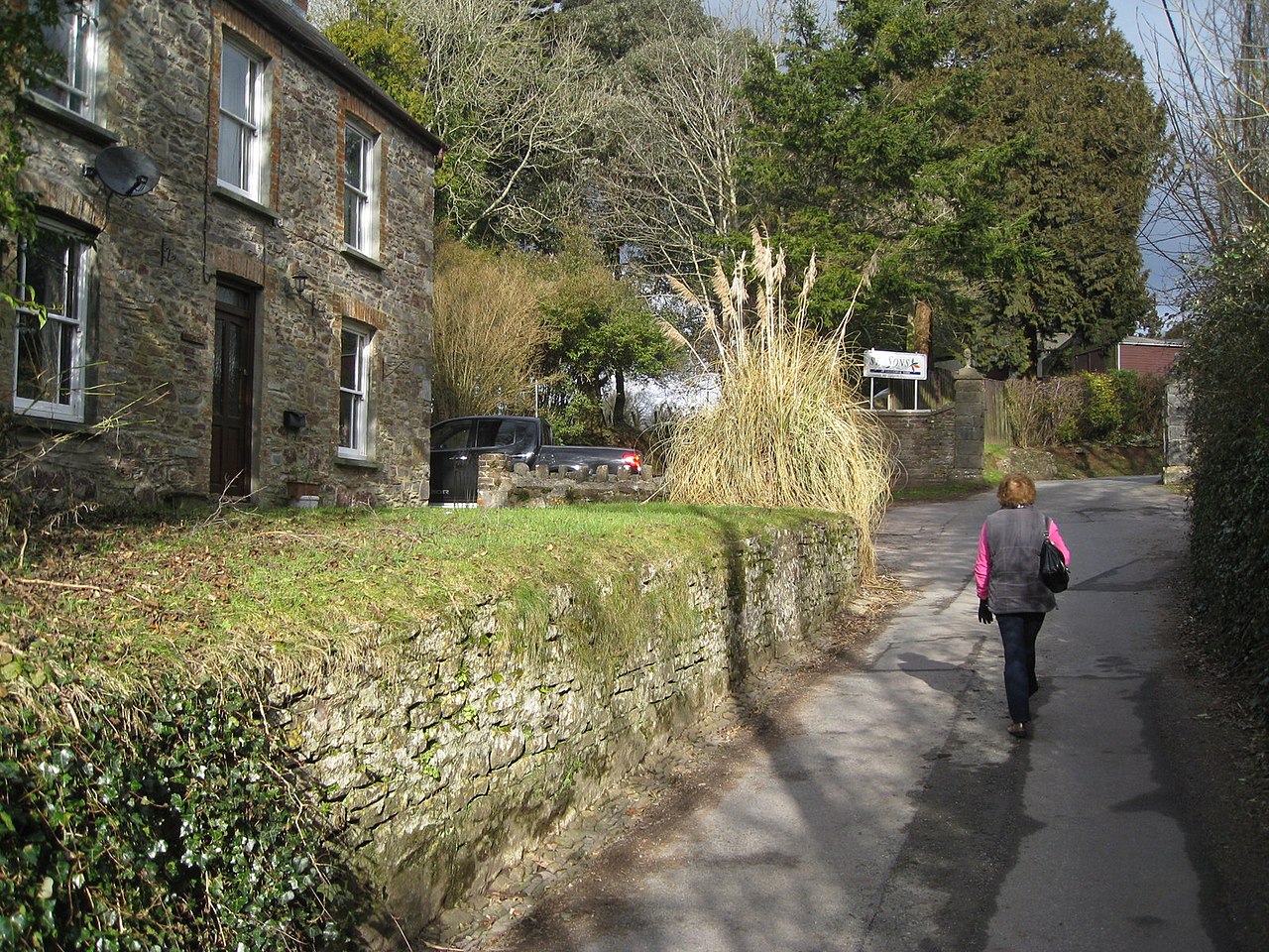
English: Five Ways ... a cross roads. This location gives the option of five ways to travel.
To the left is a bridle way which meanders along an almost level path passed the village churchyard where Dylan Thomas is buried. Another path to the left at the junction, heads up the hill along a very rough public footpath to the top of the hill. The road ahead is private and leads into Laugharne Park now a holiday lodge development. The combined road and footpath to the right contours along the cliff top towards Milk Wood passing on the way Dylan Thomas' Cartref 'The Boat House'. The photograph was taken on the road coming out of Laugharne village. |
| Date | |
| Source | From geograph.org.uk |
| Author | Colin Vosper |
| Attribution (required by the license) | Colin Vosper / Five Ways ... a cross roads. / |
| Camera location | | View this and other nearby images on: OpenStreetMap |
|---|
| Object location | | View this and other nearby images on: OpenStreetMap |
|---|
Licensing[edit]

|
This image was taken from the Geograph project collection. See this photograph's page on the Geograph website for the photographer's contact details. The copyright on this image is owned by Colin Vosper and is licensed for reuse under the Creative Commons Attribution-ShareAlike 2.0 license.
|
This file is licensed under the Creative Commons Attribution-Share Alike 2.0 Generic license.
Attribution: Colin Vosper
- You are free:
- to share – to copy, distribute and transmit the work
- to remix – to adapt the work
- Under the following conditions:
- attribution – You must give appropriate credit, provide a link to the license, and indicate if changes were made. You may do so in any reasonable manner, but not in any way that suggests the licensor endorses you or your use.
- share alike – If you remix, transform, or build upon the material, you must distribute your contributions under the same or compatible license as the original.

_heading:45.00&language=en)
_heading:45.00&language=en)
File history
Click on a date/time to view the file as it appeared at that time.
| Date/Time | Thumbnail | Dimensions | User | Comment | |
|---|---|---|---|---|---|
| current | 11:39, 5 March 2011 | | 1,600 × 1,200 (683 KB) | GeographBot (talk | contribs) | == {{int:filedesc}} == {{Information |description={{en|1=Five Ways ... a cross roads. This location gives the option of five ways to travel. To the left is a bridle way which meanders along an almost level path passed the village churchyard where Dyla |
You cannot overwrite this file.
File usage on Commons
There are no pages that use this file.