Category:Laugharne Township
Jump to navigation
Jump to search
community in Carmarthenshire, Wales | |||||
| Upload media | |||||
| Pronunciation audio | |||||
|---|---|---|---|---|---|
| Instance of | |||||
| Location | Carmarthenshire, Wales | ||||
 | |||||
Subcategories
This category has the following 6 subcategories, out of 6 total.
Media in category "Laugharne Township"
The following 200 files are in this category, out of 313 total.
(previous page) (next page)-
 'Holey' sand on Pendine beach - geograph.org.uk - 5419700.jpg 2,285 × 1,714; 720 KB
-
 A view of the estuary - geograph.org.uk - 4159196.jpg 4,320 × 3,240; 2.88 MB
-
 A winter view - Salt marshes south of Laugharne - geograph.org.uk - 1710959.jpg 1,600 × 1,200; 554 KB
-
 A4066 at Brook - geograph.org.uk - 3267669.jpg 640 × 480; 61 KB
-
 A4066 at Laugharne village boundary - geograph.org.uk - 3267657.jpg 640 × 479; 52 KB
-
 A4066 at Llansadurnen - geograph.org.uk - 3267667.jpg 640 × 480; 58 KB
-
 Afon Taf near Laugharne - geograph.org.uk - 4159193.jpg 3,240 × 4,320; 3.06 MB
-

-
 Bannister Farm, Laugharne - geograph.org.uk - 578592.jpg 640 × 468; 111 KB
-
 Beach south of Pendine Burrows - geograph.org.uk - 5419703.jpg 2,285 × 1,714; 648 KB
-
 Bend in the sea wall, Laugharne - geograph.org.uk - 578543.jpg 640 × 475; 95 KB
-
 Boat House, Laugharne - geograph.org.uk - 6168036.jpg 2,560 × 1,884; 2.92 MB
-
 Bridle way at the edge of the marsh - geograph.org.uk - 4161204.jpg 4,320 × 3,240; 4.24 MB
-
 Broadway - geograph.org.uk - 4625092.jpg 640 × 480; 122 KB
-
 Brook Farm, Llanmiloe - geograph.org.uk - 2667587.jpg 3,648 × 2,736; 3.2 MB
-
 Buildings Farm - geograph.org.uk - 3410283.jpg 1,024 × 680; 228 KB
-
 Buildings near Brill - geograph.org.uk - 4838534.jpg 2,576 × 1,932; 1.22 MB
-
 Bull rushes and water tanks at Brill - geograph.org.uk - 4838402.jpg 2,576 × 1,932; 1.23 MB
-
 Butchers Arms Court, Laugharne - geograph.org.uk - 4336212.jpg 1,600 × 1,062; 341 KB
-
 Castle Back, Laugharne - geograph.org.uk - 6193728.jpg 2,560 × 1,708; 4.04 MB
-

-
 Changing the landscape of the Laugharne marshes - geograph.org.uk - 1710948.jpg 1,600 × 1,197; 429 KB
-
 Clifton Auto ^ Marine, Laugharne - geograph.org.uk - 4094481.jpg 800 × 706; 127 KB
-
 Closed Baptist Chapel, Plashett - geograph.org.uk - 4838368.jpg 2,576 × 1,932; 1.14 MB
-
 Coastal path and castle turret - Laugharne - geograph.org.uk - 3051608.jpg 3,000 × 1,987; 4.74 MB
-
 Cors field, Laugharne - geograph.org.uk - 4674875.jpg 2,576 × 1,932; 1.1 MB
-
 Cors field, Laugharne - geograph.org.uk - 4674897.jpg 2,576 × 1,932; 1.09 MB
-
 Coygen Quarry entrance - geograph.org.uk - 4161195.jpg 4,320 × 3,240; 3.56 MB
-
 Dead end road - on way down to Coygan Quarry - geograph.org.uk - 4838395.jpg 2,576 × 1,932; 1.1 MB
-
 Dylan Thomas' Boathouse - geograph.org.uk - 6206721.jpg 640 × 480; 43 KB
-
 Dylan Thomas's Boat House - geograph.org.uk - 4857801.jpg 640 × 428; 76 KB
-
 Dylan's Birthday Walk, Laugharne - geograph.org.uk - 4336289.jpg 1,600 × 1,599; 1.01 MB
-
 East along Pendine Sands - geograph.org.uk - 5419705.jpg 2,285 × 1,714; 627 KB
-
 East Hill Farm, Clifton Street, Laugharne - geograph.org.uk - 3216936.jpg 2,576 × 1,932; 831 KB
-
 Entrance to Coygen Quarry - Broadway - geograph.org.uk - 3052155.jpg 1,024 × 678; 221 KB
-
 Farmland near Llandawke - geograph.org.uk - 1316524.jpg 640 × 480; 119 KB
-
 Farmland without sheep near Llandawke - geograph.org.uk - 1316529.jpg 640 × 480; 167 KB
-
 Ffarm Hills - Hills Farm - geograph.org.uk - 4627395.jpg 640 × 480; 90 KB
-
 Field edge and red flag, Laugharne - geograph.org.uk - 596412.jpg 640 × 475; 93 KB
-
 Five Ways ... a cross roads. - geograph.org.uk - 1720232.jpg 1,600 × 1,200; 683 KB
-
 Footbridge to St Martins - geograph.org.uk - 4858128.jpg 640 × 428; 125 KB
-
 Footpath and tree, Laugharne - geograph.org.uk - 581208.jpg 640 × 474; 110 KB
-
 Footpath at side of closed chapel, Plashett - geograph.org.uk - 4838382.jpg 2,576 × 1,932; 1.19 MB
-

-
 Footpath by-passing Salt House Farm - geograph.org.uk - 2374845.jpg 640 × 480; 98 KB
-
 Footpath, Laugharne - geograph.org.uk - 581235.jpg 640 × 468; 119 KB
-
 Foreshore Path, Laugharne - geograph.org.uk - 6168144.jpg 2,560 × 1,708; 3.65 MB
-
 Frogmore Gardens bungalows, Laugharne - geograph.org.uk - 4082635.jpg 800 × 475; 118 KB
-
 From one field to the next, Laugharne - geograph.org.uk - 596478.jpg 640 × 480; 180 KB
-
 Garage of Dylan Thomas's boathouse - geograph.org.uk - 2056773.jpg 480 × 640; 116 KB
-
 Gate and old tree, east of Delacorse Farm - geograph.org.uk - 2154840.jpg 1,024 × 768; 392 KB
-
 Ger Talacharn - Near Laugharne - geograph.org.uk - 4625120.jpg 640 × 480; 128 KB
-
 Gosport Street, Laugharne - geograph.org.uk - 3267661.jpg 640 × 480; 59 KB
-
 Graveyard at St Martin's Church - geograph.org.uk - 5227429.jpg 1,600 × 1,064; 596 KB
-

-
-
 Houses on Clifton St - geograph.org.uk - 4858100.jpg 640 × 428; 76 KB
-

-

-
 Inlet of River Taf at Laugharne - geograph.org.uk - 2056769.jpg 480 × 640; 103 KB
-
 Inside Laugharne Castle - geograph.org.uk - 5809148.jpg 5,184 × 3,888; 5.86 MB
-
 Kissing gate, Laugharne - geograph.org.uk - 1017510.jpg 640 × 467; 126 KB
-

-
 Lane by St Martin's Church, Laugharne - geograph.org.uk - 5718141.jpg 436 × 582; 121 KB
-

-
 Laugharne - Clifton Street sign - geograph.org.uk - 5108246.jpg 2,576 × 1,932; 1.28 MB
-
 Laugharne - high tide coming in - geograph.org.uk - 4692204.jpg 2,576 × 1,932; 1.26 MB
-
 Laugharne - high tide coming in - geograph.org.uk - 4692251.jpg 2,576 × 1,932; 1.26 MB
-
 Laugharne - high tide coming in - geograph.org.uk - 4692256.jpg 2,576 × 1,932; 1.25 MB
-
 Laugharne - high tide coming in - geograph.org.uk - 4692260.jpg 2,576 × 1,932; 1.26 MB
-
 Laugharne - high tide coming in - geograph.org.uk - 4693424.jpg 2,576 × 1,932; 1.23 MB
-
 Laugharne - high tide coming in - geograph.org.uk - 4693425.jpg 2,576 × 1,932; 1.22 MB
-
 Laugharne - high tide coming in - geograph.org.uk - 4693426.jpg 2,576 × 1,932; 1.25 MB
-
 Laugharne - high tide coming in - geograph.org.uk - 4693430.jpg 2,576 × 1,932; 1.23 MB
-
 Laugharne - old wall by Town Hall - geograph.org.uk - 5130311.jpg 2,576 × 1,932; 1.14 MB
-
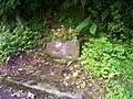
 Laugharne - parish boundary stone hidden in hedge - geograph.org.uk - 5251188.jpg 2,576 × 1,932; 1.08 MB
-
 Laugharne - parish boundary stone hidden in hedge - geograph.org.uk - 5251192.jpg 2,576 × 1,932; 1.07 MB
-
 Laugharne - parish boundary stone hidden in hedge - geograph.org.uk - 5251193.jpg 2,576 × 1,932; 1.04 MB
-
 Laugharne - parish boundary stone hidden in hedge - geograph.org.uk - 5251195.jpg 2,268 × 1,789; 901 KB
-
 Laugharne - rural view - geograph.org.uk - 5251198.jpg 2,576 × 1,932; 1.19 MB
-
 Laugharne - rural view - geograph.org.uk - 5251200.jpg 2,576 × 1,932; 1.19 MB
-
 Laugharne - slipway - geograph.org.uk - 4814390.jpg 2,576 × 1,932; 1.26 MB
-
 Laugharne Boat House from across the saltings - geograph.org.uk - 6193793.jpg 2,560 × 1,708; 2.81 MB
-
 Laugharne Castle - bird - geograph.org.uk - 4677379.jpg 2,576 × 1,932; 1.25 MB
-
 Laugharne Castle - geograph.org.uk - 4814423.jpg 2,576 × 1,932; 1.24 MB
-
 Laugharne Castle - geograph.org.uk - 6193771.jpg 2,560 × 1,708; 3 MB
-
 Laugharne castle - geograph.org.uk - 6206710.jpg 640 × 480; 32 KB
-
 Laugharne Castle - geograph.org.uk - 6283493.jpg 2,592 × 1,944; 1.29 MB
-
 Laugharne Castle - high tide coming in - geograph.org.uk - 4692189.jpg 2,576 × 1,932; 1.24 MB
-
 Laugharne Castle - high tide coming in - geograph.org.uk - 4692191.jpg 2,576 × 1,932; 1.2 MB
-
 Laugharne Castle - high tide coming in - geograph.org.uk - 4692202.jpg 2,576 × 1,932; 1.25 MB
-
 Laugharne Castle - high tide coming in - geograph.org.uk - 4693448.jpg 2,576 × 1,932; 1.25 MB
-
 Laugharne Castle Ford - geograph.org.uk - 6131582.jpg 3,000 × 2,000; 4.59 MB
-
 Laugharne Castle Reflection - high tide coming in - geograph.org.uk - 4692210.jpg 2,576 × 1,932; 1.21 MB
-
 Laugharne Castle walls - geograph.org.uk - 5809146.jpg 5,184 × 3,888; 6.25 MB
-
 Laugharne Estuary - geograph.org.uk - 4610247.jpg 2,576 × 1,932; 1.26 MB
-
 Laugharne Estuary - geograph.org.uk - 4610251.jpg 2,576 × 1,932; 1.27 MB
-
 Laugharne Estuary - geograph.org.uk - 4610270.jpg 2,576 × 1,932; 1.24 MB
-
 Laugharne Estuary - geograph.org.uk - 4677371.jpg 2,576 × 1,932; 1.23 MB
-
 Laugharne Estuary - geograph.org.uk - 4677389.jpg 2,576 × 1,932; 1.25 MB
-
 Laugharne Estuary - geograph.org.uk - 4814408.jpg 2,576 × 1,932; 1.26 MB
-
 Laugharne Estuary - geograph.org.uk - 4814414.jpg 2,576 × 1,932; 1.26 MB
-
 Laugharne Estuary - geograph.org.uk - 4814416.jpg 2,576 × 1,932; 1.26 MB
-
 Laugharne Estuary - geograph.org.uk - 6054507.jpg 3,599 × 2,399; 1.62 MB
-
 Laugharne Estuary - small jetty - geograph.org.uk - 4814397.jpg 2,576 × 1,932; 1.25 MB
-
 Laugharne post box by church - geograph.org.uk - 5108241.jpg 2,576 × 1,932; 1.19 MB
-
 Laugharne Sands - geograph.org.uk - 1767092.jpg 2,852 × 1,833; 672 KB
-
 Laugharne Sewage Pumping Station - geograph.org.uk - 4082694.jpg 800 × 721; 243 KB
-
 Laugharne Surgery - geograph.org.uk - 4088731.jpg 800 × 551; 103 KB
-
 Laugharne Telephone Exchange - geograph.org.uk - 881247.jpg 640 × 480; 57 KB
-
 Laugharne Town Hall - Beating the Bounds map - geograph.org.uk - 5130324.jpg 1,405 × 1,388; 707 KB
-
 Laugharne Town Hall - Beating the Bounds map detail - geograph.org.uk - 5130331.jpg 2,576 × 1,932; 1.1 MB
-
 Laugharne Town Hall - detail - geograph.org.uk - 5130321.jpg 2,576 × 1,932; 1.2 MB
-
 Laugharne Town Hall - detail - geograph.org.uk - 5130347.jpg 2,576 × 1,932; 1.25 MB
-
 Laugharne Town Hall - old painting detail - geograph.org.uk - 5130352.jpg 1,848 × 920; 523 KB
-
 Laugharne ~ Sewage Works - geograph.org.uk - 1715799.jpg 1,600 × 1,200; 550 KB
-
 Laugharne, estuary - geograph.org.uk - 2087657.jpg 1,024 × 681; 131 KB
-
 Laugharne, estuary - geograph.org.uk - 2087661.jpg 1,024 × 681; 152 KB
-

-

-
 Laugharne, lane by churchyard - geograph.org.uk - 2084339.jpg 681 × 1,024; 278 KB
-
 Laugharne, lane by churchyard - geograph.org.uk - 2084350.jpg 1,024 × 681; 344 KB
-
 Laugharne, St Martin - geograph.org.uk - 5438746.jpg 4,608 × 3,456; 5.27 MB
-
 Llandawke Church - roadway - geograph.org.uk - 4680378.jpg 2,576 × 1,932; 1.2 MB
-
 Llansadurnen Church - name board and new property opposite - geograph.org.uk - 4678744.jpg 2,576 × 1,932; 1.26 MB
-
 Llansadurnen Church - rear - geograph.org.uk - 4677413.jpg 2,576 × 1,932; 1.25 MB
-
 Llansadurnen Church - west window - geograph.org.uk - 4678751.jpg 2,576 × 1,932; 1.04 MB
-
 Llwybr Delacorse Path - geograph.org.uk - 4625153.jpg 640 × 480; 128 KB
-
 Llwybr Glancorran - Glancorran Path - geograph.org.uk - 5184360.jpg 640 × 480; 93 KB
-
 Llwybr Glancorran Path - geograph.org.uk - 4625069.jpg 640 × 480; 79 KB
-
 Lon Horsepool Lane - geograph.org.uk - 4625079.jpg 640 × 480; 76 KB
-
 Longridge, Laugharne - geograph.org.uk - 583649.jpg 640 × 469; 101 KB
-
 Looking inland from well out below the low tide line - geograph.org.uk - 5419695.jpg 2,285 × 1,714; 691 KB
-
 Looking north from Brill - geograph.org.uk - 4838406.jpg 2,576 × 1,932; 1.24 MB
-
 Looking north from Brill - geograph.org.uk - 4838413.jpg 2,576 × 1,932; 1.26 MB
-
 Looking north from Brill - geograph.org.uk - 4838547.jpg 2,576 × 1,932; 1.25 MB
-
 Looking north to Coygan Quarry - geograph.org.uk - 4838524.jpg 2,576 × 1,932; 1.26 MB
-
 Looking north to Coygan Quarry - geograph.org.uk - 4838539.jpg 2,576 × 1,932; 1.28 MB
-
 Looking north to Coygan Quarry - geograph.org.uk - 4838545.jpg 2,576 × 1,932; 1.26 MB
-
 Looking towards Laugharne from Brill - geograph.org.uk - 4838415.jpg 2,576 × 1,932; 1.27 MB
-
 Looking up Church Street, Laugharne - geograph.org.uk - 3216953.jpg 1,932 × 2,576; 1.14 MB
-
 Lower Marsh - geograph.org.uk - 1463585.jpg 640 × 480; 74 KB
-
 Lower Marsh - geograph.org.uk - 1463599.jpg 640 × 480; 71 KB
-
 Lower Marsh Laugharne - geograph.org.uk - 596424.jpg 640 × 474; 83 KB
-
 Main Pill at Longridge - geograph.org.uk - 1299973.jpg 599 × 640; 188 KB
-
 Memorial Hall, Laugharne - geograph.org.uk - 3216500.jpg 1,932 × 2,576; 1.33 MB
-
 Military Road, Laugharne - geograph.org.uk - 583635.jpg 640 × 484; 70 KB
-
 Mouth of the Coran - geograph.org.uk - 4857963.jpg 640 × 428; 75 KB
-
 Mud Flats - geograph.org.uk - 5144930.jpg 1,229 × 819; 418 KB
-
 Muddy shore of the River Taf - geograph.org.uk - 2247354.jpg 640 × 480; 347 KB
-
 Newbridge Laugharne - bridge into The Cors - geograph.org.uk - 4675783.jpg 2,576 × 1,932; 1.1 MB
-
 Newbridge Laugharne - corner stone - geograph.org.uk - 4674977.jpg 2,576 × 1,932; 1.13 MB
-
 Newbridge Laugharne - geograph.org.uk - 4674844.jpg 2,576 × 1,932; 1.1 MB
-
 Newbridge Laugharne - geograph.org.uk - 4674868.jpg 2,576 × 1,932; 1.09 MB
-
 Newbridge Laugharne - geograph.org.uk - 4674890.jpg 2,576 × 1,932; 1.23 MB
-
 Newbridge Laugharne - river Coran - geograph.org.uk - 4674980.jpg 2,576 × 1,932; 1.18 MB
-
 Newbridge Laugharne - river Coran - geograph.org.uk - 4674985.jpg 2,576 × 1,932; 1.22 MB
-
 Newbridge Laugharne - stile - geograph.org.uk - 4675778.jpg 2,576 × 1,932; 1.24 MB
-
 Newbridge Laugharne - stream - geograph.org.uk - 4674902.jpg 2,576 × 1,932; 1.22 MB
-

-

-
 Old water pump - The Lacques Laugharne - geograph.org.uk - 4674760.jpg 2,576 × 1,932; 1.15 MB
-
 Old water trough - The Lacques Laugharne - dated 1909 - geograph.org.uk - 4674746.jpg 2,576 × 1,932; 1.1 MB
-
 Old water trough - The Lacques Laugharne - dated 1909 - geograph.org.uk - 4674757.jpg 2,576 × 1,932; 1.15 MB
-
 Ordnance Survey Cut Mark - geograph.org.uk - 4531025.jpg 640 × 480; 104 KB
-
 Ordnance Survey Cut Mark - geograph.org.uk - 4531030.jpg 480 × 640; 106 KB
-
 Ordnance Survey Cut Mark - geograph.org.uk - 4531032.jpg 480 × 640; 67 KB
-
 Ordnance Survey Cut Mark - geograph.org.uk - 4531038.jpg 480 × 640; 106 KB
-
 Ordnance Survey Cut Mark - geograph.org.uk - 4531043.jpg 480 × 640; 105 KB
-
 Ordnance Survey Cut Mark - geograph.org.uk - 4531108.jpg 480 × 640; 116 KB
-
 Ordnance Survey Pivot - geograph.org.uk - 4531050.jpg 640 × 480; 118 KB
-

-
 Part of Dylan's Birthday Walk, Laugharne - geograph.org.uk - 2374788.jpg 640 × 480; 120 KB
-
 Part of East Hill Farm, Clifton Street, Laugharne - geograph.org.uk - 3216930.jpg 2,576 × 1,932; 1.04 MB
-
 Path along the foreshore, Laugharne - geograph.org.uk - 6281640.jpg 1,024 × 768; 194 KB
-
 Path leading to Market Lane, Laugharne - geograph.org.uk - 4336277.jpg 1,600 × 1,062; 738 KB
-
 Path through the wood, Laugharne - geograph.org.uk - 1017499.jpg 640 × 480; 129 KB
-
 Path to a ruin, Laugharne - geograph.org.uk - 1017449.jpg 480 × 640; 103 KB
-
 Pendine Sands - geograph.org.uk - 1886633.jpg 746 × 496; 68 KB
-

-
 Plaque - Bethel Baptist Chapel, 1862 - at Plashett - geograph.org.uk - 4838374.jpg 2,576 × 1,932; 1.28 MB
-
 Plaque, The Strand, Laugharne - geograph.org.uk - 3611362.jpg 2,576 × 1,932; 1.11 MB
-

-
 Portreeve, Laugharne - geograph.org.uk - 4088817.jpg 800 × 567; 116 KB
-
 Post box at Plashett - geograph.org.uk - 4838377.jpg 1,554 × 1,435; 551 KB
-
 Railsgate Pill - geograph.org.uk - 4161223.jpg 4,320 × 3,240; 2.95 MB
-
 Railsgate Pill, Laugharne - geograph.org.uk - 583658.jpg 640 × 474; 99 KB
-

-
 River Coran, Laugharne - geograph.org.uk - 3611340.jpg 2,576 × 1,932; 955 KB
-
 River Coran, Laugharne - geograph.org.uk - 3611357.jpg 2,576 × 1,932; 956 KB
-
 River Coran, Laugharne - geograph.org.uk - 3611366.jpg 2,576 × 1,932; 777 KB
-
 River Coran, Laugharne - geograph.org.uk - 4336271.jpg 1,600 × 1,062; 680 KB
-
 River Coran, Laugharne - geograph.org.uk - 4336284.jpg 1,600 × 1,062; 620 KB
-
 Road down to Coygan Quarry - geograph.org.uk - 4838386.jpg 2,576 × 1,932; 1.23 MB
-
 Road north from Brill - geograph.org.uk - 4838528.jpg 2,576 × 1,932; 1.25 MB
-
 Road south down to Brill - geograph.org.uk - 4838551.jpg 2,576 × 1,932; 1.27 MB
-
 Salt House Farm - geograph.org.uk - 4161212.jpg 4,320 × 3,240; 5.84 MB
-
 Salt House Farm, Laugharne - geograph.org.uk - 2374851.jpg 640 × 480; 150 KB
-
 Salt marsh at Laugharne - geograph.org.uk - 6193802.jpg 2,560 × 1,708; 2.74 MB
-
 Salt marsh south of Laugharne - geograph.org.uk - 596335.jpg 640 × 471; 92 KB


