File:European Union Iceland Locator.svg
Jump to navigation
Jump to search

Size of this PNG preview of this SVG file: 587 × 600 pixels. Other resolutions: 235 × 240 pixels | 470 × 480 pixels | 752 × 768 pixels | 1,002 × 1,024 pixels | 2,004 × 2,048 pixels | 593 × 606 pixels.
Original file (SVG file, nominally 593 × 606 pixels, file size: 711 KB)
Captions
Captions
Add a one-line explanation of what this file represents
Summary[edit]
| Description |
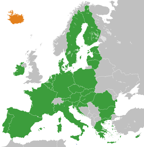
English: The European Union and Iceland
Français : L'Union Européenne à 28 sans ses frontières internes et l'Islande.
Islande
UE à 28 |
| Date | |
| Source |
Own work This W3C-unspecified vector image was created with Inkscape . |
| Author | S. Solberg J. |
| Other versions |
|
.svg)
Licensing[edit]
| I, the copyright holder of this work, release this work into the public domain. This applies worldwide. In some countries this may not be legally possible; if so: I grant anyone the right to use this work for any purpose, without any conditions, unless such conditions are required by law. |
File history
Click on a date/time to view the file as it appeared at that time.
| Date/Time | Thumbnail | Dimensions | User | Comment | |
|---|---|---|---|---|---|
| current | 13:40, 20 November 2022 | | 593 × 606 (711 KB) | M.Bitton (talk | contribs) | Reverted to version as of 01:53, 19 November 2022 (UTC): per COM:OVERWRITE. 2016 was 6 years ago, making this map stable. Feel free to upload under a different name |
| 09:00, 20 November 2022 |  | 593 × 606 (714 KB) | Рагин1987 (talk | contribs) | Removed the gray square at the maritime borders of Spain, also painted over Malta from blue to green (also a member of the EU). Slightly expanded the map to the borders of Georgia (the territory of Abkhazia), since Georgia, like Moldova, is a member of the Eastern Partnership, an associated trio and applied for EU membership. Please, before automatically referring to COM:OVERWRITE, take a close look at the history of the file, and the fact that its format was radically edited in 2016. | |
| 01:53, 19 November 2022 |  | 593 × 606 (711 KB) | M.Bitton (talk | contribs) | Reverted to version as of 12:05, 3 February 2020 (UTC): meaningless edit summary | |
| 12:54, 18 November 2022 |  | 593 × 606 (710 KB) | Рагин1987 (talk | contribs) | Small correction | |
| 12:05, 3 February 2020 |  | 593 × 606 (711 KB) | Darranc (talk | contribs) | Remove UK from EU | |
| 18:21, 26 October 2016 |  | 680 × 520 (602 KB) | Giorgi Balakhadze (talk | contribs) | Rv of sockpuppet and per COM:OVERWRITE | |
| 21:00, 15 March 2015 |  | 680 × 520 (620 KB) | Leftcry (talk | contribs) | Update layout | |
| 10:51, 11 July 2013 |  | 680 × 520 (307 KB) | Augusta 89 (talk | contribs) | Croatie (oubli) | |
| 10:13, 11 July 2013 |  | 680 × 520 (309 KB) | Augusta 89 (talk | contribs) | Localisation des micro-États européens | |
| 09:23, 1 July 2013 |  | 680 × 520 (318 KB) | Treehill (talk | contribs) | + croatia |
You cannot overwrite this file.
File usage on Commons
The following 2 pages use this file:
File usage on other wikis
The following other wikis use this file:
- Usage on de.wikipedia.org
- Usage on en.wikipedia.org
- Usage on en.wikinews.org
- Usage on es.wikinews.org
- Usage on fr.wikipedia.org
- Usage on fr.wikinews.org
- Usage on it.wikipedia.org
- Usage on mk.wikipedia.org
- Usage on pl.wikipedia.org
- Usage on sv.wikipedia.org
- Usage on tr.wikinews.org
- Usage on uk.wikipedia.org
- Usage on www.wikidata.org
- Usage on zh.wikipedia.org