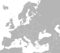
File:Europa político en blanco.png
From Wikimedia Commons, the free media repository
Jump to navigation
Jump to search

Size of this preview: 720 × 600 pixels. Other resolutions: 288 × 240 pixels | 576 × 480 pixels | 922 × 768 pixels | 1,200 × 1,000 pixels.
Original file (1,200 × 1,000 pixels, file size: 20 KB, MIME type: image/png)
File information
Structured data
Captions
Captions
Add a one-line explanation of what this file represents
Summary[edit]
| DescriptionEuropa político en blanco.png |
Español: Mapa político en blanco del continente europeo. |
| Date | |
| Source | Own work |
| Author | Fobos92 |
Licensing[edit]
I, the copyright holder of this work, hereby publish it under the following license:
This file is licensed under the Creative Commons Attribution-Share Alike 3.0 Unported license.
- You are free:
- to share – to copy, distribute and transmit the work
- to remix – to adapt the work
- Under the following conditions:
- attribution – You must give appropriate credit, provide a link to the license, and indicate if changes were made. You may do so in any reasonable manner, but not in any way that suggests the licensor endorses you or your use.
- share alike – If you remix, transform, or build upon the material, you must distribute your contributions under the same or compatible license as the original.
File history
Click on a date/time to view the file as it appeared at that time.
| Date/Time | Thumbnail | Dimensions | User | Comment | |
|---|---|---|---|---|---|
| current | 04:31, 28 March 2021 |  | 1,200 × 1,000 (20 KB) | Iketsi (talk | contribs) | *Jan Mayen. Cropped for exact 6:5 proportions. Libya no longer split in half. |
| 04:26, 28 March 2021 |  | 1,208 × 1,052 (20 KB) | Iketsi (talk | contribs) | Connected Jan Mayan and Bjørnøya to Norway; Connected Hiiumaa and Saaremaa to Estonia; Added Akrotiri and Dhekelia, Northern Cyprus, and Gibraltar; Cleaned up Morocco. | |
| 03:48, 28 March 2021 |  | 1,208 × 1,052 (20 KB) | Iketsi (talk | contribs) | Removed chromatic artifacts for a true 2-bit image. | |
| 03:32, 28 March 2021 |  | 1,208 × 1,052 (41 KB) | Iketsi (talk | contribs) | Rounded AD, MC, LI and SM; Connected Åland islands to Finland; Disconnected Crimea to reflect disputed status. | |
| 16:15, 14 November 2018 |  | 1,208 × 1,052 (41 KB) | BegbertBiggs (talk | contribs) | closed a gap in the border of Finland and Russia | |
| 03:16, 28 June 2018 |  | 1,208 × 1,052 (54 KB) | Fobos92 (talk | contribs) | . | |
| 01:07, 28 June 2018 |  | 1,208 × 1,052 (53 KB) | Fobos92 (talk | contribs) | . | |
| 00:50, 28 June 2018 |  | 1,200 × 1,000 (49 KB) | Fobos92 (talk | contribs) | . | |
| 00:23, 27 January 2018 |  | 1,200 × 1,000 (72 KB) | Fobos92 (talk | contribs) | . | |
| 16:27, 3 July 2016 |  | 1,200 × 1,000 (72 KB) | Brejnev (talk | contribs) | Corfu is part of Greece |
You cannot overwrite this file.
File usage on Commons
The following 3 pages use this file:
- User:Fobos92
- File:Europa blanco.PNG (file redirect)
File usage on other wikis
The following other wikis use this file:
- Usage on en.wikipedia.org
Hidden categories: