File:Ethnographic map of Czoernig.jpg

Original file (1,202 × 910 pixels, file size: 372 KB, MIME type: image/jpeg)
Captions
Captions
Summary[edit]
| Description |
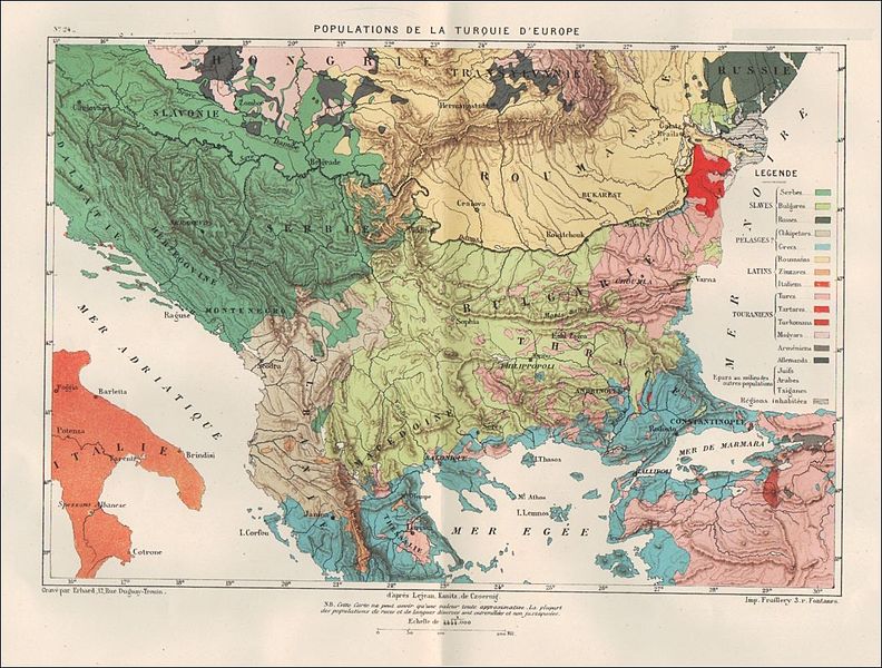
English: Etnographical map of Balkans |
| Date | before 1889 |
| Source | Self-scanned |
| Author | Karl von Czoernig-Czernhausen |
Licensing[edit]
|
This work is in the public domain in its country of origin and other countries and areas where the copyright term is the author's life plus 70 years or fewer.
| |
| This file has been identified as being free of known restrictions under copyright law, including all related and neighboring rights. | |
File history
Click on a date/time to view the file as it appeared at that time.
| Date/Time | Thumbnail | Dimensions | User | Comment | |
|---|---|---|---|---|---|
| current | 09:34, 22 January 2012 | | 1,202 × 910 (372 KB) | Подпоручикъ (talk | contribs) | {{Information |Description ={{en|1=Etnographical map of Balkans}} |Source =scanned from original |Author =Karl von Czoernig-Czernhausen |Date =before 1889 |Permission = |other_versions = }} [[Category:Ethnographers from G |
You cannot overwrite this file.
File usage on Commons
There are no pages that use this file.
File usage on other wikis
The following other wikis use this file:
- Usage on bg.wikipedia.org
- Usage on de.wikipedia.org
- Usage on fr.wikipedia.org
- Usage on it.wikipedia.org
- Usage on uk.wikipedia.org
- Historical maps of ethnic groups in Austria
- Historical maps of ethnic groups in Hungary
- Historical maps of ethnic groups in Italy
- Historical maps of ethnic groups in the Czech Republic
- Historical maps of ethnic groups in Slovakia
- Historical maps of ethnic groups in Poland
- Historical maps of ethnic groups in Ukraine
- Historical maps of ethnic groups in Romania
- Historical maps of ethnic groups in Transylvania
- Historical maps of ethnic groups in Serbia
- Historical maps of ethnic groups in Vojvodina
- Historical maps of ethnic groups in Croatia
- Historical maps of ethnic groups in Slovenia
- Historical maps of ethnic groups in the Balkans
- Ethnographic maps of the Austrian Empire
- Old maps of the Austrian Empire
- Karl von Czoernig-Czernhausen