Category:Historical maps of ethnic groups in Transylvania
Jump to navigation
Jump to search
Subcategories
This category has the following 4 subcategories, out of 4 total.
1
- 1850 census in Transylvania (20 F)
A
Media in category "Historical maps of ethnic groups in Transylvania"
The following 81 files are in this category, out of 81 total.
-
 1910年奧匈帝國民族組成.svg 1,360 × 1,052; 919 KB
-
 7 Stühle-Landkarte.svg 3,030 × 2,778; 8.17 MB
-
 Ardeal si Bucovina.JPG 6,402 × 4,764; 5.76 MB
-
 Austria hungary 1911 and post war borders.jpg 1,525 × 1,166; 389 KB
-
 Austria hungary 1911.gif 907 × 687; 397 KB
-
 Austria hungary 1911.jpg 1,521 × 1,155; 1.76 MB
-
 Austria Hungary ethnic UK.svg 512 × 396; 287 KB
-
 Austria Hungary ethnic-ar.svg 1,360 × 1,052; 1,000 KB
-
 Austria Hungary ethnic.svg 1,360 × 1,052; 1.56 MB
-
 Austria-Hungary (ethnic).JPG 5,150 × 3,395; 4.73 MB
-
 Austria-Hungary (ethnic).jpg 4,314 × 2,820; 3.63 MB
-
 Austria-Hungary ethnic map.jpg 1,623 × 1,276; 312 KB
-
 Austro-Ungaria si Romania (harta etnica).jpg 6,245 × 3,505; 6.73 MB
-
 AşezareaSaşilorTransilvania.PNG 750 × 701; 287 KB
-
 BiserciSăseştiŢaraOltului.svg 2,046 × 1,012; 3.28 MB
-
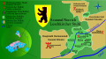
 Bistritzer sächsischer Distrikt.svg 1,123 × 589; 1.34 MB
-
 CronologieSaşiTransilvania.svg 1,209 × 1,342; 731 KB
-
 Csangos.PNG 724 × 500; 43 KB
-

-
 DE 7 Stühle-Landkarte.svg 3,030 × 2,778; 8.21 MB
-
 Deutschsieben bürgen-es.svg 695 × 568; 111 KB
-
 Deutschsieben bürgen.svg 695 × 568; 111 KB
-
 Deutschsiebenbürgen.svg 695 × 568; 93 KB
-
 Ernst-Ravenstein-Balkans-Ethnic-Map-1880.jpg 716 × 563; 160 KB
-
 Ethnic Germans in Hungary and parts of adjacent Austrian territories.JPG 3,930 × 2,842; 4.68 MB
-
 Ethnic map transylvania.png 577 × 587; 28 KB
-
 Ethnographic map of austrian monarchy czoernig 1855.jpg 7,997 × 5,862; 23.73 MB
-
 Ethnographic map of Czoernig.jpg 1,202 × 910; 372 KB
-
 Ethnographic map of hungary 1910 by teleki carte rouge.jpg 4,962 × 3,509; 5.18 MB
-
 Ethnographical map of Hungary based on density of population, Census of 1910.jpg 12,000 × 9,751; 25.69 MB
-
 Ethnographische Karte der Österreichischen Monarchie - Kartenteil 2.png 9,429 × 7,116; 81.38 MB
-
 Ethnographische Karte der Österreichischen Monarchie - Kartenteil 4.png 9,429 × 7,116; 67.8 MB
-

-
 Grossschenker Stuhl.svg 1,102 × 591; 1.49 MB
-
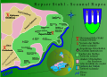
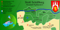
 Hauptstuhl Hermannstadt.svg 2,680 × 1,671; 2.74 MB
-
 Hermannstädter Stuhl - Josephinische Landesaufnahme, 1769-73.jpg 16,117 × 9,669; 28.52 MB
-
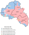
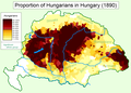 Hungarians in Hungary (1890).png 1,064 × 766; 159 KB
-
 Hungary 1941 ethnic hu.svg 860 × 490; 339 KB
-
 Hungary 1941 ethnic.svg 860 × 490; 475 KB
-
 Hungary-ethnic groups.jpg 2,913 × 2,250; 2.18 MB
-
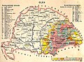
 Kogutowicz Károly Magyarország Néprajzi Térképe.jpg 2,062 × 1,372; 4.06 MB
-
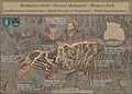
 Kronstädter Distrikt-Josephinische Landesaufnahme 1769-1773.jpg 10,946 × 10,110; 23.01 MB
-
 Kronstädter Distrikt.svg 1,440 × 1,135; 1.01 MB
-
 Leschkircher Stuhl.svg 1,047 × 586; 1.24 MB
-
 Magiarizzazione in Ungheria (1890).png 1,064 × 766; 193 KB
-
 Magyars (Hungarians) in Hungary, census 1890.jpg 1,064 × 800; 760 KB
-
 Mediascher Stuhl-Josephinische Landesaufnahme 1769-1773.jpg 9,935 × 7,101; 14.83 MB
-
 Mediascher Stuhl.svg 1,102 × 591; 941 KB
-
 Meyers b12 s0486a.jpg 2,048 × 1,683; 1.35 MB
-
 Mures Harghita and Covasna ethnic map(1992) BG.png 655 × 600; 78 KB
-
 Repser Stuhl - Scaunul Rupea, Josephinische Landesaufnahme 1769-73 cut.jpg 12,884 × 9,885; 29.91 MB
-
 Repser Stuhl.svg 958 × 683; 1.17 MB
-
 RizMap23.jpg 3,200 × 3,110; 6.71 MB
-
 RizMap24.jpg 2,046 × 1,839; 2.78 MB
-
 RO Deutschsieben bürgen 2.svg 696 × 570; 299 KB
-
 RO Deutschsieben bürgen.svg 695 × 568; 95 KB
-
 Romania harta etnica 1977.PNG 1,518 × 1,023; 204 KB
-
 Romanians before WW1.jpg 800 × 640; 229 KB
-
 Sachsen in Siebenbürgen.JPG 1,019 × 990; 1.31 MB
-
 Scaunul filial al Talmaciului - Josephinische Landesaufnahme, 1769 - 73.jpg 11,188 × 3,081; 12.27 MB
-
 Scaunul Nocrich - Josephinische Landesaufnahme, 1769 - 1773.jpg 5,537 × 5,564; 13.31 MB
-
 Scaunul Orastiei - Josephinische Landesaufnahme, 1769 - 1773.jpg 9,328 × 8,029; 26 MB
-
 Schelker Stuhl.svg 1,102 × 591; 1.41 MB
-
 Schäßburger Stuhl-Josephinische Landesaufnahme 1769-1773.jpg 8,870 × 6,344; 10.78 MB
-
 Stuhl Broos.svg 1,277 × 1,227; 1.39 MB
-
 Stuhl Mühlbach.svg 1,277 × 1,227; 1.37 MB
-
 Stuhl Reußmarkt.svg 1,816 × 1,562; 1.26 MB
-
 Stuhl Schäßburg.svg 1,148 × 583; 914 KB
-
 Szekely03 map1992hun.png 1,152 × 1,365; 45 KB
-
 Szekely03 original map.png 1,152 × 1,365; 99 KB
-
 Szekely03-nl.png 1,152 × 1,365; 95 KB
-
 Szekelys-in-hungary(hun).png 606 × 393; 145 KB
-
 Szekelys-in-hungary.png 606 × 393; 130 KB
-
 Szeklers-in-hungary.jpg 642 × 469; 79 KB
-
 Székely Seats.PNG 1,431 × 1,396; 101 KB
-
 The Balkan Peninsula, Distribution of Races. EB 1911.png 1,057 × 1,510; 91 KB
-
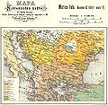
 Transilvania harta etnica 1850 (cu secui si sasi).png 1,514 × 1,022; 212 KB
-
 Transilvania harta etnica 1850.png 1,515 × 1,022; 209 KB
-
 Trianon-Romanians.jpg 1,062 × 789; 250 KB
-
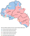
 Walachians (Romanians) in Hungary, census 1890.jpg 1,062 × 789; 654 KB
-
 Zwei Stühle.svg 1,102 × 591; 1.65 MB


.JPG)
.jpg)

.jpg)


.jpg)


.PNG)


.png)


.png)
_in_Hungary,_census_1890.jpg)


_BG.png)


.png)


_in_Hungary,_census_1890.jpg)

.png)