File:Ethiopia and Eritrea attatched (Derg, PDR).png
Jump to navigation
Jump to search
No higher resolution available.
Ethiopia_and_Eritrea_attatched_(Derg,_PDR).png (611 × 344 pixels, file size: 67 KB, MIME type: image/png)
Captions
Captions
Add a one-line explanation of what this file represents

|
File:Ethiopia in its region (before 1993).svg is a vector version of this file. It should be used in place of this PNG file when not inferior.
File:Ethiopia and Eritrea attatched (Derg, PDR).png → File:Ethiopia in its region (before 1993).svg
For more information, see Help:SVG. |
.svg) |
Summary[edit]
.png&action=edit§ion=1)
| Description |
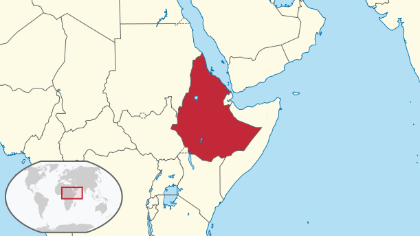
English: This is a map of Ethiopia and Eritrea attached which is The People's Democratic Republic of Ethiopia, the map of the Derg military junta (1974–1987) and the Federation of Ethiopia and Eritrea (1952-1962). I created the map using the maps of Eritrea and Ethiopia published by TUBS |
| Date | |
| Source |
File:Ethiopia_in_its_region.svg File:Eritrea_in_its_region.svg This vector image includes elements that have been taken or adapted from this file: |
| Author |
PlanespotterA320 using two maps made by TUBS |
.svg)
Licensing[edit]
.png&action=edit§ion=2)
This file is licensed under the Creative Commons Attribution-Share Alike 3.0 Unported license.
- You are free:
- to share – to copy, distribute and transmit the work
- to remix – to adapt the work
- Under the following conditions:
- attribution – You must give appropriate credit, provide a link to the license, and indicate if changes were made. You may do so in any reasonable manner, but not in any way that suggests the licensor endorses you or your use.
- share alike – If you remix, transform, or build upon the material, you must distribute your contributions under the same or compatible license as the original.
File history
Click on a date/time to view the file as it appeared at that time.
| Date/Time | Thumbnail | Dimensions | User | Comment | |
|---|---|---|---|---|---|
| current | 23:46, 10 September 2017 | | 611 × 344 (67 KB) | PlanespotterA320 (talk | contribs) | User created page with UploadWizard |
You cannot overwrite this file.
File usage on Commons
The following 2 pages use this file:
- File:Derg-People's Democratic Republic of Ethiopia.png (file redirect)
- File:People's Democratic Republic of Ethiopia.png (file redirect)
File usage on other wikis
The following other wikis use this file:
- Usage on bg.wikipedia.org
- Usage on en.wikipedia.org
- Usage on it.wikipedia.org
- Usage on ko.wikipedia.org
.png&oldid=745802760)