File:Ethiopia-CIA WFB Map (2004).png
Jump to navigation
Jump to search
No higher resolution available.
Ethiopia-CIA_WFB_Map_(2004).png (330 × 355 pixels, file size: 12 KB, MIME type: image/png)
Captions
Captions
Add a one-line explanation of what this file represents
Summary[edit]
.png&action=edit§ion=1)
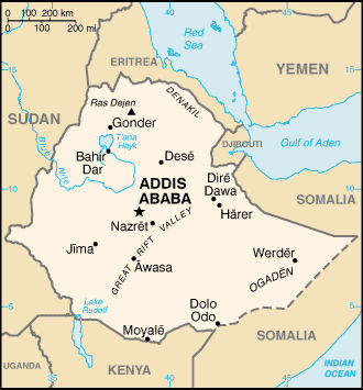
| Description | Ethiopia map from CIA World Factbook 2004, converted from original GIF format |
| Date | |
| Source | CIA World Factbook: Ethiopia. Archived from the original on 12 October 2002. |
| Author | United States Central Intelligence Agency |
| Other versions |
|
Licensing[edit]
.png&action=edit§ion=2)
This image is in the public domain because it contains materials that originally came from the United States Central Intelligence Agency's World Factbook.
|
 |
File history
Click on a date/time to view the file as it appeared at that time.
| Date/Time | Thumbnail | Dimensions | User | Comment | |
|---|---|---|---|---|---|
| current | 18:34, 4 June 2009 | | 330 × 355 (12 KB) | Spangineer (talk | contribs) | {{original}} {{CIA-map}} Category:Maps of Ethiopia <!--{{ImageUpload|basic}}--> |
You cannot overwrite this file.
File usage on Commons
There are no pages that use this file.
File usage on other wikis
The following other wikis use this file:
- Usage on en.wikipedia.org
- Usage on mdf.wikipedia.org
.png&oldid=498550848)