File:Devils Tower, also known by more benign names, including Bear Lodge, by indigenous American Indians, in northeastern Wyoming LCCN2015634033.tif
Jump to navigation
Jump to search

Size of this JPG preview of this TIF file: 798 × 600 pixels. Other resolutions: 320 × 240 pixels | 639 × 480 pixels | 1,022 × 768 pixels | 1,280 × 962 pixels | 2,560 × 1,923 pixels | 10,328 × 7,760 pixels.
Original file (10,328 × 7,760 pixels, file size: 458.62 MB, MIME type: image/tiff)
Captions
Captions
Add a one-line explanation of what this file represents
Summary[edit]
| Warning | The original file is very high-resolution. It might not load properly or could cause your browser to freeze when opened at full size. |
|---|
| Description |
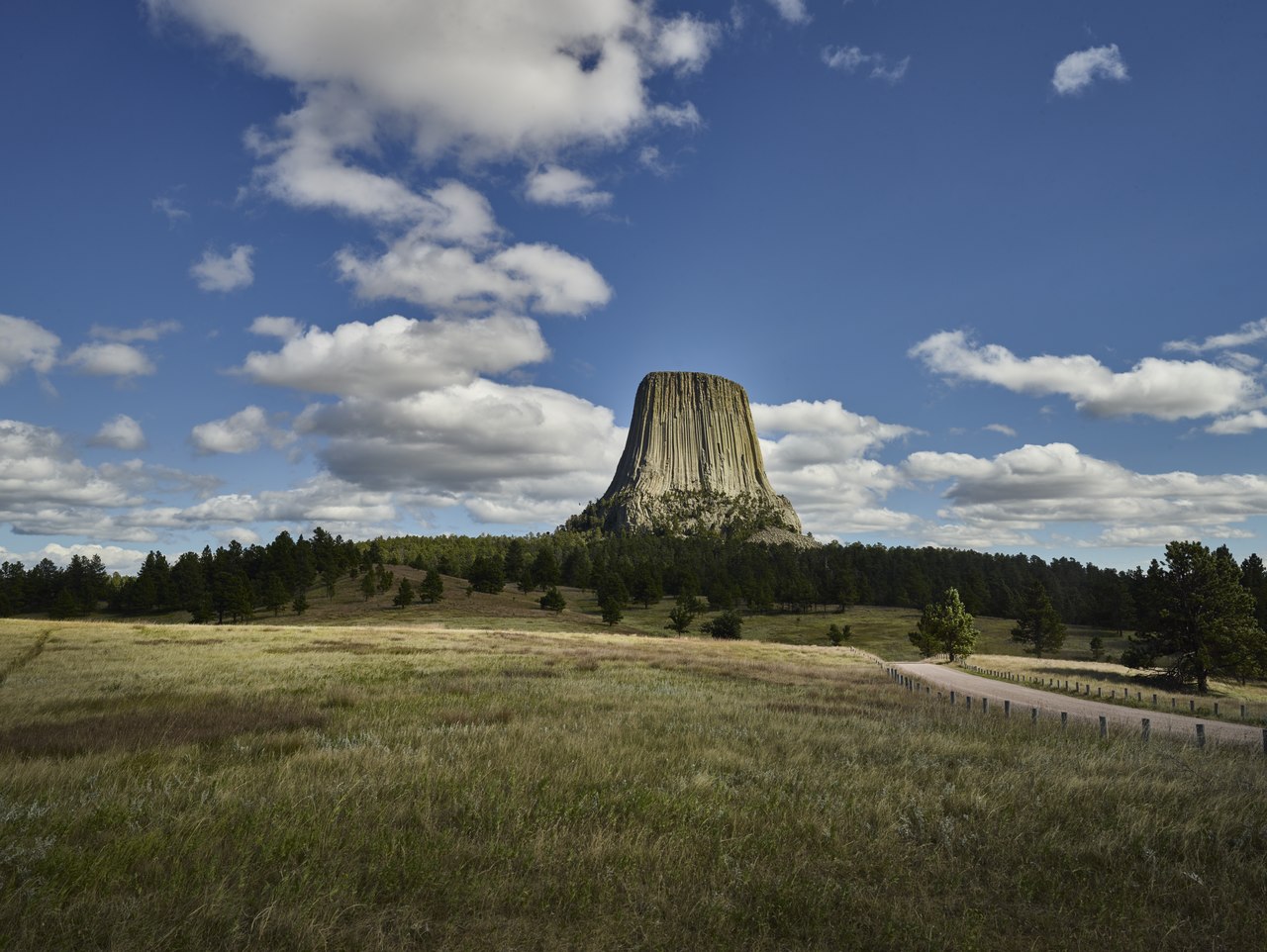
English: Title: Devils Tower, also known by more benign names, including Bear Lodge, by indigenous American Indians, in northeastern Wyoming
Physical description: 1 photograph : digital, tiff file, color. Notes: Forms part of: Gates Frontiers Fund Wyoming Collection within the Carol M. Highsmith Archive.; America's first declared national monument (in 1906), the formation is an "igneous intrusion," formed when molten lava deep beneath the earth's surface pushes rocks upward, in this case, 1,267 feet above the surrounding terrain. As of the early 2000s, an estimated 1 percent of the surrounding park's 400,000 annual visitors climb, or attempt to climb, the rock structure, which can be seen for miles. The National Park Service, which manages the attraction, declares each June as a "climb-free" period (with mixed success), out of respect for nearby tribes, who consider the monument sacred.; Title, date and keywords based on information provided by the photographer.; Purchase; Carol M. Highsmith Photography, Inc.; 2015; (DLC/PP-2015:069).; Credit line: Gates Frontiers Fund Wyoming Collection within the Carol M. Highsmith Archive, Library of Congress, Prints and Photographs Division. |
||||||||||||||||||||||||||
| Date | Taken on 22 August 2015, 17:00 (according to Exif data) | ||||||||||||||||||||||||||
| Source |
Library of Congress
|
||||||||||||||||||||||||||
| Author |
|
||||||||||||||||||||||||||
| Permission (Reusing this file) |
No known restrictions on publication.
|
||||||||||||||||||||||||||


| Camera location | | View this and other nearby images on: OpenStreetMap |
|---|
Licensing[edit]
| This work is from the Carol M. Highsmith Archive collection at the Library of Congress. According to the library, there are no known copyright restrictions on the use of this work. Carol M. Highsmith has stipulated that her photographs are in the public domain. Photographs of sculpture or other works of art may be restricted by the copyright of the artist. |
 |
File history
Click on a date/time to view the file as it appeared at that time.
| Date/Time | Thumbnail | Dimensions | User | Comment | |
|---|---|---|---|---|---|
| current | 19:27, 17 September 2016 |  | 10,328 × 7,760 (458.62 MB) | Fæ (talk | contribs) | LOC 2015634033, Carol M. Highsmith collection. P360.15101 TIFF (458.6mb) |
You cannot overwrite this file.
File usage on Commons
There are no pages that use this file.