File:D STREET ELEVATION - Jenifer Building (Commercial Building), 400-404 Seventh Street, Northwest, Washington, District of Columbia, DC HABS DC,WASH,190-2.tif

Original file (5,000 × 3,971 pixels, file size: 18.94 MB, MIME type: image/tiff)
Captions
Captions
Summary[edit]
| D STREET ELEVATION - Jenifer Building (Commercial Building), 400-404 Seventh Street, Northwest, Washington, District of Columbia, DC | ||||
|---|---|---|---|---|
| Title |
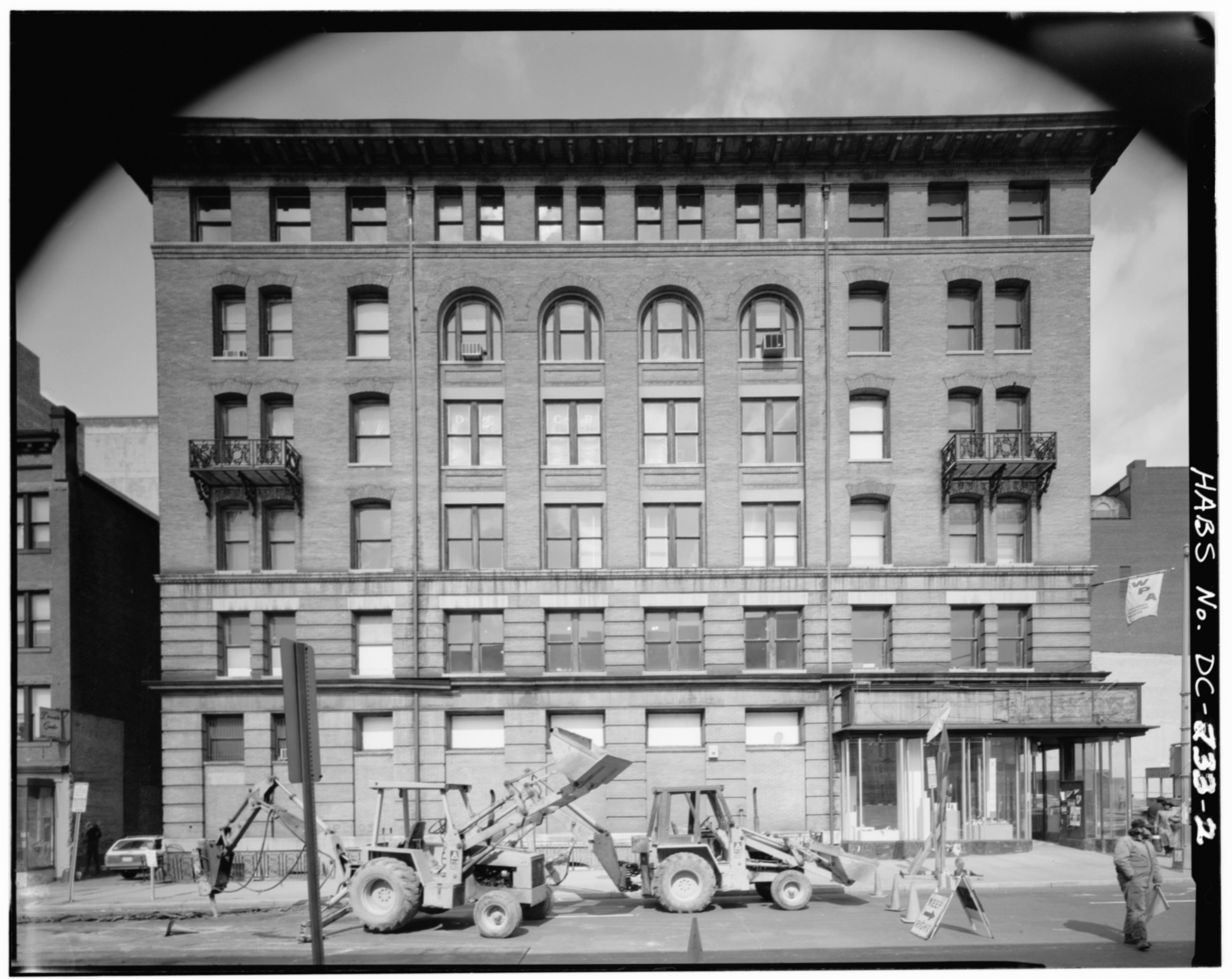
D STREET ELEVATION - Jenifer Building (Commercial Building), 400-404 Seventh Street, Northwest, Washington, District of Columbia, DC |
|||
| Depicted place | District of Columbia; District of Columbia; Washington | |||
| Date | Documentation compiled after 1933 | |||
| Dimensions | 4 x 5 in. | |||
| Current location |
Library of Congress Prints and Photographs Division Washington, D.C. 20540 USA http://hdl.loc.gov/loc.pnp/pp.print |
|||
| Accession number |
HABS DC,WASH,190-2 |
|||
| Credit line |
|
|||
| Notes |
The facades are designed according to the orthodox scheme of that time, having a greater proportion of solid wall at the corners and more openings toward the centers, where a three-story arcaded treatment united the third, fourth and fifth floors (three bays on the east, four on the south). The lower two stories are expressed as a podium by recesses between brick courses at intervals , which simulate rustication. Moulded belt courses at the second, third and sixth floors mark the division of the walls into horizontal zones, and a refined cornice of sheet metal, with a course of modillions, terminates the composition. The roof is flat. Ornamental cast-iron balconies at the corner bays of the fourth story relieve the over-all simplicity.
|
|||
| Source | https://www.loc.gov/pictures/item/dc0059.photos.027129p | |||
| Permission (Reusing this file) |
|
|||

| Object location | | View this and other nearby images on: OpenStreetMap |
|---|
File history
Click on a date/time to view the file as it appeared at that time.
| Date/Time | Thumbnail | Dimensions | User | Comment | |
|---|---|---|---|---|---|
| current | 11:28, 8 July 2014 |  | 5,000 × 3,971 (18.94 MB) | Fæ (talk | contribs) | GWToolset: Creating mediafile for Fæ. HABS 08 July 2014 (701:800) |
You cannot overwrite this file.
File usage on Commons
The following page uses this file: