File:CtRoute162.png
Jump to navigation
Jump to search
No higher resolution available.
CtRoute162.png (477 × 433 pixels, file size: 49 KB, MIME type: image/png)
Captions
Captions
Add a one-line explanation of what this file represents
Summary[edit]
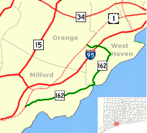
| Description | Map of Connecticut Route 162 |
| Date | |
| Source | Derived by uploader from National Atlas and Libre Map Project using Gimp 2.2.1.3 |
| Author | Karl Hahn 03:47, 17 August 2007 (UTC) |
| Permission (Reusing this file) |
CC-BY-SA-2.0. |
Licensing[edit]
This file is licensed under the Creative Commons Attribution 2.0 Generic license.
- You are free:
- to share – to copy, distribute and transmit the work
- to remix – to adapt the work
- Under the following conditions:
- attribution – You must give appropriate credit, provide a link to the license, and indicate if changes were made. You may do so in any reasonable manner, but not in any way that suggests the licensor endorses you or your use.
File history
Click on a date/time to view the file as it appeared at that time.
| Date/Time | Thumbnail | Dimensions | User | Comment | |
|---|---|---|---|---|---|
| current | 19:34, 3 September 2007 | | 477 × 433 (49 KB) | Karlhahn (talk | contribs) | New version increases contrast for route 162 itself {{Information |Description=Map of Connecticut Route 162 |Source=Derived by uploader from [http://www.nationalatlas.gov/ National Atlas] and [http://libremap.org/data/boundary/ Libre Map Project] using G |
| 04:29, 22 August 2007 |  | 477 × 433 (54 KB) | Karlhahn (talk | contribs) | New version adds more route numbers and locator-inset in lower right. {{Information |Description=Map of Connecticut Route 162 |Source=Derived by uploader from [http://www.nationalatlas.gov/ National Atlas] and [http://libremap.org/data/boundary/ Libre Ma | |
| 03:47, 17 August 2007 |  | 477 × 433 (25 KB) | Karlhahn (talk | contribs) | {{Information |Description=Map of Connecticut Route 162 |Source=Derived by uploader from [http://www.nationalatlas.gov/ National Atlas] and [http://libremap.org/data/boundary/ Libre Map Project] using Gimp 2.2.1.3 |Date= 2007-08-17 |Author= ~~~~ |Permissi |
You cannot overwrite this file.
File usage on Commons
There are no pages that use this file.