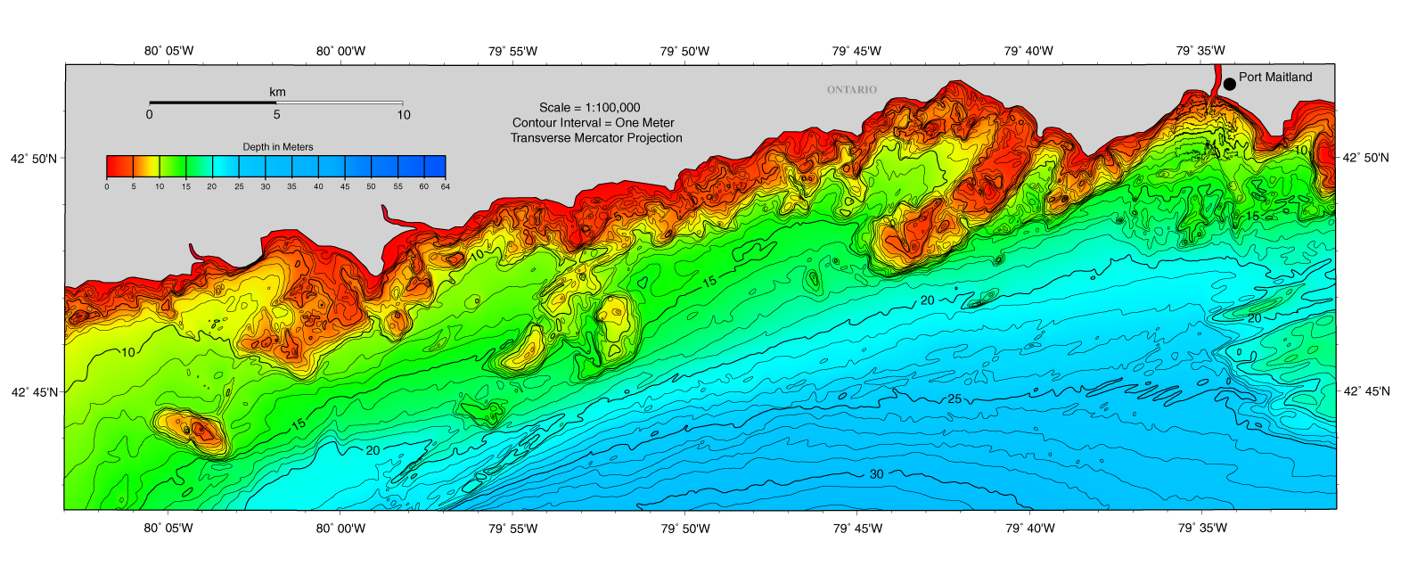
File:Coast of Lake Erie, west of Port Maitland and the mouth of the Grand River.jpg
Jump to navigation
Jump to search
Size of this preview: 800 × 328 pixels. Other resolutions: 320 × 131 pixels | 640 × 263 pixels | 1,572 × 645 pixels.
Original file (1,572 × 645 pixels, file size: 986 KB, MIME type: image/jpeg)
Captions
Captions
Add a one-line explanation of what this file represents
| Description | ||||
| Source | https://www.ngdc.noaa.gov/mgg/greatlakes/lakeerie_cdrom/html/e_images.htm | |||
| Author | NOAA | |||
| Permission (Reusing this file) |
|
File history
Click on a date/time to view the file as it appeared at that time.
| Date/Time | Thumbnail | Dimensions | User | Comment | |
|---|---|---|---|---|---|
| current | 00:16, 25 June 2017 | 1,572 × 645 (986 KB) | Geo Swan (talk | contribs) | {{Information |Description= |Source=https://www.ngdc.noaa.gov/mgg/greatlakes/lakeerie_cdrom/html/e_images.htm |Date= |Author=NOAA |Permission={{PD-USGov-NOAA}} |other_versions= }} Category:Lake Erie Category:Bathymetric maps of the Great Lakes... |
You cannot overwrite this file.
File usage on Commons
There are no pages that use this file.