File:Churton Heath - Ridge and Furrow Farmland.jpg
From Wikimedia Commons, the free media repository
Jump to navigation
Jump to search
Churton_Heath_-_Ridge_and_Furrow_Farmland.jpg (640 × 480 pixels, file size: 195 KB, MIME type: image/jpeg)
File information
Structured data
Captions
DescriptionChurton Heath - Ridge and Furrow Farmland.jpg |
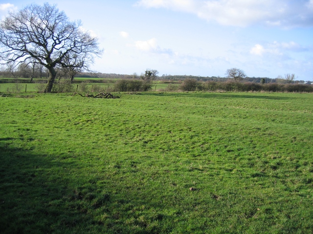
English: Ridge and Furrow Farmland. The low afternoon sun shows off the ridge and furrow shape of this Cheshire field. Although it is known as a mediaeval practice, it has been used in living memory to improve drainage in wet Cheshire farmland. |
||
Date | |||
Source | From geograph.org.uk | ||
Author | John S Turner | ||
Permission (Reusing this file) |
This file is licensed under the Creative Commons Attribution-Share Alike 2.0 Generic license. Attribution: John S Turner
|
||
Attribution (required by the license) InfoField | John S Turner / Ridge and Furrow Farmland / | ||
InfoField | John S Turner / Ridge and Furrow Farmland |
Camera location | 53° 07′ 48.51″ N, 2° 50′ 25.78″ W | View this and other nearby images on: OpenStreetMap | 53.130141; -2.840495 |
---|
File history
Click on a date/time to view the file as it appeared at that time.
Date/Time | Thumbnail | Dimensions | User | Comment | |
---|---|---|---|---|---|
current | 14:16, 12 December 2009 | 640 × 480 (195 KB) | Skinsmoke (talk | contribs) | {{Information |Description={{en|1=The low afternoon sun shows off the ridge and furrow shape of this Cheshire field. Although it is known as a mediaeval practice, it has been used in living memory to improve drainage in wet Cheshire farmland. }} |Source=h |
You cannot overwrite this file.
File usage on Commons
The following page uses this file:
File usage on other wikis
The following other wikis use this file:
- Usage on ar.wikipedia.org
- Usage on arz.wikipedia.org
- Usage on ceb.wikipedia.org
- Usage on cy.wikipedia.org
- Usage on en.wikipedia.org
- Usage on lld.wikipedia.org
- Usage on pl.wikipedia.org
- Usage on sv.wikipedia.org
- Usage on www.wikidata.org
- Usage on zh-min-nan.wikipedia.org
Metadata
This file contains additional information such as Exif metadata which may have been added by the digital camera, scanner, or software program used to create or digitize it. If the file has been modified from its original state, some details such as the timestamp may not fully reflect those of the original file. The timestamp is only as accurate as the clock in the camera, and it may be completely wrong.
Camera manufacturer | Canon |
---|---|
Camera model | Canon DIGITAL IXUS 500 |
Exposure time | 1/640 sec (0.0015625) |
F-number | f/2.8 |
Date and time of data generation | 14:12, 2 February 2007 |
Lens focal length | 7.40625 mm |
File change date and time | 14:12, 2 February 2007 |
Y and C positioning | Centered |
Exif version | 2.2 |
Date and time of digitizing | 14:12, 2 February 2007 |
Image compression mode | 5 |
APEX shutter speed | 9.3125 |
APEX aperture | 2.96875 |
APEX exposure bias | 0 |
Maximum land aperture | 2.96875 APEX (f/2.8) |
Metering mode | Pattern |
Flash | Flash did not fire, auto mode |
Color space | sRGB |
Focal plane X resolution | 9,159.0106007067 |
Focal plane Y resolution | 9,169.8113207547 |
Focal plane resolution unit | inches |
Sensing method | One-chip color area sensor |
Custom image processing | Normal process |
Exposure mode | Auto exposure |
White balance | Auto white balance |
Digital zoom ratio | 1 |
Scene capture type | Standard |
Structured data
Items portrayed in this file
depicts
some value
2 February 2007
53°7'48.508"N, 2°50'25.782"W
0.0015625 second
2.8
7.40625 millimetre
image/jpeg
1e93b48b82b7e96479cb708536226e118fb4a774
199,946 byte
480 pixel
640 pixel
Hidden categories:
- CC-BY-SA-2.0
- Images from Geograph Britain and Ireland
- Images from Geograph Britain and Ireland missing SDC coordinates of depicted place
- Information field template with formatting
- Files with coordinates missing SDC location of creation
- United Kingdom photographs taken on 2007-02-02
- Images by John S Turner
- Pages with maps