Category:United Kingdom photographs taken on 2007-02-02
Jump to navigation
Jump to search
Countries of Europe: Austria · Belgium · Finland · France‡ · Republic of Ireland · Italy · Netherlands‡ · Poland · Portugal‡ · Russia‡ · Slovakia · Spain‡ · Sweden · Switzerland · Turkey‡ · Ukraine · United Kingdom
‡: partly located in Europe
‡: partly located in Europe
| ← | 2 February 2007 | → | ||
| ← | February 2007 | → | ||

United Kingdom photographs taken on 2 February 2007.
Image files should be categorized here automatically using {{taken on}} template. Direct categorisation is also possible, if automatic is impossible.
Subcategories
This category has the following 2 subcategories, out of 2 total.
L
S
Media in category "United Kingdom photographs taken on 2007-02-02"
The following 200 files are in this category, out of 710 total.
(previous page) (next page)-
-
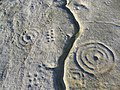
 19th century rock graffiti - geograph.org.uk - 329138.jpg 640 × 480; 136 KB
-
 24 North Parade - geograph.org.uk - 335331.jpg 427 × 640; 74 KB
-
 46 North Parade - geograph.org.uk - 335335.jpg 427 × 640; 79 KB
-
 A house known as Culpho Hall - geograph.org.uk - 327166.jpg 640 × 412; 80 KB
-

-
 A touch of Taiwan in Telford - geograph.org.uk - 326977.jpg 600 × 450; 253 KB
-
 A view of Boot Street - geograph.org.uk - 327172.jpg 640 × 480; 62 KB
-
 A422 at Steane Park - geograph.org.uk - 327127.jpg 640 × 396; 49 KB
-
 A422, Steane Park - geograph.org.uk - 326976.jpg 640 × 480; 102 KB
-
 Akenham Hall, as seen from Henley Road - geograph.org.uk - 326994.jpg 640 × 480; 119 KB
-
 Aldbrough Cliffs - geograph.org.uk - 326877.jpg 640 × 469; 94 KB
-
 Alexander Street, Carlisle - geograph.org.uk - 327275.jpg 640 × 505; 70 KB
-
-
 Banbury Road Cottages - geograph.org.uk - 327139.jpg 640 × 436; 58 KB
-
 Barn near Hunsingore, North Yorkshire - geograph.org.uk - 326847.jpg 640 × 480; 76 KB
-
 Beach and Hills - geograph.org.uk - 327353.jpg 640 × 267; 75 KB
-
 Beehives - geograph.org.uk - 329173.jpg 640 × 480; 97 KB
-
 Belted Galloway Cattle at RAF Chilmark - geograph.org.uk - 331901.jpg 640 × 480; 120 KB
-

-
 Belvoir House belcote - geograph.org.uk - 333715.jpg 427 × 640; 82 KB
-
 Belvoir House Care Home - geograph.org.uk - 333714.jpg 640 × 427; 111 KB
-
 Blackmoor Road - geograph.org.uk - 327147.jpg 640 × 427; 43 KB
-
 Blue plaque for John Buchan - geograph.org.uk - 334515.jpg 640 × 427; 120 KB
-
 Boulders below Fiurnean - geograph.org.uk - 326942.jpg 640 × 480; 90 KB
-
 Bradley Wood - geograph.org.uk - 327406.jpg 480 × 640; 154 KB
-
 Brant Road - geograph.org.uk - 327163.jpg 640 × 427; 62 KB
-
 Bridge - geograph.org.uk - 326720.jpg 640 × 480; 142 KB
-

-
 Bridge Stile over Drainage Ditch - geograph.org.uk - 327228.jpg 640 × 480; 225 KB
-
 Bridleway by Kington Down Cottage - geograph.org.uk - 327031.jpg 640 × 480; 35 KB
-
 Bridleway through Freegreen Farm - geograph.org.uk - 328574.jpg 640 × 474; 76 KB
-
 Bridleway to Freegreen Farm - geograph.org.uk - 328564.jpg 640 × 463; 80 KB
-
 Brownside - geograph.org.uk - 682310.jpg 640 × 427; 58 KB
-
 Building Foundations - geograph.org.uk - 326898.jpg 640 × 480; 113 KB
-
 Burn on Regal Hill - geograph.org.uk - 326997.jpg 640 × 480; 148 KB
-
 Burton Pidsea Mill.jpg 640 × 420; 67 KB
-
 Burton Road, Roos - geograph.org.uk - 327398.jpg 640 × 477; 88 KB
-
 Buzzards Nest, Burton Pidsea - geograph.org.uk - 327399.jpg 640 × 442; 102 KB
-
 Camera shy - geograph.org.uk - 326919.jpg 640 × 480; 175 KB
-
 Castle Menzies - geograph.org.uk - 329210.jpg 640 × 480; 102 KB
-
 Chilcote Pumping Station - geograph.org.uk - 327029.jpg 640 × 480; 114 KB
-

-
-
 St Margaret of Antioch, Chilmark - geograph.org.uk - 330849.jpg 480 × 640; 103 KB
-

-
 Churton Heath - Ridge and Furrow Farmland.jpg 640 × 480; 195 KB
-
 Cliff Path - geograph.org.uk - 326873.jpg 640 × 480; 123 KB
-
 Cliff path north of Aldbrough - geograph.org.uk - 326887.jpg 640 × 480; 130 KB
-
 Cliff path north of Aldbrough - geograph.org.uk - 326903.jpg 640 × 480; 128 KB
-
 Close up of ruin near Pant-y-fotty - geograph.org.uk - 328013.jpg 640 × 480; 97 KB
-
 Clywedog at Cyffylliog - geograph.org.uk - 327001.jpg 640 × 480; 152 KB
-
-
 Confluence of springs - geograph.org.uk - 327298.jpg 640 × 480; 154 KB
-
 Corner House, Roos - geograph.org.uk - 327396.jpg 640 × 476; 94 KB
-
 Cote at Embleton - geograph.org.uk - 335951.jpg 635 × 461; 72 KB
-
 Cote House Farm, Halsham - geograph.org.uk - 327386.jpg 640 × 445; 87 KB
-
 Cotswold barn - geograph.org.uk - 327046.jpg 640 × 480; 33 KB
-
 Cottages in Stockton - geograph.org.uk - 327264.jpg 640 × 480; 67 KB
-
 Council Housing, Sorn, East Ayrshire.jpg 640 × 426; 71 KB
-
 Crops under Water near Rolling Bridge - geograph.org.uk - 326904.jpg 640 × 480; 74 KB
-
-
 Dalton Lane, Halsham - geograph.org.uk - 327354.jpg 640 × 450; 81 KB
-
 Danger Area^ - geograph.org.uk - 326889.jpg 640 × 480; 75 KB
-
 Danger Area^ - geograph.org.uk - 326892.jpg 640 × 480; 92 KB
-
 Decorated Gothic - geograph.org.uk - 335272.jpg 640 × 427; 76 KB
-
 Derelict Lime Kiln - geograph.org.uk - 328049.jpg 640 × 480; 115 KB
-
 Dewartown - geograph.org.uk - 328123.jpg 640 × 480; 87 KB
-

-
 Dobbs Lane looking north - geograph.org.uk - 327513.jpg 640 × 480; 118 KB
-
 Dock Point - geograph.org.uk - 326988.jpg 640 × 384; 65 KB
-
 Down Road - geograph.org.uk - 327084.jpg 640 × 480; 25 KB
-
 Downthorns Farm - geograph.org.uk - 327063.jpg 640 × 480; 51 KB
-
 Doxford Farm - geograph.org.uk - 327370.jpg 640 × 480; 68 KB
-

-
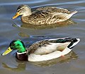 Ducks - geograph.org.uk - 326788.jpg 640 × 561; 125 KB
-
 Dundee Queen Elizabeth Wharf Cranes in 2007 (1 of 2).jpg 1,944 × 2,592; 1.87 MB
-
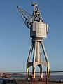 Dundee Queen Elizabeth Wharf Cranes in 2007 (2 of 2).jpg 1,944 × 2,592; 2.02 MB
-
 Dyke on Fiurnean - geograph.org.uk - 326936.jpg 640 × 480; 59 KB
-
 East Field Farm, Halsham - geograph.org.uk - 327357.jpg 640 × 406; 65 KB
-
 East Field Farm, Halsham - geograph.org.uk - 327358.jpg 640 × 438; 57 KB
-
 East of Elsfield - geograph.org.uk - 327345.jpg 640 × 480; 124 KB
-
 Eden Court, Ticehurst - geograph.org.uk - 327023.jpg 640 × 480; 140 KB
-
 EdgwRd.JPG 1,948 × 1,551; 1.38 MB
-
 Elm Farm, Roos - geograph.org.uk - 327394.jpg 640 × 428; 81 KB
-
 Elsfield church.jpg 640 × 480; 153 KB
-
 Embleton Burn at Prickley Bridge - geograph.org.uk - 327365.jpg 640 × 480; 105 KB
-
 Enjoying The Sunshine - geograph.org.uk - 400235.jpg 640 × 458; 149 KB
-
 Entering Oxford on the B4150 - geograph.org.uk - 327342.jpg 640 × 480; 146 KB
-
 Ewen Fields - geograph.org.uk - 1010944.jpg 640 × 439; 89 KB
-
 Ewen Fields - geograph.org.uk - 888848.jpg 637 × 481; 100 KB
-
 F.J.Tollemache - geograph.org.uk - 335262.jpg 427 × 640; 59 KB
-
 Factory Unit in Stafford Park 6 - geograph.org.uk - 326965.jpg 600 × 450; 195 KB
-
 Factory units in Stafford Park 11 - geograph.org.uk - 326948.jpg 600 × 450; 203 KB
-
 Famous birthplace - geograph.org.uk - 327245.jpg 640 × 427; 72 KB
-
 Farish Almshouses date stone - geograph.org.uk - 327416.jpg 640 × 427; 87 KB
-
 Farm Track - geograph.org.uk - 327412.jpg 480 × 640; 168 KB
-
 Farm track - geograph.org.uk - 334503.jpg 640 × 480; 135 KB
-
 Farmland NE Of Nafferton - geograph.org.uk - 327250.jpg 640 × 480; 100 KB
-
 Farmland near Waddington - geograph.org.uk - 327075.jpg 640 × 427; 74 KB
-
 Feeding time - geograph.org.uk - 327372.jpg 626 × 474; 82 KB
-
 Field and Factory - geograph.org.uk - 328734.jpg 640 × 480; 105 KB
-
 Fifield church.jpg 640 × 480; 101 KB
-
 Fifield village.jpg 640 × 480; 120 KB
-
 Fish counter, Omagh - geograph.org.uk - 326871.jpg 640 × 285; 47 KB
-
 Flooding in the Wylye Valley - geograph.org.uk - 326989.jpg 640 × 480; 62 KB
-
 Fly-tipping at the Waterworks - geograph.org.uk - 326875.jpg 640 × 428; 158 KB
-
 Font at St Cosmos and St Damian Church - geograph.org.uk - 327236.jpg 480 × 640; 107 KB
-
 Font at St John the Baptist Church - geograph.org.uk - 327310.jpg 480 × 640; 85 KB
-
-
 Footpath across the pond at Sherrington - geograph.org.uk - 327248.jpg 640 × 480; 118 KB
-

-
 Footpath to Lea Newbold Farm - geograph.org.uk - 327074.jpg 640 × 480; 236 KB
-
 Footpath to South Newton - geograph.org.uk - 326969.jpg 640 × 480; 187 KB
-
 Footpath to South Newton Mill - geograph.org.uk - 326958.jpg 640 × 480; 98 KB
-

-
 Former Corn Exchange - geograph.org.uk - 335233.jpg 427 × 640; 68 KB
-
 Former Oddfellows Arms - geograph.org.uk - 335350.jpg 640 × 427; 68 KB
-
-
 Former Robert's Shop - geograph.org.uk - 327260.jpg 640 × 427; 73 KB
-
 Fox Covert, Halsham - geograph.org.uk - 327392.jpg 640 × 474; 84 KB
-
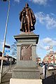 Frederick Tollemache statue in Grantham.jpeg 427 × 640; 71 KB
-
 Fulbeck Park Avenue - geograph.org.uk - 335365.jpg 640 × 427; 122 KB
-

-
 Garden at Campsie Road, Omagh - geograph.org.uk - 326874.jpg 640 × 479; 96 KB
-
 Geograph-327293-Carlton-Scroop-Bed-of-railway-by-Richard-Croft.jpg 640 × 427; 64 KB
-
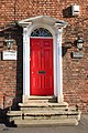 Georgian door - geograph.org.uk - 335327.jpg 427 × 640; 95 KB
-
 Golborne Brook - geograph.org.uk - 327024.jpg 640 × 480; 202 KB
-
 Goodbush Hill - geograph.org.uk - 327087.jpg 640 × 480; 149 KB
-
 Grantham Baptist Chapel - geograph.org.uk - 333743.jpg 640 × 427; 54 KB
-
 Grantham Barracks - geograph.org.uk - 335196.jpg 640 × 427; 76 KB
-
 Grantham Barracks detail - geograph.org.uk - 335199.jpg 427 × 640; 78 KB
-
 Grantham House - geograph.org.uk - 333721.jpg 640 × 427; 97 KB
-
 Grantham Market Cross - geograph.org.uk - 333749.jpg 427 × 640; 62 KB
-
 Grantham Market Place - geograph.org.uk - 333745.jpg 640 × 427; 68 KB
-
 St.Wulfram's church tower - geograph.org.uk - 335277.jpg 427 × 640; 75 KB
-
 West front - geograph.org.uk - 335276.jpg 640 × 427; 81 KB
-
 Greasy Spoon in Stafford Park 10 - geograph.org.uk - 326998.jpg 600 × 450; 198 KB
-
 Greenhow - geograph.org.uk - 326681.jpg 640 × 480; 35 KB
-
 Halifax Building Society - geograph.org.uk - 333755.jpg 427 × 640; 63 KB
-
 Hall Farm - geograph.org.uk - 327055.jpg 640 × 427; 50 KB
-
 Hall Farm Cottages - geograph.org.uk - 327058.jpg 640 × 427; 60 KB
-
 Harmston Low Fields - geograph.org.uk - 327142.jpg 640 × 427; 57 KB
-

-
 Hartley Church - geograph.org.uk - 326758.jpg 640 × 428; 90 KB
-
 Henryston Woodland - geograph.org.uk - 337244.jpg 640 × 427; 130 KB
-
-
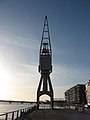
 HMS Unicorn close up (cropped version).jpg 1,728 × 1,728; 1.84 MB
-
 Hms-unicorn-close-up.jpg 2,464 × 1,728; 2.16 MB
-
 Holy Trinity, Dartford, Kent - geograph.org.uk - 326676.jpg 640 × 425; 111 KB
-
 Home décor centre, Omagh - geograph.org.uk - 326888.jpg 387 × 640; 89 KB
-
 HONG KONG Chinese takeaway, Omagh - geograph.org.uk - 326885.jpg 361 × 640; 65 KB
-
 Horses at Doxford Farm - geograph.org.uk - 329339.jpg 617 × 453; 69 KB
-
 House by road junction - geograph.org.uk - 334519.jpg 640 × 480; 103 KB
-
 Houses at New Bewick Farm - geograph.org.uk - 327374.jpg 640 × 499; 69 KB
-
 Houses at Warenton - geograph.org.uk - 329159.jpg 611 × 456; 95 KB
-
 Hungerford Lodge Farm - geograph.org.uk - 327015.jpg 640 × 480; 101 KB
-
 Hunsingore Parish Church - geograph.org.uk - 326918.jpg 640 × 480; 116 KB
-
 Immediate Horizon - panoramio.jpg 2,916 × 1,944; 3.72 MB
-
 Industrial units off Euridge Lane - geograph.org.uk - 327092.jpg 640 × 480; 38 KB
-
 Inside the Walled Garden, Helmsley - geograph.org.uk - 331851.jpg 640 × 480; 137 KB
-
 Interesting ornamentation - geograph.org.uk - 335229.jpg 427 × 640; 69 KB
-
-
 Kings Burn - geograph.org.uk - 327002.jpg 480 × 640; 99 KB
-
 Kings Burn - geograph.org.uk - 327006.jpg 480 × 640; 74 KB
-
 Knotted Tree, Ivy Lane - geograph.org.uk - 342056.jpg 640 × 480; 193 KB
-
 Kontak Club - geograph.org.uk - 327405.jpg 640 × 427; 96 KB
-
 Lamb Lane, Roos - geograph.org.uk - 327395.jpg 476 × 640; 95 KB
-
 Lane Head Lowton - geograph.org.uk - 482122.jpg 640 × 480; 78 KB
-

-
 Leaze Burn - geograph.org.uk - 327073.jpg 640 × 480; 152 KB
-
 Leiston Abbey - geograph.org.uk - 327910.jpg 640 × 481; 47 KB
-
 Lime Kiln - geograph.org.uk - 328035.jpg 640 × 480; 91 KB
-

-
 Churchyard at St Nicholas Church - geograph.org.uk - 327157.jpg 640 × 480; 167 KB
-
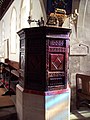
 Pulpit at St Nicholas of Mira Church - geograph.org.uk - 327129.jpg 480 × 640; 83 KB
-

-
 The Church of St. Nicholas of Mira - geograph.org.uk - 327096.jpg 480 × 640; 118 KB
-
-
 Little Langford Farm - geograph.org.uk - 327042.jpg 640 × 480; 102 KB
-
-
 Living Health - geograph.org.uk - 327249.jpg 640 × 427; 93 KB
-
 Local Authority Housing - geograph.org.uk - 337447.jpg 640 × 426; 62 KB
-
 Loch Fada - geograph.org.uk - 326886.jpg 640 × 481; 77 KB
-
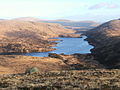 Loch Valley from Buchan Hill.jpg 640 × 480; 98 KB
-
 Logan Water - geograph.org.uk - 327116.jpg 640 × 480; 159 KB
-
 Longden End Valley - geograph.org.uk - 327045.jpg 640 × 480; 59 KB
-
-

-
 Looking down Dippal Rig - geograph.org.uk - 326982.jpg 640 × 480; 167 KB
-
 Looking towards Jodrell Bank - geograph.org.uk - 327541.jpg 640 × 419; 61 KB
-
 Looking up the road to Reaveley - geograph.org.uk - 327378.jpg 640 × 480; 96 KB
-
 Lotus Hill - geograph.org.uk - 412729.jpg 640 × 428; 130 KB
-
 Lovell Telescope 01.jpg 2,592 × 3,888; 3.01 MB
-
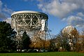 Lovell Telescope 02.jpg 3,888 × 2,592; 3.21 MB
-
 Lovell Telescope 03.jpg 3,888 × 2,592; 7.01 MB
-
 Lunchtime at Waters' Edge Park - geograph.org.uk - 326765.jpg 640 × 452; 161 KB
-
 Lutterworth St Marys.jpg 3,072 × 2,304; 2.32 MB
-
 Manor House, Burton Pidsea - geograph.org.uk - 327402.jpg 640 × 480; 85 KB
-
 Melling - Tithebarn.jpg 525 × 394; 112 KB


.jpg)
.jpg)


.jpg)


