File:Caucasus 1213 AD map krc.svg
Jump to navigation
Jump to search

Size of this PNG preview of this SVG file: 771 × 599 pixels. Other resolutions: 309 × 240 pixels | 618 × 480 pixels | 988 × 768 pixels | 1,280 × 995 pixels | 2,560 × 1,990 pixels | 1,155 × 898 pixels.
Original file (SVG file, nominally 1,155 × 898 pixels, file size: 4.5 MB)
Captions
Captions
Add a one-line explanation of what this file represents
Summary[edit]
| Description |
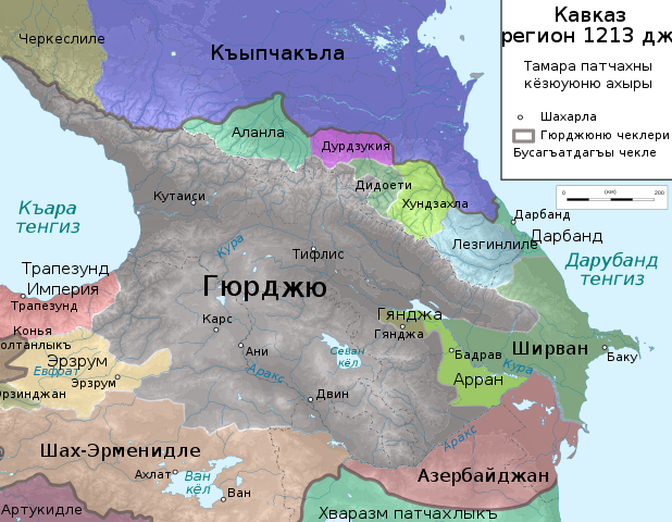
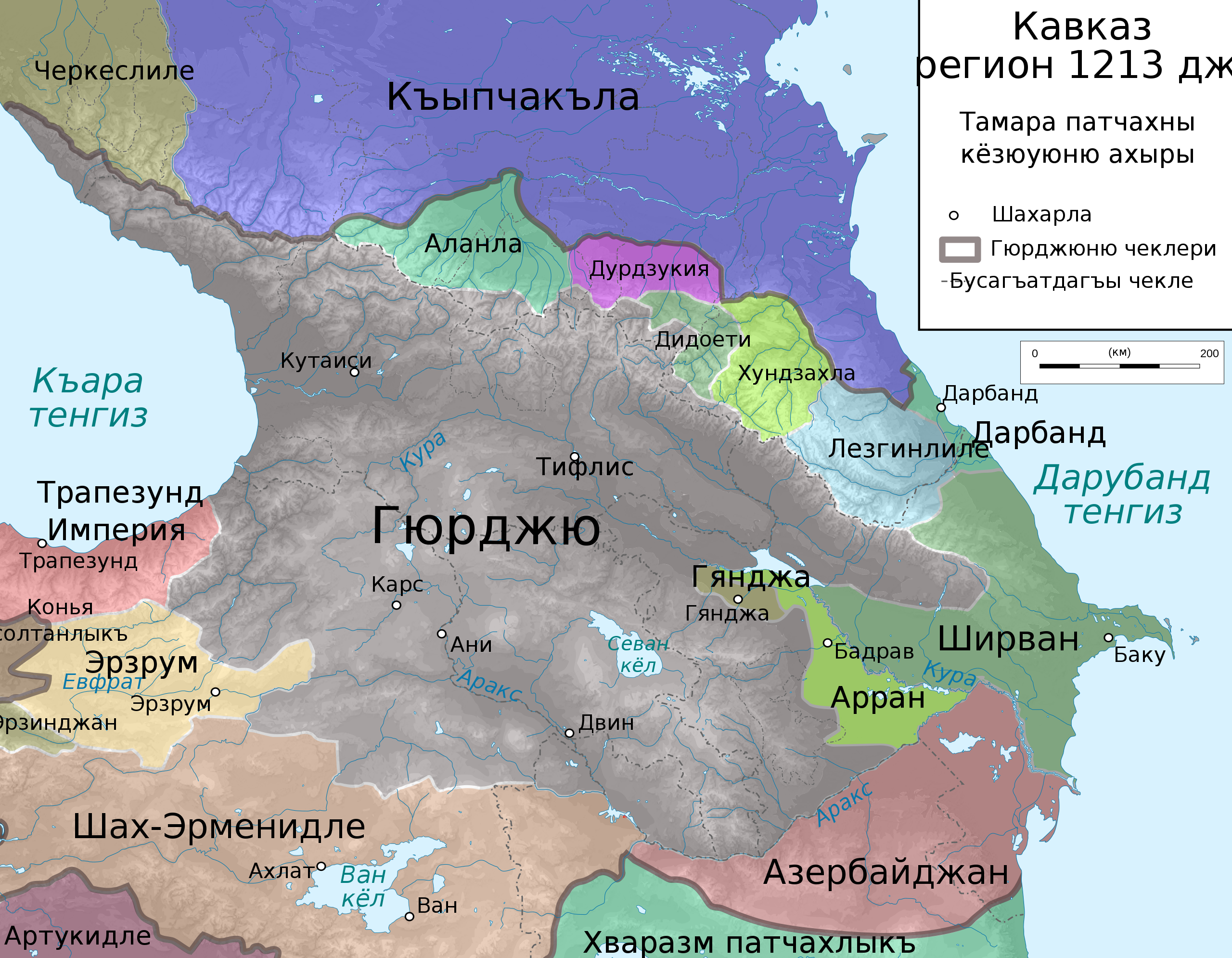
English: Map of Caucasus Region around 1213 AC in Karachay-Balkar. |
| Date | (UTC) |
| Source |
This file was derived from: Caucasus 1206 AD map de alt.svg: |
| Author |
|
| Other versions |
[]
|


| This is a retouched picture, which means that it has been digitally altered from its original version. Modifications: The language. The original can be viewed here: Caucasus 1124 AC de.png:
|
Licensing[edit]
I, the copyright holder of this work, hereby publish it under the following licenses:
This file is licensed under the Creative Commons Attribution 3.0 Unported license.
- You are free:
- to share – to copy, distribute and transmit the work
- to remix – to adapt the work
- Under the following conditions:
- attribution – You must give appropriate credit, provide a link to the license, and indicate if changes were made. You may do so in any reasonable manner, but not in any way that suggests the licensor endorses you or your use.

|
Permission is granted to copy, distribute and/or modify this document under the terms of the GNU Free Documentation License, Version 1.2 or any later version published by the Free Software Foundation; with no Invariant Sections, no Front-Cover Texts, and no Back-Cover Texts. A copy of the license is included in the section entitled GNU Free Documentation License. |
You may select the license of your choice.
Original upload log[edit]
This image is a derivative work of the following images:
- File:Caucasus_1124_AC_de.png licensed with Cc-by-3.0, GFDL
- 2010-02-23T20:40:05Z Don-kun 2990x2324 (3731809 Bytes) {{Information |Description= |Source= |Date=2010-02-23 |Author=[[User:Don-kun|Don-kun]] |Permission=Own work, attribution required (Multi-license with GFDL and Creative Commons CC-BY 3.0) |other_versions= }} {{self|GFDL|cc-by
Uploaded with derivativeFX
File history
Click on a date/time to view the file as it appeared at that time.
| Date/Time | Thumbnail | Dimensions | User | Comment | |
|---|---|---|---|---|---|
| current | 14:54, 25 February 2020 | | 1,155 × 898 (4.5 MB) | Don-kun (talk | contribs) | Reverted to version as of 13:05, 9 September 2012 (UTC) |
| 22:31, 18 February 2020 |  | 1,155 × 898 (4.4 MB) | Takhirgeran Umar (talk | contribs) | об | |
| 13:05, 9 September 2012 |  | 1,155 × 898 (4.5 MB) | Ernác (talk | contribs) | == {{int:filedesc}} == {{Information |Description={{en|1=Map of Caucasus Region around 1124 AC in Karachay-Balkar.}} |Source={{Derived from|Caucasus_1124_AC_de.png|display=50}} |Date=2012-09-09 13:02 (UTC) |Author=*File:Caucasus_1124_AC_de.png: *... |
You cannot overwrite this file.
File usage on Commons
The following 12 pages use this file:
- User:Magog the Ogre/Multilingual legend/2020 February 10-19
- User:Magog the Ogre/Multilingual legend/2020 February 20-29
- File:Caucasus 1213 AD map de.png
- File:Caucasus 1213 AD map de.svg
- File:Caucasus 1213 AD map en.svg
- File:Caucasus 1213 AD map es.svg
- File:Caucasus 1213 AD map hy.png
- File:Caucasus 1213 AD map hy.svg
- File:Caucasus 1213 AD map ka.svg
- File:Caucasus 1213 AD map krc.svg
- File:Caucasus 1213 AD map ru.svg
- Template:Other versions/Caucasus 1213 AD map
File usage on other wikis
The following other wikis use this file:
- Usage on krc.wikipedia.org
Metadata
Categories:
- Maps of Alania
- Maps of the history of Adygea
- SVG maps of the history of Armenia
- SVG maps of the history of Azerbaijan
- Maps of the history of Chechnya
- Maps of the history of Dagestan
- SVG maps of the history of Georgia
- Maps of the history of Kabardino-Balkaria
- Maps of the history of Karachay-Cherkessia
- Karachay-Balkar-language SVG maps showing history