File:Cambridgeshire outline map with UK.png
Jump to navigation
Jump to search

Size of this preview: 504 × 600 pixels. Other resolutions: 202 × 240 pixels | 600 × 714 pixels.
Original file (600 × 714 pixels, file size: 342 KB, MIME type: image/png)
Captions
Captions
Add a one-line explanation of what this file represents
Summary[edit]
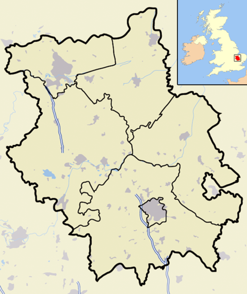
| Description | A map of the ceremonial county of Cambridgeshire, in the East of England. Appended to the top right is a mini map of the British Isles with Cambridgeshire's location and relative size marked in red. On the main map rural areas are in yellow; urban areas are in grey; district and county boundaries are in black; bodies of water are in light blue; motorways are in dark blue with a white stripe. |
| Date | |
| Source | Completely self-made, but boundaries and features can be verified via a variety of sources including (but not exclusive to) the Fifth periodical report - Volume 3 Mapping for the London Boroughs and the Metropolitan Counties by the Boundary Commission for England. |
| Author | Jhamez84 |
| Permission (Reusing this file) |
Own work |
| Other versions |
Derivative works of this file: |
Licensing[edit]
| I, the copyright holder of this work, release this work into the public domain. This applies worldwide. In some countries this may not be legally possible; if so: I grant anyone the right to use this work for any purpose, without any conditions, unless such conditions are required by law. |
File history
Click on a date/time to view the file as it appeared at that time.
| Date/Time | Thumbnail | Dimensions | User | Comment | |
|---|---|---|---|---|---|
| current | 00:01, 23 November 2007 | | 600 × 714 (342 KB) | Jza84 (talk | contribs) | {{Information |Description=Map of the County of Cambridgeshire, England, United Kingdom |Source=self-made |Date=November 2007 |Author= Jhamez84 |Permission=See below |other_versions= }} |
You cannot overwrite this file.
File usage on Commons
The following page uses this file:
File usage on other wikis
The following other wikis use this file:
- Usage on ar.wikipedia.org
- Usage on arz.wikipedia.org
- Usage on ceb.wikipedia.org
- Usage on en.wikipedia.org
- Usage on fr.wikipedia.org
- Usage on ml.wikipedia.org
- Usage on ro.wikipedia.org
- Usage on sv.wikipedia.org
- Usage on www.wikidata.org