File:California map showing counties (source).xcf

Original file (957 × 1,107 pixels, file size: 363 KB, MIME type: image/x-xcf)
Captions
Captions
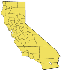
Summary[edit]
- Based on the modified Commerce Dept. map used in California.
- For en:wikipedia California county links, see also: en: List of California counties.
- Maps by county links
-
- The following maps are scaled down to 200x231, with individual county's highlight layers made visible:
Alameda | Alpine | Amador | Butte | Calaveras | Colusa | Contra Costa | Del Norte | El Dorado | Fresno | Glenn | Humboldt | Imperial | Inyo | Kern | Kings | Lake | Lassen | Los Angeles | Madera | Marin | Mariposa | Mendocino | Merced | Modoc | Mono | Monterey | Napa | Nevada | Orange | Placer | Plumas | Riverside | Sacramento | San Benito | San Bernardino | San Diego | San Francisco | San Joaquin | San Luis Obispo | San Mateo | Santa Barbara | Santa Clara | Santa Cruz | Shasta | Sierra | Siskiyou | Solano | Sonoma | Stanislaus | Sutter | Tehama | Trinity | Tulare | Tuolumne | Ventura | Yolo | Yuba
Source[edit]
Uncompressed version of w:File:California map showing counties (source).xcf.gz (gzipped images are not permitted for upload anymore).
Licensing[edit]
This file created by me, w:User:Brion VIBBER, based on the above-referenced file uploaded to meta.wikipedia.org a long time ago (old upload system from 2001/2002). That file claims to be a product of the US Department of Commerce, and should be public domain as a US government product. I claim no additional copyright on the modified image. --Brion 01:06, 14 January 2006 (UTC)
This work is in the public domain in the United States because it is a work prepared by an officer or employee of the United States Government as part of that person’s official duties under the terms of Title 17, Chapter 1, Section 105 of the US Code.
Note: This only applies to original works of the Federal Government and not to the work of any individual U.S. state, territory, commonwealth, county, municipality, or any other subdivision. This template also does not apply to postage stamp designs published by the United States Postal Service since 1978. (See § 313.6(C)(1) of Compendium of U.S. Copyright Office Practices). It also does not apply to certain US coins; see The US Mint Terms of Use.
|
 | |
| This file has been identified as being free of known restrictions under copyright law, including all related and neighboring rights. | ||
Original Wikipedia upload log[edit]
- 06:36, 9 September 2002 (84 KB) w:User:Brion VIBBER (Base image for the California county maps (GIMP image))
|
|
File history
Click on a date/time to view the file as it appeared at that time.
| Date/Time | Thumbnail | Dimensions | User | Comment | |
|---|---|---|---|---|---|
| current | 22:45, 15 February 2009 |  | 957 × 1,107 (363 KB) | Papa November (talk | contribs) | == Summary == Base image for the California county maps (GIMP image). Based on the [http://meta.wikipedia.com/upload/California_Map.jpg modified Commerce Dept map] used in California. The following maps are scaled |
You cannot overwrite this file.
File usage on Commons
The following page uses this file: