File:Beaufort Sea and disputed waters cropped.png
Jump to navigation
Jump to search
No higher resolution available.
Beaufort_Sea_and_disputed_waters_cropped.png (509 × 456 pixels, file size: 122 KB, MIME type: image/png)
Captions
Captions
Add a one-line explanation of what this file represents
| Description |
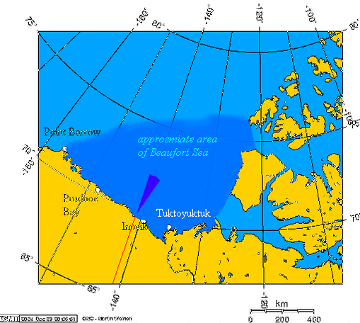
This is a cropped version of Image:Beaufort_Sea_and_disputed_waters.png. Español: Área aproximada del Mar de Beaufort, y el área en disputa
Beaufort Sea and the disputed waters The wedge shaped area on this map is the approximate area of the waters in dispute between the Yukon and Alaska. The longitude and latitudes of the communities follow:
|
||||||||||
| Source | Own work by uploader, using this online map creation tool | ||||||||||
| Author | Geo Swan | ||||||||||
| Permission (Reusing this file) |
|
||||||||||
| Other versions | Image:Beaufort_Sea_and_disputed_waters.png |

File history
Click on a date/time to view the file as it appeared at that time.
| Date/Time | Thumbnail | Dimensions | User | Comment | |
|---|---|---|---|---|---|
| current | 17:11, 26 August 2007 | | 509 × 456 (122 KB) | Reaper X (talk | contribs) | {{Information |Description='''This is a cropped version of Image:Beaufort_Sea_and_disputed_waters.png.''' {{es|Área aproximada del Mar de Beaufort, y el área en disputa}} Beaufort Sea and the disputed waters The wedge shaped area on this map is |
You cannot overwrite this file.
File usage on Commons
There are no pages that use this file.
File usage on other wikis
The following other wikis use this file:
- Usage on fr.wikipedia.org