Category:Maps of the Beaufort Sea
Jump to navigation
Jump to search
Media in category "Maps of the Beaufort Sea"
The following 24 files are in this category, out of 24 total.
-
 1598 map of the Polar Regions by Willem Barentsz.jpg 13,719 × 10,160; 30.66 MB
-

-
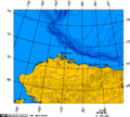 Alaska north shore.png 513 × 461; 19 KB
-
 Barents third voyage.jpg 2,000 × 1,511; 965 KB
-
 Barentskartet, 1598 (12068020364).jpg 2,842 × 2,091; 3.85 MB
-
 Barentsz Full Map.jpg 1,000 × 742; 258 KB
-
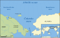
 Beaufort Sea and disputed waters cropped.png 509 × 456; 122 KB
-
 Beaufort Sea and disputed waters.png 512 × 602; 31 KB
-
 Beaufort Sea and disputed waters1.png 511 × 455; 25 KB
-
 Beaufortzee.PNG 747 × 492; 16 KB
-
 Chukchi Sea af.png 896 × 570; 167 KB
-
 Chukchi Sea hr.svg 1,004 × 639; 317 KB
-
 Chukchi Sea hu.svg 1,195 × 760; 210 KB
-
 Chukchi Sea.png 896 × 570; 110 KB
-
 Forminsket utgave av Barentskartet - no-nb krt 00487.jpg 4,418 × 3,449; 3.45 MB
-

-

-
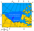 MerdeBeaufort.png 495 × 455; 134 KB
-
 Operational Navigation Chart B-7, 5th edition.jpg 9,254 × 6,665; 17 MB
-
 Operational Navigation Chart C-10, 4th edition.jpg 9,254 × 6,677; 18.68 MB
-
 Operational Navigation Chart C-9, 6th edition.jpg 9,053 × 6,596; 18.9 MB
-
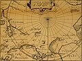 Pontanus 1611 Arctic Map.jpg 2,852 × 2,142; 802 KB
-
 Smith Bay map.jpg 3,300 × 2,550; 2.55 MB
-
 The American Museum journal (c1900-(1918)) (17974422180).jpg 942 × 2,280; 428 KB

-from-deep-water-Beaufort-Sea-northern-zookeys-462-011-g001.jpg)


.jpg)


_door_Willem_Barendsz_(titel_op_object),_NG-800.jpg)


)_(17974422180).jpg)