File:Bathymetric map of Guam.pdf
Jump to navigation
Jump to search

Size of this JPG preview of this PDF file: 597 × 599 pixels. Other resolutions: 239 × 240 pixels | 478 × 480 pixels | 765 × 768 pixels | 1,029 × 1,033 pixels.
Original file (1,029 × 1,033 pixels, file size: 427 KB, MIME type: application/pdf)
Captions
Captions
Add a one-line explanation of what this file represents
Summary[edit]
| Description |
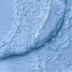
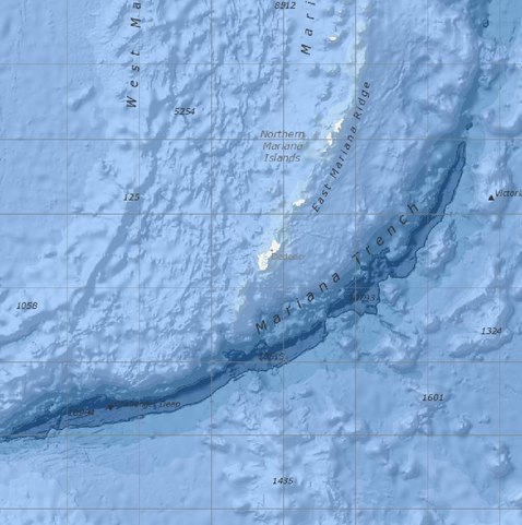
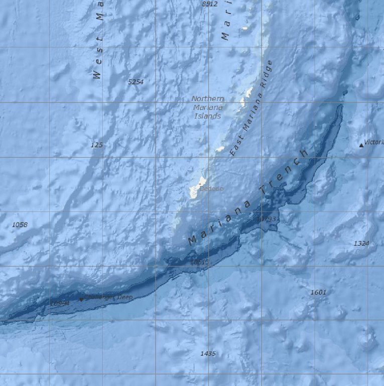
English: Bathymetric map screenshot of the NOAA Marine Geology Data visualizer, showing the immediate vicinity of Guam. Features named include the Mariana Trench, East Mariana Ridge, and Challenger Deep. Features indicated but not named are Sirena Deep, directly south of Guam, and Nero Deep.
From Version 2.72. of Marine Geology Data, last updated 10/2/2020. |
| Date | |
| Source | https://maps.ngdc.noaa.gov/viewers/marine_geology/, selection and crop by uploader |
| Author | National Centers for Environmental Information, NOAA |
| Other versions |

Licensing[edit]
This work is in the public domain in the United States because it is a work prepared by an officer or employee of the United States Government as part of that person’s official duties under the terms of Title 17, Chapter 1, Section 105 of the US Code.
Note: This only applies to original works of the Federal Government and not to the work of any individual U.S. state, territory, commonwealth, county, municipality, or any other subdivision. This template also does not apply to postage stamp designs published by the United States Postal Service since 1978. (See § 313.6(C)(1) of Compendium of U.S. Copyright Office Practices). It also does not apply to certain US coins; see The US Mint Terms of Use.
|
 | |
| This file has been identified as being free of known restrictions under copyright law, including all related and neighboring rights. | ||
File history
Click on a date/time to view the file as it appeared at that time.
| Date/Time | Thumbnail | Dimensions | User | Comment | |
|---|---|---|---|---|---|
| current | 23:03, 13 March 2021 |  | 1,029 × 1,033 (427 KB) | Featous (talk | contribs) | Uploaded a work by National Centers for Environmental Information, NOAA from https://maps.ngdc.noaa.gov/viewers/marine_geology/, selection and crop by uploader with UploadWizard |
You cannot overwrite this file.
File usage on Commons
The following page uses this file: