File:Attica topography basemap.svg

Original file (SVG file, nominally 714 × 769 pixels, file size: 1.64 MB)
Captions
Captions
Summary[edit]
| Description | |
| Date | |
| Source | Own work |
| Author | Future Perfect at Sunrise |
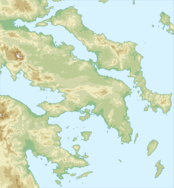
Test of map-making technique: Made with GRASS GIS and Inkscape software from public-domain geo data (SRTM3, SWBD). See the excellent tutorials by User:Sting at w:fr:Wikipédia:Atelier graphique/Didacticiels cartographiques/Didacticiels pour la cartographie numérique géoréférencée. Relief levels vectorised and exported to SVG; relief shading is embedded bitmap graphics.
Geographical extent: from 22.4E 37.2N to 24.63E 39.10N; map projection: Lambert conformal conic, parallels 38.33, 33.00 and 45.00, meridian 23.5.
Licensing[edit]
| I, the copyright holder of this work, release this work into the public domain. This applies worldwide. In some countries this may not be legally possible; if so: I grant anyone the right to use this work for any purpose, without any conditions, unless such conditions are required by law. |
File history
Click on a date/time to view the file as it appeared at that time.
| Date/Time | Thumbnail | Dimensions | User | Comment | |
|---|---|---|---|---|---|
| current | 11:46, 22 January 2009 | | 714 × 769 (1.64 MB) | Future Perfect at Sunrise (talk | contribs) | minor fix |
| 20:22, 13 January 2009 |  | 714 × 769 (1.64 MB) | Future Perfect at Sunrise (talk | contribs) | dang, need to learn how to properly embed graphics in SVG. | |
| 19:51, 13 January 2009 |  | 714 × 769 (938 KB) | Future Perfect at Sunrise (talk | contribs) | properly embedded this time | |
| 19:41, 13 January 2009 |  | 714 × 769 (938 KB) | Future Perfect at Sunrise (talk | contribs) | jpg embedded | |
| 19:18, 13 January 2009 |  | 714 × 769 (927 KB) | Future Perfect at Sunrise (talk | contribs) | {{Information |Description={{en|1=Topographical map of south-east Greece: Attica, Euboea, Boeotia, Argolis. }} |Source=Own work by uploader |Author=[[User:Future Perfect at Sunrise|Future Perfect a |
You cannot overwrite this file.
File usage on Commons
The following page uses this file:
File usage on other wikis
The following other wikis use this file:
- Usage on de.wikipedia.org