File:Asou-Bay ria coast aerial photograph.JPG
Jump to navigation
Jump to search
Size of this preview: 800 × 599 pixels. Other resolutions: 320 × 239 pixels | 640 × 479 pixels | 1,024 × 766 pixels | 1,280 × 958 pixels | 2,560 × 1,915 pixels | 3,487 × 2,609 pixels.
Original file (3,487 × 2,609 pixels, file size: 3.63 MB, MIME type: image/jpeg)
Captions
Captions
Add a one-line explanation of what this file represents
Summary[edit]
| Description |
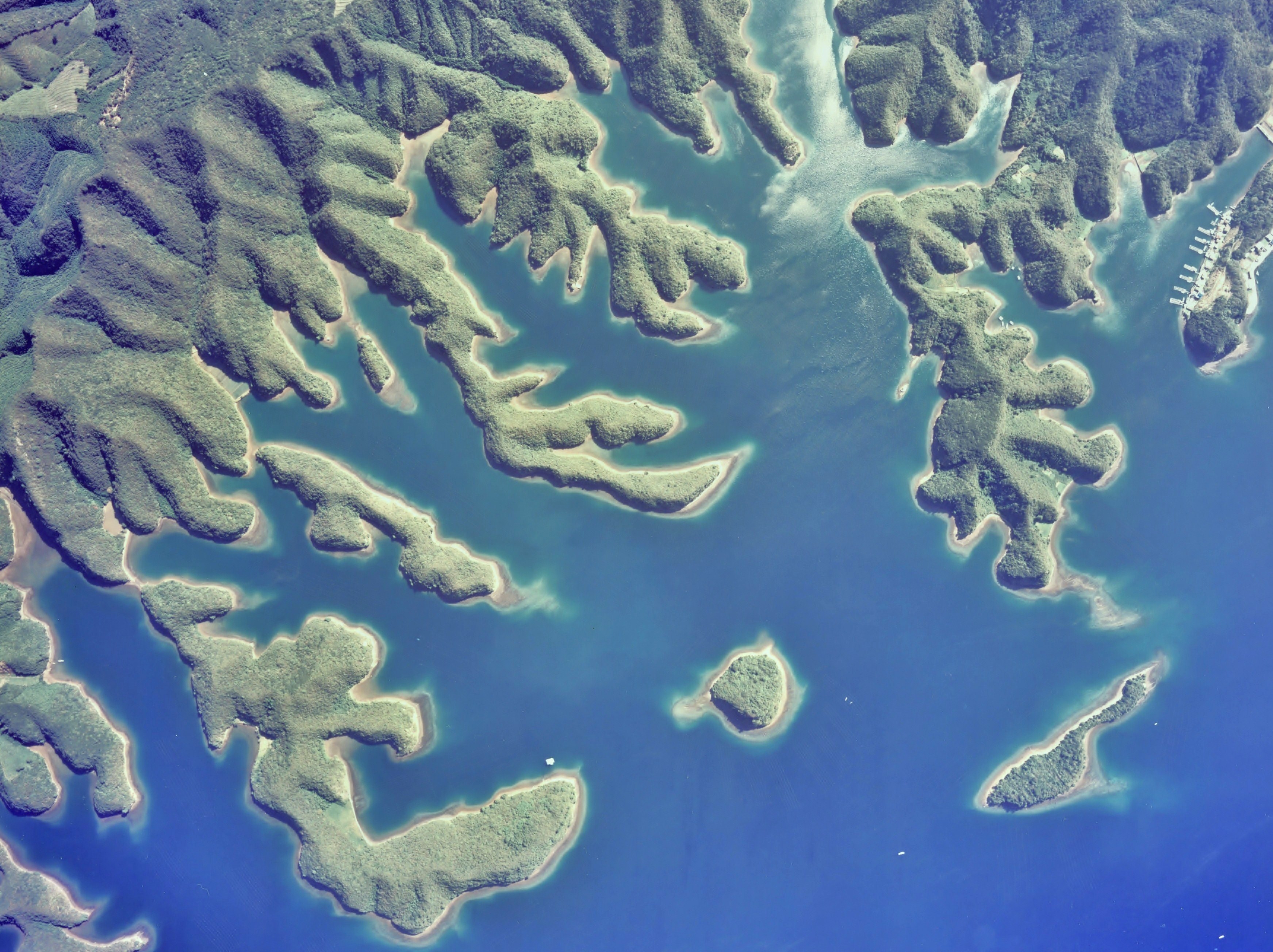
English: Gulf of Asou-Bay ria coast(drowned valley)aerial photograph in Tsushima Island Japan
日本語: 対馬、浅茅湾大千切島付近のリアス式海岸(溺れ谷)地形の空中写真。Cku-77-1_c16_13-1を使用。 |
| Date | |
| Source | 国土情報ウェブマッピングシステム |
| Author | 国土交通省 |
| Object location | | View this and other nearby images on: OpenStreetMap |
|---|
Licensing[edit]

|
The copyright holder of this file, the Ministry of Land, Infrastructure, Transport and Tourism of Japan, allows anyone to use it for any purpose, provided that the copyright holder is properly attributed. Redistribution, derivative work, commercial use, and all other use is permitted. |
Attribution:
Copyright © National Land Image Information (Color Aerial Photographs), Ministry of Land, Infrastructure, Transport and Tourism
|
 |
This image is copyrighted by the Ministry of Land, Infrastructure, Transport and Tourism of Japan. For terms of use, see the stipulation to use of National Land Information (in Japanese) and message from MLIT (in Japanese and English). When you display this image on an article, include the following phrase in the description: "Made based on National Land Image Information (Color Aerial Photographs), Ministry of Land, Infrastructure, Transport and Tourism".
|
File history
Click on a date/time to view the file as it appeared at that time.
| Date/Time | Thumbnail | Dimensions | User | Comment | |
|---|---|---|---|---|---|
| current | 02:11, 4 December 2010 | | 3,487 × 2,609 (3.63 MB) | さかおり (talk | contribs) | {{Information |Description={{en|1=Gulf of Asou-Bay ria coast(drowned valley)aerial photograph in Tsushima Island Japan {{en|1={{ja|1=対馬、浅茅湾大千切島付近のリアス式海岸(溺れ谷)地形の空中写真。Cku-77-1_c16_13-1を� |
You cannot overwrite this file.
File usage on Commons
The following page uses this file:
File usage on other wikis
The following other wikis use this file:
- Usage on bn.wikipedia.org
- Usage on en.wikipedia.org
- Usage on ja.wikipedia.org
- Usage on ko.wikipedia.org
- Usage on ms.wikipedia.org
- Usage on nl.wikipedia.org
- Usage on nl.wiktionary.org
- Usage on no.wikipedia.org