File:Approximate extension of the Zagwe Empire.JPG
Jump to navigation
Jump to search
Size of this preview: 692 × 600 pixels. Other resolutions: 277 × 240 pixels | 554 × 480 pixels | 886 × 768 pixels | 1,182 × 1,024 pixels | 1,500 × 1,300 pixels.
Original file (1,500 × 1,300 pixels, file size: 1.87 MB, MIME type: image/jpeg)
Captions
Captions
Add a one-line explanation of what this file represents
Summary[edit]
| Description |
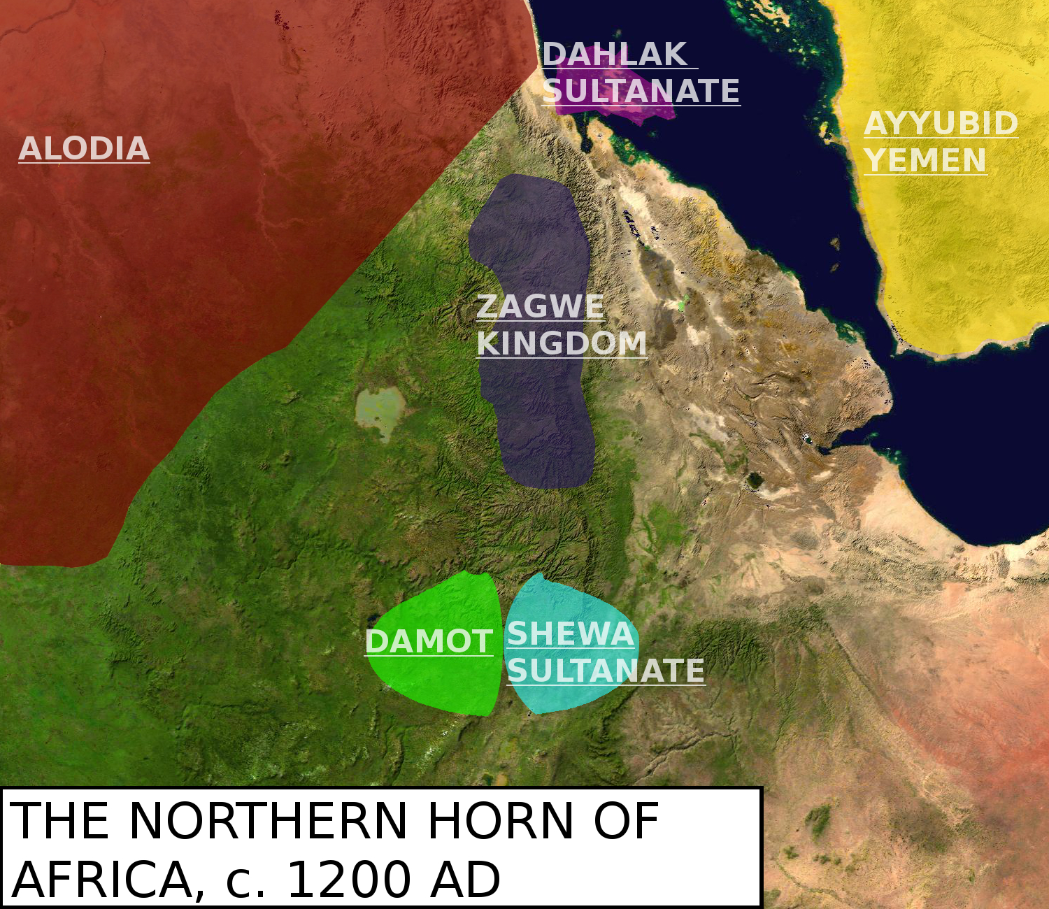
English: Map showing the northern Horn around the year 1200. Original map is called File:Africa_satellite_plane.jpg. Sources used: Encyclopedia Aethiopia Volume 2 and 5, Mohi Zarroug's "Kingdom of Alwa" and Ayda Bouanga's "Le Damot dans l'histoire de l'Ethiopie (XIIIe-XXe siecles)". |
| Date | |
| Source | Own work |
| Author | LeGabrie |
Licensing[edit]
I, the copyright holder of this work, hereby publish it under the following license:
This file is licensed under the Creative Commons Attribution-Share Alike 4.0 International license.
- You are free:
- to share – to copy, distribute and transmit the work
- to remix – to adapt the work
- Under the following conditions:
- attribution – You must give appropriate credit, provide a link to the license, and indicate if changes were made. You may do so in any reasonable manner, but not in any way that suggests the licensor endorses you or your use.
- share alike – If you remix, transform, or build upon the material, you must distribute your contributions under the same or compatible license as the original.
File history
Click on a date/time to view the file as it appeared at that time.
| Date/Time | Thumbnail | Dimensions | User | Comment | |
|---|---|---|---|---|---|
| current | 15:36, 22 March 2018 | | 1,500 × 1,300 (1.87 MB) | LeGabrie (talk | contribs) | Made the names transparent |
| 21:41, 17 March 2018 |  | 1,500 × 1,300 (1.88 MB) | LeGabrie (talk | contribs) | Separated Damot and Shewa, as Damot probably didn't interfer in Shewa until the 1230's. | |
| 17:44, 17 March 2018 |  | 1,500 × 1,300 (1.88 MB) | LeGabrie (talk | contribs) | Re-added the Shewa Sultanate as part of Damot | |
| 15:41, 17 March 2018 |  | 1,500 × 1,300 (1.87 MB) | LeGabrie (talk | contribs) | Gave the other kingdoms borders | |
| 21:13, 16 March 2018 |  | 1,500 × 1,300 (2.01 MB) | LeGabrie (talk | contribs) | Desperately needed historical and aesthetical update | |
| 22:08, 29 May 2015 |  | 553 × 511 (41 KB) | LeGabrie (talk | contribs) | Deleted one remaining line of the Red Sea. | |
| 21:54, 27 May 2015 |  | 553 × 511 (42 KB) | LeGabrie (talk | contribs) | User created page with UploadWizard |
You cannot overwrite this file.
File usage on Commons
There are no pages that use this file.
File usage on other wikis
The following other wikis use this file:
- Usage on af.wikipedia.org
- Usage on ar.wikipedia.org
- Usage on cs.wikipedia.org
- Usage on da.wikipedia.org
- Usage on en.wikipedia.org
- Usage on eo.wikipedia.org
- Usage on es.wikipedia.org
- Usage on fr.wikipedia.org
- Usage on id.wikipedia.org
- Usage on it.wikipedia.org
- Usage on ja.wikipedia.org
- Usage on ko.wikipedia.org
- Usage on pt.wikipedia.org
- Usage on uk.wikipedia.org
- Usage on vi.wikipedia.org
- Usage on zh.wikipedia.org