Category:Maps showing history of Africa
Jump to navigation
Jump to search

Temperate regions: North America · South America · Africa · Europe · Asia · Oceania – Polar regions: – Other regions:
Countries of Africa: Algeria · Angola · Benin · Botswana · Burkina Faso · Burundi · Cameroon · Central African Republic · Chad · Democratic Republic of the Congo · Republic of the Congo · Djibouti · Egypt‡ · Equatorial Guinea · Eritrea · Eswatini · Ethiopia · Gabon · The Gambia · Ghana · Guinea · Guinea-Bissau · Ivory Coast · Kenya · Lesotho · Liberia · Libya · Madagascar · Malawi · Mali · Mauritania · Morocco · Mozambique · Namibia · Niger · Nigeria · Rwanda · Senegal · Sierra Leone · Somalia · South Africa · South Sudan · Sudan · Tanzania · Togo · Tunisia · Uganda · Zambia · Zimbabwe
Limited recognition: Ambazonia · Azawad · Somaliland – Other areas: Ceuta · Melilla · Réunion · Western Sahara
‡: partly located in Africa
Limited recognition: Ambazonia · Azawad · Somaliland – Other areas: Ceuta · Melilla · Réunion · Western Sahara
‡: partly located in Africa
Wikimedia category | |||||
| Upload media | |||||
| Instance of | |||||
|---|---|---|---|---|---|
| |||||
Use the appropriate category for maps showing all or a large part of Africa. See subcategories for smaller areas:
| If the map shows | Category to use |
|---|---|
| Africa on a recently created map | Category:Maps of Africa or its subcategories |
| Africa on a map created more than 70 years ago | Category:Old maps of Africa or its subcategories |
| the history of Africa on a recently created map | Category:Maps of the history of Africa or its subcategories |
| the history of Africa on a map created more than 70 years ago | Category:Old maps of the history of Africa or its subcategories |

Subcategories
This category has the following 74 subcategories, out of 74 total.
!
*
+
- Maps of the history of Réunion (16 F)
A
B
C
D
- Daraawiish maps (11 F)
E
G
H
I
K
L
- Maps of the history of Lesotho (18 F)
M
- Maps of Fouta Jallon (3 F)
N
P
R
S
T
U
Z
Media in category "Maps showing history of Africa"
The following 126 files are in this category, out of 126 total.
-
 10 Afr Est -700 png élargi.png 2,001 × 1,830; 589 KB
-
 11-2 Afr Est -600 png élargi.png 2,002 × 1,830; 603 KB
-
 12-2 Afr Est -500 png élargi.png 1,998 × 1,830; 635 KB
-

-

-
 4-2 Afr Est -2500 png élargi.png 2,001 × 1,830; 548 KB
-
 7 Afr Est -1000 png élargi.png 2,001 × 1,830; 595 KB
-
 A Map of ancient Africa (FL35469195 2370147).jpg 8,543 × 6,346; 73.37 MB
-
 Adal Sultanate.png 379 × 245; 9 KB
-
 Africa historical traite.JPG 2,667 × 2,287; 572 KB
-
 Africa independence dates (hy).svg 1,300 × 1,000; 205 KB
-
 Africa independence dates.PNG 752 × 800; 42 KB
-
 Africa, australopitecines discovery sites.png 341 × 341; 14 KB
-
 Africa-Decolonization.png 360 × 392; 18 KB
-
 African Horn in 1915 English.png 500 × 599; 169 KB
-
 African nations order of independence 1950-1993.gif 450 × 355; 16 KB
-
 African slave trade.png 721 × 600; 98 KB
-
 African-civilizations-map-pre-colonial.svg 1,390 × 1,295; 488 KB
-
 AfricanMalagasyUnionMembers.png 341 × 341; 10 KB
-
 Afrique latine3.png 966 × 848; 39 KB
-
 Aksumite empire.svg 631 × 540; 1.35 MB
-
 Approximate extension of the Zagwe Empire.JPG 1,500 × 1,300; 1.87 MB
-
 AreasCulturais-Africa-Herskovits.jpg 1,440 × 1,593; 837 KB
-
 Australopithecines area.jpg 3,195 × 3,167; 933 KB
-
 Australopithecines.jpg 3,195 × 3,167; 1,007 KB
-
 Bantu Phillipson.png 332 × 680; 15 KB
-
 Basic Map of East Africa, c.1500.png 470 × 437; 22 KB
-
 BoerStatesukr.jpeg 454 × 393; 55 KB
-
 Bornu15century.jpg 800 × 430; 24 KB
-
 British Decolonisation in Africa.png 2,000 × 2,000; 406 KB
-
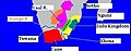
 Cabinda, R. Congo, D.R. Congo, Angola.png 380 × 370; 18 KB
-
 Cabra safari 1905 1906.png 2,663 × 2,639; 4.73 MB
-
 Carte bunyoro.png 553 × 400; 34 KB
-
 Carte monde arabe.JPG 600 × 400; 30 KB
-
 Carte-afrique-fer.png 450 × 550; 30 KB
-
 Carte-afrique.png 450 × 450; 31 KB
-
 Cartografia XIII-XV a l'Atlàntic.png 733 × 744; 176 KB
-
 Colonialism in 1945 updated legend.png 1,554 × 628; 100 KB
-
 Commerce transsaharien.jpg 2,214 × 1,488; 1.33 MB
-
 D257-Vestiges d’ancienne civilisation au sud du Zambèze.-L2-Ch7.png 1,430 × 1,808; 62 KB
-
 Descolonizacion d'Africa (1945-1990).png 1,021 × 685; 154 KB
-
 Descolonizacion d'Africa (1945-1991).png 1,317 × 670; 184 KB
-
 DinastíaIjshidí935-969ProyecciónOrtográfica.svg 553 × 553; 412 KB
-
 East and southern africa early iron age.png 677 × 784; 15 KB
-
 East&southern africa early iron age.png 677 × 784; 11 KB
-
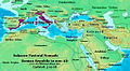
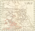
 Egypt and neighbors 1880 map de.png 2,122 × 2,100; 896 KB
-
 Egypt and Syria 1768 to 1774 map ar.png 2,792 × 2,172; 778 KB
-
 Egypt and Syria 1768 to 1774 map de.png 2,792 × 2,172; 874 KB
-
 Egypt and Syria 1768 to 1774 map en.png 2,792 × 2,172; 873 KB
-
 Egypt and Syria 1775 to 1805 map de.png 2,792 × 2,172; 835 KB
-
 Emirate of Trarza Map.png 2,445 × 1,295; 396 KB
-
 Endonyms of Africa.jpg 1,705 × 1,829; 697 KB
-
 Esclavatge - Comèrci mondiau sègle XVIII.png 2,727 × 2,249; 1,004 KB
-
 Etiopia - Partiment d'Africa Orientala (1889-1914).png 1,005 × 886; 218 KB
-
 Ghana Empire Map.svg 1,000 × 1,000; 149 KB
-
 Ghana successor map 1200 ru.jpg 428 × 448; 34 KB
-
 Ghana successor map 1200.png 431 × 500; 199 KB
-
 Guinea1882.PNG 247 × 137; 4 KB
-
 Hanno der Seefahrer.png 596 × 830; 236 KB
-
 Ikhshidid Dynasty 935 - 969 (AD)-ar.png 821 × 440; 36 KB
-
 Ikhshidid Dynasty 935 - 969 (AD).PNG 821 × 440; 33 KB
-
 IslamicWorld850.png 1,481 × 902; 50 KB
-
 Kajoor ca. 1850.png 2,269 × 1,569; 584 KB
-
 Kingdom of Jolof Map.png 3,158 × 1,895; 636 KB
-
 Kingdom of Kiang Map.png 1,568 × 1,081; 288 KB
-
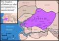 Kingdom of Saloum Map.png 2,689 × 1,881; 688 KB
-
 Kingdom of Sine Map.png 1,929 × 1,318; 400 KB
-
 Kingdom of Waalo Map.png 2,021 × 1,428; 405 KB
-
 Kingdom of Wuli Map.png 1,752 × 1,082; 264 KB
-
 Late miocene hominidae.jpg 3,195 × 3,167; 970 KB
-
 Luo migrations.png 2,663 × 2,639; 4.66 MB
-
 Map ndongo - mapa mais acertado.jpg 1,092 × 1,448; 332 KB
-
 Map of ancient and Medieval Sub-Saharan states zoomed in.jpg 658 × 519; 131 KB
-
 Map of ancient and Medieval Sub-Saharan states.jpg 1,172 × 1,197; 876 KB
-

-
 Map of Colonial Africa in 1913.png 350 × 382; 87 KB
-
 Map of Futa Jallon.png 2,000 × 1,876; 1.22 MB
-
-
 Map of Portuguese Carreira da India.gif 1,047 × 593; 69 KB
-
 Map of the Kingdom of Mauretania.jpg 1,472 × 792; 159 KB
-
 Map of the MENA region in 1798.svg 1,543 × 1,006; 528 KB
-
 Mauretania cesarea and tingitan10 A JC.jpg 296 × 170; 8 KB
-
 Mauretania Titled Focus.jpg 1,482 × 796; 135 KB
-
 Mediterranean Area Map.jpg 557 × 419; 64 KB
-
 Mediterranean1400.png 1,215 × 549; 187 KB
-
 Mediterraneans 1328.png 806 × 454; 39 KB
-
 Mega africa.png 640 × 392; 6 KB
-
 NE 500ad.jpg 1,424 × 1,049; 238 KB
-
 NE 600ad.jpg 1,439 × 1,086; 1.14 MB
-
 Near East480ad.jpg 1,402 × 1,023; 226 KB
-
 Origins of nubian and indian vaults.svg 797 × 797; 172 KB
-
 Paranthropus Africa.jpg 3,195 × 3,167; 999 KB
-

-
 PSM V37 D676 Map of africa circa 1890.jpg 1,781 × 1,926; 223 KB
-
 Ptolemaic-Empire 200bc.jpg 1,164 × 636; 1.02 MB
-
 Ptolemaic-Empire 200bcARABIC.JPG 800 × 437; 119 KB
-
 Rabih az-Zubayr 1896.png 825 × 550; 165 KB
-
 Realnam.JPG 412 × 161; 18 KB
-
 Realzulu.JPG 412 × 161; 14 KB
-
 Reiaume de Kush (periòde Napata-Meroe).png 686 × 943; 84 KB
-
 Reiaumes nubians de l'Edat Mejana Auta.png 599 × 1,013; 95 KB
-
 Roman-Empire 200bc.jpg 1,164 × 636; 887 KB
-
 Roman-Empire 477ad.jpg 1,405 × 954; 372 KB
-
 Rome-Seleucia-Parthia 200bc.jpg 1,205 × 567; 767 KB
-
 Routes d'Henri le Navigateur-sr.JPG 365 × 425; 24 KB
-
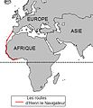 Routes d'Henri le Navigateur.JPG 365 × 425; 25 KB
-
 Sidney Hall, Mauritania, Numidia, et Africa Propria (FL13726068 2496071).jpg 4,268 × 3,378; 17.64 MB
-
 State of Bundu Map.png 3,007 × 1,867; 620 KB
-
 The Mbunda migration route.jpg 3,581 × 3,336; 594 KB
-
 The Mbunda migration routes.jpg 515 × 480; 139 KB
-
 Toubou.png 640 × 578; 778 KB
-
 Triangle trade2-ar.png 448 × 327; 176 KB
-
 Triangle trade2.png 448 × 327; 170 KB
-
 Triângulo Comercial Atlântico - África, Américas, Europa.png 2,880 × 1,620; 928 KB
-
 ZAfrica australopitecines discovery sites.png 223 × 115; 3 KB
-
 Empire-rozvi.png 915 × 706; 2.47 MB
-
 África urbanismos.png 1,525 × 1,440; 527 KB
-
 Δυτική Αφρική (τέλη 18ου αιώνα).png 1,192 × 592; 160 KB
-
 Δυτική Αφρική 1625.png 498 × 306; 58 KB
-
 Ζουλού, Τσουάνα, Νγκούνι.jpg 420 × 222; 69 KB
-
 Ιστορία των Ίγκμπο.jpg 418 × 371; 168 KB
-
 Κράτη που διαδέχτηκαν την Αυτοκρατορία Γκάνα 1200.png 431 × 500; 213 KB
-
 Λαός των Νάμα.jpg 508 × 222; 159 KB
-
 Υπερσαχάριες εμπορικές διαδρομές.png 878 × 1,024; 176 KB
-
 Χάρτης προαποικιακών Αφρικανικών πολιτισμών.png 2,000 × 1,863; 774 KB
-
 罗德西亚形势图1975.jpg 624 × 475; 45 KB


.jpg)
%27_(11004000943).jpg)


.jpg)


.svg)


.png)
.png)


.png)


-ar.png)
.PNG)


.jpg)


.jpg)


.png)


.jpg)


.png)


