File:Aerial view looking west; Andrew McLean Company Textile Mill at bottom, Dundee Canal at center, Botany Worsted Mills at top - Dundee Canal Industrial Historic District, Beginning HAER NJ,16-PASA,9-56.tif
Jump to navigation
Jump to search

Size of this JPG preview of this TIF file: 740 × 600 pixels. Other resolutions: 296 × 240 pixels | 592 × 480 pixels | 948 × 768 pixels | 1,263 × 1,024 pixels | 2,527 × 2,048 pixels | 5,391 × 4,370 pixels.
Original file (5,391 × 4,370 pixels, file size: 22.47 MB, MIME type: image/tiff)
Captions
Captions
Add a one-line explanation of what this file represents
Summary[edit]
| Photographer |
Tucher, Rob Related names:
|
|||
| Title |
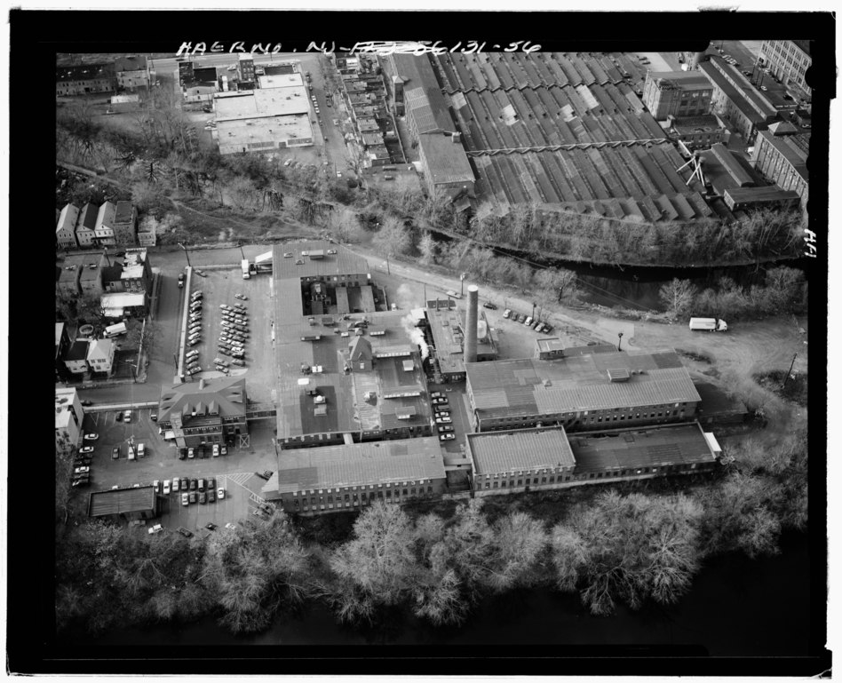
Aerial view looking west; Andrew McLean Company Textile Mill at bottom, Dundee Canal at center, Botany Worsted Mills at top - Dundee Canal Industrial Historic District, Beginning at George Street in Passaic and extending north along Dundee Canal approximately 1.2 miles to Canal headgates opposite East Clifton Avenue in Clifton, Passaic, Passaic County, NJ |
|||
| Depicted place | New Jersey; Passaic County; Passaic | |||
| Date | 1997 | |||
| Dimensions | 4 x 5 in. | |||
| Current location |
Library of Congress Prints and Photographs Division Washington, D.C. 20540 USA http://hdl.loc.gov/loc.pnp/pp.print |
|||
| Accession number |
HAER NJ,16-PASA,9-56 |
|||
| Credit line |
|
|||
| Notes |
|
|||
| Source | https://www.loc.gov/pictures/item/nj1660.photos.191259p | |||
| Permission (Reusing this file) |
|

| Object location | | View this and other nearby images on: OpenStreetMap |
|---|
File history
Click on a date/time to view the file as it appeared at that time.
| Date/Time | Thumbnail | Dimensions | User | Comment | |
|---|---|---|---|---|---|
| current | 20:58, 28 July 2014 |  | 5,391 × 4,370 (22.47 MB) | Fæ (talk | contribs) | GWToolset: Creating mediafile for Fæ. HABS 24 July 2014 (2301:2600) |
You cannot overwrite this file.
File usage on Commons
The following page uses this file: