File:931225 7 7a 3537 1427 Chemin Roy.jpg
Jump to navigation
Jump to search
Size of this preview: 800 × 334 pixels. Other resolutions: 320 × 134 pixels | 640 × 267 pixels | 1,024 × 428 pixels | 1,280 × 535 pixels | 3,537 × 1,477 pixels.
Original file (3,537 × 1,477 pixels, file size: 5.32 MB, MIME type: image/jpeg)
Captions
Captions
Chemin du Roy, Trois-Rivières (City)
Summary[edit]
| Description |
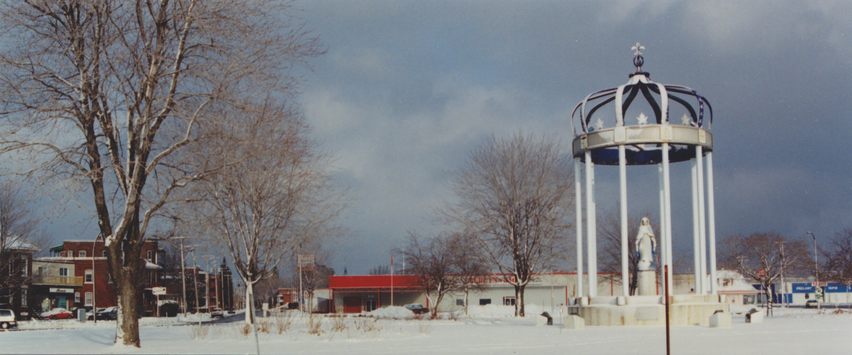
English: 46º 19' 59.4" N - 072º 33' 04.9" W, Mauricie, Trois-Rivières (City), Chemin du Roy, roundabout between Gene-H-Kruger Boulevard, de la Commune Boulevard and Royal Street, Thursday, December 25, 1993.
Français : 46º 19' 59,4" N - 072º 33' 04,9" O, Mauricie, Trois-Rivières (Ville), Chemin du Roy, rondpoint entre les boulevards Gene-H-Kruger, de la Commune et la rue Royale, le jeudi 25 décembre 1993. |
| Date | |
| Source | Own work |
| Author | Nichole Ouellette |
Licensing[edit]
I, the copyright holder of this work, hereby publish it under the following license:
This file is licensed under the Creative Commons Attribution-Share Alike 4.0 International license.
- You are free:
- to share – to copy, distribute and transmit the work
- to remix – to adapt the work
- Under the following conditions:
- attribution – You must give appropriate credit, provide a link to the license, and indicate if changes were made. You may do so in any reasonable manner, but not in any way that suggests the licensor endorses you or your use.
- share alike – If you remix, transform, or build upon the material, you must distribute your contributions under the same or compatible license as the original.
File history
Click on a date/time to view the file as it appeared at that time.
| Date/Time | Thumbnail | Dimensions | User | Comment | |
|---|---|---|---|---|---|
| current | 19:41, 14 April 2023 | | 3,537 × 1,477 (5.32 MB) | Nichole Ouellette (talk | contribs) | Uploaded own work with UploadWizard |
You cannot overwrite this file.
File usage on Commons
The following page uses this file:
File usage on other wikis
The following other wikis use this file:
- Usage on en.wikipedia.org
- Usage on fr.wikipedia.org