Category:Chemin du Roy (Quebec)
Jump to navigation
Jump to search
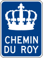
historic route in New France, now Quebec, Canada  Route marker for the Chemin du Roy in Quebec City.    | |||||
| Upload media | |||||
| Instance of | |||||
|---|---|---|---|---|---|
| Location | Quebec, Canada | ||||
| Located in or next to body of water | |||||
| Commissioned by |
| ||||
| Inception |
| ||||
| Partially coincident with |
| ||||
 | |||||
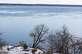
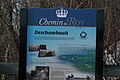
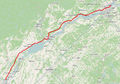
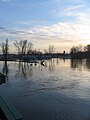
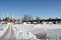
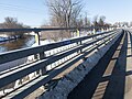
The Chemin du Roy (French for "King's Highway" or "King's Road") is a historic road along the north shore of the St. Lawrence River in Quebec. The road begins in Repentigny and extends almost 280 kilometres (170 mi) eastward towards Quebec City, its eastern terminus.
Subcategories
This category has the following 2 subcategories, out of 2 total.
G
P
- Pont de Batiscan (13 F)
Media in category "Chemin du Roy (Quebec)"
The following 37 files are in this category, out of 37 total.
-
 931225 7 7a 3537 1427 Chemin Roy.jpg 3,537 × 1,477; 5.32 MB
-
 Batiscan sur le Chemin du Roy 001.jpg 3,536 × 1,792; 5.51 MB
-
 CA-QC road sign I-185-1-A.svg 180 × 180; 31 KB
-
 Cap Lauzon 006.jpg 3,456 × 2,304; 4.28 MB
-
 Cap Lauzon 018.jpg 3,456 × 2,304; 1.55 MB
-
 Champlain, Chemin du Roy (route 138) - Rue Notre Dame 016.jpg 3,456 × 2,304; 1.79 MB
-
 Champlain, Chemin du Roy (route 138) - Rue Notre Dame 022.jpg 4,032 × 3,024; 5.17 MB
-
 Champlain, Chemin du Roy (route 138) - Rue Notre Dame 028.jpg 4,032 × 3,024; 5.56 MB
-
 Champlain, sur le quai du fleuve Saint-Laurent - Santa Maria 002.jpg 4,032 × 3,024; 3.35 MB
-
 Chemin du Roy (route 138) 2020 03 06 018.jpg 4,032 × 3,024; 4.15 MB
-
 Chemin du Roy 040.jpg 4,032 × 3,024; 4.54 MB
-
 Chemin du Roy neige.JPG 4,320 × 3,240; 4.29 MB
-
 Chemin du Roy Quebec City.JPG 1,200 × 1,600; 750 KB
-
 Chemin du Roy Repentigny Quebec.png 933 × 652; 855 KB
-
 Clocher de village (très français !) (525548101).jpg 2,198 × 1,465; 1.09 MB
-
 De Gaule 13a 19670624 3543 2383.jpg 3,543 × 2,383; 3.28 MB
-
 De Gaulle 12a 19670624 3553 2385.jpg 3,553 × 2,385; 3.1 MB
-
 Embouchure rivière Batiscan, Batiscan 003.jpg 1,536 × 2,048; 913 KB
-
 Embouchure rivière Batiscan, Batiscan 008.jpg 2,048 × 1,536; 660 KB
-
 Embouchure rivière Batiscan, Batiscan 010.jpg 1,536 × 2,048; 719 KB
-
 Fleuve Saint-Laurent, autoportrait au quai de Batiscan.jpg 4,032 × 3,024; 3.23 MB
-
 Glace 005 Jeffrey-Alexandre-Rousseau bridge.jpg 3,456 × 2,304; 3.27 MB
-
 Impatiens glandulifera 011.jpg 6,240 × 4,160; 7.04 MB
-
 Neuville 004 a.jpg 2,592 × 1,936; 1.58 MB
-
 Neuville 095.jpg 4,032 × 3,024; 3.69 MB
-
 Peche 003 rivière Sainte-Anne 01.jpg 3,456 × 2,304; 3.51 MB
-
 Peche 003 rivière Sainte-Anne 02.jpg 2,048 × 1,536; 1.19 MB
-
 Québec I-185-2-a.svg 356 × 90; 33 KB
-
 Québec I-185-3-a.svg 181 × 241; 21 KB
-

-
 Riviere Champlain 030.jpg 4,032 × 3,024; 5.07 MB
-
 Riviere Champlain 040.jpg 4,032 × 3,024; 8.59 MB
-
 Riviere Champlain 041.jpg 4,032 × 3,024; 8.71 MB
-
 Riviere Champlain 044.jpg 4,032 × 3,024; 8.89 MB
-
 Riviere Champlain 045.jpg 4,032 × 3,024; 8.99 MB
-
 Riviere Champlain 046.jpg 4,032 × 3,024; 8.3 MB
-
 Santa Maria 001.jpg 4,032 × 3,024; 3.66 MB


_-_Rue_Notre_Dame_016.jpg)
_-_Rue_Notre_Dame_022.jpg)
_-_Rue_Notre_Dame_028.jpg)

_2020_03_06_018.jpg)

_(525548101).jpg)


-Rue_Notre-Dame_(vers_l%27ouest)_(pr%C3%A8s_du_coin_de_la_rue_du_Chenal)-2023-11-29.jpg)