File:2008 party vote county.pdf
Jump to navigation
Jump to search

Size of this JPG preview of this PDF file: 783 × 599 pixels. Other resolutions: 314 × 240 pixels | 627 × 480 pixels | 1,003 × 768 pixels | 1,280 × 980 pixels | 1,591 × 1,218 pixels.
Original file (1,591 × 1,218 pixels, file size: 13.15 MB, MIME type: application/pdf)
Captions
Captions
Add a one-line explanation of what this file represents
Summary[edit]
| Description |
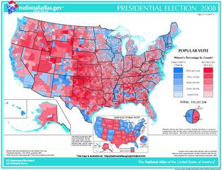
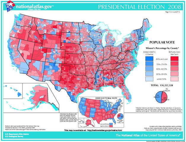
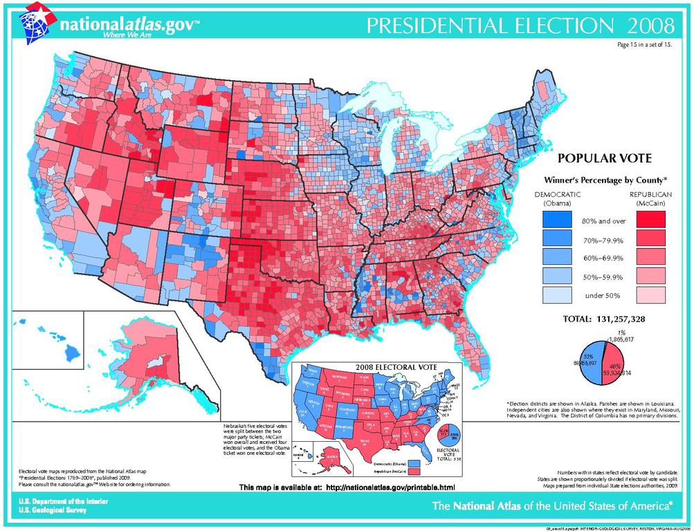
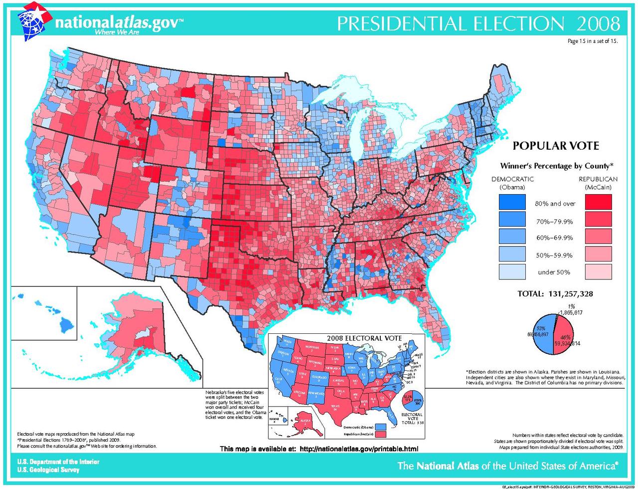
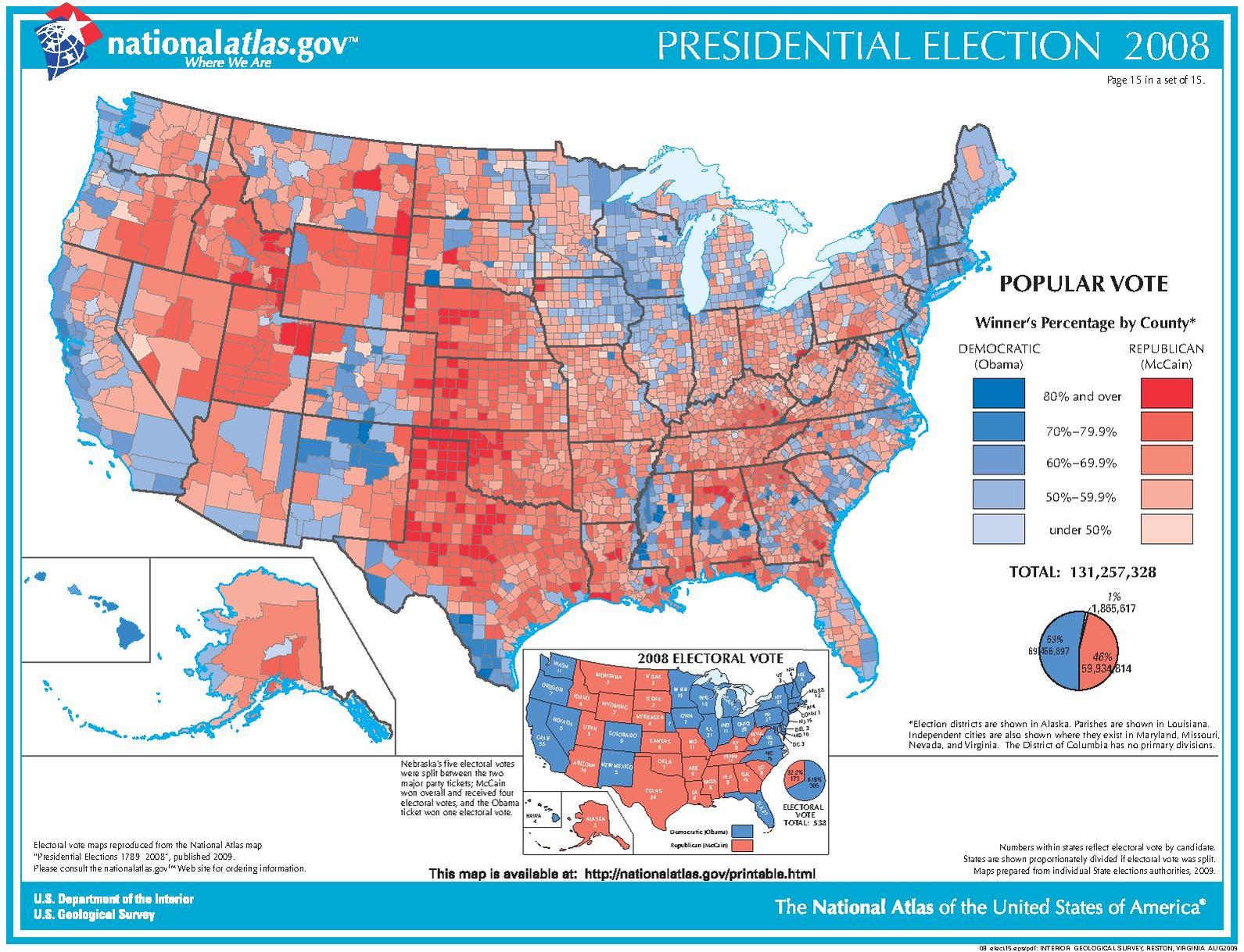
English: A map of the 2008 U.S. Presidential election vote by county |
| Date | after 2008 |
| Source | The National Atlas of the United States |
| Author | The U.S. govt. |
Licensing[edit]
This map was obtained from an edition of the National Atlas of the United States. Like almost all works of the U.S. federal government, works from the National Atlas are in the public domain in the United States.
Online access: NationalAtlas.gov | 1970 print edition: Library of Congress, Perry-Castañeda Library
|
File history
Click on a date/time to view the file as it appeared at that time.
| Date/Time | Thumbnail | Dimensions | User | Comment | |
|---|---|---|---|---|---|
| current | 00:39, 2 September 2012 |  | 1,591 × 1,218 (13.15 MB) | Futurist110 (talk | contribs) | {{Information |Description ={{en|1=A map of the 2008 U.S. Presidential election vote by county}} |Source =The National Atlas of the United States |Author =The U.S. govt. |Date =2008 or later |Permission = |other_version... |
You cannot overwrite this file.
File usage on Commons
There are no pages that use this file.
File usage on other wikis
The following other wikis use this file:
- Usage on en.wikipedia.org