File:1865 Spruner Map of Greece during the Dorian Migrations - Geographicus - GraeciaMigrationisDoricae-spruner-1865.jpg
Jump to navigation
Jump to search
Size of this preview: 724 × 599 pixels. Other resolutions: 290 × 240 pixels | 580 × 480 pixels | 928 × 768 pixels | 1,237 × 1,024 pixels | 2,474 × 2,048 pixels | 3,500 × 2,898 pixels.
Original file (3,500 × 2,898 pixels, file size: 2.87 MB, MIME type: image/jpeg)
Captions
Captions
Add a one-line explanation of what this file represents
| Karl Spruner von Merz: Graecia Tempore Migrationis Doricae
( |
||||||||||||||||||||
|---|---|---|---|---|---|---|---|---|---|---|---|---|---|---|---|---|---|---|---|---|
| Artist |
|
|||||||||||||||||||
| Title |
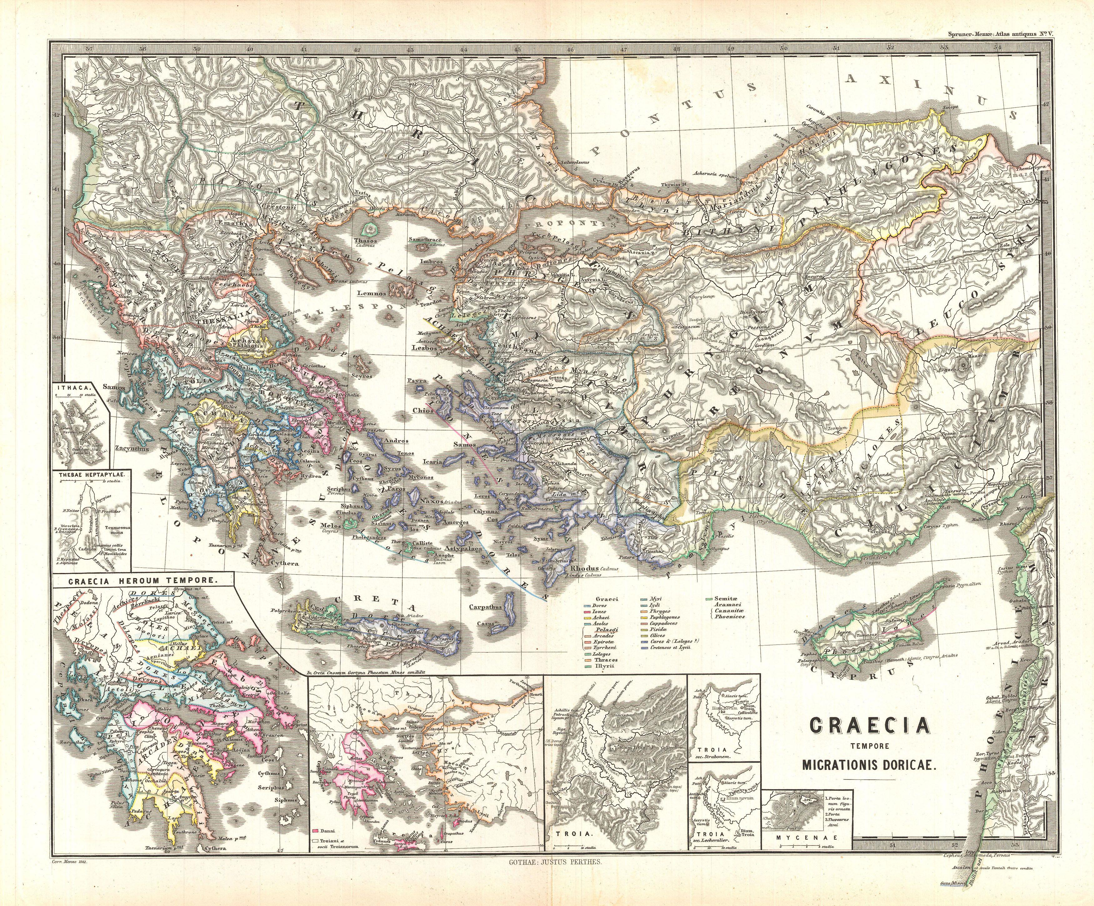
Graecia Tempore Migrationis Doricae |
|||||||||||||||||||
| Description |
English: This is Karl von Spruner’s 1865 map of Graecia Tempore Migrationis Doricae, or Greece at the time Doric Migration. Map covers modern day Macedonia, Bulgaria, Greece, Albania, Turkey, Cyprus, and Crete. The map also includes eight inserts, showing (counterclockwise) Ithaca, Thebae Heptapylae, Graecia Heroum Tempore, Danai, Troiani et socii Troianorum, Troia, Troia sec. Strabonem, Troia sec. Lechevalier, and Mycenae. Each map shows the migration of the ancient peoples, including a color-coded key for each tribe. Important cities, rivers and mountains are labeled. Countries and territories are designated with colored borders. The whole is rendered in finely engraved detail exhibiting throughout the fine craftsmanship of the Perthes firm. |
|||||||||||||||||||
| Date | 1865 (undated) | |||||||||||||||||||
| Dimensions | height: 13 in (33 cm); width: 16 in (40.6 cm) | |||||||||||||||||||
| Accession number |
Geographicus link: GraeciaMigrationisDoricae-spruner-1865 |
|||||||||||||||||||
| Source/Photographer |
Spruner, Karl von, Spruner-Menke Atlas Antiquus,, (Gotha: Justus Perthes), 1865.
|
|||||||||||||||||||
| Permission (Reusing this file) |
|
|||||||||||||||||||
| Other versions |
|
|||||||||||||||||||
.jpg)
File history
Click on a date/time to view the file as it appeared at that time.
| Date/Time | Thumbnail | Dimensions | User | Comment | |
|---|---|---|---|---|---|
| current | 04:30, 25 March 2011 | | 3,500 × 2,898 (2.87 MB) | BotMultichillT (talk | contribs) | {{subst:User:Multichill/Geographicus |link=http://www.geographicus.com/P/AntiqueMap/GraeciaMigrationisDoricae-spruner-1865 |product_name=1865 Spruner Map of Greece during the Dorian Migrations |map_title=Graecia Tempore Migrationis Doricae |description=Th |
You cannot overwrite this file.
File usage on Commons
The following page uses this file: