File:État de Franche-Comté map-fr.svg
Jump to navigation
Jump to search

Size of this PNG preview of this SVG file: 533 × 600 pixels. Other resolutions: 213 × 240 pixels | 427 × 480 pixels | 683 × 768 pixels | 910 × 1,024 pixels | 1,820 × 2,048 pixels.
Original file (SVG file, nominally 800 × 900 pixels, file size: 167 KB)
Captions
Captions
Add a one-line explanation of what this file represents
Summary[edit]
| Description |
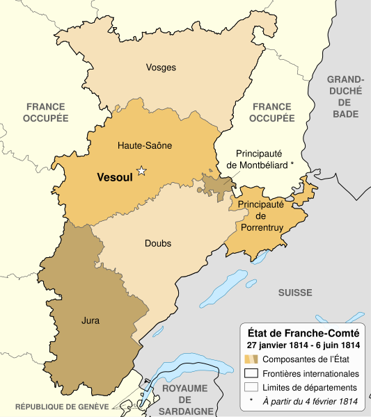
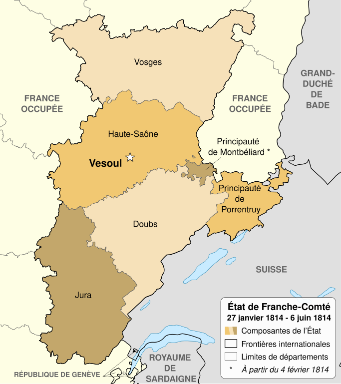
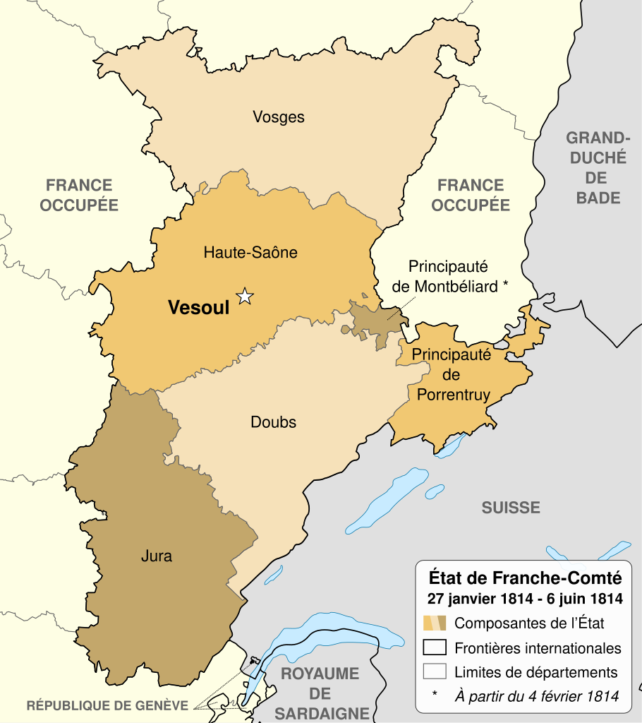
English: Map of the State of Franche-Comté in 1814.
Français : Carte de l'État de Franche-Comté en 1814. |
||
| Date | |||
| Source |
|
||
| Author | |||
| Attribution (required by the license) | © Sémhur / Wikimedia Commons / | ||
| SVG development |
|

| Object location | | View this and other nearby images on: OpenStreetMap |
|---|
Licensing[edit]
I, the copyright holder of this work, hereby publish it under the following licenses:
| Copyleft: This work of art is free; you can redistribute it and/or modify it according to terms of the Free Art License. You will find a specimen of this license on the Copyleft Attitude site as well as on other sites. |
This file is licensed under the Creative Commons Attribution-Share Alike Attribution-Share Alike 4.0 International, 3.0 Unported, 2.5 Generic, 2.0 Generic and 1.0 Generic license.
- You are free:
- to share – to copy, distribute and transmit the work
- to remix – to adapt the work
- Under the following conditions:
- attribution – You must give appropriate credit, provide a link to the license, and indicate if changes were made. You may do so in any reasonable manner, but not in any way that suggests the licensor endorses you or your use.
- share alike – If you remix, transform, or build upon the material, you must distribute your contributions under the same or compatible license as the original.
You may select the license of your choice.
File history
Click on a date/time to view the file as it appeared at that time.
| Date/Time | Thumbnail | Dimensions | User | Comment | |
|---|---|---|---|---|---|
| current | 21:20, 19 November 2021 | | 800 × 900 (167 KB) | Sémhur (talk | contribs) | == {{int:filedesc}} == {{Information |Description= {{en|1= Map of the {{w|State of Franche-Comté||en}} in 1814.}} {{fr|1= Carte de l'{{w|État de Franche-Comté||fr}} en 1814.}} |Source= * {{f|France location map-Departements 1814.svg}} by {{u|Flappiefh}} under licence CC-BY-SA 4.0 |Date=2021-11-19 |Author={{U|Sémhur}} {{User:Sémhur/Credit}}{{Igen|Im|+|%=p|gf|s=mbs|subcat=:Maps}} }} {{Object location|47.40|6.55|dim:280km_type:country_region:FR_heading:0}} == {{int:license-header}} == {{self|FA... |
You cannot overwrite this file.
File usage on Commons
The following 2 pages use this file:
File usage on other wikis
The following other wikis use this file:
- Usage on fr.wikipedia.org
- Usage on www.wikidata.org