Category:Valid SVG created with Inkscape:Maps by User:Sémhur
Jump to navigation
Jump to search
Subcategories
This category has the following 2 subcategories, out of 2 total.
Media in category "Valid SVG created with Inkscape:Maps by User:Sémhur"
The following 156 files are in this category, out of 156 total.
-
 12communesWilayaConstantine.svg 744 × 535; 104 KB
-
 1959 NATO and WP troop strengths in Europe.svg 655 × 689; 267 KB
-
 1973 NATO and WP troop strengths in Europe.svg 655 × 689; 299 KB
-
 Abidjan Communes.svg 593 × 398; 53 KB
-
 Abies beshanzuensis distribution map.svg 1,241 × 1,177; 1.22 MB
-
 Accent tonique en breton map-fr.svg 650 × 650; 1.9 MB
-
 Actinote zikani distribution map.svg 1,051 × 1,131; 1.17 MB
-

-
 Apis andreniformis distribution map.svg 863 × 443; 1.85 MB
-
 Apis cerana distribution map.svg 863 × 443; 1.85 MB
-
 Apis dorsata distribution map.svg 863 × 443; 1.85 MB
-
 Apis florea distribution map.svg 863 × 443; 1.85 MB
-
 Apis koschevnikovi distribution map.svg 863 × 443; 1.85 MB
-
 Apis mellifera distribution map.svg 863 × 443; 1.85 MB
-
 Apis nigrocincta distribution map.svg 863 × 443; 1.85 MB
-
 Atelopus balios distribution map.svg 1,499 × 1,511; 1.63 MB
-
 Aurora's drift map-fr.svg 1,560 × 1,264; 415 KB
-
 Aïn Sefra territory 1934-1955 map-fr.svg 1,287 × 1,278; 1.84 MB
-
 Bissy 1921 map.svg 968 × 726; 108 KB
-
 Béarn topographic map-fr.svg 1,608 × 1,600; 2.57 MB
-
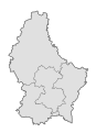
 Cantons of Luxembourg map-blank.svg 746 × 1,032; 1.05 MB
-
 Carte administrative des Provinces Maritimes du Canada.svg 2,928 × 2,106; 900 KB
-
 Carte de la Bèze.svg 1,395 × 2,790; 3.02 MB
-
 Carte des attaques du Monstre du Valais-fr.svg 1,719 × 1,290; 538 KB
-
 Carte des domaines de Chōshū, Saga, Tosa et Satsuma.svg 570 × 570; 1.94 MB
-
 Carte des pierres à cupules de Billème.svg 750 × 750; 359 KB
-
 Carte des sites majeurs de Vauban.svg 1,996 × 1,918; 1.07 MB
-
 Carte des terroirs de bagadoù en Bretagne.svg 1,064 × 786; 163 KB
-
 Carte topographique de la Bèze.svg 1,395 × 2,790; 5.23 MB
-
 Catalonia relief location map.svg 2,776 × 2,488; 4.73 MB
-
 Centre legislative circonscription of Luxembourg.svg 746 × 1,032; 1.05 MB
-
 Champagne crayeuse map-fr.svg 2,090 × 2,758; 6.98 MB
-
 Ciconia boyciana distribution map.svg 2,100 × 1,950; 1.57 MB
-
 COB data Iceland map-fr.svg 1,035 × 531; 1.4 MB
-
 Col d'Arpy map-fr.svg 2,343 × 2,302; 2.66 MB
-
 Col de Joux map-fr.svg 1,939 × 1,945; 1.86 MB
-
 Cold War Map 1959.svg 940 × 477; 853 KB
-
 Communautés du pays de Galles.svg 981 × 1,175; 4.27 MB
-
 Comtés du pays de Galles (1974-1996).svg 981 × 1,173; 1.2 MB
-
 Comtés et districts du pays de Galles (1974-1996).svg 981 × 1,173; 2.42 MB
-
 Corsica mountain range map.svg 300 × 400; 2.01 MB
-
 Crozet Islands map-fr.svg 3,849 × 2,505; 1.99 MB
-
 Crozet Islands on the globe (relief) (Crozet centered).svg 2,304 × 2,304; 3.15 MB
-
 Crozet Islands relief location map.svg 1,924 × 1,670; 1.66 MB
-
 Dakar Rally 2010 map-blank.svg 1,513 × 1,584; 3.52 MB
-
 Dakar Rally 2010 map-de.svg 1,513 × 1,584; 3.53 MB
-
 Dakar Rally 2010 map-en.svg 1,513 × 1,584; 3.53 MB
-
 Dakar Rally 2010 map-es.svg 1,513 × 1,584; 3.58 MB
-
 Dakar Rally 2010 map-fr.svg 1,513 × 1,584; 3.53 MB
-
 Dakar Rally 2010 map-hu.svg 1,513 × 1,584; 3.53 MB
-
 Dakar Rally 2010 map-mk.svg 1,513 × 1,584; 3.53 MB
-
 Destinations touristiques de Bretagne.svg 1,949 × 1,378; 1.48 MB
-
 Districts du pays de Galles (1974-1996).svg 981 × 1,173; 1.65 MB
-
 Dobrudja protected areas map-fr.svg 2,797 × 2,250; 2.02 MB
-
 Dobrudja topographic map-fr.svg 2,797 × 2,250; 2.16 MB
-
 Délai entre 10000 articles WP-fr.svg 1,703 × 714; 44 KB
-
 Développement des stations balnéaires de Bretagne map-fr.svg 1,052 × 744; 1.49 MB
-
 Eiao geological map-fr.svg 1,400 × 1,400; 1,008 KB
-
 Eiao vegetation map.svg 1,400 × 1,400; 3.21 MB
-
 Emploi touristique en Bretagne map-fr.svg 1,031 × 770; 4.61 MB
-
 Espèces d'algues de l'île d'Eiao.svg 1,000 × 500; 254 KB
-
 Est legislative circonscription of Luxembourg.svg 746 × 1,032; 1.05 MB
-
 European Route of Industrial Heritage map.svg 594 × 519; 385 KB
-
 Fond de carte Tour de France-blank.svg 2,110 × 2,525; 1.79 MB
-
 France Suisse Jura.svg 2,500 × 2,300; 2.03 MB
-
 French Alps mountain range map.svg 465 × 710; 2.01 MB
-
 French Jura mountain range map.svg 385 × 470; 2.01 MB
-
 French Pyrenees mountain range map.svg 810 × 280; 2.01 MB
-
 French Republic 1914.svg 928 × 911; 400 KB
-
 Frontière linguistique du breton map-fr.svg 1,064 × 794; 4.45 MB
-
 Frontières entre la France et le Vénézuela.svg 1,940 × 1,424; 1.16 MB
-
 Generalplan Ost-fr.svg 746 × 1,052; 227 KB
-
 Guerre de la Conquête (1754 - 1763)-fr.svg 745 × 533; 599 KB
-
 Incursions vikings en Bretagne-fr.svg 1,112 × 916; 238 KB
-
 Interaction des plaques tectoniques en Italie.svg 810 × 784; 984 KB
-
 International trains Paris-Zurich 2015.svg 1,122 × 899; 35 KB
-
 Itinéraire Smollett France Italie 1763-1765.svg 1,285 × 1,050; 1.25 MB
-
 Jeannette crew course map-fr.svg 1,443 × 1,167; 853 KB
-
 Jura mountain range map-fr.svg 1,000 × 1,000; 1.38 MB
-
 Jura mountain range topographic map.svg 500 × 500; 1.93 MB
-
 Karte Senegambische Steinkreise-fr.svg 1,890 × 973; 179 KB
-
 Le royaume de Roumanie après la Paix de Bucarest 1918-fr.svg 1,744 × 1,270; 286 KB
-
 Legislative circonscriptions of Luxembourg map-blank.svg 746 × 1,032; 808 KB
-
 Legislative circonscriptions of Luxembourg map-fr.svg 746 × 1,032; 1.05 MB
-
 Lille RER map-fr.svg 1,576 × 1,069; 530 KB
-
 Localités de Guyane française.svg 1,116 × 1,416; 525 KB
-
 Luxembourg communes map.svg 746 × 1,032; 1.05 MB
-
 Map of the Faroe Islands fr.svg 1,683 × 2,208; 1,015 KB
-
 Map of the Faroe Islands tunnels fr.svg 2,231 × 2,210; 1.02 MB
-
 Mapa del Mar Caribe (límites marinos)-fr.svg 3,587 × 2,221; 1.91 MB
-
 Maritime boundaries between Comoros and France-fr.svg 2,208 × 1,572; 772 KB
-
 Maritime boundaries between Seychelles and France-fr.svg 2,208 × 1,572; 770 KB
-
 Marquesas Islands on the globe (relief) (Marquesas centered).svg 2,304 × 2,304; 3.36 MB
-
 Marquesas map-fr.svg 4,357 × 4,301; 3.09 MB
-
 Marquesas map-mk.svg 4,357 × 4,301; 3.09 MB
-
 Massif Central mountain range map.svg 680 × 1,000; 2.08 MB
-
 Mount Mazama geological map-fr.svg 1,785 × 1,558; 3.21 MB
-
 Mount Mazama hazard map-fr.svg 2,281 × 2,199; 6.48 MB
-
 Mount Mazama map-fr.svg 2,034 × 1,518; 2.98 MB
-
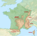 Mountain ranges of France map-fr.svg 2,602 × 2,525; 2.08 MB
-
 Nice ville de la villégiature d’hiver de riviera map-fr.svg 650 × 650; 1.13 MB
-
 Nord legislative circonscription of Luxembourg.svg 746 × 1,032; 1.05 MB
-
 Nouvelle-Calédonie répartition culture 2012.svg 708 × 591; 181 KB
-
 Nouvelle-Calédonie surface et exploitations agricoles 2012.svg 708 × 591; 169 KB
-
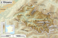
 Oisans communes map-fr.svg 1,953 × 1,302; 1.11 MB
-
 Oisans topographic map-fr.svg 1,953 × 1,302; 2.34 MB
-
 OttomanCession1915-fr.svg 1,240 × 1,637; 31 KB
-
 Panoramique des dômes map-fr.svg 1,045 × 690; 269 KB
-
 Paul Belloni Du Chaillu - Seconde voyage au Gabon - 1863-1865-fr.svg 1,474 × 644; 1.45 MB
-
 PIB Nouvelle Calédonie 2020.svg 1,500 × 1,000; 9 KB
-
 Plan du haras national de Lamballe.svg 809 × 582; 271 KB
-
 Plan métro tramway Toulouse.svg 2,237 × 1,678; 351 KB
-
 Projet de métro à Bordeaux (1986 - 1994).svg 1,201 × 2,807; 1.13 MB
-
 Présidentielle 1988 (premier tour - candidat en 2e position).svg 588 × 550; 187 KB
-
 Présidentielle 1988 (premier tour - candidat en 3e position).svg 588 × 550; 187 KB
-
 Présidentielle 1988 (premier tour - candidat en tete).svg 588 × 550; 187 KB
-
 Regione Siciliana map-blank.svg 2,812 × 3,260; 566 KB
-
 Regione Siciliana topographic map-blank.svg 2,812 × 3,260; 6.51 MB
-
 Ross Sea party map-fr.svg 945 × 1,340; 214 KB
-
 Route of the Far Eastern party map-fr.svg 1,803 × 901; 454 KB
-
 Réseau Express Grand Lille map-fr.svg 1,378 × 1,120; 3.96 MB
-
 Réserves naturelles du nord des îles Marquises-fr.svg 900 × 675; 1.86 MB
-
 Saint-Paul and Amsterdam Islands location map.svg 582 × 1,113; 36 KB
-
 Saint-Paul and Amsterdam Islands map-fr.svg 2,330 × 2,597; 2.02 MB
-
 Saint-Paul and Amsterdam Islands relief location map.svg 582 × 1,113; 1.86 MB
-
 San Marino castelli map.svg 2,242 × 2,557; 259 KB
-
 San Marino general map-fr.svg 2,242 × 2,557; 599 KB
-
 San Marino map-fr.svg 2,242 × 2,557; 3.47 MB
-
 San Marino relief map-de.svg 2,242 × 2,557; 3.61 MB
-
 San Marino relief map-fr.svg 2,242 × 2,557; 3.61 MB
-
 San Marino topographic map.svg 2,242 × 2,557; 3.26 MB
-
 Shackleton Endurance Aurora map-blank.svg 1,025 × 1,264; 585 KB
-
 Shackleton Endurance Aurora map-fr.svg 1,025 × 1,264; 690 KB
-
 Shackleton Endurance Aurora map-he.svg 1,025 × 1,264; 1.32 MB
-
 Shackleton South Georgia Crossing map-fr.svg 775 × 500; 758 KB
-
 Sicily map-blank.svg 2,373 × 1,582; 473 KB
-
 Sicily topographic map-blank.svg 2,373 × 1,582; 4.66 MB
-
 Silésie Autrichienne au sein de la double monarchie en 1914.svg 3,507 × 2,657; 691 KB
-
 Site A-Plot M Area map-fr.svg 1,080 × 726; 702 KB
-
 Sites touristiques de la région Bretagne map-fr.svg 2,062 × 1,441; 2.14 MB
-
 Skellig Michael map-fr.svg 1,944 × 1,458; 1.11 MB
-
 Skellig Michael monastery map-fr.svg 975 × 1,125; 207 KB
-
 South Shetland Islands location map-fr.svg 1,373 × 777; 142 KB
-
 Sud legislative circonscription of Luxembourg.svg 746 × 1,032; 1.05 MB
-
 Tanzania Arusha location map.svg 3,302 × 3,143; 1.04 MB
-
 Thomas-Stevens's-bicycle-journey-FR.svg 1,377 × 616; 976 KB
-
 Toponymes bretons map-fr.svg 1,064 × 794; 3.01 MB
-
 Tour de Colombie 1964 map-fr.svg 1,330 × 1,810; 692 KB
-
 Tramway IleDeFrance Line 3.svg 850 × 700; 367 KB
-
 Tuamotu relief location map.svg 1,797 × 1,319; 550 KB
-
 Turkey vineyard map-fr.svg 1,579 × 1,000; 323 KB
-
 Variantes linguistiques du breton map-fr.svg 1,064 × 994; 1.67 MB
-
 Vosges mountain range map.svg 320 × 400; 2.01 MB
-
 Zong Massacre map-fr.svg 3,200 × 2,400; 1.31 MB
-
 État de Franche-Comté map-fr.svg 800 × 900; 167 KB
-
 Îles Australes relief location map.svg 1,438 × 840; 150 KB


_(Amsterdam_and_Saint-Paul_centered).svg)


.svg)
.svg)


_(Crozet_centered).svg)


.svg)


-fr.svg)


-fr.svg)


_(Marquesas_centered).svg)


.svg)
.svg)
.svg)
.svg)


