Commons:Wiki Loves Monuments in Switzerland/Uri/N-Z
Jump to navigation
Jump to search
Realp
| Location | Upload | Photo | Object | Cat. | Coordinates | KGS-Nr | |
|---|---|---|---|---|---|---|---|
| Realp | 
|
Hotel Furkablick | B | 46°34′23″N 8°24′55″E / 46.572933°N 8.4153°E | 11485 | ||
| Realp | 
|
Florentinihaus im Dorf | B | 46°35′55″N 8°30′08″E / 46.598647°N 8.502349°E | 11479 | ||
| Realp | 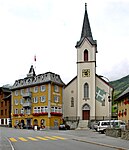
|
Pfarrkirche Heilig Kreuz im Dorf | B | 46°35′55″N 8°30′06″E / 46.598689°N 8.501736°E | 11477 | ||
| Realp | [[File:|150x150px|Schirmhaus in Tiefenbach]] | Schirmhaus in Tiefenbach | B | 46°35′35″N 8°27′39″E / 46.593109°N 8.460701°E | 11483 | ||
| Realp | 
|
Frühmittelalterlicher Schlagplatz, Biel | B | 46°35′33″N 8°29′55″E / 46.59242°N 8.49852°E | 9686 | ||
Schattdorf
| Location | Upload | Photo | Object | Cat. | Coordinates | KGS-Nr | |
|---|---|---|---|---|---|---|---|
| Schattdorf | 
|
Crivelli-Kapelle an der Gotthardstrasse | B | 46°52′11″N 8°39′05″E / 46.869815°N 8.651413°E | 5852 | ||
| Schattdorf | 
|
Haus Hof | B | 46°51′54″N 8°39′12″E / 46.865106°N 8.653471°E | 11294 | ||
| Schattdorf | 
|
Haus Schmid-Gerig (ehem. Schleife) | B | 46°51′52″N 8°38′53″E / 46.864543°N 8.648015°E | 5853 | ||
| Schattdorf | 
|
Katholische Kirche Heilige Dreifaltigkeit und St. Nikolaus mit Friedhofkapelle | B | 46°51′49″N 8°39′23″E / 46.86366°N 8.65646°E | 5854 | ||
| Schattdorf | 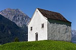
|
Pulverturm auf dem Landsgemeindeplatz | B | 46°51′35″N 8°38′59″E / 46.859768°N 8.649626°E | 5855 | ||
| Schattdorf | 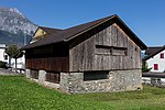
|
Tanzhaus | A | 46°51′52″N 8°39′20″E / 46.864318°N 8.655617°E | 10248 | ||
Seedorf
| Location | Upload | Photo | Object | Cat. | Coordinates | KGS-Nr | |
|---|---|---|---|---|---|---|---|
| Seedorf | 
|
Schlösschen A Pro | A | 46°53′12″N 8°36′23″E / 46.886566°N 8.606363°E | 5858 | ||
| Seedorf | 
|
Abtei St. Lazarus | A | 46°52′57″N 8°36′48″E / 46.8824°N 8.61329°E | 5856 | ||
| Seedorf | 
|
Katholische Kirche St. Ulrich mit Friedhofkapelle | B | 46°53′08″N 8°36′23″E / 46.885487°N 8.606365°E | 5857 | ||
| Seedorf | 
|
Restaurant Waldheim am Plätzli | B | 46°52′52″N 8°36′47″E / 46.881047°N 8.613026°E | 11537 | ||
Seelisberg
| Location | Upload | Photo | Object | Cat. | Coordinates | KGS-Nr | |
|---|---|---|---|---|---|---|---|
| Seelisberg | 
|
Wallfahrtskapelle Maria Sonnenberg mit Kaplaneihaus | B | 46°58′15″N 8°35′12″E / 46.97097°N 8.58667°E | 5864 | ||
| Seelisberg | 
|
Schlösschen Beroldingen mit Kapelle | B | 46°57′16″N 8°34′58″E / 46.954366°N 8.582768°E | 5863 | ||
| Seelisberg | 
|
Hotelanlage Sonnenberg | B | 46°58′13″N 8°35′10″E / 46.97031°N 8.58605°E | 11561 | ||
| Seelisberg | 
|
Rütli | A | 46°58′10″N 8°35′34″E / 46.969344444°N 8.592702777°E | 5860 | ||
| Seelisberg | 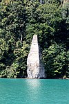
|
Schillerstein | A | 46°58′59″N 8°35′48″E / 46.982924°N 8.596732°E | 9746 | ||
| Seelisberg | 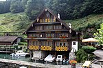
|
Wirtshaus zur Treib | A | 46°59′14″N 8°35′10″E / 46.987196°N 8.58611°E | 5859 | ||
| Seelisberg | 
|
Wohnhaus, Buechholz | A | 46°58′50″N 8°34′25″E / 46.980437°N 8.573741°E | 10249 | ||
| Seelisberg | 
|
Aebnet, altes Haus | B | 46°58′31″N 8°34′05″E / 46.975203°N 8.568097°E | 11562 | ||
| Seelisberg | 
|
Gadenhaus | B | 46°58′42″N 8°35′28″E / 46.978222°N 8.591045°E | 11563 | ||
| Seelisberg | 
|
Schiffsstation, Rütli | B | 46°58′13″N 8°35′35″E / 46.970186°N 8.593093°E | 5862 | ||
Silenen
| Location | Upload | Photo | Object | Cat. | Coordinates | KGS-Nr | |
|---|---|---|---|---|---|---|---|
| Silenen | 
|
Kraftwerk Amsteg | A | 46°46′05″N 8°40′18″E / 46.76815°N 8.671611111°E | 5868 | ||
| Silenen | 
|
Berghotel Maderanertal | ISOS | 46°46′56″N 8°46′21″E / 46.78222°N 8.77249°E | |||
| Silenen | 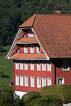
|
Altes Pfarrhaus an der vorderen Kirchstrasse | B | 46°47′31″N 8°40′14″E / 46.79202°N 8.670562°E | 11571 | ||
| Silenen | 
|
Reussbrücke bei Amsteg (Plattibrücke) | B | 46°46′04″N 8°40′09″E / 46.767694°N 8.669279°E | 11564 | ||
| Silenen | 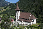
|
Pfarrkirche Maria zum Guten Rat in Bristen | B | 46°46′10″N 8°41′29″E / 46.76945°N 8.69135°E | 11565 | ||
| Silenen | 
|
Kapelle 14-Nothelfer im Dörfli | B | 46°46′45″N 8°40′21″E / 46.77913°N 8.672486°E | 11556 | ||
| Silenen | 
|
Katholische Kirche St. Albin mit Beinhaus | B | 46°47′31″N 8°40′21″E / 46.791859°N 8.672581°E | 5870 | ||
| Silenen | 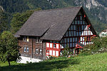
|
Altes Pfarrhelferhaus an der hinteren Kirchgasse | B | 46°47′28″N 8°40′23″E / 46.791178°N 8.673116°E | 11569 | ||
| Silenen | 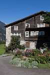
|
Steinhaus nordöstlich der Kirche | B | 46°47′32″N 8°40′23″E / 46.792304°N 8.672984°E | 5872 | ||
| Silenen | 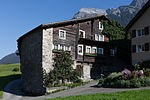
|
Bauernhaus, Kirchstrasse | A | 46°47′32″N 8°40′23″E / 46.792278°N 8.672918°E | 10250 | ||
| Silenen | 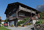
|
Wohnhaus, Burghofstatt | A | 46°46′46″N 8°40′19″E / 46.779531°N 8.671945°E | 10313 | ||
| Silenen | 
|
Meierturm | A | 46°46′45″N 8°40′20″E / 46.779159°N 8.672238°E | 10449 | ||
| Silenen | 
|
Eisenschmelzofen | A | 46°46′00″N 8°42′47″E / 46.766637°N 8.713142°E | 5869 | ||
| Silenen | 
|
Ehemalige Sust mit Gasthof | A | 46°46′43″N 8°40′21″E / 46.778733°N 8.672556°E | 10312 | ||
| Silenen | 
|
Zwing Uri, prähistorische/mittelalterliche Siedlung / Burg | A | 46°46′28″N 8°40′14″E / 46.77432°N 8.670477°E | 5867 | ||
| Silenen | 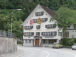
|
Hotel Stern und Post | B | 46°46′10″N 8°40′15″E / 46.769521°N 8.670865°E | 11568 | ||
| Silenen | 
|
Ellbogenkapelle St. Ursula auf der Stetten | B | 46°48′08″N 8°39′49″E / 46.802194°N 8.663542°E | 11559 | ||
| Silenen | 
|
Landjägerhaus im Buechholz | B | 46°48′08″N 8°40′03″E / 46.80235°N 8.66745°E | 11560 | ||
| Silenen | 
|
Pfarrhaus in Amsteg | B | 46°46′13″N 8°40′16″E / 46.770266°N 8.670974°E | 11567 | ||
| Silenen | 
|
Wohnhaus zur Aschart | B | 46°47′22″N 8°40′14″E / 46.789525°N 8.670445°E | 11570 | ||
| Silenen | 
|
Berghotel Maderanertal | ISOS | 46°46′56″N 8°46′21″E / 46.78222°N 8.77249°E | |||
| Silenen | 
|
Amsteg | ISOS | 46°46′16″N 8°40′15″E / 46.7711°N 8.6709°E | |||
Sisikon
| Location | Upload | Photo | Object | Cat. | Coordinates | KGS-Nr | |
|---|---|---|---|---|---|---|---|
| Sisikon | 
|
Tellskapelle | A | 46°55′56″N 8°36′45″E / 46.932258333°N 8.612472222°E | 5873 | ||
Spiringen
| Location | Upload | Photo | Object | Cat. | Coordinates | KGS-Nr | |
|---|---|---|---|---|---|---|---|
| Spiringen | [[File:|150x150px|Kirche St. Verena samt Friedhof]] | Kirche St. Verena samt Friedhof | B | 46°53′20″N 8°54′08″E / 46.889013°N 8.90223°E | 11575 | ||
| Spiringen | 
|
Wohnhaus, Oberdorf | A | 46°52′18″N 8°44′15″E / 46.871794°N 8.737435°E | 10314 | ||
| Spiringen | 
|
Haus im Tal | B | 46°52′29″N 8°43′30″E / 46.874589°N 8.724987°E | 11574 | ||
| Spiringen | 
|
Kapelle 7 Schmerzen Mariä, Getschwiler | B | 46°52′20″N 8°45′03″E / 46.872227°N 8.750774°E | 5875 | ||
| Spiringen | 
|
Pfarrhaus | B | 46°52′21″N 8°43′37″E / 46.872587°N 8.727038°E | 5876 | ||
Unterschächen
| Location | Upload | Photo | Object | Cat. | Coordinates | KGS-Nr | |
|---|---|---|---|---|---|---|---|
| Unterschächen | 
|
Hotel Posthaus Urigen | B | 46°52′18″N 8°45′30″E / 46.871546°N 8.758327°E | 11579 | ||
| Unterschächen | 
|
Katholische Kirche St. Theodul mit Beinhauskapelle | B | 46°51′50″N 8°46′08″E / 46.864012°N 8.768806°E | 5879 | ||
| Unterschächen | 
|
Wohnhaus Stüssihofstatt | B | 46°51′45″N 8°46′16″E / 46.862418°N 8.771207°E | 11576 | ||
| Unterschächen | 
|
Hof Bodenbergli | B | 46°52′29″N 8°45′40″E / 46.87459°N 8.761196°E | 11580 | ||
| Unterschächen | 
|
Sägerei | A | 46°51′30″N 8°46′16″E / 46.858416°N 8.771147°E | 5878 | ||
| Unterschächen | 
|
Kapelle St. Anna in Schwanden | B | 46°51′52″N 8°47′20″E / 46.864406°N 8.788885°E | 5880 | ||
Wassen
| Location | Upload | Photo | Object | Cat. | Coordinates | KGS-Nr | |
|---|---|---|---|---|---|---|---|
| Wassen | 
|
Dörfli | ISOS | 46°43′24″N 8°33′25″E / 46.7232°N 8.557°E | |||
| Wassen | 
|
Katholische Pfarrkirche St. Gallus | A | 46°42′25″N 8°36′04″E / 46.707043°N 8.601066°E | 5883 | ||
| Wassen | 
|
Beinhauskapelle in Wassen-Dorf | B | 46°42′25″N 8°36′03″E / 46.707055°N 8.600792°E | 11581 | ||
| Wassen | 
|
Russenhaus in Wassen-Dorf | B | 46°42′25″N 8°35′59″E / 46.706968°N 8.599678°E | 11582 | ||
| Wassen | 
|
Kapelle St. Josef in Wattingen | B | 46°41′44″N 8°35′43″E / 46.69555°N 8.595327°E | 11583 | ||
| Wassen | 
|
Meienschanze am alten Sustenweg | B | 46°42′37″N 8°35′21″E / 46.710322°N 8.589104°E | 5884 | ||