Commons:Wiki Loves Monuments in Switzerland/Schaffhausen/A-I

From Wikimedia Commons, the free media repository
Jump to navigation Jump to search

Bargen

Location Upload Photo Object Cat. Coordinates KGS-Nr
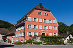
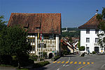
Bargen Upload a file Gasthaus Löwen
Gasthaus Löwen B 47°47′31″N 8°36′38″E / 47.791989°N 8.610598°E / 47.791989; 8.610598 4318
Bargen Upload a file Gmaandhuus
Gmaandhuus B 47°47′57″N 8°36′38″E / 47.799149°N 8.610596°E / 47.799149; 8.610596 14112
Bargen Upload a file Schulhaus
Schulhaus B 47°47′34″N 8°36′40″E / 47.792829°N 8.611164°E / 47.792829; 8.611164 14111

Beggingen

Location Upload Photo Object Cat. Coordinates KGS-Nr
Beggingen Upload a file
Aalt Gmaandhus B 47°46′01″N 8°32′14″E / 47.767046°N 8.537169°E / 47.767046; 8.537169 14537
Beggingen Upload a file
Erdburg, Chollgruben B 47°45′14″N 8°32′22″E / 47.75383°N 8.539496°E / 47.75383; 8.539496 4319
Beggingen Upload a file
Kehlhof Baugruppe (Zeile) B 47°46′04″N 8°32′04″E / 47.76777°N 8.53439°E / 47.76777; 8.53439 14118
Beggingen Upload a file Reformierte Kirche
Reformierte Kirche B 47°46′04″N 8°32′01″E / 47.767673°N 8.533634°E / 47.767673; 8.533634 10885
Beggingen Upload a file
Speicher / Wohnhaus 16. Jh. B 47°46′03″N 8°32′03″E / 47.767559°N 8.534219°E / 47.767559; 8.534219 14115
Beggingen Upload a file
Wohnhaus mit Scheune B 47°46′00″N 8°32′16″E / 47.766761°N 8.537844°E / 47.766761; 8.537844 14116
Beggingen Upload a file
Zum Schwanen B 47°45′59″N 8°32′14″E / 47.766504°N 8.537358°E / 47.766504; 8.537358 14117

Beringen

Location Upload Photo Object Cat. Coordinates KGS-Nr
Beringen Upload a file
Alte Mühle B 47°42′06″N 8°34′23″E / 47.701701°N 8.573122°E / 47.701701; 8.573122 14126
Beringen Upload a file
Bahnhof B 47°41′42″N 8°34′28″E / 47.69505°N 8.574431°E / 47.69505; 8.574431 14125
Beringen Upload a file
Haumesser B 47°41′53″N 8°34′24″E / 47.698082°N 8.573404°E / 47.698082; 8.573404 14120
Beringen Upload a file
Im Egg B 47°41′52″N 8°34′25″E / 47.697828°N 8.573638°E / 47.697828; 8.573638 14127
Beringen Upload a file
Kehlhof B 47°41′56″N 8°34′20″E / 47.698992°N 8.572344°E / 47.698992; 8.572344 14121
Beringen Upload a file Kehlhof mit Stallscheune
Kehlhof mit Stallscheune B 47°41′08″N 8°33′23″E / 47.685432°N 8.556284°E / 47.685432; 8.556284 4326
Beringen Upload a file Oberneuhaus
Oberneuhaus B 47°41′19″N 8°33′15″E / 47.688725°N 8.554249°E / 47.688725; 8.554249 14165
Beringen Upload a file
Reformierte Kirche B 47°41′57″N 8°34′21″E / 47.69917°N 8.572521°E / 47.69917; 8.572521 14122
Beringen Upload a file
Restaurant Gemeindehaus B 47°41′55″N 8°34′27″E / 47.698677°N 8.574229°E / 47.698677; 8.574229 14124
Beringen Upload a file
Restaurant Sonne B 47°41′49″N 8°34′30″E / 47.696852°N 8.575109°E / 47.696852; 8.575109 14123
Beringen Upload a file Schloss, Ortsmuseum (13. Jh.)
Schloss, Ortsmuseum (13. Jh.) B 47°41′56″N 8°34′28″E / 47.69899°N 8.574462°E / 47.69899; 8.574462 4320
Beringen Upload a file Schulhaus
Schulhaus B 47°41′08″N 8°33′25″E / 47.685596°N 8.556927°E / 47.685596; 8.556927 14171
Beringen Upload a file Stallscheune
Stallscheune B 47°41′08″N 8°33′28″E / 47.685526°N 8.557711°E / 47.685526; 8.557711 14166
Beringen Upload a file Vielzweckhaus
Vielzweckhaus B 47°41′07″N 8°33′22″E / 47.685407°N 8.556084°E / 47.685407; 8.556084 14169
Beringen Upload a file Wohnhaus
Wohnhaus B 47°41′08″N 8°33′27″E / 47.685637°N 8.557367°E / 47.685637; 8.557367 14168
Beringen Upload a file
Wohnspeicher B 47°41′14″N 8°33′25″E / 47.687161°N 8.556946°E / 47.687161; 8.556946 14167

Bezirk Oberklettgau

Location Upload Photo Object Cat. Coordinates KGS-Nr
Bezirk Oberklettgau Upload a file Löhningen
Löhningen ISOS 47°42′07″N 8°33′06″E / 47.7019°N 8.5517°E / 47.7019; 8.5517
Bezirk Oberklettgau Upload a file Gächlingen
Gächlingen ISOS 47°42′10″N 8°29′56″E / 47.7027°N 8.499°E / 47.7027; 8.499
Bezirk Oberklettgau Upload a file Neunkirch
Neunkirch ISOS 47°41′24″N 8°29′56″E / 47.69°N 8.498888888°E / 47.69; 8.498888888

Bezirk Reiat

Location Upload Photo Object Cat. Coordinates KGS-Nr
Bezirk Reiat Upload a file Dörflingen
Dörflingen ISOS 47°42′27″N 8°43′13″E / 47.7075°N 8.7202°E / 47.7075; 8.7202
Bezirk Reiat Upload a file Lohn
Lohn ISOS 47°44′59″N 8°40′00″E / 47.749722222°N 8.666666666°E / 47.749722222; 8.666666666
Bezirk Reiat Upload a file Thayngen
Thayngen ISOS 47°43′59″N 8°41′59″E / 47.733055555°N 8.699722222°E / 47.733055555; 8.699722222

Bezirk Schaffhausen

Location Upload Photo Object Cat. Coordinates KGS-Nr
Bezirk Schaffhausen Upload a file Rüdlingen
Rüdlingen ISOS 47°34′00″N 8°33′59″E / 47.566666666°N 8.566388888°E / 47.566666666; 8.566388888
Bezirk Schaffhausen Upload a file Merishausen
Merishausen ISOS 47°45′38″N 8°36′33″E / 47.760555555°N 8.609166666°E / 47.760555555; 8.609166666
Bezirk Schaffhausen Upload a file Schaffhausen
Schaffhausen ISOS 47°41′48″N 8°38′02″E / 47.69653°N 8.63386°E / 47.69653; 8.63386

Bezirk Schleitheim

Location Upload Photo Object Cat. Coordinates KGS-Nr
Bezirk Schleitheim Upload a file Schleitheim
Schleitheim ISOS 47°44′57″N 8°29′06″E / 47.7493°N 8.4851°E / 47.7493; 8.4851

Bezirk Stein

Location Upload Photo Object Cat. Coordinates KGS-Nr
Bezirk Stein Upload a file Stein am Rhein
Stein am Rhein ISOS 47°39′34″N 8°51′33″E / 47.659444444°N 8.859166666°E / 47.659444444; 8.859166666
Bezirk Stein Upload a file Ramsen
Ramsen ISOS 47°41′59″N 8°47′59″E / 47.699722222°N 8.799722222°E / 47.699722222; 8.799722222

Bezirk Unterklettgau

Location Upload Photo Object Cat. Coordinates KGS-Nr
Bezirk Unterklettgau Upload a file Oberhallau
Oberhallau ISOS 47°42′19″N 8°28′39″E / 47.7053°N 8.4775°E / 47.7053; 8.4775
Bezirk Unterklettgau Upload a file Wilchingen
Wilchingen ISOS 47°39′59″N 8°28′00″E / 47.666388888°N 8.466666666°E / 47.666388888; 8.466666666
Bezirk Unterklettgau Upload a file Hallau
Hallau ISOS 47°41′48″N 8°27′28″E / 47.6966°N 8.4578°E / 47.6966; 8.4578

Buch

Location Upload Photo Object Cat. Coordinates KGS-Nr
Buch Upload a file
Alte Mühle (Wohnhaus) B 47°43′05″N 8°47′02″E / 47.718026°N 8.783974°E / 47.718026; 8.783974 14133
Buch Upload a file
Alte Mühle (Wohnhaus) B 47°43′04″N 8°47′01″E / 47.717896°N 8.783584°E / 47.717896; 8.783584 14132
Buch Upload a file Kirche
Kirche B 47°42′57″N 8°47′01″E / 47.715872°N 8.783559°E / 47.715872; 8.783559 14128
Buch Upload a file
Pfarrhaus B 47°42′57″N 8°47′02″E / 47.715698°N 8.783848°E / 47.715698; 8.783848 14129
Buch Upload a file Säge Freilichtmuseum
Säge Freilichtmuseum B 47°43′04″N 8°47′02″E / 47.717891°N 8.783984°E / 47.717891; 8.783984 4321
Buch Upload a file
Wohnhaus gestelzt, mit Oekonomie B 47°43′00″N 8°46′59″E / 47.716707°N 8.782954°E / 47.716707; 8.782954 14130
Buch Upload a file
Wohnhaus mit Scheune B 47°42′58″N 8°47′02″E / 47.716193°N 8.783781°E / 47.716193; 8.783781 14131

Buchberg

Location Upload Photo Object Cat. Coordinates KGS-Nr
Buchberg Upload a file Felsenburg mit Nebengebäude
Felsenburg mit Nebengebäude B 47°34′23″N 8°33′36″E / 47.573057°N 8.559888°E / 47.573057; 8.559888 14135
Buchberg Upload a file Pfarrhaus (Pfarrguet)
Pfarrhaus (Pfarrguet) B 47°34′30″N 8°33′59″E / 47.575072°N 8.566338°E / 47.575072; 8.566338 14134
Buchberg Upload a file Wallanlage Murkathof
Wallanlage Murkathof B 47°33′51″N 8°33′31″E / 47.564138°N 8.558557°E / 47.564138; 8.558557 4323
Buchberg Upload a file Wohnhäuser, Baugruppe «Gupfe«
Wohnhäuser, Baugruppe «Gupfe« B 47°34′19″N 8°33′30″E / 47.572029°N 8.558312°E / 47.572029; 8.558312 14136

Dörflingen

Location Upload Photo Object Cat. Coordinates KGS-Nr
Dörflingen Upload a file
Bauernhaus B 47°42′20″N 8°43′22″E / 47.705621°N 8.722843°E / 47.705621; 8.722843 14138
Dörflingen Upload a file
Kanzlei / Altes Schulhaus (Wohnhaus) B 47°42′22″N 8°43′23″E / 47.706024°N 8.723066°E / 47.706024; 8.723066 14140
Dörflingen Upload a file Kirche
Kirche B 47°42′22″N 8°43′22″E / 47.70617°N 8.722856°E / 47.70617; 8.722856 14137
Dörflingen Upload a file
Rebhüsli Wohnhaus und Oekonomie B 47°42′26″N 8°43′10″E / 47.707142°N 8.719548°E / 47.707142; 8.719548 14142
Dörflingen Upload a file
Vielzweckbau B 47°42′21″N 8°43′21″E / 47.705839°N 8.722635°E / 47.705839; 8.722635 14145
Dörflingen Upload a file
Wohnhaus B 47°42′16″N 8°43′26″E / 47.704576°N 8.72387°E / 47.704576; 8.72387 14146
Dörflingen Upload a file
Wohnhaus B 47°42′24″N 8°43′13″E / 47.706612°N 8.720229°E / 47.706612; 8.720229 14141
Dörflingen Upload a file
Wohnhaus / Baugruppe mit Oekonomie B 47°42′21″N 8°43′25″E / 47.705962°N 8.723717°E / 47.705962; 8.723717 14139
Dörflingen Upload a file
Wohnhaus mit Oekonomie B 47°42′22″N 8°43′19″E / 47.706035°N 8.722014°E / 47.706035; 8.722014 14144
Dörflingen Upload a file
Wohnhausteil B 47°42′25″N 8°43′09″E / 47.706965°N 8.719224°E / 47.706965; 8.719224 14143

Gächlingen

Location Upload Photo Object Cat. Coordinates KGS-Nr
Gächlingen Upload a file
Goldäcker, neolithische Landsiedlung A 47°42′05″N 8°29′38″E / 47.701369°N 8.493774°E / 47.701369; 8.493774 9657
Gächlingen Upload a file
Anbau Spitalscheune B 47°42′11″N 8°29′53″E / 47.703136°N 8.498179°E / 47.703136; 8.498179 14164
Gächlingen Upload a file Ganze Hofzeile Restaurant Kreuz, Zur Traube bis GB 168
Ganze Hofzeile Restaurant Kreuz, Zur Traube bis GB 168 B 47°42′11″N 8°29′55″E / 47.703096°N 8.498631°E / 47.703096; 8.498631 14539
Gächlingen Upload a file Haus zum Brunnquell (Hofzeile)
Haus zum Brunnquell (Hofzeile) B 47°42′10″N 8°29′49″E / 47.702834°N 8.496827°E / 47.702834; 8.496827 14158
Gächlingen Upload a file Haus zum Talhof
Haus zum Talhof B 47°42′12″N 8°29′48″E / 47.703203°N 8.496781°E / 47.703203; 8.496781 14160
Gächlingen Upload a file Hofzeile
Hofzeile B 47°42′10″N 8°29′55″E / 47.702693°N 8.49853°E / 47.702693; 8.49853 14154
Gächlingen Upload a file Im Spital, Oekonomie- und Vielzweckgebäude
Im Spital, Oekonomie- und Vielzweckgebäude B 47°42′12″N 8°29′54″E / 47.703334°N 8.498243°E / 47.703334; 8.498243 14538
Gächlingen Upload a file Kirche
Kirche B 47°42′08″N 8°30′00″E / 47.702239°N 8.499906°E / 47.702239; 8.499906 14147
Gächlingen Upload a file Mühle
Mühle B 47°42′12″N 8°30′18″E / 47.703425°N 8.504953°E / 47.703425; 8.504953 14151
Gächlingen Upload a file Pfarrhaus
Pfarrhaus B 47°42′06″N 8°29′53″E / 47.701636°N 8.497962°E / 47.701636; 8.497962 14148
Gächlingen Upload a file Post (ehemalige Kirche)
Post (ehemalige Kirche) B 47°42′09″N 8°29′51″E / 47.702576°N 8.497475°E / 47.702576; 8.497475 14150
Gächlingen Upload a file Vielzweckbau
Vielzweckbau B 47°42′17″N 8°30′02″E / 47.704652°N 8.500687°E / 47.704652; 8.500687 14152
Gächlingen Upload a file Vielzweckbau
Vielzweckbau B 47°42′07″N 8°29′58″E / 47.702073°N 8.499423°E / 47.702073; 8.499423 14155
Gächlingen Upload a file Vielzweckbau (Hofzeile Brunnquell)
Vielzweckbau (Hofzeile Brunnquell) B 47°42′10″N 8°29′47″E / 47.702685°N 8.496411°E / 47.702685; 8.496411 14159
Gächlingen Upload a file Wachthütte (30-jähriger Krieg)
Wachthütte (30-jähriger Krieg) B 47°43′03″N 8°29′53″E / 47.717626°N 8.498122°E / 47.717626; 8.498122 14156
Gächlingen Upload a file Wohnhaus
Wohnhaus B 47°42′11″N 8°29′51″E / 47.703097°N 8.497618°E / 47.703097; 8.497618 14162
Gächlingen Upload a file Zehnteschüür
Zehnteschüür B 47°42′11″N 8°29′53″E / 47.703137°N 8.498086°E / 47.703137; 8.498086 14163
Gächlingen Upload a file Zum Gemeindehaus
Zum Gemeindehaus B 47°42′07″N 8°29′53″E / 47.701942°N 8.498008°E / 47.701942; 8.498008 14157
Gächlingen Upload a file Zum grossen Haus
Zum grossen Haus B 47°42′11″N 8°29′51″E / 47.703052°N 8.497618°E / 47.703052; 8.497618 14161
Gächlingen Upload a file Zur Alten Post
Zur Alten Post B 47°42′06″N 8°30′00″E / 47.701727°N 8.499896°E / 47.701727; 8.499896 14149

Hallau

Location Upload Photo Object Cat. Coordinates KGS-Nr
Hallau Upload a file Dorfkirche St. Moritz
Dorfkirche St. Moritz B 47°41′54″N 8°27′43″E / 47.6983°N 8.46194°E / 47.6983; 8.46194 4330
Hallau Upload a file
Ortsmuseum Hallau B 47°41′55″N 8°27′44″E / 47.6986°N 8.46222°E / 47.6986; 8.46222 14185
Hallau Upload a file Wunderklingen
Wunderklingen B 47°41′53″N 8°24′24″E / 47.6981°N 8.40667°E / 47.6981; 8.40667 14398
Hallau Upload a file
Am Egg B 47°41′49″N 8°27′23″E / 47.696835°N 8.456475°E / 47.696835; 8.456475 14172
Hallau Upload a file
Brauerei B 47°41′47″N 8°27′19″E / 47.696307°N 8.455159°E / 47.696307; 8.455159 14193
Hallau Upload a file Farb
Farb B 47°41′44″N 8°27′25″E / 47.695581°N 8.456957°E / 47.695581; 8.456957 14191
Hallau Upload a file
Fronhof B 47°41′48″N 8°27′25″E / 47.696562°N 8.456949°E / 47.696562; 8.456949 14194
Hallau Upload a file
Gemeindehaus B 47°41′51″N 8°27′35″E / 47.697526°N 8.459752°E / 47.697526; 8.459752 14635
Hallau Upload a file
Hallauerhof B 47°41′46″N 8°27′26″E / 47.696056°N 8.457166°E / 47.696056; 8.457166 14192
Hallau Upload a file
Häuserzeile Brunnquell mit Stützmauer B 47°41′54″N 8°27′41″E / 47.698331°N 8.461339°E / 47.698331; 8.461339 14184
Hallau Upload a file
Hauszeile Falken und Am Platz B 47°41′53″N 8°27′37″E / 47.698061°N 8.460348°E / 47.698061; 8.460348 14179
Hallau Upload a file
Hauszeile Hirschen B 47°41′48″N 8°27′22″E / 47.696695°N 8.456086°E / 47.696695; 8.456086 14197
Hallau Upload a file
Hofzeile B 47°41′52″N 8°27′33″E / 47.697791°N 8.459304°E / 47.697791; 8.459304 14178
Hallau Upload a file
Konservenfabrik B 47°41′39″N 8°27′35″E / 47.694182°N 8.459621°E / 47.694182; 8.459621 10886
Hallau Upload a file
Lindenau B 47°41′48″N 8°27′10″E / 47.696777°N 8.452903°E / 47.696777; 8.452903 14636
Hallau Upload a file
Messmerhaus/ Spittel / Kelleranlagen B 47°41′54″N 8°27′42″E / 47.69839°N 8.461753°E / 47.69839; 8.461753 14187
Hallau Upload a file
Metzgerrain B 47°41′51″N 8°27′32″E / 47.697606°N 8.458914°E / 47.697606; 8.458914 14177
Hallau Upload a file
Neumühle B 47°41′53″N 8°27′21″E / 47.697939°N 8.455776°E / 47.697939; 8.455776 14198
Hallau Upload a file
Ortsteil Festi mit Mantelmauer B 47°41′49″N 8°27′16″E / 47.69688°N 8.45451°E / 47.69688; 8.45451 14782
Hallau Upload a file
Ortsteil Hohwehri mit Mantelmauer B 47°41′56″N 8°27′41″E / 47.698754°N 8.461268°E / 47.698754; 8.461268 14780
Hallau Upload a file
Ortsteil Hohwehri mit Mantelmauer B 47°41′53″N 8°27′43″E / 47.698181°N 8.461989°E / 47.698181; 8.461989 14778
Hallau Upload a file
Ortsteil Hohwehri mit Mantelmauer B 47°41′54″N 8°27′40″E / 47.698242°N 8.461244°E / 47.698242; 8.461244 14779
Hallau Upload a file
Ortsteil Schulgasse mit Mantelmauer B 47°41′55″N 8°27′37″E / 47.698538°N 8.460251°E / 47.698538; 8.460251 14781
Hallau Upload a file
Ortsteil Usserhof B 47°41′53″N 8°27′49″E / 47.698024°N 8.463532°E / 47.698024; 8.463532 14540
Hallau Upload a file
Pfarrhaus mit Mantelmauer B 47°41′54″N 8°27′45″E / 47.698322°N 8.462378°E / 47.698322; 8.462378 14186
Hallau Upload a file
Vielzweckbauernhaus B 47°41′43″N 8°27′24″E / 47.695142°N 8.456748°E / 47.695142; 8.456748 14182
Hallau Upload a file
Wohnhaus B 47°41′52″N 8°27′50″E / 47.697786°N 8.463993°E / 47.697786; 8.463993 14188
Hallau Upload a file
Wohnhaus B 47°41′50″N 8°27′27″E / 47.697186°N 8.457574°E / 47.697186; 8.457574 14173
Hallau Upload a file
Wohnhaus / Oekonomie B 47°41′51″N 8°27′47″E / 47.697615°N 8.462964°E / 47.697615; 8.462964 14189
Hallau Upload a file
Wohnhaus / Oekonomie am Ortsteilrand B 47°41′54″N 8°27′35″E / 47.698416°N 8.459836°E / 47.698416; 8.459836 14181
Hallau Upload a file
Wohnhaus / Schueune, Weinbaumuseum B 47°41′56″N 8°27′39″E / 47.698957°N 8.460752°E / 47.698957; 8.460752 14180
Hallau Upload a file
Wohnhaus mit Bogendurchfahrt B 47°41′50″N 8°27′28″E / 47.697238°N 8.457721°E / 47.697238; 8.457721 14174
Hallau Upload a file
Wohnhaus mit Oekonomie B 47°41′50″N 8°27′28″E / 47.697264°N 8.457842°E / 47.697264; 8.457842 14175
Hallau Upload a file
Wohnhauszeile mit Mantelmauer B 47°41′49″N 8°27′16″E / 47.69688°N 8.45449°E / 47.69688; 8.45449 14196
Hallau Upload a file
Zeilenhaus am Ortsteilrand B 47°41′57″N 8°27′39″E / 47.699046°N 8.460794°E / 47.699046; 8.460794 14183
Hallau Upload a file
Zum Erker B 47°41′51″N 8°27′31″E / 47.697447°N 8.458578°E / 47.697447; 8.458578 14176
Hallau Upload a file Bergkirche St. Moritz
Bergkirche St. Moritz A 47°42′09″N 8°27′40″E / 47.7024°N 8.46104°E / 47.7024; 8.46104 4328

Hemishofen

Location Upload Photo Object Cat. Coordinates KGS-Nr
Hemishofen Upload a file Ruine Wolkenstein (Hemishofen)
Ruine Wolkenstein (Hemishofen) B 47°40′49″N 8°50′17″E / 47.6802°N 8.83803°E / 47.6802; 8.83803 14199
Hemishofen Upload a file
Sankert, eisenzeitliche Grabhügelgruppe A 47°41′15″N 8°49′43″E / 47.687505°N 8.828503°E / 47.687505; 8.828503 9658
Hemishofen Upload a file
Bauernhaus B 47°40′36″N 8°49′47″E / 47.676634°N 8.829683°E / 47.676634; 8.829683 14206
Hemishofen Upload a file
Ehemaliger Lehnhof St. Georgen B 47°40′36″N 8°49′43″E / 47.676619°N 8.828697°E / 47.676619; 8.828697 14202
Hemishofen Upload a file
Neue Linde (Vielzweckbau) B 47°40′35″N 8°49′54″E / 47.676349°N 8.83178°E / 47.676349; 8.83178 14204
Hemishofen Upload a file
Oekonomiegebäude B 47°40′35″N 8°49′44″E / 47.676373°N 8.828957°E / 47.676373; 8.828957 14205
Hemishofen Upload a file Schul- und Gemeindehaus
Schul- und Gemeindehaus B 47°40′35″N 8°49′41″E / 47.676311°N 8.828117°E / 47.676311; 8.828117 14201
Hemishofen Upload a file
Vielzweckbau B 47°40′35″N 8°49′52″E / 47.67641°N 8.831169°E / 47.67641; 8.831169 14207
Hemishofen Upload a file
Vielzweckbau B 47°40′35″N 8°49′55″E / 47.676499°N 8.83197°E / 47.676499; 8.83197 14203
Hemishofen Upload a file
Vielzweckbau B 47°40′34″N 8°49′45″E / 47.676074°N 8.829189°E / 47.676074; 8.829189 14200