Commons:Wiki Loves Monuments in Switzerland/Graubünden/P-S
Jump to navigation
Jump to search
Pasqual
| Location | Upload | Photo | Object | Cat. | Coordinates | KGS-Nr | |
|---|---|---|---|---|---|---|---|
| Pasqual | 
|
Burg Neu-Süns | B | 46°44′39″N 9°26′52″E / 46.744146°N 9.44764°E | 3128 | ||
| Pasqual | 
|
Ruine Alt-Süns | B | 46°44′58″N 9°26′21″E / 46.749516°N 9.439069°E | 3127 | ||
| Pasqual | 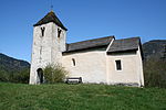
|
Kapelle St. Lorenz | A | 46°45′24″N 9°26′13″E / 46.756748°N 9.43698°E | 3125 | ||
| Pasqual | 
|
Kapelle St. Maria Magdalena | A | 46°45′23″N 9°27′00″E / 46.75652°N 9.449934°E | 3126 | ||
| Pasqual | 
|
Schloss Paspels | B | 46°45′00″N 9°26′25″E / 46.750013888°N 9.440197222°E | 3130 | ||
Pitasch
| Location | Upload | Photo | Object | Cat. | Coordinates | KGS-Nr | |
|---|---|---|---|---|---|---|---|
| Pitasch | 
|
Baselgia reformada da Pitasch | A | 46°43′51″N 9°13′01″E / 46.730787°N 9.216824°E | 3134 | ||
Pratval
| Location | Upload | Photo | Object | Cat. | Coordinates | KGS-Nr | |
|---|---|---|---|---|---|---|---|
| Pratval | 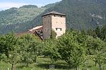
|
Schloss Rietberg | A | 46°44′09″N 9°26′53″E / 46.735794°N 9.448035°E | 3157 | ||
Puntraschigna
| Location | Upload | Photo | Object | Cat. | Coordinates | KGS-Nr | |
|---|---|---|---|---|---|---|---|
| Puntraschigna | 
|
Burgturm Spaniola | A | 46°29′22″N 9°54′35″E / 46.489325°N 9.909693°E | 10048 | ||
| Puntraschigna | 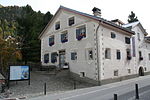
|
Museum Alpin | B | 46°29′22″N 9°54′21″E / 46.48945°N 9.90588°E | 3137 | ||
| Puntraschigna | 
|
Grand Hotel Kronenhof | A | 46°29′37″N 9°54′05″E / 46.493611111°N 9.901388888°E | 3136 | ||
| Puntraschigna | 
|
Sta. Maria | A | 46°29′24″N 9°54′35″E / 46.490002°N 9.90962°E | 3135 | ||
| Puntraschigna | 
|
Hotel Saratz | B | 46°29′36″N 9°54′07″E / 46.49323°N 9.90182°E | 9048 | ||
| Puntraschigna | 
|
Chesa Dr. Campell cun stalla e tablà | B | 46°29′40″N 9°54′04″E / 46.49455°N 9.90123°E | 10756 | ||
| Puntraschigna | 
|
Pontresina | ISOS | 46°29′27″N 9°54′19″E / 46.4907°N 9.9052°E | |||
Puschlev
| Location | Upload | Photo | Object | Cat. | Coordinates | KGS-Nr | |
|---|---|---|---|---|---|---|---|
| Puschlev | 
|
Reformierte Kirche Poschiavo | B | 46°19′37″N 10°03′31″E / 46.32692°N 10.0587°E | 3150 | ||
| Puschlev | 
|
Poschiavo | ISOS | 46°19′28″N 10°03′26″E / 46.3244°N 10.05721°E | |||
| Puschlev | 
|
Gemeindearchiv Poschiavo | B | 46°19′36″N 10°03′30″E / 46.32654°N 10.05847°E | 10583 | ||
| Puschlev | 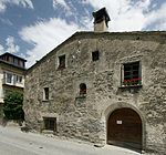
|
Museo Poschiavino | B | 46°19′36″N 10°03′24″E / 46.32654°N 10.05665°E | 8570 | ||
| Puschlev | 
|
Casa Tomé | A | 46°19′33″N 10°03′26″E / 46.325807°N 10.057241°E | 10049 | ||
| Puschlev | chiesa cattolica di S. Maria Assunta | chiesa cattolica di S. Maria Assunta | A | 46°19′14″N 10°03′37″E / 46.320469°N 10.060387°E | 3141 | ||
| Puschlev | 
|
chiesa collegiata cattolica di S. Vittore | A | 46°19′34″N 10°03′30″E / 46.326061°N 10.058318°E | 3142 | ||
| Puschlev | 
|
chiesa parrocchiale di S. Carlo Borromeo | A | 46°20′37″N 10°03′43″E / 46.343473°N 10.062018°E | 3143 | ||
| Puschlev | 
|
Devon House | A | 46°19′24″N 10°03′32″E / 46.323275°N 10.058911°E | 3138 | ||
| Puschlev | 
|
Haus, Li Curt | A | 46°18′40″N 10°03′45″E / 46.31116°N 10.062444°E | 10378 | ||
| Puschlev | 
|
Mulino di Aino, segherie, fucina | A | 46°20′18″N 10°03′34″E / 46.3384°N 10.05955°E | 10050 | ||
| Puschlev | 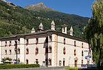
|
Palazzo De Bassus Mengotti (Museo) | A | 46°19′36″N 10°03′24″E / 46.326586°N 10.056655°E | 3140 | ||
| Puschlev | 
|
Palazzo Dorizzi (Crameri) | A | 46°20′36″N 10°03′40″E / 46.343289°N 10.061034°E | 9267 | ||
| Puschlev | 
|
Vecchio Monastero con cappella monastica di S. Maria Presentata | A | 46°19′33″N 10°03′33″E / 46.325915°N 10.059182°E | 3144 | ||
| Puschlev | 
|
Azienda stanziale isolata sul territorio | B | 46°20′32″N 10°03′55″E / 46.34223°N 10.0653°E | 10758 | ||
| Puschlev | 
|
Campel Dasot, Azienda unitaria no. 2964 | B | 46°19′29″N 10°02′48″E / 46.32484°N 10.0467°E | 10757 | ||
| Puschlev | 
|
Campel Dasot, Gehöft | B | 46°19′30″N 10°02′48″E / 46.32493°N 10.0467°E | 12460 | ||
| Puschlev | 
|
Cappella cattolica di S. Pietro | B | 46°19′33″N 10°03′13″E / 46.32585°N 10.0535°E | 3146 | ||
| Puschlev | 
|
Casa Albrici (Albergo) | B | 46°19′34″N 10°03′29″E / 46.32624°N 10.05794°E | 3147 | ||
| Puschlev | 
|
Le Prese, Albergo Bagni Le Prese | B | 46°17′24″N 10°04′44″E / 46.28989°N 10.07878°E | 3151 | ||
| Puschlev | 
|
Li Curt, Annunziata, cappella S. Annunziata e casa | B | 46°18′27″N 10°04′03″E / 46.30761°N 10.06743°E | 3145 | ||
| Puschlev | 
|
Li Tagliadi | B | 46°20′32″N 10°03′55″E / 46.34223°N 10.06534°E | 12463 | ||
| Puschlev | 
|
Oratorio di S. Anna con ossario | B | 46°19′33″N 10°03′30″E / 46.32578°N 10.05837°E | 3152 | ||
| Puschlev | 
|
Palazzo Rodolfo Landolfi | B | 46°19′30″N 10°03′28″E / 46.32495°N 10.05774°E | 3148 | ||
| Puschlev | 
|
Plazzo Matossi-Lendi | B | 46°19′30″N 10°03′25″E / 46.32505°N 10.05697°E | 3149 | ||
| Puschlev | 
|
Prada, chiesa cattolica S. Bernardo | B | 46°18′33″N 10°04′20″E / 46.30917°N 10.07231°E | 3154 | ||
| Puschlev | 
|
San Carlo, Gebäudegruppe (Sägerei, Mühle, Schmiede, Waschhäuschen) | B | 46°20′18″N 10°03′34″E / 46.3384°N 10.05956°E | 12461 | ||
| Puschlev | 
|
San Carlo, Ponte d'Aino | B | 46°20′22″N 10°03′32″E / 46.33941°N 10.05883°E | 12462 | ||
| Puschlev | 
|
Selva, cappella di SS. Sebastiano e Sinforosa e crot (Kühlkeller) | B | 46°18′09″N 10°02′54″E / 46.30257°N 10.04835°E | 3155 | ||
| Puschlev | 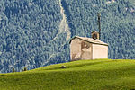
|
Selva, chiesa evangelica riformata | B | 46°18′07″N 10°02′58″E / 46.30191°N 10.04949°E | 3156 | ||
| Puschlev | 
|
Cantone | ISOS | 46°17′48″N 10°05′07″E / 46.2968°N 10.0853°E | |||
| Puschlev | 
|
San Carlo | ISOS | 46°20′34″N 10°03′39″E / 46.3429°N 10.0609°E | |||
| Puschlev | 
|
Prada | ISOS | 46°18′32″N 10°04′22″E / 46.3089°N 10.0727°E | |||
Razén
| Location | Upload | Photo | Object | Cat. | Coordinates | KGS-Nr | |
|---|---|---|---|---|---|---|---|
| Razén | 
|
Schloss Rhäzüns | B | 46°47′54″N 9°24′12″E / 46.79836°N 9.40328°E | 3171 | ||
| Razén | 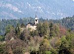
|
Baselgia catolica S. Gieri cun frescas | A | 46°48′12″N 9°24′32″E / 46.803396°N 9.408965°E | 3168 | ||
| Razén | 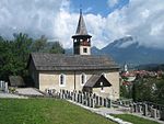
|
Kirche Sogn Paul | A | 46°47′44″N 9°23′44″E / 46.79562°N 9.395447°E | 3169 | ||
| Razén | 
|
Baselgia catolic S. Maria | B | 46°47′54″N 9°23′50″E / 46.79847°N 9.39712°E | 3170 | ||
| Razén | 
|
Chaplutta S. Appolonia | B | 46°47′55″N 9°23′49″E / 46.79874°N 9.3969°E | 13015 | ||
Riein
| Location | Upload | Photo | Object | Cat. | Coordinates | KGS-Nr | |
|---|---|---|---|---|---|---|---|
| Riein | 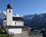
|
Reformierte Kirche Riein | B | 46°44′39″N 9°13′59″E / 46.744305555°N 9.233166666°E | 10760 | ||
Riom-Parsonz
| Location | Upload | Photo | Object | Cat. | Coordinates | KGS-Nr | |
|---|---|---|---|---|---|---|---|
| Riom-Parsonz | 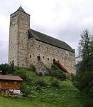
|
Casti da Riom | A | 46°36′33″N 9°35′03″E / 46.609281°N 9.5843°E | 3172 | ||
| Riom-Parsonz | 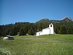
|
Baselgia da Son Baltermia, Salaschigns | B | 46°36′54″N 9°33′46″E / 46.61495°N 9.56265°E | 10761 | ||
Rossa
| Location | Upload | Photo | Object | Cat. | Coordinates | KGS-Nr | |
|---|---|---|---|---|---|---|---|
| Rossa | 
|
chiesa parrocchiale cattolica di S. Domenica e Ossario | A | 46°21′06″N 9°07′22″E / 46.351793°N 9.122811°E | 3177 | ||
| Rossa | 
|
Augio, Casa Spadini, no. 95 | B | 46°21′52″N 9°07′36″E / 46.36436°N 9.12675°E | 3178 | ||
| Rossa | 
|
Augio, Chiesa cattolica SS. Giusep e Antonio di Padova | B | 46°21′53″N 9°07′36″E / 46.36469°N 9.12659°E | 3179 | ||
| Rossa | 
|
Augio | ISOS | 46°21′54″N 9°07′36″E / 46.365°N 9.1267°E | |||
| Rossa | 
|
Rossa | ISOS | 46°22′24″N 9°07′35″E / 46.37333°N 9.12627°E | |||
Roveredo
| Location | Upload | Photo | Object | Cat. | Coordinates | KGS-Nr | |
|---|---|---|---|---|---|---|---|
| Roveredo | 
|
chiesa Madonna del Ponte chiuso | A | 46°13′48″N 9°07′47″E / 46.22995°N 9.129802°E | 3184 | ||
| Roveredo | 
|
Casa con parco | B | 46°14′09″N 9°07′47″E / 46.23571°N 9.12972°E | 10763 | ||
| Roveredo | 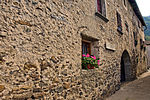
|
Casa Gabrieli | B | 46°13′57″N 9°07′25″E / 46.23257°N 9.12356°E | 12471 | ||
| Roveredo | 
|
Casa Nicola | B | 46°13′50″N 9°07′34″E / 46.23042°N 9.126°E | 12472 | ||
| Roveredo | 
|
Casa Tenchio no. 149/150 | B | 46°14′15″N 9°07′46″E / 46.23751°N 9.12941°E | 3185 | ||
| Roveredo | 
|
Casa Zuccalli | B | 46°13′59″N 9°07′40″E / 46.233°N 9.12769°E | 3186 | ||
| Roveredo | 
|
chiesa cattolica di S. Giulio | B | 46°13′59″N 9°07′12″E / 46.23306°N 9.12004°E | 3187 | ||
| Roveredo | 
|
chiesa San Antonio | B | 46°14′20″N 9°07′57″E / 46.23892°N 9.13244°E | 3188 | ||
| Roveredo | 
|
Palazzo Tovéda | B | 46°14′06″N 9°07′44″E / 46.23497°N 9.12901°E | 12473 | ||
| Roveredo | 
|
San Giulio, Palazzo Comacio | B | 46°14′02″N 9°07′12″E / 46.23397°N 9.11994°E | 3189 | ||
Rueun
| Location | Upload | Photo | Object | Cat. | Coordinates | KGS-Nr | |
|---|---|---|---|---|---|---|---|
| Rueun | 
|
Kapelle St. Maria Magdalena | B | 46°46′43″N 9°10′23″E / 46.77861°N 9.17315°E | 10772 | ||
| Rueun | 
|
Punt da Rueun | B | 46°46′27″N 9°08′49″E / 46.77405°N 9.14701°E | 9069 | ||
Ruschein
| Location | Upload | Photo | Object | Cat. | Coordinates | KGS-Nr | |
|---|---|---|---|---|---|---|---|
| Ruschein | 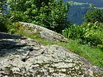
|
Schalensteine von Plontabuora | B | 46°47′01″N 9°11′32″E / 46.78353°N 9.19224°E | 3190 | ||
S-chanf
| Location | Upload | Photo | Object | Cat. | Coordinates | KGS-Nr | |
|---|---|---|---|---|---|---|---|
| S-chanf | 
|
Reformierte Kirche Cinuos-chel | B | 46°38′30″N 10°01′23″E / 46.641555555°N 10.023055555°E | 3234 | ||
| S-chanf | 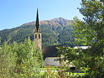
|
Reformierte Kirche S-chanf | B | 46°36′42″N 9°59′00″E / 46.61159°N 9.98323°E | 3229 | ||
| S-chanf | 
|
Reformierte Kirche Susauna | B | 46°38′12″N 9°59′23″E / 46.636611111°N 9.989722222°E | 10056 | ||
| S-chanf | 
|
Doppelwohnhaus mit Stallscheunen Nrn. 216/217 | A | 46°38′12″N 9°59′24″E / 46.636613°N 9.990011°E | 10406 | ||
| S-chanf | 
|
Wohnhaus mit Stallscheune, Nr. 107 | A | 46°36′45″N 9°59′10″E / 46.612527°N 9.986052°E | 10404 | ||
| S-chanf | 
|
Chasa Juvalta | B | 46°36′41″N 9°58′57″E / 46.61151°N 9.98263°E | 3232 | ||
| S-chanf | 
|
Chasa pravenda | B | 46°36′40″N 9°58′54″E / 46.61098°N 9.98168°E | 3233 | ||
| S-chanf | 
|
Cinuos-chel, Chasa Feldscher | B | 46°38′31″N 10°01′25″E / 46.6420055°N 10.0234875°E | 3235 | ||
| S-chanf | 
|
Cinuos-chel, Chasa Heidiger | B | 46°38′32″N 10°01′26″E / 46.64213°N 10.0238°E | 12478 | ||
| S-chanf | 
|
Cinuos-chel, Chesa Nr. 262 | B | 46°38′32″N 10°01′27″E / 46.64233°N 10.02408°E | 3236 | ||
Saas en il Partenz
| Location | Upload | Photo | Object | Cat. | Coordinates | KGS-Nr | |
|---|---|---|---|---|---|---|---|
| Saas en il Partenz | 
|
Reformierte Kirche Saas im Prättigau | B | 46°54′39″N 9°48′19″E / 46.91089°N 9.80527°E | 3191 | ||
Safiental
| Location | Upload | Photo | Object | Cat. | Coordinates | KGS-Nr | |
|---|---|---|---|---|---|---|---|
| Safiental | 
|
Valendau | ISOS | 46°46′59″N 9°16′00″E / 46.783055555°N 9.266666666°E | |||
Sagogn
| Location | Upload | Photo | Object | Cat. | Coordinates | KGS-Nr | |
|---|---|---|---|---|---|---|---|
| Sagogn | 
|
Katholische Kirche Sagogn | A | 46°47′20″N 9°15′14″E / 46.788958°N 9.253983°E | 3196 | ||
| Sagogn | 
|
Casa pravenda catolica | B | 46°47′23″N 9°15′03″E / 46.78964°N 9.25072°E | 12476 | ||
| Sagogn | 
|
Chasa Castelli | B | 46°47′23″N 9°15′07″E / 46.78967°N 9.25185°E | 3199 | ||
| Sagogn | 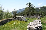
|
Burg Schiedberg | A | 46°47′30″N 9°16′00″E / 46.791666666°N 9.266666666°E | 3197 | ||
Samedan
| Location | Upload | Photo | Object | Cat. | Coordinates | KGS-Nr | |
|---|---|---|---|---|---|---|---|
| Samedan | 
|
Chesa Planta Samedan | B | 46°32′04″N 9°52′19″E / 46.53438°N 9.87187°E | 3206 | ||
| Samedan | 
|
St. Peter | B | 46°32′09″N 9°51′58″E / 46.53582°N 9.86601°E | 3205 | ||
| Samedan | 
|
Bibliothek der Fundaziun de Planta | A | 46°32′04″N 9°52′19″E / 46.534395°N 9.871872°E | 9302 | ||
| Samedan | 
|
Reformierte Kirche Samedan | B | 46°32′02″N 9°52′14″E / 46.53393°N 9.87061°E | 3204 | ||
| Samedan | 
|
Baselgia catolica Herz-Jesu | A | 46°32′02″N 9°52′04″E / 46.534016°N 9.867682°E | 10055 | ||
| Samedan | 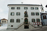
|
Chesa cumünela | B | 46°32′04″N 9°52′16″E / 46.53434°N 9.8711°E | 12477 | ||
Samignun
| Location | Upload | Photo | Object | Cat. | Coordinates | KGS-Nr | |
|---|---|---|---|---|---|---|---|
| Samignun | 
|
Kapelle Maria Hilf | B | 46°56′34″N 10°21′32″E / 46.9429°N 10.35897°E | 10778 | ||
| Samignun | 
|
Katholische Pfarrkirche St. Jakob | B | 46°57′37″N 10°24′12″E / 46.96032°N 10.40337°E | 10776 | ||
| Samignun | 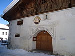
|
Talmuseum Chasa Retica | B | 46°57′23″N 10°23′06″E / 46.95651°N 10.38494°E | 10779 | ||
San Murezzan
San Vittore
| Location | Upload | Photo | Object | Cat. | Coordinates | KGS-Nr | |
|---|---|---|---|---|---|---|---|
| San Vittore | 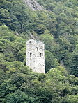
|
Torre Palas | A | 46°14′23″N 9°06′19″E / 46.239851°N 9.105342°E | 3211 | ||
| San Vittore | 
|
Cappella di S. Lucio e dintorni | A | 46°14′21″N 9°06′20″E / 46.239047°N 9.105512°E | 3207 | ||
| San Vittore | 
|
Ca'del Gerb | B | 46°14′16″N 9°05′56″E / 46.23771°N 9.09884°E | 3208 | ||
| San Vittore | 
|
chiesa c. di SS Giovanni e Vittore | B | 46°14′19″N 9°06′35″E / 46.23852°N 9.10984°E | 3209 | ||
| San Vittore | 
|
Palazzo Viscardi (Museo moesano) | B | 46°14′19″N 9°06′35″E / 46.23871°N 9.10965°E | 3210 | ||
Scharons
| Location | Upload | Photo | Object | Cat. | Coordinates | KGS-Nr | |
|---|---|---|---|---|---|---|---|
| Scharons | 
|
Haus Bardill | A | 46°42′59″N 9°27′33″E / 46.716349°N 9.459229°E | 3239 | ||
| Scharons | 
|
Reformierte Kirche Scharans | B | 46°43′05″N 9°27′34″E / 46.718067°N 9.459425°E | 3242 | ||
| Scharons | 
|
Haus Buchli-Balzer | B | 46°42′57″N 9°27′35″E / 46.7159°N 9.459828°E | 3240 | ||
| Scharons | 
|
Häuser Nr. 36 und 38 | B | 46°42′59″N 9°27′33″E / 46.716316°N 9.459229°E | 3241 | ||
| Scharons | 
|
Wohnhaus Joos | B | 46°43′05″N 9°27′32″E / 46.718174°N 9.458971°E | 10781 | ||
| Scharons | 
|
Wohnhaus Patzen Kohler | B | 46°43′04″N 9°27′32″E / 46.717671°N 9.458952°E | 10782 | ||
Schlarigna
| Location | Upload | Photo | Object | Cat. | Coordinates | KGS-Nr | |
|---|---|---|---|---|---|---|---|
| Schlarigna | 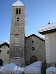
|
Reformierte Kirche Celerina Crasta | B | 46°30′39″N 9°51′21″E / 46.510861111°N 9.855833333°E | 2914 | ||
| Schlarigna | 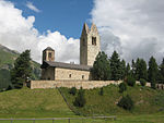
|
Kirche San Gian | A | 46°30′48″N 9°52′11″E / 46.513272°N 9.869749°E | 2912 | ||
| Schlarigna | 
|
Chesa Las Lavinatschas | B | 46°30′31″N 9°51′10″E / 46.50864°N 9.85278°E | 10728 | ||
| Schlarigna | 
|
Chesa Windegg | B | 46°30′54″N 9°51′42″E / 46.51506°N 9.86168°E | 10730 | ||
| Schlarigna | 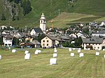
|
Bel Taimpel | B | 46°30′48″N 9°51′36″E / 46.51345°N 9.86004°E | 2913 | ||
Schluein
| Location | Upload | Photo | Object | Cat. | Coordinates | KGS-Nr | |
|---|---|---|---|---|---|---|---|
| Schluein | 
|
Baselgia catolica SS. Peder e Paul | A | 46°47′20″N 9°13′42″E / 46.788867°N 9.228343°E | 3246 | ||
Schnaus
| Location | Upload | Photo | Object | Cat. | Coordinates | KGS-Nr | |
|---|---|---|---|---|---|---|---|
| Schnaus | 
|
Reformierte Kirche Schnaus | B | 46°46′37″N 9°10′50″E / 46.777027777°N 9.180555555°E | 10788 | ||
Scuol
Seewis
| Location | Upload | Photo | Object | Cat. | Coordinates | KGS-Nr | |
|---|---|---|---|---|---|---|---|
| Seewis | 
|
Burg Fracstein | A | 46°58′30″N 9°36′56″E / 46.975°N 9.61556°E | 3256 | ||
| Seewis | 
|
Burg Solavers | B | 46°59′00″N 9°38′40″E / 46.98339°N 9.64436°E | 3257 | ||
| Seewis | 
|
Reformierte Kirche Seewis im Prättigau | B | 46°59′23″N 9°38′23″E / 46.98969°N 9.63983°E | 3258 | ||
| Seewis | 
|
Alp Fasons, Sennerei | B | 47°02′50″N 9°40′16″E / 47.04717°N 9.67124°E | 12491 | ||
| Seewis | 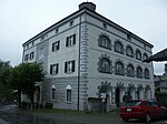
|
Gemeindehaus (Salis-Schloss) | B | 46°59′19″N 9°38′12″E / 46.98871°N 9.63669°E | 10792 | ||
Segl
| Location | Upload | Photo | Object | Cat. | Coordinates | KGS-Nr | |
|---|---|---|---|---|---|---|---|
| Segl | 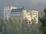
|
Hotel Waldhaus (Sils) | B | 46°25′42″N 9°45′41″E / 46.4283°N 9.76125°E | 3277 | ||
| Segl | 
|
Reformierte Kirche Fex Crasta | B | 46°24′50″N 9°45′54″E / 46.413833333°N 9.765083333°E | 3276 | ||
| Segl | 
|
Reformierte Kirche Sils-Baselgia | B | 46°26′05″N 9°45′18″E / 46.43476°N 9.75506°E | 3278 | ||
| Segl | 
|
Segl-Baselgia, Hotel Chesa Randolina | B | 46°25′57″N 9°45′23″E / 46.43258°N 9.75634°E | 3279 | ||
| Segl | 
|
Segl-Baselgia, Hotel Margna | B | 46°26′01″N 9°45′24″E / 46.43356°N 9.7567°E | 3280 | ||
| Segl | 
|
Segl-Baselgia, Residenza Crastella | B | 46°25′57″N 9°45′21″E / 46.4325°N 9.75575°E | 12470 | ||
Seglias
| Location | Upload | Photo | Object | Cat. | Coordinates | KGS-Nr | |
|---|---|---|---|---|---|---|---|
| Seglias | 
|
Burg Campell | A | 46°42′02″N 9°28′17″E / 46.700444444°N 9.471388888°E | 3269 | ||
| Seglias | 
|
Burg Ehrenfels | A | 46°41′48″N 9°27′06″E / 46.696738°N 9.45176°E | 10058 | ||
| Seglias | 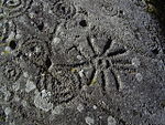
|
Carschenna | A | 46°41′38″N 9°27′31″E / 46.6939°N 9.45872°E | 3270 | ||
| Seglias | 
|
Hohen Rätien | A | 46°41′31″N 9°26′41″E / 46.691944444°N 9.444722222°E | 3271 | ||
| Seglias | 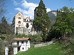
|
Schloss Baldenstein | B | 46°42′24″N 9°27′37″E / 46.706666666°N 9.460277777°E | 3275 | ||
| Seglias | 
|
St. Cassian | B | 46°42′15″N 9°27′36″E / 46.704272°N 9.459994°E | 3274 | ||
| Seglias | 
|
Haus Künzler mit Garten | B | 46°42′02″N 9°27′15″E / 46.700513°N 9.454255°E | 3272 | ||
| Seglias | 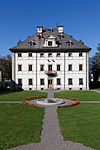
|
Palazzo Donatz mit Gartenanlage | B | 46°42′00″N 9°27′07″E / 46.700069°N 9.451884°E | 3273 | ||
| Seglias | 
|
Campi | ISOS | 46°42′03″N 9°28′13″E / 46.70072°N 9.47024°E | |||
Sent
| Location | Upload | Photo | Object | Cat. | Coordinates | KGS-Nr | |
|---|---|---|---|---|---|---|---|
| Sent | 
|
Reformierte Kirche Sent | B | 46°48′57″N 10°20′12″E / 46.81584°N 10.33679°E | 3260 | ||
| Sent | 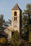
|
San Peder | B | 46°48′58″N 10°19′58″E / 46.81612°N 10.33287°E | 3261 | ||
Sevgein
| Location | Upload | Photo | Object | Cat. | Coordinates | KGS-Nr | |
|---|---|---|---|---|---|---|---|
| Sevgein | 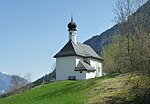
|
Wallfahrtskapelle Sontga Fossa | B | 46°44′35″N 8°59′26″E / 46.743183333°N 8.990572222°E | 3266 | ||
Signuradi
| Location | Upload | Photo | Object | Cat. | Coordinates | KGS-Nr | |
|---|---|---|---|---|---|---|---|
| Signuradi | 
|
Maiavilla | ISOS | 47°00′28″N 9°31′51″E / 47.007777777°N 9.530833333°E | |||
| Signuradi | 
|
Fläsch | ISOS | 47°02′23″N 9°31′59″E / 47.03974°N 9.53303°E | |||
| Signuradi | 
|
Jenins | ISOS | 46°59′59″N 9°33′00″E / 46.999722222°N 9.55°E | |||
| Signuradi | 
|
Malans | ISOS | 46°58′55″N 9°34′34″E / 46.981944444°N 9.576111111°E | |||
Silvaplauna
| Location | Upload | Photo | Object | Cat. | Coordinates | KGS-Nr | |
|---|---|---|---|---|---|---|---|
| Silvaplauna | 
|
Reformierte Kirche Silvaplana | B | 46°27′34″N 9°47′43″E / 46.45941°N 9.79518°E | 3281 | ||
| Silvaplauna | 
|
Chastè Crap da Sass | B | 46°27′31″N 9°48′13″E / 46.45851°N 9.80361°E | 3282 | ||
| Silvaplauna | 
|
Surlej, Chasa Tramunt (mit Kornspeicher) | B | 46°27′30″N 9°48′31″E / 46.45832°N 9.80862°E | 3283 | ||
| Silvaplauna | 
|
Surlej, Chesa Lansel | B | 46°27′30″N 9°48′31″E / 46.45836°N 9.80862°E | 10798 | ||
Soazza
| Location | Upload | Photo | Object | Cat. | Coordinates | KGS-Nr | |
|---|---|---|---|---|---|---|---|
| Soazza | 
|
Soazza | ISOS | 46°21′57″N 9°13′18″E / 46.36592°N 9.22155°E | |||
| Soazza | 
|
Casa Paret | A | 46°21′58″N 9°13′16″E / 46.365973°N 9.221058°E | 10059 | ||
| Soazza | [[File:|150x150px|chiesa parrocchiale cattolica di S. Martino, ossario e oratorio della Madonna Addolorata]] | chiesa parrocchiale cattolica di S. Martino, ossario e oratorio della Madonna Addolorata | A | 46°21′50″N 9°13′25″E / 46.363838°N 9.223522°E | 3284 | ||
| Soazza | 
|
Ospizio e Via Crucis | A | 46°21′57″N 9°13′14″E / 46.365918°N 9.220575°E | 3286 | ||
| Soazza | 
|
Casa San Floriano | B | 46°21′57″N 9°13′16″E / 46.36585°N 9.221°E | 10799 | ||
| Soazza | 
|
Case no. 130,131 (Haus Anderson) | B | 46°22′01″N 9°13′16″E / 46.36687°N 9.22118°E | 10800 | ||
| Soazza | 
|
chiesa cattolica San Rocco | B | 46°22′01″N 9°13′22″E / 46.36685°N 9.22286°E | 3287 | ||
| Soazza | 
|
Palazzo a Marca | B | 46°21′59″N 9°13′17″E / 46.36636°N 9.2213°E | 3288 | ||
Sogn Martin
| Location | Upload | Photo | Object | Cat. | Coordinates | KGS-Nr | |
|---|---|---|---|---|---|---|---|
| Sogn Martin | 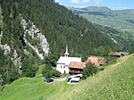
|
Kirche St. Martin | B | 46°40′29″N 9°10′49″E / 46.67462°N 9.18016°E | 10804 | ||
Sontg Antönia
| Location | Upload | Photo | Object | Cat. | Coordinates | KGS-Nr | |
|---|---|---|---|---|---|---|---|
| Sontg Antönia | 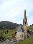
|
Reformierte Kirche St. Antönien | B | 46°58′10″N 9°48′50″E / 46.96943°N 9.81391°E | 3301 | ||
Sour
| Location | Upload | Photo | Object | Cat. | Coordinates | KGS-Nr | |
|---|---|---|---|---|---|---|---|
| Sour | 
|
Burg Spliatsch | B | 46°31′01″N 9°37′36″E / 46.51695°N 9.62679°E | 3325 | ||
Spleia
| Location | Upload | Photo | Object | Cat. | Coordinates | KGS-Nr | |
|---|---|---|---|---|---|---|---|
| Spleia | 
|
Burg Splügen | B | 46°33′27″N 9°20′04″E / 46.557365°N 9.33443°E | 3295 | ||
| Spleia | 
|
Hotel Alte Herberge Weiss Kreuz | A | 46°33′13″N 9°19′21″E / 46.553638°N 9.322377°E | 10555 | ||
| Spleia | 
|
Hotel Bodenhaus | B | 46°33′13″N 9°19′26″E / 46.553733333°N 9.323938888°E | 10801 | ||
| Spleia | 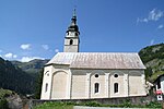
|
Reformierte Kirche Splügen | B | 46°33′15″N 9°19′27″E / 46.554172°N 9.324066°E | 10802 | ||
| Spleia | 
|
Gemeindehaus (altes Schulhaus) | B | 46°33′14″N 9°19′20″E / 46.553861°N 9.322203°E | 3300 | ||
| Spleia | 
|
Haus Albertini | B | 46°33′15″N 9°19′19″E / 46.554278°N 9.321983°E | 3294 | ||
| Spleia | 
|
Haus Camastral | B | 46°33′14″N 9°19′21″E / 46.5539°N 9.32253°E | 3297 | ||
| Spleia | 
|
Schorsch-Haus, Nr. 58, 58A | B | 46°33′15″N 9°19′20″E / 46.554267°N 9.322152°E | 3299 | ||
Sta. Maria
| Location | Upload | Photo | Object | Cat. | Coordinates | KGS-Nr | |
|---|---|---|---|---|---|---|---|
| Sta. Maria | 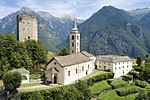
|
Kirche Sta. Maria Assunta Calanca | A | 46°15′43″N 9°08′45″E / 46.262052777°N 9.145827777°E | 3212 | ||
| Sta. Maria | 
|
Turm von Sta. Maria in Calanca | A | 46°15′44″N 9°08′45″E / 46.26228°N 9.145855°E | 3213 | ||
Sumvitg
| Location | Upload | Photo | Object | Cat. | Coordinates | KGS-Nr | |
|---|---|---|---|---|---|---|---|
| Sumvitg | 
|
Russeinerbrücke | A | 46°43′18″N 8°53′46″E / 46.721738°N 8.896239°E | 9070 | ||
| Sumvitg | 
|
Baselgia catolic S. Gion B. | B | 46°43′41″N 8°56′21″E / 46.72816°N 8.93908°E | 3323 | ||
| Sumvitg | 
|
Chasa Gilli (Maissen) | B | 46°43′40″N 8°56′15″E / 46.72764°N 8.93756°E | 3324 | ||
Suot Tasna
| Location | Upload | Photo | Object | Cat. | Coordinates | KGS-Nr | |
|---|---|---|---|---|---|---|---|
| Suot Tasna | 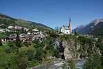
|
Scuol | ISOS | 46°47′49″N 10°17′58″E / 46.797°N 10.2995°E | |||
| Suot Tasna | 
|
Sent | ISOS | 46°49′00″N 10°20′00″E / 46.816666666°N 10.333333333°E | |||
Sur Tasna
| Location | Upload | Photo | Object | Cat. | Coordinates | KGS-Nr | |
|---|---|---|---|---|---|---|---|
| Sur Tasna | 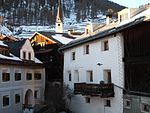
|
Ardez | ISOS | 46°46′29″N 10°12′03″E / 46.7747°N 10.2008°E | |||
| Sur Tasna | 
|
Zernez | ISOS | 46°41′59″N 10°05′59″E / 46.699722222°N 10.099722222°E | |||
| Sur Tasna | 
|
Guarda | ISOS | 46°46′32″N 10°09′05″E / 46.775555555°N 10.151388888°E | |||
| Sur Tasna | 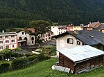
|
Lavin | ISOS | 46°46′03″N 10°06′38″E / 46.7676°N 10.1105°E | |||
| Sur Tasna | 
|
Tarasp | ISOS | 46°46′40″N 10°15′37″E / 46.7778°N 10.2604°E | |||
Sursaissa
| Location | Upload | Photo | Object | Cat. | Coordinates | KGS-Nr | |
|---|---|---|---|---|---|---|---|
| Sursaissa | 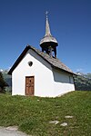
|
St.-Georgs-Kapelle | B | 46°44′59″N 9°06′07″E / 46.74961°N 9.10191°E | 3122 | ||
Surses
Susch
| Location | Upload | Photo | Object | Cat. | Coordinates | KGS-Nr | |
|---|---|---|---|---|---|---|---|
| Susch | 
|
Fortezza Rohan | A | 46°44′54″N 10°05′00″E / 46.748315°N 10.083306°E | 3332 | ||
| Susch | 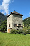
|
Turm la Praschun | B | 46°45′08″N 10°05′00″E / 46.7523°N 10.08332°E | 3333 | ||
| Susch | 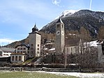
|
Reformierte Kirche Susch | B | 46°45′03″N 10°04′54″E / 46.75079°N 10.08172°E | 3330 | ||
| Susch | 
|
Tuor Planta | B | 46°45′04″N 10°04′55″E / 46.7511°N 10.08181°E | 3334 | ||


