| Name
|
Heritage list
|
Place
|
Street address
|
Coordinates
|
place_id
|
Image
|
| ABC Radio Studios (Q38150912)
|
listed on the Commonwealth Heritage List
|
Rockhampton
|
|
23°22′48″S 150°30′57″E / 23.380052°S 150.515723°E / -23.380052; 150.515723
|
105420
|

|
| ABC Regional Radio Studio (Q38165593)
|
listed on the Commonwealth Heritage List
|
Wagin
|
|
33°18′33″S 117°20′38″E / 33.309173°S 117.343885°E / -33.309173; 117.343885
|
106083
|

|
| Aboriginal Embassy Site (Q38086784)
|
listed on the Commonwealth Heritage List
|
|
|
35°18′04″S 149°07′51″E / 35.301123°S 149.130708°E / -35.301123; 149.130708
|
105224
|

|
| Acton Conservation Area (Q38160638)
|
listed on the Commonwealth Heritage List
|
|
|
35°17′12″S 149°07′01″E / 35.286731°S 149.116989°E / -35.286731; 149.116989
|
105340
|
|
| Acton Peninsula Building 1 (Q38151064)
|
listed on the Commonwealth Heritage List
|
|
|
35°17′29″S 149°07′09″E / 35.291351°S 149.119055°E / -35.291351; 149.119055
|
105341
|
|
| Acton Peninsula Building 15 (Q38166622)
|
listed on the Commonwealth Heritage List
|
|
|
35°17′27″S 149°07′07″E / 35.290837°S 149.118666°E / -35.290837; 149.118666
|
105342
|
|
| Acton Peninsula Building 2 (Q38147812)
|
listed on the Commonwealth Heritage List
|
|
|
35°17′30″S 149°07′10″E / 35.291655°S 149.119581°E / -35.291655; 149.119581
|
105343
|
|
| Acton Peninsula Limestone Outcrops (Q38153958)
|
listed on the Commonwealth Heritage List
|
|
|
35°17′26″S 149°07′08″E / 35.290643°S 149.118996°E / -35.290643; 149.118996
|
105344
|
|
| Adelaide General Post Office (Q38162479)
|
listed on the Commonwealth Heritage List
|
Adelaide
|
|
34°55′37″S 138°35′58″E / 34.926906°S 138.599323°E / -34.926906; 138.599323
|
105518
|
|
| Adelaide River War Cemetery (Q38160721)
|
listed on the Commonwealth Heritage List
|
Adelaide River
|
|
13°13′52″S 131°06′52″E / 13.231164°S 131.114417°E / -13.231164; 131.114417
|
105422
|

|
| Administration Building Forecourt (Q38162199)
|
listed on the Commonwealth Heritage List
|
|
|
12°11′18″S 96°49′46″E / 12.188417°S 96.829431°E / -12.188417; 96.829431
|
105356
|
|
| Administrators House Precinct (Q38163699)
|
listed on the Commonwealth Heritage List
|
|
|
10°25′43″S 105°39′54″E / 10.428719°S 105.66498°E / -10.428719; 105.66498
|
105337
|
|
| Admiralty House Garden and Fortifications (Q38169375)
|
listed on the Commonwealth Heritage List
|
Kirribilli
|
|
33°51′07″S 151°13′07″E / 33.851847°S 151.218559°E / -33.851847; 151.218559
|
105399
|
|
| Admiralty House and Lodge (Q38162268)
|
listed on the Commonwealth Heritage List
|
Kirribilli
|
|
33°51′06″S 151°13′06″E / 33.851694°S 151.218266°E / -33.851694; 151.218266
|
105398
|
|
| Albury Post Office (Q30106394)
|
listed on the Commonwealth Heritage List
|
Albury
|
|
36°04′50″S 146°54′57″E / 36.080422°S 146.915959°E / -36.080422; 146.915959
|
105506
|

|
| Amberley RAAF Base Group (Q38147937)
|
listed on the Commonwealth Heritage List
|
Amberley
|
|
27°38′22″S 152°42′26″E / 27.639354°S 152.70722°E / -27.639354; 152.70722
|
105650
|
|
| Anglesea Barracks (Q4763383)
|
listed on the Commonwealth Heritage List
|
Battery Point
|
|
42°53′22″S 147°19′33″E / 42.889359°S 147.325955°E / -42.889359; 147.325955
|
105488
|

|
| Anson Bay Reserve (Q38164796)
|
listed on the Commonwealth Heritage List
|
Burnt Pine
|
|
29°00′39″S 167°55′26″E / 29.010963°S 167.923804°E / -29.010963; 167.923804
|
105646
|
|
| Anzac Memorial Chapel of St Paul (Q38152647)
|
listed on the Commonwealth Heritage List
|
|
|
35°17′47″S 149°10′05″E / 35.296384°S 149.167991°E / -35.296384; 149.167991
|
105184
|
|
| Apostolic Nunciature (Q38141274)
|
listed on the Commonwealth Heritage List
|
|
|
35°19′38″S 149°07′36″E / 35.327254°S 149.126581°E / -35.327254; 149.126581
|
105191
|
|
| Apple Shed Asset C58 (Q38168920)
|
listed on the Commonwealth Heritage List
|
|
|
35°18′01″S 149°09′50″E / 35.300384°S 149.163894°E / -35.300384; 149.163894
|
105182
|

|
| Arched Building, Longridge (Q38154617)
|
listed on the Commonwealth Heritage List
|
|
|
29°02′48″S 167°56′32″E / 29.046578°S 167.942108°E / -29.046578; 167.942108
|
105623
|
|
| Arid A Type Residence (Q38167685)
|
listed on the Commonwealth Heritage List
|
|
|
23°41′42″S 133°53′20″E / 23.694911°S 133.888958°E / -23.694911; 133.888958
|
105423
|
|
| Armidale Post Office (Q38159730)
|
listed on the Commonwealth Heritage List
|
Armidale
|
|
30°30′50″S 151°40′01″E / 30.513864°S 151.666855°E / -30.513864; 151.666855
|
105493
|

|
| Army Cottage with return verandah (Q38155490)
|
listed on the Commonwealth Heritage List
|
Vaucluse
|
|
33°51′12″S 151°17′07″E / 33.853463°S 151.28523°E / -33.853463; 151.28523
|
105404
|
|
| Army Magazine Buildings Irwin Barracks (Q38155154)
|
listed on the Commonwealth Heritage List
|
Karrakatta
|
|
31°57′57″S 115°47′41″E / 31.965799°S 115.794626°E / -31.965799; 115.794626
|
105215
|
|
| Artillery Barracks (Q38148365)
|
listed on the Commonwealth Heritage List
|
|
|
32°02′41″S 115°45′17″E / 32.0447464°S 115.7547136°E / -32.0447464; 115.7547136
|
105332
|
|
| Artillery Orderly Room / Drill Hall (Q38154898)
|
listed on the Commonwealth Heritage List
|
St Kilda East
|
|
37°51′36″S 144°59′33″E / 37.860003°S 144.992442°E / -37.860003; 144.992442
|
105175
|
|
| Ashmore Reef Marine Park (Q726181)
|
listed on the Commonwealth Heritage List
|
|
|
12°14′26″S 123°05′36″E / 12.240469°S 123.093314°E / -12.240469; 123.093314
|
105218
|
|
| Australian American Memorial and Sir Thomas Blamey Square (Q38164210)
|
listed on the Commonwealth Heritage List
|
|
|
35°17′52″S 149°09′05″E / 35.297734°S 149.151399°E / -35.297734; 149.151399
|
105313
|

|
| Australian Forestry School (former) (Q38161352)
|
listed on the Commonwealth Heritage List
|
|
|
35°18′14″S 149°05′41″E / 35.303863°S 149.094806°E / -35.303863; 149.094806
|
105426
|

|
| Australian Maritime College, Newnham Campus (Q38157482)
|
listed on the Commonwealth Heritage List
|
Newnham
|
|
41°24′01″S 147°07′06″E / 41.400178°S 147.118343°E / -41.400178; 147.118343
|
105663
|
|
| Australian National Botanic Gardens (part) (Q38165817)
|
listed on the Commonwealth Heritage List
|
|
|
35°16′31″S 149°06′28″E / 35.27516°S 149.107673°E / -35.27516; 149.107673
|
105345
|
|
| Australian War Memorial (Q782783)
|
listed on the Commonwealth Heritage List
|
Canberra
Campbell
|
|
35°16′51″S 149°08′55″E / 35.280815°S 149.148707°E / -35.280815; 149.148707
|
105469 105889
105469
|

|
| Ayr Post Office (Q38158012)
|
listed on the Commonwealth Heritage List
|
Ayr
|
|
19°34′34″S 147°24′17″E / 19.576188°S 147.404696°E / -19.576188; 147.404696
|
106172
|

|
| Ball Bay Reserve (Q38165399)
|
listed on the Commonwealth Heritage List
|
Kingston
|
|
29°02′47″S 167°58′53″E / 29.046363°S 167.98139°E / -29.046363; 167.98139
|
105647
|
|
| Bankstown Airport Air Traffic Control Tower (Q38161838)
|
listed on the Commonwealth Heritage List
|
Bankstown
|
|
33°55′18″S 150°58′55″E / 33.921739°S 150.981896°E / -33.921739; 150.981896
|
106118
|
|
| Barracks Block (Q38168711)
|
listed on the Commonwealth Heritage List
|
|
|
33°50′53″S 151°10′14″E / 33.848064°S 151.170583°E / -33.848064; 151.170583
|
105257
|
|
| Barracks Group HMAS Watson (Q38168834)
|
listed on the Commonwealth Heritage List
|
Watsons Bay
|
|
33°50′17″S 151°16′51″E / 33.838167°S 151.280737°E / -33.838167; 151.280737
|
105582
|
|
| Batteries A83 and C9A (Q38163569)
|
listed on the Commonwealth Heritage List
|
Georges Heights
|
|
33°50′09″S 151°15′24″E / 33.835914°S 151.256686°E / -33.835914; 151.256686
|
105577
|
|
| Battery B42 (Q38161616)
|
listed on the Commonwealth Heritage List
|
Georges Heights
|
|
33°49′57″S 151°15′29″E / 33.832625°S 151.258177°E / -33.832625; 151.258177
|
105576
|
|
| Battery for Five Guns (Q38159654)
|
listed on the Commonwealth Heritage List
|
Georges Heights
|
|
33°50′12″S 151°15′34″E / 33.836751°S 151.259479°E / -33.836751; 151.259479
|
105247
|
|
| Beecroft Peninsula (Q38156353)
|
listed on the Commonwealth Heritage List
|
Currarong
|
|
35°02′53″S 150°48′20″E / 35.047955°S 150.805565°E / -35.047955; 150.805565
|
105539
|
|
| Beeliar Regional Park (Q21970741)
|
listed on the Commonwealth Heritage List
|
|
|
32°10′03″S 115°49′57″E / 32.1675°S 115.8325°E / -32.1675; 115.8325
|
14862
|

|
| Biloela Group (Q38166295)
|
listed on the Commonwealth Heritage List
|
|
|
33°50′51″S 151°10′20″E / 33.847414°S 151.172239°E / -33.847414; 151.172239
|
105263
|
|
| Bindoon Defence Training Area (Q38166548)
|
listed on the Commonwealth Heritage List
|
Bindoon
|
|
31°16′38″S 116°17′11″E / 31.277301°S 116.286392°E / -31.277301; 116.286392
|
105619
|
|
| Blowfly Insectary Numbers 1 and 2 (Q38149852)
|
listed on the Commonwealth Heritage List
|
|
|
35°16′25″S 149°06′54″E / 35.27368°S 149.115092°E / -35.27368; 149.115092
|
105559
|
|
| Blundells Farmhouse, Slab Outbuilding and Surrounds (Q38166823)
|
listed on the Commonwealth Heritage List
|
|
|
35°17′34″S 149°08′30″E / 35.29282°S 149.141761°E / -35.29282; 149.141761
|
105734
|

|
| Bondi Beach Post Office (Q38156481)
|
listed on the Commonwealth Heritage List
|
Bondi
|
|
33°53′27″S 151°16′22″E / 33.890794°S 151.272753°E / -33.890794; 151.272753
|
106174
|

|
| Boonah Post Office (Q38151998)
|
listed on the Commonwealth Heritage List
|
Boonah
|
|
27°59′51″S 152°40′55″E / 27.997456°S 152.681927°E / -27.997456; 152.681927
|
106123
|

|
| Botany Post Office (Q38167425)
|
listed on the Commonwealth Heritage List
|
Botany
|
|
33°56′40″S 151°11′49″E / 33.944407°S 151.197001°E / -33.944407; 151.197001
|
106143
|
|
| Boulder Hill West Area (Q38160795)
|
listed on the Commonwealth Heritage List
|
Derby
|
|
16°44′43″S 124°12′12″E / 16.74524°S 124.2034°E / -16.74524; 124.2034
|
105238
|
|
| Bowen Post Office (Q38151628)
|
listed on the Commonwealth Heritage List
|
Bowen
|
|
20°00′44″S 148°14′48″E / 20.01219°S 148.246804°E / -20.01219; 148.246804
|
106124
|

|
| Bradshaw Defence Area (Q38149612)
|
listed on the Commonwealth Heritage List
|
|
|
15°09′20″S 130°21′13″E / 15.155646°S 130.353521°E / -15.155646; 130.353521
|
105655
|
|
| Broken Hill Post Office (Q38154863)
|
listed on the Commonwealth Heritage List
|
Broken Hill
|
|
31°57′29″S 141°27′55″E / 31.958144°S 141.465256°E / -31.958144; 141.465256
|
105499
|

|
| Building VB1 and Parade Ground (Q38160834)
|
listed on the Commonwealth Heritage List
|
Paddington
|
|
33°53′08″S 151°13′24″E / 33.885642°S 151.22322°E / -33.885642; 151.22322
|
105302
|
|
| Building VB2 Guard House (Q38167221)
|
listed on the Commonwealth Heritage List
|
Paddington
|
|
33°53′05″S 151°13′25″E / 33.884702°S 151.223614°E / -33.884702; 151.223614
|
105282
|
|
| Buildings 31 and 32 (Q38165136)
|
listed on the Commonwealth Heritage List
|
|
|
33°51′42″S 151°13′40″E / 33.861799°S 151.227795°E / -33.861799; 151.227795
|
105287
|
|
| Buildings MQVB16 and VB56 (Q38165259)
|
listed on the Commonwealth Heritage List
|
Paddington
|
|
33°53′11″S 151°13′17″E / 33.88626°S 151.221322°E / -33.88626; 151.221322
|
105280
|
|
| Buildings VB13, 15, 16 & 17 (Q38156159)
|
listed on the Commonwealth Heritage List
|
Paddington
|
|
33°53′09″S 151°13′30″E / 33.885793°S 151.224997°E / -33.885793; 151.224997
|
105279
|
|
| Buildings VB41, 45 & 53 (Q38157131)
|
listed on the Commonwealth Heritage List
|
Paddington
|
|
33°53′11″S 151°13′20″E / 33.886282°S 151.222334°E / -33.886282; 151.222334
|
105278
|
|
| Buildings VB60 and VB62 (Q38168478)
|
listed on the Commonwealth Heritage List
|
Paddington
|
|
33°53′08″S 151°13′17″E / 33.885539°S 151.221438°E / -33.885539; 151.221438
|
105283
|
|
| Buildings VB69, 75 & 76 including Garden (Q38147562)
|
listed on the Commonwealth Heritage List
|
Paddington
|
|
33°53′07″S 151°13′17″E / 33.885317°S 151.221476°E / -33.885317; 151.221476
|
105303
|
|
| Buildings VB83, 84, 85, 87 & 89 (Q38165861)
|
listed on the Commonwealth Heritage List
|
Paddington
|
|
33°53′04″S 151°13′16″E / 33.884421°S 151.221197°E / -33.884421; 151.221197
|
105304
|
|
| Buildings VB90, 91, 91A & 92 (Q38141038)
|
listed on the Commonwealth Heritage List
|
Paddington
|
|
33°53′03″S 151°13′16″E / 33.884092°S 151.221167°E / -33.884092; 151.221167
|
105305
|
|
| Bumbora Reserve (Q38164598)
|
listed on the Commonwealth Heritage List
|
|
|
29°03′22″S 167°56′31″E / 29.05623°S 167.941833°E / -29.05623; 167.941833
|
105622
|
|
| Bundaberg Post Office (Q38154187)
|
listed on the Commonwealth Heritage List
|
Bundaberg
|
|
24°51′57″S 152°20′54″E / 24.86585°S 152.348401°E / -24.86585; 152.348401
|
106125
|

|
| Bundanon Trust Property (Q38167469)
|
listed on the Commonwealth Heritage List
|
Nowra
|
|
34°52′47″S 150°29′14″E / 34.879704°S 150.487268°E / -34.879704; 150.487268
|
105321
|
|
| Bungalow 702 (Q38166996)
|
listed on the Commonwealth Heritage List
|
Drumsite
|
|
10°25′55″S 105°40′23″E / 10.431891°S 105.672966°E / -10.431891; 105.672966
|
105338
|
|
| Byron Bay Post Office (Q38160908)
|
listed on the Commonwealth Heritage List
|
Byron Bay
|
|
28°38′39″S 153°36′46″E / 28.644212°S 153.612801°E / -28.644212; 153.612801
|
106175
|
|
| CSIRO Main Entomology Building (Q38163532)
|
listed on the Commonwealth Heritage List
|
|
|
35°16′29″S 149°06′51″E / 35.274812°S 149.114294°E / -35.274812; 149.114294
|
105348
|

|
| Camden Post Office (Q38153536)
|
listed on the Commonwealth Heritage List
|
Camden
|
|
34°03′16″S 150°41′42″E / 34.054532°S 150.694955°E / -34.054532; 150.694955
|
106176
|
|
| Cameron Offices (Wings 3, 4 and 5, and Bridge) (Q38155447)
|
listed on the Commonwealth Heritage List
|
|
|
35°14′29″S 149°04′11″E / 35.241318°S 149.069736°E / -35.241318; 149.069736
|
105410
|
|
| Camperdown Post Office (Q38155621)
|
listed on the Commonwealth Heritage List
|
Camperdown
|
|
38°13′54″S 143°08′47″E / 38.231735°S 143.146525°E / -38.231735; 143.146525
|
106130
|

|
| Canberra School of Art (Q38156193)
|
listed on the Commonwealth Heritage List
|
|
|
35°16′52″S 149°07′19″E / 35.280983°S 149.122079°E / -35.280983; 149.122079
|
105765
|
|
| Canberra School of Music (Q38146532)
|
listed on the Commonwealth Heritage List
|
|
|
35°16′51″S 149°07′25″E / 35.280717°S 149.123629°E / -35.280717; 149.123629
|
105636
|
|
| Canterbury Post Office (Q38153998)
|
listed on the Commonwealth Heritage List
|
Canterbury
|
|
37°49′28″S 145°04′56″E / 37.82436°S 145.082328°E / -37.82436; 145.082328
|
106131
|

|
| Canungra Land Warfare Centre Training Area (part) (Q38168013)
|
listed on the Commonwealth Heritage List
|
Canungra
|
|
28°01′45″S 153°12′41″E / 28.029146°S 153.211432°E / -28.029146; 153.211432
|
105479
|
|
| Cape Baily Light (Q5034579)
|
listed on the Commonwealth Heritage List
|
Kurnell
|
|
34°02′07″S 151°13′19″E / 34.0352°S 151.222°E / -34.0352; 151.222
|
105571
|

|
| Cape Byron Lighthouse (Q38169704)
|
listed on the Commonwealth Heritage List
|
Byron Bay
|
|
28°38′19″S 153°38′11″E / 28.638549°S 153.636333°E / -28.638549; 153.636333
|
105599
|
|
| Cape Leeuwin Lighthouse (Q1034452)
|
listed on the Commonwealth Heritage List
|
Augusta
|
|
34°22′30″S 115°08′11″E / 34.375031°S 115.136357°E / -34.375031; 115.136357
|
105416
|

|
| Cape Northumberland Lighthouse (Q38164440)
|
listed on the Commonwealth Heritage List
|
Port MacDonnell
|
|
38°03′23″S 140°40′03″E / 38.056365°S 140.66739°E / -38.056365; 140.66739
|
105376
|
|
| Cape Sorell Lighthouse (Q38163888)
|
listed on the Commonwealth Heritage List
|
Strahan
|
|
42°11′52″S 145°10′10″E / 42.19789°S 145.16934°E / -42.19789; 145.16934
|
105597
|
|
| Cape St Albans lighthouse (Q28211308)
|
listed on the Commonwealth Heritage List
|
Cape St Albans
Penneshaw
|
|
35°48′13″S 138°07′29″E / 35.8036°S 138.1248°E / -35.8036; 138.1248
35°48′14″S 138°07′32″E / 35.803858°S 138.125429°E / -35.803858; 138.125429
|
105413 7426
105413
|

|
| Cape St George Lighthouse Ruins & Curtilage (Q38167304)
|
listed on the Commonwealth Heritage List
|
|
|
35°09′07″S 150°45′40″E / 35.151848°S 150.761116°E / -35.151848; 150.761116
|
105312
|

|
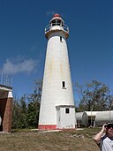
| Cape Wickham Lighthouse (Q38154823)
|
listed on the Commonwealth Heritage List
|
|
|
39°35′19″S 143°56′35″E / 39.588706°S 143.943024°E / -39.588706; 143.943024
|
105567
|
|
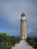
| Cape du Couedic Lighthouse (Q15207441)
|
listed on the Commonwealth Heritage List
|
Parndana
|
|
36°03′29″S 136°42′19″E / 36.057944444444°S 136.70516666667°E / -36.057944444444; 136.70516666667
36°03′31″S 136°42′16″E / 36.058649°S 136.704311°E / -36.058649; 136.704311
|
105414
|
|
| Captain Ballards Grave (Q38157257)
|
listed on the Commonwealth Heritage List
|
|
|
12°06′56″S 96°53′47″E / 12.115492°S 96.896278°E / -12.115492; 96.896278
|
105361
|
|
| Captains Quarters Assets B1 to B4 (Q38168877)
|
listed on the Commonwealth Heritage List
|
|
|
35°17′48″S 149°09′59″E / 35.296716°S 149.166375°E / -35.296716; 149.166375
|
105382
|
|
| Carillon (Q38152694)
|
listed on the Commonwealth Heritage List
|
|
|
35°17′55″S 149°08′30″E / 35.298503°S 149.14174°E / -35.298503; 149.14174
|
105346
|

|
| Casey House and Garden (Q38151673)
|
listed on the Commonwealth Heritage List
|
|
|
35°18′15″S 149°07′12″E / 35.304207°S 149.12007°E / -35.304207; 149.12007
|
105629
|

|
| Casino Post Office (Q30101295)
|
listed on the Commonwealth Heritage List
|
Casino
|
|
28°51′41″S 153°03′49″E / 28.8614905116°S 153.063747055°E / -28.8614905116; 153.063747055
28°51′52″S 153°02′49″E / 28.864428°S 153.047017°E / -28.864428; 153.047017
|
105492
|
|
| Castlemaine Post Office (Q28929009)
|
listed on the Commonwealth Heritage List
|
Castlemaine
|
|
37°03′53″S 144°12′51″E / 37.0648611°S 144.2140278°E / -37.0648611; 144.2140278
37°03′51″S 144°13′02″E / 37.064245°S 144.217352°E / -37.064245; 144.217352
|
105514
|

|
| Chain and Anchor Store (former) (Q38169984)
|
listed on the Commonwealth Heritage List
|
|
|
33°51′41″S 151°13′39″E / 33.861293°S 151.227366°E / -33.861293; 151.227366
|
105293
|
|
| Challenger Battery (Q92880143)
|
listed on the Commonwealth Heritage List
|
Garden Island
|
|
32°09′31″S 115°39′53″E / 32.1587°S 115.6647°E / -32.1587; 115.6647
|
105272
|

|
| Changi Chapel (Q38164521)
|
listed on the Commonwealth Heritage List
|
|
|
35°17′48″S 149°10′02″E / 35.29674°S 149.167178°E / -35.29674; 149.167178
|
105188
|
|
| Charters Towers Post Office (Q38164925)
|
listed on the Commonwealth Heritage List
|
Charters Towers
|
|
20°04′33″S 146°15′29″E / 20.075822°S 146.257955°E / -20.075822; 146.257955
|
105523
|

|
| Chowder Bay Barracks Group (Q38141632)
|
listed on the Commonwealth Heritage List
|
Georges Heights
|
|
33°50′21″S 151°15′19″E / 33.839251°S 151.255174°E / -33.839251; 151.255174
|
105254
|
|
| Christians Minde Settlement (Q38168353)
|
listed on the Commonwealth Heritage List
|
|
|
35°09′18″S 150°36′30″E / 35.154916°S 150.608356°E / -35.154916; 150.608356
|
105314
|
|
| Christmas Island Natural Areas (Q38155665)
|
listed on the Commonwealth Heritage List
|
|
|
10°29′09″S 105°37′53″E / 10.485876°S 105.631256°E / -10.485876; 105.631256
|
105187
|
|
| Claremont Post Office (Q38159204)
|
listed on the Commonwealth Heritage List
|
Claremont
|
|
31°58′53″S 115°46′54″E / 31.981272°S 115.781565°E / -31.981272; 115.781565
|
105526
|

|
| Cliff House (Q38162944)
|
listed on the Commonwealth Heritage List
|
Watsons Bay
|
|
33°50′19″S 151°16′49″E / 33.838695°S 151.280313°E / -33.838695; 151.280313
|
105392
|
|
| Cliff Point Historic Site (Q38148461)
|
listed on the Commonwealth Heritage List
|
|
|
32°11′18″S 115°40′32″E / 32.18821°S 115.67559°E / -32.18821; 115.67559
|
105273
|
|
| Cobar Post Office (Q38168746)
|
listed on the Commonwealth Heritage List
|
Cobar
|
|
31°29′58″S 145°50′16″E / 31.499575°S 145.837828°E / -31.499575; 145.837828
|
106178
|
|
| Cockatoo Island Industrial Conservation Area (Q38164640)
|
listed on the Commonwealth Heritage List
|
|
|
33°50′52″S 151°10′20″E / 33.847668°S 151.172115°E / -33.847668; 151.172115
|
105262
|
|
| Commandants House Asset B9 (Q38166473)
|
listed on the Commonwealth Heritage List
|
|
|
35°17′50″S 149°10′06″E / 35.297274°S 149.168231°E / -35.297274; 149.168231
|
105386
|
|
| Commencement Column Monument (Q38163116)
|
listed on the Commonwealth Heritage List
|
|
|
35°18′22″S 149°07′34″E / 35.306209°S 149.126181°E / -35.306209; 149.126181
|
105347
|

|
| Commonwealth Avenue Defence Housing (Q38161706)
|
listed on the Commonwealth Heritage List
|
Georges Heights
|
|
33°50′12″S 151°15′20″E / 33.836583°S 151.255424°E / -33.836583; 151.255424
|
105586
|
|
| Commonwealth Offices Building (Q38163377)
|
listed on the Commonwealth Heritage List
|
East Melbourne
|
|
37°48′45″S 144°58′38″E / 37.81243°S 144.977208°E / -37.81243; 144.977208
|
17018 105453
17018
|

|
| Communications Centre (Q38160553)
|
listed on the Commonwealth Heritage List
|
|
|
35°18′09″S 149°08′02″E / 35.30246°S 149.133875°E / -35.30246; 149.133875
|
105618
|
|
| Cooroy Post Office (Q38160363)
|
listed on the Commonwealth Heritage List
|
Cooroy
|
|
26°25′06″S 152°54′37″E / 26.418369°S 152.910365°E / -26.418369; 152.910365
|
106202
|

|
| Cottage at Macquarie Lighthouse (Q38159316)
|
listed on the Commonwealth Heritage List
|
Vaucluse
|
|
33°51′14″S 151°17′07″E / 33.853943°S 151.285165°E / -33.853943; 151.285165
|
105411
|
|
| Crocodile Head Area (Q38166950)
|
listed on the Commonwealth Heritage List
|
Currarong
|
|
35°04′25″S 150°49′47″E / 35.073513°S 150.829779°E / -35.073513; 150.829779
|
105322
|
|
| Cronulla Post Office (Q38170260)
|
listed on the Commonwealth Heritage List
|
Cronulla
|
|
34°03′11″S 151°09′08″E / 34.05292°S 151.15234°E / -34.05292; 151.15234
|
106203
|
|
| Cubbitch Barta National Estate Area (Q38164709)
|
listed on the Commonwealth Heritage List
|
Holsworthy
|
|
34°04′18″S 150°54′44″E / 34.071636°S 150.912303°E / -34.071636; 150.912303
|
105405
|
|
| Currarong Rockshelters Area (Q38162226)
|
listed on the Commonwealth Heritage List
|
Currarong
|
|
35°01′39″S 150°49′15″E / 35.02759°S 150.820774°E / -35.02759; 150.820774
|
105320
|
|
| Customs House, Sydney (Q5196499)
|
listed on the Commonwealth Heritage List
|
Sydney
|
|
33°51′44″S 151°12′39″E / 33.862199°S 151.210859°E / -33.862199; 151.210859
|
105436 1787
105436
|

|
| Customs Marine Centre (Q38163654)
|
listed on the Commonwealth Heritage List
|
Neutral Bay
|
|
33°50′28″S 151°13′04″E / 33.841192°S 151.217701°E / -33.841192; 151.217701
|
105249
|
|
| Defence Explosive Factory Maribyrnong (Q38151304)
|
listed on the Commonwealth Heritage List
|
Maribyrnong
|
|
37°45′50″S 144°52′46″E / 37.763963°S 144.879502°E / -37.763963; 144.879502
|
105325
|

|
| Defence National Storage and Distribution Centre (Q38153681)
|
listed on the Commonwealth Heritage List
|
Moorebank
|
|
33°57′09″S 150°55′34″E / 33.952435°S 150.926062°E / -33.952435; 150.926062
|
105641
|
|
| Defence site - Georges Heights and Middle Head (Q38152044)
|
listed on the Commonwealth Heritage List
|
Georges Heights
|
|
33°49′56″S 151°15′28″E / 33.832312°S 151.257887°E / -33.832312; 151.257887
|
105541
|
|
| Dent Island Light (Q5259374)
|
listed on the Commonwealth Heritage List
|
|
|
20°22′09″S 148°55′44″E / 20.36925278°S 148.92893611°E / -20.36925278; 148.92893611
20°22′08″S 148°55′45″E / 20.368799°S 148.929171°E / -20.368799; 148.929171
|
105369 19571
105369
|

|
| Direction Island (DI) Houses (Q38145728)
|
listed on the Commonwealth Heritage List
|
|
|
12°11′36″S 96°49′59″E / 12.193214°S 96.833007°E / -12.193214; 96.833007
|
105358
|
|
| Drill Hall Gallery (Q38162355)
|
listed on the Commonwealth Heritage List
|
|
|
35°16′35″S 149°07′25″E / 35.276262°S 149.123556°E / -35.276262; 149.123556
|
105635
|

|
| Drumsite Industrial Area (Q38168794)
|
listed on the Commonwealth Heritage List
|
Drumsite
|
|
10°25′26″S 105°40′31″E / 10.423972°S 105.675225°E / -10.423972; 105.675225
|
105339
|
|
| Dumont D'Urville (Q38161544)
|
listed on the Commonwealth Heritage List
|
|
|
67°36′00″S 62°52′24″E / 67.599971°S 62.873215°E / -67.599971; 62.873215
|
105444
|
|
| Duntroon House and Garden (Q38160953)
|
listed on the Commonwealth Heritage List
|
|
|
35°17′58″S 149°09′51″E / 35.299464°S 149.164139°E / -35.299464; 149.164139
|
105448
|

|
| Early Settlers Graves (Q38150016)
|
listed on the Commonwealth Heritage List
|
|
|
12°07′08″S 96°53′53″E / 12.118884°S 96.898113°E / -12.118884; 96.898113
|
105362
|
|
| East Block Government Offices (Q38163926)
|
listed on the Commonwealth Heritage List
|
|
|
35°18′18″S 149°07′50″E / 35.304906°S 149.130661°E / -35.304906; 149.130661
|
105349
|
|
| Eddystone Lighthouse (Q38161578)
|
listed on the Commonwealth Heritage List
|
|
|
40°59′35″S 148°20′53″E / 40.992956°S 148.347963°E / -40.992956; 148.347963
|
105565
|
|
| Edmund Barton Offices (Q38141517)
|
listed on the Commonwealth Heritage List
|
|
|
35°18′18″S 149°08′08″E / 35.304867°S 149.135605°E / -35.304867; 149.135605
|
105476
|
|
| Edward Braddon Commonwealth Law Courts (Q38149712)
|
listed on the Commonwealth Heritage List
|
|
|
42°53′07″S 147°19′41″E / 42.885177°S 147.328169°E / -42.885177; 147.328169
|
106152
|

|
| Elsternwick Metropolitan Fire Brigade Station (Q38153438)
|
listed on the Commonwealth Heritage List
|
Elsternwick
|
|
37°53′02″S 145°00′05″E / 37.88393°S 145.001509°E / -37.88393; 145.001509
|
105216
|

|
| Enoggera Magazine Complex (Q38166580)
|
listed on the Commonwealth Heritage List
|
Enoggera
|
|
27°26′03″S 152°58′41″E / 27.434094°S 152.977933°E / -27.434094; 152.977933
|
105229
|
|
| Essendon Airport Air Traffic Control Tower (Q38151495)
|
listed on the Commonwealth Heritage List
|
Strathmore
|
|
37°43′31″S 144°53′57″E / 37.725322°S 144.899028°E / -37.725322; 144.899028
|
106119
|
|
| Euroa Post Office (Q38153487)
|
listed on the Commonwealth Heritage List
|
Euroa
|
|
36°45′04″S 145°34′14″E / 36.751174°S 145.570475°E / -36.751174; 145.570475
|
106201
|

|
| Factory (Q38146980)
|
listed on the Commonwealth Heritage List
|
|
|
33°51′37″S 151°13′40″E / 33.860352°S 151.227845°E / -33.860352; 151.227845
|
105290
|
|
| Fitzroy Dock (Q38169491)
|
listed on the Commonwealth Heritage List
|
|
|
33°50′55″S 151°10′22″E / 33.848572°S 151.172897°E / -33.848572; 151.172897
|
105261
|
|
| Flemington Post Office (Q28929066)
|
listed on the Commonwealth Heritage List
|
Flemington
|
|
37°47′13″S 144°55′55″E / 37.7870833°S 144.9320833°E / -37.7870833; 144.9320833
37°47′14″S 144°55′55″E / 37.787237°S 144.931838°E / -37.787237; 144.931838
|
105517
|

|
| Forbes Post Office (Q30102940)
|
listed on the Commonwealth Heritage List
|
Forbes
|
|
33°23′08″S 148°00′27″E / 33.385487°S 148.007583°E / -33.385487; 148.007583
|
105502
|

|
| Fort Gellibrand (Q38155832)
|
listed on the Commonwealth Heritage List
|
Williamstown
|
|
37°52′10″S 144°54′23″E / 37.869475°S 144.906297°E / -37.869475; 144.906297
|
105615
|
|
| Fort Queenscliff (Q3077989)
|
listed on the Commonwealth Heritage List
|
Queenscliff
|
|
38°16′20″S 144°39′37″E / 38.272256°S 144.660284°E / -38.272256; 144.660284
|
105417
|

|
| Fort Wallace (Q38161660)
|
listed on the Commonwealth Heritage List
|
Stockton
|
|
32°53′18″S 151°47′44″E / 32.888255°S 151.795582°E / -32.888255; 151.795582
|
105335
|
|
| Gabo Island Lighthouse (Q23073587)
|
listed on the Commonwealth Heritage List
|
Mallacoota
|
|
37°34′07″S 149°55′01″E / 37.5685°S 149.91689°E / -37.5685; 149.91689
37°34′07″S 149°55′01″E / 37.568694°S 149.91698°E / -37.568694; 149.91698
|
105379
|

|
| Garden Island (Q3095431)
|
listed on the Commonwealth Heritage List
|
|
|
32°11′57″S 115°40′31″E / 32.199201°S 115.675209°E / -32.199201; 115.675209
|
105274
|

|
| Garden Island Precinct (Q38156401)
|
listed on the Commonwealth Heritage List
|
|
|
33°51′37″S 151°13′43″E / 33.860256°S 151.228657°E / -33.860256; 151.228657
|
105286
|
|
| Gazebo (Q38163034)
|
listed on the Commonwealth Heritage List
|
Potts Point
|
|
33°52′01″S 151°13′32″E / 33.866969°S 151.225562°E / -33.866969; 151.225562
|
105306
|
|
| General Bridges Grave (Q38146641)
|
listed on the Commonwealth Heritage List
|
|
|
35°17′47″S 149°09′50″E / 35.296369°S 149.163786°E / -35.296369; 149.163786
|
105439
|

|
| General Post Office (Q5532113)
|
listed on the Commonwealth Heritage List
|
Brisbane City
|
|
27°28′05″S 153°01′41″E / 27.468054°S 153.028161°E / -27.468054; 153.028161
|
105521
|

|
| General Post Office, Hobart (Q19866433)
|
listed on the Commonwealth Heritage List
|
Hobart
|
|
42°52′57″S 147°19′48″E / 42.8824°S 147.33°E / -42.8824; 147.33
|
105465
|

|
| General Post Office, Perth (Q5532116)
|
listed on the Commonwealth Heritage List
|
|
|
31°57′08″S 115°51′32″E / 31.952215°S 115.858855°E / -31.952215; 115.858855
|
105527
|

|
| General Post Office, Sydney (Q5532119)
|
listed on the Commonwealth Heritage List
|
Sydney
|
|
33°52′04″S 151°12′28″E / 33.867773°S 151.207748°E / -33.867773; 151.207748
|
105509
|

|
| Geraldton Drill Hall Complex (Q38158133)
|
listed on the Commonwealth Heritage List
|
Geraldton
|
|
28°46′33″S 114°36′35″E / 28.775769°S 114.609756°E / -28.775769; 114.609756
|
105658
|
|
| Glen Innes Post Office (Q38153076)
|
listed on the Commonwealth Heritage List
|
Glen Innes
|
|
29°44′13″S 151°44′10″E / 29.73683°S 151.736177°E / -29.73683; 151.736177
|
105494
|
|
| Golf Clubhouse (former) (Q38153860)
|
listed on the Commonwealth Heritage List
|
Georges Heights
|
|
33°49′43″S 151°15′37″E / 33.828484°S 151.260155°E / -33.828484; 151.260155
|
105575
|
|
| Goods Island Light (Q5583593)
|
listed on the Commonwealth Heritage List
|
|
|
10°33′54″S 142°09′09″E / 10.56496111°S 142.15251667°E / -10.56496111; 142.15251667
10°33′54″S 142°09′08″E / 10.56512°S 142.152258°E / -10.56512; 142.152258
|
101518 105458
101518
|

|
| Goose Island Lighthouse (Q38162652)
|
listed on the Commonwealth Heritage List
|
Whitemark
|
|
40°18′42″S 147°48′05″E / 40.311699°S 147.801374°E / -40.311699; 147.801374
|
105564
|
|
| Goulburn Post Office (Q30106401)
|
listed on the Commonwealth Heritage List
|
Goulburn
|
|
34°45′19″S 149°43′06″E / 34.755255°S 149.71824°E / -34.755255; 149.71824
|
105503
|

|
| Government House (Q38149324)
|
listed on the Commonwealth Heritage List
|
|
|
12°11′37″S 96°49′58″E / 12.19374°S 96.832796°E / -12.19374; 96.832796
|
105360
|
|
| Green Hill Fort (Q38152906)
|
listed on the Commonwealth Heritage List
|
|
|
10°34′57″S 142°12′44″E / 10.58263°S 142.212161°E / -10.58263; 142.212161
|
105419
|
|
| Greenbank Military Training Area (part) (Q38166014)
|
listed on the Commonwealth Heritage List
|
Greenbank
|
|
27°40′15″S 152°57′57″E / 27.670698°S 152.965908°E / -27.670698; 152.965908
|
105235
|
|
| Gungahlin Complex (Q38151016)
|
listed on the Commonwealth Heritage List
|
|
|
35°13′19″S 149°07′22″E / 35.221865°S 149.122897°E / -35.221865; 149.122897
|
105437
|
|
| Gungahlin Homestead and Landscape (Q38160419)
|
listed on the Commonwealth Heritage List
|
|
|
35°13′16″S 149°07′27″E / 35.221159°S 149.124164°E / -35.221159; 149.124164
|
105434
|
|
| HMAS Cerberus Central Area Group (Q38168666)
|
listed on the Commonwealth Heritage List
|
HMAS Cerberus
|
|
38°22′02″S 145°11′20″E / 38.367264°S 145.188787°E / -38.367264; 145.188787
|
105336
|
|
| HMAS Cerberus Marine and Coastal Area (Q38155575)
|
listed on the Commonwealth Heritage List
|
HMAS Cerberus
|
|
38°23′24″S 145°13′37″E / 38.390031°S 145.226843°E / -38.390031; 145.226843
|
105457
|
|
| HMAS Penguin (Q38155905)
|
listed on the Commonwealth Heritage List
|
Georges Heights
|
|
33°49′42″S 151°15′28″E / 33.828457°S 151.257903°E / -33.828457; 151.257903
|
105581
|
|
| HMAS Sydney II and HSK Kormoran Shipwreck Sites (Q38165444)
|
listed on the Commonwealth Heritage List
|
|
|
26°14′39″S 111°12′48″E / 26.244167°S 111.213333°E / -26.244167; 111.213333
|
106062
|
|
| HMS Sirius Shipwreck (Q38149666)
|
listed on the Commonwealth Heritage List
|
Kingston
|
|
29°03′35″S 167°57′22″E / 29.059765°S 167.956026°E / -29.059765; 167.956026
|
105179 106167
105179
|
|
| Hamilton Post Office (Q38162816)
|
listed on the Commonwealth Heritage List
|
Hamilton
|
|
37°44′39″S 142°01′18″E / 37.744197°S 142.021766°E / -37.744197; 142.021766
|
106135
|

|
| Hay Post Office (Q38166330)
|
listed on the Commonwealth Heritage List
|
Hay
|
|
34°30′34″S 144°50′35″E / 34.509482°S 144.843087°E / -34.509482; 144.843087
|
105501
|

|
| Headquarters 8th Brigade Precinct (Q38170308)
|
listed on the Commonwealth Heritage List
|
Clifton Gardens
|
|
33°50′11″S 151°14′56″E / 33.836293°S 151.248935°E / -33.836293; 151.248935
|
105574
|
|
| Headquarters Building 32, Keswick Barracks (Q38161218)
|
listed on the Commonwealth Heritage List
|
Keswick
|
|
34°56′38″S 138°34′57″E / 34.943824°S 138.582398°E / -34.943824; 138.582398
|
105308
|
|
| Headquarters Training Command Precinct (Q38155991)
|
listed on the Commonwealth Heritage List
|
Georges Heights
|
|
33°50′09″S 151°15′25″E / 33.83594°S 151.256998°E / -33.83594; 151.256998
|
105584
|
|
| High Commission of Australia, London (Q12252353)
|
listed on the Commonwealth Heritage List
|
|
|
51°30′46″N 0°06′57″W / 51.5129°N 0.115722°W / 51.5129; -0.115722
|
106165
|

|
| High Court - National Gallery Precinct (Q38168517)
|
listed on the Commonwealth Heritage List
|
|
|
35°17′59″S 149°08′10″E / 35.299861°S 149.136247°E / -35.299861; 149.136247
|
105544
|
|
| High Court of Australia Building (Q38161040)
|
listed on the Commonwealth Heritage List
|
Parkes
|
|
35°17′56″S 149°08′09″E / 35.298972°S 149.135698°E / -35.298972; 149.135698
|
105557
|

|
| Hobart Airport Air Traffic Control Tower (Q38150292)
|
listed on the Commonwealth Heritage List
|
Cambridge
|
|
42°50′08″S 147°30′06″E / 42.835677°S 147.501662°E / -42.835677; 147.501662
|
106117
|
|
| Holsworthy Internment Camp (Q38155700)
|
listed on the Commonwealth Heritage List
|
Holsworthy
|
|
33°58′50″S 150°57′43″E / 33.980456°S 150.961946°E / -33.980456; 150.961946
|
105406
|
|
| Home Island Cemetery (Q38164179)
|
listed on the Commonwealth Heritage List
|
|
|
12°06′28″S 96°53′19″E / 12.107904°S 96.888662°E / -12.107904; 96.888662
|
105355
|
|
| Home Island Foreshore (Q38157813)
|
listed on the Commonwealth Heritage List
|
|
|
12°07′05″S 96°53′37″E / 12.11811°S 96.893681°E / -12.11811; 96.893681
|
105363
|
|
| Home Island Industrial Precinct (Q38161080)
|
listed on the Commonwealth Heritage List
|
|
|
12°06′56″S 96°53′38″E / 12.115482°S 96.89396°E / -12.115482; 96.89396
|
105220
|
|
| Hundred Acres Reserve (Q38165357)
|
listed on the Commonwealth Heritage List
|
|
|
29°02′58″S 167°55′25″E / 29.049509°S 167.92348°E / -29.049509; 167.92348
|
105460
|
|
| Hunter River Lancers Training Depot (Q38165637)
|
listed on the Commonwealth Heritage List
|
Armidale
|
|
30°31′07″S 151°39′32″E / 30.518714°S 151.658771°E / -30.518714; 151.658771
|
105656
|
|
| Industrial and Administrative Group (Q38152602)
|
listed on the Commonwealth Heritage List
|
|
|
10°25′30″S 105°40′20″E / 10.424865°S 105.672096°E / -10.424865; 105.672096
|
105246
|
|
| Ingham Post Office (Q38151542)
|
listed on the Commonwealth Heritage List
|
Ingham
|
|
18°39′03″S 146°09′18″E / 18.650892°S 146.155107°E / -18.650892; 146.155107
|
106200
|
|
| Inglewood Post Office (Q38151203)
|
listed on the Commonwealth Heritage List
|
Inglewood
|
|
31°55′18″S 115°53′06″E / 31.921609°S 115.885058°E / -31.921609; 115.885058
|
106134
|

|
| Institute of Anatomy (former) (Q38163496)
|
listed on the Commonwealth Heritage List
|
|
|
35°16′59″S 149°07′17″E / 35.283056°S 149.121268°E / -35.283056; 149.121268
|
105351
|
|
| Inverell Post Office (Q30101298)
|
listed on the Commonwealth Heritage List
|
Inverell
|
|
29°46′35″S 151°06′47″E / 29.776296°S 151.112983°E / -29.776296; 151.112983
|
106126
|

|
| J Gun Battery (Q38169261)
|
listed on the Commonwealth Heritage List
|
|
|
32°09′31″S 115°39′53″E / 32.158654°S 115.664731°E / -32.158654; 115.664731
|
105272
|
|
| Jervis Bay Botanic Gardens (Q38166705)
|
listed on the Commonwealth Heritage List
|
|
|
35°08′45″S 150°40′21″E / 35.145875°S 150.67238°E / -35.145875; 150.67238
|
105400
|
|
| Jervis Bay Territory (Q38163339)
|
listed on the Commonwealth Heritage List
|
|
|
35°08′57″S 150°41′46″E / 35.149052°S 150.696117°E / -35.149052; 150.696117
|
105394
|
|
| John Gorton Building (Q38150546)
|
listed on the Commonwealth Heritage List
|
|
|
35°18′07″S 149°08′03″E / 35.302071°S 149.134303°E / -35.302071; 149.134303
|
105472
|

|
| Junee Post Office (Q10541346)
|
listed on the Commonwealth Heritage List
|
Junee
|
|
34°52′16″S 147°35′04″E / 34.8712105493°S 147.584326345°E / -34.8712105493; 147.584326345
34°52′16″S 147°35′04″E / 34.871199°S 147.584345°E / -34.871199; 147.584345
|
105500
|

|
| Kempsey Post Office (Q38165012)
|
listed on the Commonwealth Heritage List
|
Kempsey
|
|
31°04′48″S 152°50′32″E / 31.079939°S 152.842321°E / -31.079939; 152.842321
|
105511
|

|
| Kerang Post Office (Q38156119)
|
listed on the Commonwealth Heritage List
|
Kerang
|
|
35°44′01″S 143°55′15″E / 35.733635°S 143.920762°E / -35.733635; 143.920762
|
106132
|

|
| Kiama Post Office (Q38170176)
|
listed on the Commonwealth Heritage List
|
Kiama
|
|
34°40′19″S 150°51′22″E / 34.67187°S 150.856242°E / -34.67187; 150.856242
|
105508
|

|
| King George V Memorial (Q30601743)
|
listed on the Commonwealth Heritage List
|
|
|
35°18′04″S 149°07′47″E / 35.30115°S 149.129797°E / -35.30115; 149.129797
|
105352
|

|
| Kingston and Arthurs Vale Commonwealth Tenure Area (Q38141387)
|
listed on the Commonwealth Heritage List
|
Kingston
|
|
29°03′13″S 167°57′43″E / 29.053534°S 167.961886°E / -29.053534; 167.961886
|
105606
|
|
| Kirribilli House (Q38161793)
|
listed on the Commonwealth Heritage List
|
Kirribilli
|
|
33°51′05″S 151°13′09″E / 33.851283°S 151.219183°E / -33.851283; 151.219183
|
105451
|
|
| Kirribilli House Garden & Grounds (Q38152431)
|
listed on the Commonwealth Heritage List
|
Kirribilli
|
|
33°51′05″S 151°13′10″E / 33.851281°S 151.219321°E / -33.851281; 151.219321
|
105589
|
|
| Kyneton Post Office (Q38170130)
|
listed on the Commonwealth Heritage List
|
Kyneton
|
|
37°14′52″S 144°27′12″E / 37.247784°S 144.453244°E / -37.247784; 144.453244
|
106133
|

|
| Lady Elliot Island Light (Q6470134)
|
listed on the Commonwealth Heritage List
|
Burnett Heads
|
|
24°06′53″S 152°42′42″E / 24.11463889°S 152.71153333°E / -24.11463889; 152.71153333
24°06′52″S 152°42′42″E / 24.114501°S 152.711731°E / -24.114501; 152.711731
|
105415
|
|
| Lancelin Defence Training Area (Q38158261)
|
listed on the Commonwealth Heritage List
|
Lancelin
|
|
30°49′41″S 115°20′27″E / 30.828043°S 115.340756°E / -30.828043; 115.340756
|
105578
|
|
| Lancer Barracks (Q38169148)
|
listed on the Commonwealth Heritage List
|
Parramatta
|
|
33°49′02″S 151°00′24″E / 33.817158°S 151.006636°E / -33.817158; 151.006636
|
105214
|
|
| Lancer Barracks Precinct (Q38154703)
|
listed on the Commonwealth Heritage List
|
Parramatta
|
|
33°49′02″S 151°00′25″E / 33.817205°S 151.006843°E / -33.817205; 151.006843
|
105512
|
|
| Larrakeyah Barracks Headquarters Building (Q38149965)
|
listed on the Commonwealth Heritage List
|
Larrakeyah
|
|
12°27′28″S 130°49′27″E / 12.457872°S 130.824133°E / -12.457872; 130.824133
|
105192
|
|
| Larrakeyah Barracks Precinct (Q38151451)
|
listed on the Commonwealth Heritage List
|
|
|
12°27′24″S 130°49′25″E / 12.45666°S 130.823501°E / -12.45666; 130.823501
|
105251
|
|
| Larrakeyah Barracks Sergeants Mess (Q38152733)
|
listed on the Commonwealth Heritage List
|
|
|
12°27′25″S 130°49′32″E / 12.456899°S 130.825579°E / -12.456899; 130.825579
|
105193
|
|
| Launceston Airport Air Traffic Control Tower (Q38170354)
|
listed on the Commonwealth Heritage List
|
|
|
41°32′52″S 147°12′32″E / 41.547757°S 147.208918°E / -41.547757; 147.208918
|
106121
|
|
| Launceston General Post Office (Q38169903)
|
listed on the Commonwealth Heritage List
|
|
|
41°26′07″S 147°08′16″E / 41.435368°S 147.137721°E / -41.435368; 147.137721
|
105210
|

|
| Learmonth Air Weapons Range Facility (Q38163268)
|
listed on the Commonwealth Heritage List
|
|
|
22°26′57″S 113°48′40″E / 22.449045°S 113.811018°E / -22.449045; 113.811018
|
105551
|
|
| Lennox House Complex (Q38169081)
|
listed on the Commonwealth Heritage List
|
Acton
|
|
35°17′20″S 149°07′04″E / 35.288828°S 149.117719°E / -35.288828; 149.117719
|
105307
|
|
| Leongatha Post & Telegraph Office (Q38164353)
|
listed on the Commonwealth Heritage List
|
Leongatha
|
|
38°28′34″S 145°56′46″E / 38.475999°S 145.946197°E / -38.475999; 145.946197
|
105640
|

|
| Low Isles Light (Q6692895)
|
listed on the Commonwealth Heritage List
|
Port Douglas
|
|
16°23′03″S 145°33′36″E / 16.38405556°S 145.55988333°E / -16.38405556; 145.55988333
16°23′03″S 145°33′36″E / 16.384152°S 145.559919°E / -16.384152; 145.559919
|
105367
|

|
| Macksville Post Office (Q38152258)
|
listed on the Commonwealth Heritage List
|
Macksville
|
|
30°42′24″S 152°55′15″E / 30.706735°S 152.92074°E / -30.706735; 152.92074
|
106127
|
|
| Macquarie Lighthouse (Q1065004)
|
listed on the Commonwealth Heritage List
|
Vaucluse
|
|
33°51′14″S 151°17′07″E / 33.853944°S 151.285167°E / -33.853944; 151.285167
|
105366
|

|
| Macquarie Lighthouse Group (Q38155861)
|
listed on the Commonwealth Heritage List
|
Vaucluse
|
|
33°51′15″S 151°17′08″E / 33.854047°S 151.28546°E / -33.854047; 151.28546
|
105365
|
|
| Macquarie Lighthouse Surrounding Wall (Q38165968)
|
listed on the Commonwealth Heritage List
|
Vaucluse
|
|
33°51′15″S 151°17′08″E / 33.854056°S 151.285604°E / -33.854056; 151.285604
|
105412
|
|
| Macrossan Stores Depot Group (Q38167795)
|
listed on the Commonwealth Heritage List
|
|
|
20°00′20″S 146°28′37″E / 20.005596°S 146.476881°E / -20.005596; 146.476881
|
105330
|
|
| Maitland Post Office (Q38167172)
|
listed on the Commonwealth Heritage List
|
Maitland
|
|
32°44′01″S 151°33′26″E / 32.733654°S 151.557245°E / -32.733654; 151.557245
|
105504
|
|
| Majura Valley Natural Temperate Grassland (Q38152469)
|
listed on the Commonwealth Heritage List
|
|
|
35°17′24″S 149°12′21″E / 35.290036°S 149.205764°E / -35.290036; 149.205764
|
105991
|
|
| Malabar Headland (Q38161748)
|
listed on the Commonwealth Heritage List
|
Malabar
|
|
33°57′47″S 151°15′46″E / 33.963169°S 151.262701°E / -33.963169; 151.262701
|
105605
|

|
| Malay Kampong Group (Q38163076)
|
listed on the Commonwealth Heritage List
|
|
|
10°25′40″S 105°40′19″E / 10.427792°S 105.671963°E / -10.427792; 105.671963
|
105402
|
|
| Malay Kampong Precinct (Q38162173)
|
listed on the Commonwealth Heritage List
|
|
|
10°25′43″S 105°40′19″E / 10.428525°S 105.671872°E / -10.428525; 105.671872
|
105433
|
|
| Marine Biological Station (Q38168431)
|
listed on the Commonwealth Heritage List
|
Watsons Bay
|
|
33°50′27″S 151°16′41″E / 33.840696°S 151.278136°E / -33.840696; 151.278136
|
105450
|
|
| Marrickville Post Office (Q38155525)
|
listed on the Commonwealth Heritage List
|
Marrickville
|
|
33°54′40″S 151°09′26″E / 33.911108°S 151.157233°E / -33.911108; 151.157233
|
106204
|
|
| Maryborough Post Office (Q38160200)
|
listed on the Commonwealth Heritage List
|
Maryborough
|
|
37°02′47″S 143°44′12″E / 37.046268°S 143.736683°E / -37.046268; 143.736683
|
105515
|
|
| Maryborough Post Office (Q38160864)
|
listed on the Commonwealth Heritage List
|
Maryborough
|
|
25°32′15″S 152°42′16″E / 25.537548°S 152.704523°E / -25.537548; 152.704523
|
106140
|

|
| Mawsons Huts Historic Site (Q38163418)
|
listed on the Commonwealth Heritage List
|
|
|
67°00′32″S 142°39′37″E / 67.008987°S 142.66032°E / -67.008987; 142.66032
|
105435
|
|
| Mawsons Huts of 1912 (Q38166512)
|
listed on the Commonwealth Heritage List
|
|
|
67°00′31″S 142°39′39″E / 67.00873°S 142.660912°E / -67.00873; 142.660912
|
105395
|
|
| Melbourne General Post Office (Q6811781)
|
listed on the Commonwealth Heritage List
|
|
|
37°48′50″S 144°57′47″E / 37.8138°S 144.963°E / -37.8138; 144.963
|
105516
|

|
| Mermaid Reef - Rowley Shoals (Q38168194)
|
listed on the Commonwealth Heritage List
|
Broome
|
|
17°06′04″S 119°37′31″E / 17.101076°S 119.625241°E / -17.101076; 119.625241
|
105255
|
|
| Mersey Bluff Lighthouse (Q28375271)
|
listed on the Commonwealth Heritage List
|
Devonport
|
|
41°09′31″S 146°21′19″E / 41.158698°S 146.355218°E / -41.158698; 146.355218
|
105377 12070
105377
|

|
| Mess Hall (former) (Q38167513)
|
listed on the Commonwealth Heritage List
|
|
|
33°50′53″S 151°10′13″E / 33.848127°S 151.170287°E / -33.848127; 151.170287
|
105259
|
|
| Military Guard Room (Q38153004)
|
listed on the Commonwealth Heritage List
|
|
|
33°50′54″S 151°10′12″E / 33.848219°S 151.169969°E / -33.848219; 151.169969
|
105258
|
|
| Military Road Framework - Defence Land (Q38149135)
|
listed on the Commonwealth Heritage List
|
Georges Heights
|
|
33°49′41″S 151°15′41″E / 33.828106°S 151.261294°E / -33.828106; 151.261294
|
105572
|
|
| Montague Island Light (Q12061985)
|
listed on the Commonwealth Heritage List
|
Narooma
|
|
36°15′09″S 150°13′42″E / 36.252463°S 150.228365°E / -36.252463; 150.228365
|
105601
|

|
| Mount Bundey Training Area (Q38152818)
|
listed on the Commonwealth Heritage List
|
|
|
13°00′23″S 131°55′03″E / 13.00646°S 131.917548°E / -13.00646; 131.917548
|
105652
|

|
| Mount Stromlo Observatory Precinct (Q38156030)
|
listed on the Commonwealth Heritage List
|
|
|
35°19′08″S 149°00′22″E / 35.318882°S 149.006128°E / -35.318882; 149.006128
|
105309
|
|
| Mudgee Post Office (Q38155262)
|
listed on the Commonwealth Heritage List
|
Mudgee
|
|
32°35′25″S 149°35′09″E / 32.590412°S 149.585771°E / -32.590412; 149.585771
|
105498
|
|
| Mulwala Homestead Precinct (Q38155787)
|
listed on the Commonwealth Heritage List
|
Mulwala
|
|
35°58′20″S 145°58′38″E / 35.972144°S 145.977289°E / -35.972144; 145.977289
|
105659
|
|
| Murinbin House Group (Q38156877)
|
listed on the Commonwealth Heritage List
|
Broke
|
|
32°44′19″S 151°07′56″E / 32.738473°S 151.132211°E / -32.738473; 151.132211
|
105642
|
|
| Murray Mallee - Calperum Station and Taylorville Station (Q38152210)
|
listed on the Commonwealth Heritage List
|
Renmark
|
|
33°49′49″S 140°28′03″E / 33.830207°S 140.467574°E / -33.830207; 140.467574
|
105547
|
|
| Muswellbrook Post Office (Q38154659)
|
listed on the Commonwealth Heritage List
|
Muswellbrook
|
|
32°15′54″S 150°53′20″E / 32.264921°S 150.888968°E / -32.264921; 150.888968
|
106128
|
|
| Narrabri Post Office and former Telegraph Office (Q38167550)
|
listed on the Commonwealth Heritage List
|
Narrabri
|
|
30°19′30″S 149°47′00″E / 30.32498°S 149.783251°E / -30.32498; 149.783251
|
105495
|

|
| National Gallery of Australia (Q795228)
|
listed on the Commonwealth Heritage List
|
Parkes
|
|
35°18′01″S 149°08′12″E / 35.300368°S 149.136786°E / -35.300368; 149.136786
|
105558
|

|
| National Library of Australia and Surrounds (Q38164103)
|
listed on the Commonwealth Heritage List
|
|
|
35°17′47″S 149°07′46″E / 35.296492°S 149.129504°E / -35.296492; 149.129504
|
105470
|

|
| National Rose Gardens (Q38169660)
|
listed on the Commonwealth Heritage List
|
|
|
35°18′07″S 149°07′55″E / 35.301944°S 149.132082°E / -35.301944; 149.132082
|
105473
|

|
| Naval Offices, Brisbane (Q19876104)
|
listed on the Commonwealth Heritage List
|
Brisbane City
|
|
27°28′19″S 153°01′52″E / 27.4719°S 153.031°E / -27.4719; 153.031
27°28′19″S 153°01′50″E / 27.471877°S 153.030679°E / -27.471877; 153.030679
|
105225
|

|
| Naval Store (Q38170383)
|
listed on the Commonwealth Heritage List
|
|
|
33°51′41″S 151°13′41″E / 33.861342°S 151.227988°E / -33.861342; 151.227988
|
105291
|
|
| Navy Refuelling Depot and Caretakers House (Q38159536)
|
listed on the Commonwealth Heritage List
|
Georges Heights
|
|
33°50′14″S 151°15′17″E / 33.837094°S 151.254714°E / -33.837094; 151.254714
|
105583
|
|
| Nepean Island Reserve (Q38148989)
|
listed on the Commonwealth Heritage List
|
Kingston
|
|
29°04′19″S 167°57′50″E / 29.071859°S 167.963966°E / -29.071859; 167.963966
|
105625
|
|
| Ningaloo Marine Park (Q21924247)
|
listed on the Commonwealth Heritage List
|
|
|
22°38′00″S 113°31′53″E / 22.633246°S 113.53149°E / -22.633246; 113.53149
|
105548
|
|
| Nobbys Head Light (Q7045615)
|
listed on the Commonwealth Heritage List
|
Newcastle East
|
|
32°55′07″S 151°47′53″E / 32.9186°S 151.798°E / -32.9186; 151.798
32°55′08″S 151°47′56″E / 32.918927°S 151.798888°E / -32.918927; 151.798888
|
105373
|

|
| North Adelaide Post Office (Q38153359)
|
listed on the Commonwealth Heritage List
|
North Adelaide
|
|
34°54′22″S 138°35′38″E / 34.906003°S 138.593999°E / -34.906003; 138.593999
34°54′22″S 138°35′38″E / 34.906°S 138.594°E / -34.906; 138.594
|
106136
|
|
| North Base Trig Station (Q38163807)
|
listed on the Commonwealth Heritage List
|
|
|
33°35′52″S 150°46′36″E / 33.597711°S 150.77659°E / -33.597711; 150.77659
|
105240
|
|
| North Head Artillery Barracks (Q38151857)
|
listed on the Commonwealth Heritage List
|
Manly
|
|
33°48′44″S 151°17′48″E / 33.812341°S 151.296731°E / -33.812341; 151.296731
|
105431
|
|
| North Hobart Post Office (Q38167637)
|
listed on the Commonwealth Heritage List
|
North Hobart
|
|
42°52′20″S 147°18′51″E / 42.872282°S 147.314186°E / -42.872282; 147.314186
|
105538
|

|
| North Keeling Island (Q38161472)
|
listed on the Commonwealth Heritage List
|
|
|
11°49′51″S 96°49′24″E / 11.830829°S 96.823203°E / -11.830829; 96.823203
|
105180
|
|
| North Reef Light (Q7056470)
|
listed on the Commonwealth Heritage List
|
|
|
23°11′07″S 151°54′14″E / 23.18537778°S 151.90379722°E / -23.18537778; 151.90379722
23°11′06″S 151°54′12″E / 23.184995°S 151.903241°E / -23.184995; 151.903241
|
105368 16455
105368
|

|
| North Sydney Post Office (Q38169181)
|
listed on the Commonwealth Heritage List
|
North Sydney
|
|
33°50′18″S 151°12′23″E / 33.838463°S 151.206295°E / -33.838463; 151.206295
|
106144
|

|
| Northam Post Office (Q38161313)
|
listed on the Commonwealth Heritage List
|
Northam
|
|
31°39′18″S 116°40′13″E / 31.65513°S 116.670298°E / -31.65513; 116.670298
|
105528
|

|
| Oceania House and Surrounds (Q38165055)
|
listed on the Commonwealth Heritage List
|
|
|
12°07′14″S 96°53′41″E / 12.120434°S 96.894706°E / -12.120434; 96.894706
|
105236
|

|
| Office Building (Q38148412)
|
listed on the Commonwealth Heritage List
|
|
|
33°51′39″S 151°13′42″E / 33.860948°S 151.228327°E / -33.860948; 151.228327
|
105292
|
|
| Officers Mess - RAAF Williams Laverton Base (Q38166739)
|
listed on the Commonwealth Heritage List
|
Laverton
|
|
37°51′34″S 144°45′36″E / 37.859541°S 144.760064°E / -37.859541; 144.760064
|
105166
|
|
| Officers Mess, HQ Training Command (Q38169610)
|
listed on the Commonwealth Heritage List
|
Georges Heights
|
|
33°50′12″S 151°15′31″E / 33.836751°S 151.258646°E / -33.836751; 151.258646
|
105248
|
|
| Old Co-op Shop (Canteen) (Q38155029)
|
listed on the Commonwealth Heritage List
|
|
|
12°07′03″S 96°53′43″E / 12.117522°S 96.895292°E / -12.117522; 96.895292
|
105409
|
|
| Old Parliament House Gardens (Q38154049)
|
listed on the Commonwealth Heritage List
|
|
|
35°18′05″S 149°07′40″E / 35.301271°S 149.127837°E / -35.301271; 149.127837
|
105616
|

|
| Old Parliament House and Curtilage (Q38155356)
|
listed on the Commonwealth Heritage List
|
|
|
35°18′08″S 149°07′47″E / 35.302349°S 149.129614°E / -35.302349; 149.129614
|
105318 105774
105318
|

|
| Oombalai Area (Q38165906)
|
listed on the Commonwealth Heritage List
|
Derby
|
|
16°44′30″S 123°47′50″E / 16.741663°S 123.797108°E / -16.741663; 123.797108
|
105237
|
|
| Orange Post Office (Q38148798)
|
listed on the Commonwealth Heritage List
|
Orange
|
|
33°17′02″S 149°06′00″E / 33.283915°S 149.100097°E / -33.283915; 149.100097
|
106146
|

|
| Orchard Hills Cumberland Plain Woodland (Q38158738)
|
listed on the Commonwealth Heritage List
|
Orchard Hills
|
|
33°48′59″S 150°42′57″E / 33.816512°S 150.715813°E / -33.816512; 150.715813
|
105317
|
|
| Paddington Post Office (Q38167592)
|
listed on the Commonwealth Heritage List
|
Paddington
|
|
33°53′05″S 151°13′35″E / 33.884791°S 151.226353°E / -33.884791; 151.226353
33°53′05″S 151°13′35″E / 33.8847673°S 151.22636405°E / -33.8847673; 151.22636405
|
105300
|
|
| Parade Ground and Associated Buildings Group (Q38156314)
|
listed on the Commonwealth Heritage List
|
|
|
35°17′54″S 149°09′49″E / 35.29821°S 149.163652°E / -35.29821; 149.163652
|
105183
|
|
| Parafield Airport Air Traffic Control Tower (Q38167266)
|
listed on the Commonwealth Heritage List
|
Parafield
|
|
34°47′27″S 138°38′11″E / 34.790791°S 138.636261°E / -34.790791; 138.636261
|
106120
|
|
| Parliament House Vista (Q38149467)
|
listed on the Commonwealth Heritage List
|
|
|
35°17′43″S 149°08′08″E / 35.295248°S 149.135674°E / -35.295248; 149.135674
|
105466
|
|
| Parliament House Vista Extension - Portal Buildings (Q38162991)
|
listed on the Commonwealth Heritage List
|
|
|
35°17′27″S 149°08′31″E / 35.29089°S 149.142008°E / -35.29089; 149.142008
|
105474
|
|
| Patent Office (former) (Q38162314)
|
listed on the Commonwealth Heritage List
|
|
|
35°18′19″S 149°08′01″E / 35.305256°S 149.133662°E / -35.305256; 149.133662
|
105454
|
|
| Paterson Barracks Commissariat Store (Q38145974)
|
listed on the Commonwealth Heritage List
|
|
|
41°25′59″S 147°08′07″E / 41.433194°S 147.135263°E / -41.433194; 147.135263
|
105163
|
|
| Phillip Island (Q38162058)
|
listed on the Commonwealth Heritage List
|
Kingston
|
|
29°07′15″S 167°57′09″E / 29.120874°S 167.952555°E / -29.120874; 167.952555
|
105627
|
|
| Phosphate Hill Historic Area (Q38153771)
|
listed on the Commonwealth Heritage List
|
Poon Saan
|
|
10°25′32″S 105°41′39″E / 10.425625°S 105.694045°E / -10.425625; 105.694045
|
105297
|
|
| Phytotron (Q38168627)
|
listed on the Commonwealth Heritage List
|
|
|
35°16′26″S 149°06′44″E / 35.273871°S 149.112115°E / -35.273871; 149.112115
|
105560
|

|
| Point Cook Air Base (Q38156271)
|
listed on the Commonwealth Heritage List
|
Point Cook
|
|
37°55′59″S 144°45′04″E / 37.933°S 144.751°E / -37.933; 144.751
37°55′55″S 144°45′02″E / 37.931922°S 144.750447°E / -37.931922; 144.750447
|
105275 105671
105275
|
|
| Point Cook Air Base - College & Training Area (Q38145103)
|
listed on the Commonwealth Heritage List
|
Point Cook
|
|
37°55′34″S 144°44′51″E / 37.926151°S 144.747378°E / -37.926151; 144.747378
|
105634
|
|
| Point Cook Air Base - Museum & Heritage Precincts (Q38164014)
|
listed on the Commonwealth Heritage List
|
Point Cook
|
|
37°55′52″S 144°44′50″E / 37.930979°S 144.747331°E / -37.930979; 144.747331
|
105633
|
|
| Point Perpendicular Light (Q2100730)
|
listed on the Commonwealth Heritage List
|
Currarong
|
|
35°05′39″S 150°48′16″E / 35.0941453°S 150.80432°E / -35.0941453; 150.80432
|
105364
|

|
| Point Ross Reserve (Q38152305)
|
listed on the Commonwealth Heritage List
|
|
|
29°03′36″S 167°56′15″E / 29.060063°S 167.937517°E / -29.060063; 167.937517
|
105461
|
|
| Point Wilson Defence Natural Area (Q38162727)
|
listed on the Commonwealth Heritage List
|
Lara
|
|
38°04′46″S 144°30′20″E / 38.079406°S 144.50554°E / -38.079406; 144.50554
|
105276
|
|
| Pontville Small Arms Range Grassland Site (Q38160593)
|
listed on the Commonwealth Heritage List
|
Pontville
|
|
42°40′08″S 147°17′51″E / 42.668908°S 147.29741°E / -42.668908; 147.29741
|
105455
|
|


.jpg)


.jpg)


.JPG)


.jpg)


.jpg)


.jpg)


.jpg)


.jpg)


.jpg)


.jpg)


.jpg)
.jpg)

.jpg)


