Commons:Wiki4Alps/Einsiedeln

From Wikimedia Commons, the free media repository
Jump to navigation Jump to search


KGS-Nr Upload Foto   Object Other Cov. Cat. Type Address Town Coordinates
9309 Upload a file Bibliothek der Stiftung Werner Oechslin Bibliothek der Stiftung Werner Oechslin No images A S Luegetenstrasse 11 [[:Category:|]]
47° 07′ 30.51″ N, 8° 44′ 51.45″ E Kartographer map based on OpenStreetMap.View all coordinates using: OpenStreetMapinfo


4774 Upload a file Kloster Einsiedeln Kloster Einsiedeln No images A G Klosterplatz [[:Category:|]]
47° 07′ 36.49″ N, 8° 45′ 09.59″ E Kartographer map based on OpenStreetMap.View all coordinates using: OpenStreetMapinfo


8913 Upload a file Klosterarchiv sowie Musikaliensammlung No images A S Klosterplatz [[:Category:|]]
47° 07′ 36.59″ N, 8° 45′ 10.55″ E Kartographer map based on OpenStreetMap.View all coordinates using: OpenStreetMapinfo


9400 Upload a file Haus zur Ilge Haus zur Ilge No images A G Schwanenstrasse 44 [[:Category:|]]
47° 07′ 34.44″ N, 8° 44′ 59.47″ E Kartographer map based on OpenStreetMap.View all coordinates using: OpenStreetMapinfo


4778 Upload a file Meinradskapelle und Pilgerhaus St. Meinrad Meinradskapelle und Pilgerhaus St. Meinrad No images A G Etzelstrasse [[:Category:|]]
47° 10′ 23.66″ N, 8° 46′ 20.23″ E Kartographer map based on OpenStreetMap.View all coordinates using: OpenStreetMapinfo


8520 Upload a file Sammlung der Benediktinerabtei Einsiedeln No images A S Klosterplatz [[:Category:|]]
47° 07′ 36.55″ N, 8° 45′ 10.01″ E Kartographer map based on OpenStreetMap.View all coordinates using: OpenStreetMapinfo


9308 Upload a file Stiftsbibliothek Einsiedeln Stiftsbibliothek Einsiedeln No images A S Klosterplatz [[:Category:|]]
47° 07′ 36.66″ N, 8° 45′ 11.2″ E Kartographer map based on OpenStreetMap.View all coordinates using: OpenStreetMapinfo


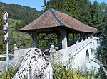
4777 Upload a file Teufelsbrücke am Etzel Teufelsbrücke am Etzel No images A G Etzelstrasse, Egg SZ [[:Category:|]]
47° 10′ 02.6″ N, 8° 46′ 02.09″ E Kartographer map based on OpenStreetMap.View all coordinates using: OpenStreetMapinfo


10176 Upload a file Altes Schulhaus Altes Schulhaus No images B G Schmiedenstrasse 37 [[:Category:|]]
47° 07′ 42.38″ N, 8° 45′ 04.97″ E Kartographer map based on OpenStreetMap.View all coordinates using: OpenStreetMapinfo


4783 Upload a file Chärnehus No images B G Kornhausstrasse 12 [[:Category:|]]
47° 07′ 33.96″ N, 8° 44′ 34.66″ E Kartographer map based on OpenStreetMap.View all coordinates using: OpenStreetMapinfo


4780 Upload a file Friedhofkapelle Friedhofkapelle No images B G Birchlistrasse [[:Category:|]]
47° 07′ 45.52″ N, 8° 45′ 26.42″ E Kartographer map based on OpenStreetMap.View all coordinates using: OpenStreetMapinfo


12800 Upload a file Haus Euthal No images B G Steinbach 2, Euthal [[:Category:|]]
47° 05′ 55.82″ N, 8° 47′ 31.31″ E Kartographer map based on OpenStreetMap.View all coordinates using: OpenStreetMapinfo


12796 Upload a file Haus Haldeli No images B G Studenstrasse 19, Euthal [[:Category:|]]
47° 04′ 42.46″ N, 8° 50′ 22.02″ E Kartographer map based on OpenStreetMap.View all coordinates using: OpenStreetMapinfo


12797 Upload a file Haus Klostermühle No images B G Klostermühlestrasse 16 [[:Category:|]]
47° 07′ 59.38″ N, 8° 44′ 51.18″ E Kartographer map based on OpenStreetMap.View all coordinates using: OpenStreetMapinfo


12798 Upload a file Haus Tüfelsbrugg Haus Tüfelsbrugg No images B G Etzelstrasse 1, Egg [[:Category:|]]
47° 10′ 01.63″ N, 8° 46′ 04.12″ E Kartographer map based on OpenStreetMap.View all coordinates using: OpenStreetMapinfo


12799 Upload a file Haus Tulipan No images B G Schwanenstrasse 29 [[:Category:|]]
47° 07′ 35.87″ N, 8° 44′ 52.94″ E Kartographer map based on OpenStreetMap.View all coordinates using: OpenStreetMapinfo


12801 Upload a file Kapelle Heilige Dreifaltigkeit No images B G Trachslau [[:Category:|]]
47° 06′ 52.09″ N, 8° 44′ 10.03″ E Kartographer map based on OpenStreetMap.View all coordinates using: OpenStreetMapinfo


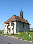
4781 Upload a file Kapelle St. Gangulf Kapelle St. Gangulf No images B G Etzelstrasse [[:Category:|]]
47° 07′ 53.15″ N, 8° 45′ 09.36″ E Kartographer map based on OpenStreetMap.View all coordinates using: OpenStreetMapinfo


4782 Upload a file Kapelle St. Josef No images B G Kornhausstrasse [[:Category:|]]
47° 07′ 26.36″ N, 8° 44′ 20.22″ E Kartographer map based on OpenStreetMap.View all coordinates using: OpenStreetMapinfo


4784 Upload a file Kirche St. Josef Kirche St. Josef No images B G Seestrasse / Grund, Willerzell [[:Category:|]]
47° 07′ 47.32″ N, 8° 47′ 38.44″ E Kartographer map based on OpenStreetMap.View all coordinates using: OpenStreetMapinfo


12802 Upload a file Kloster in der Au Kloster in der Au No images B G Austrasse, Trachslau [[:Category:|]]
47° 06′ 53.1″ N, 8° 43′ 43.14″ E Kartographer map based on OpenStreetMap.View all coordinates using: OpenStreetMapinfo


12803 Upload a file Pfarrkirche St. Nepomuk No images B G Grosserstrasse, Gross [[:Category:|]]
47° 06′ 56.66″ N, 8° 46′ 34.86″ E Kartographer map based on OpenStreetMap.View all coordinates using: OpenStreetMapinfo


12804 Upload a file Rathaus Rathaus No images B G Haupstrasse 78 [[:Category:|]]
47° 07′ 35.47″ N, 8° 44′ 58.63″ E Kartographer map based on OpenStreetMap.View all coordinates using: OpenStreetMapinfo


4776 Upload a file Viertelskirche Johannes der Täufer Viertelskirche Johannes der Täufer No images B G Meierenstrasse, Egg [[:Category:|]]
47° 09′ 40.82″ N, 8° 46′ 50.63″ E Kartographer map based on OpenStreetMap.View all coordinates using: OpenStreetMapinfo


4775 Upload a file Viertelskirche St. Sebastian No images B G Burgerenstrasse, Bennau [[:Category:|]]
47° 08′ 55.46″ N, 8° 43′ 48.43″ E Kartographer map based on OpenStreetMap.View all coordinates using: OpenStreetMapinfo


12805 Upload a file Viertelskirche St. Stefan No images B G Trachslauerstrasse, Trachslau [[:Category:|]]
47° 05′ 52.04″ N, 8° 43′ 29.78″ E Kartographer map based on OpenStreetMap.View all coordinates using: OpenStreetMapinfo


4779 Upload a file Viertelskirche zur schmerzhaften Muttergottes No images B G Euthal [[:Category:|]]
47° 05′ 44.88″ N, 8° 48′ 58.39″ E Kartographer map based on OpenStreetMap.View all coordinates using: OpenStreetMapinfo


12806 Upload a file Villa Oechslin Villa Oechslin No images B G Luegetenstrasse 11 [[:Category:|]]
47° 07′ 30.54″ N, 8° 44′ 51.4″ E Kartographer map based on OpenStreetMap.View all coordinates using: OpenStreetMapinfo


Übrige Baudenkmäler
KGS-Nr Upload Foto   Object Other Cov. Cat. Type Address Town Coordinates
Upload a file Diorama No images G Benzigerstrasse 23 [[:Category:|]]
47° 07′ 48.14″ N, 8° 44′ 56.83″ E Kartographer map based on OpenStreetMap.View all coordinates using: OpenStreetMapinfo


Upload a file Eissenkapelle No images G Gross [[:Category:|]]
47° 06′ 17.96″ N, 8° 46′ 49.73″ E Kartographer map based on OpenStreetMap.View all coordinates using: OpenStreetMapinfo


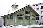
Upload a file Feuerwehrlokal Feuerwehrlokal No images G Wilhelm-Tellstrasse/Kronenstrasse [[:Category:|]]
47° 07′ 41.7″ N, 8° 44′ 54.06″ E Kartographer map based on OpenStreetMap.View all coordinates using: OpenStreetMapinfo


Upload a file Friedheim No images G Benzigerstrasse 17 [[:Category:|]]
47° 07′ 45.7″ N, 8° 44′ 57.19″ E Kartographer map based on OpenStreetMap.View all coordinates using: OpenStreetMapinfo


Upload a file Galgenchappeli Galgenchappeli No images G Egg [[:Category:|]]
47° 09′ 05″ N, 8° 45′ 29.41″ E Kartographer map based on OpenStreetMap.View all coordinates using: OpenStreetMapinfo


Upload a file Grotzenmühle No images G Grotzenmühlestrasse 39 [[:Category:|]]
47° 07′ 14.92″ N, 8° 44′ 03.12″ E Kartographer map based on OpenStreetMap.View all coordinates using: OpenStreetMapinfo


Upload a file Haus No images G Alpthalerstrasse 8, Trachslau [[:Category:|]]
47° 05′ 44.12″ N, 8° 43′ 30.58″ E Kartographer map based on OpenStreetMap.View all coordinates using: OpenStreetMapinfo


Upload a file Haus No images G Eublätz 6–8, Euthal [[:Category:|]]
47° 05′ 47.72″ N, 8° 49′ 02.68″ E Kartographer map based on OpenStreetMap.View all coordinates using: OpenStreetMapinfo


Upload a file Haus No images G Neuberg 7, Bennau [[:Category:|]]
47° 08′ 56.36″ N, 8° 44′ 38.54″ E Kartographer map based on OpenStreetMap.View all coordinates using: OpenStreetMapinfo


Upload a file Haus No images G Neuberg 9, Rabennest, Bennau [[:Category:|]]
47° 08′ 56.58″ N, 8° 44′ 41.46″ E Kartographer map based on OpenStreetMap.View all coordinates using: OpenStreetMapinfo


Upload a file Haus No images G Seestrasse 37, Willerzell [[:Category:|]]
47° 07′ 21.86″ N, 8° 47′ 50.75″ E Kartographer map based on OpenStreetMap.View all coordinates using: OpenStreetMapinfo


Upload a file Haus No images G Steinbach 1, Euthal [[:Category:|]]
47° 05′ 51″ N, 8° 47′ 28.18″ E Kartographer map based on OpenStreetMap.View all coordinates using: OpenStreetMapinfo


Upload a file Haus No images G Steinbach 3, Euthal [[:Category:|]]
47° 05′ 49.7″ N, 8° 47′ 25.55″ E Kartographer map based on OpenStreetMap.View all coordinates using: OpenStreetMapinfo


Upload a file Haus Adam und Eva / Paradies No images G Benzigerstrasse 2/4 [[:Category:|]]
47° 07′ 39.36″ N, 8° 44′ 58.42″ E Kartographer map based on OpenStreetMap.View all coordinates using: OpenStreetMapinfo


Upload a file Haus Adler Haus Adler No images G Schmiedenstrasse 32/34 [[:Category:|]]
47° 07′ 38.96″ N, 8° 44′ 59.5″ E Kartographer map based on OpenStreetMap.View all coordinates using: OpenStreetMapinfo


Upload a file Haus Amstutz No images G Ilgenweidstrasse 20/22 [[:Category:|]]
47° 07′ 31.4″ N, 8° 44′ 58.2″ E Kartographer map based on OpenStreetMap.View all coordinates using: OpenStreetMapinfo


Upload a file Haus Birke (Waldstatt) Haus Birke (Waldstatt) No images G Bahnhofplatz 4 [[:Category:|]]
47° 07′ 39.25″ N, 8° 44′ 39.77″ E Kartographer map based on OpenStreetMap.View all coordinates using: OpenStreetMapinfo


Upload a file Haus Blüemenen No images G Eigenstrasse 22, Trachslau [[:Category:|]]
47° 05′ 37.18″ N, 8° 43′ 15.2″ E Kartographer map based on OpenStreetMap.View all coordinates using: OpenStreetMapinfo


Upload a file Haus Dorfzentrum Haus Dorfzentrum No images G Hauptstrasse 20 [[:Category:|]]
47° 07′ 36.98″ N, 8° 44′ 42.61″ E Kartographer map based on OpenStreetMap.View all coordinates using: OpenStreetMapinfo


Upload a file Haus Drei Herzen Haus Drei Herzen No images G Hauptstrasse 66 [[:Category:|]]
47° 07′ 36.66″ N, 8° 44′ 55.82″ E Kartographer map based on OpenStreetMap.View all coordinates using: OpenStreetMapinfo


Upload a file Haus Egochs Haus Egochs No images G Etzel 10, Egg [[:Category:|]]
47° 10′ 21.14″ N, 8° 46′ 08.72″ E Kartographer map based on OpenStreetMap.View all coordinates using: OpenStreetMapinfo


Upload a file Haus Entenbach No images G Grossbachstrasse 52, Gross [[:Category:|]]
47° 06′ 40.07″ N, 8° 45′ 56.45″ E Kartographer map based on OpenStreetMap.View all coordinates using: OpenStreetMapinfo


Upload a file Haus Erlen No images G Seestrasse 47, Willerzell [[:Category:|]]
47° 07′ 04.73″ N, 8° 47′ 53.63″ E Kartographer map based on OpenStreetMap.View all coordinates using: OpenStreetMapinfo


Upload a file Haus Falken Haus Falken No images G Hauptstrasse 68 [[:Category:|]]
47° 07′ 36.62″ N, 8° 44′ 56.29″ E Kartographer map based on OpenStreetMap.View all coordinates using: OpenStreetMapinfo


Upload a file Haus Freiwies Haus Freiwies No images G Etzel 9, Egg [[:Category:|]]
47° 10′ 10.63″ N, 8° 46′ 00.3″ E Kartographer map based on OpenStreetMap.View all coordinates using: OpenStreetMapinfo


Upload a file Haus Gutgrund No images G Boden 4, Gross [[:Category:|]]
47° 06′ 52.56″ N, 8° 46′ 24.42″ E Kartographer map based on OpenStreetMap.View all coordinates using: OpenStreetMapinfo


Upload a file Haus Hecht No images G Hauptstrasse 74 [[:Category:|]]
47° 07′ 36.34″ N, 8° 44′ 57.52″ E Kartographer map based on OpenStreetMap.View all coordinates using: OpenStreetMapinfo


Upload a file Haus Gans (Regina) No images G Erlenbachstrasse 1 [[:Category:|]]
47° 07′ 33.06″ N, 8° 44′ 58.81″ E Kartographer map based on OpenStreetMap.View all coordinates using: OpenStreetMapinfo


Upload a file Haus Gemse No images G Erlenbachstrasse 16 [[:Category:|]]
47° 07′ 33.2″ N, 8° 44′ 54.17″ E Kartographer map based on OpenStreetMap.View all coordinates using: OpenStreetMapinfo


Upload a file Haus Goldapfel (Traube) Haus Goldapfel (Traube) No images G Hauptstrasse 67 [[:Category:|]]
47° 07′ 37.63″ N, 8° 44′ 54.2″ E Kartographer map based on OpenStreetMap.View all coordinates using: OpenStreetMapinfo


Upload a file Haus Goldapfel No images G Kronenstrasse 1 [[:Category:|]]
47° 07′ 38.28″ N, 8° 44′ 54.67″ E Kartographer map based on OpenStreetMap.View all coordinates using: OpenStreetMapinfo


Upload a file Haus Gutenberg No images G Werner-Kälin-Strasse 11 [[:Category:|]]
47° 07′ 33.17″ N, 8° 44′ 47.22″ E Kartographer map based on OpenStreetMap.View all coordinates using: OpenStreetMapinfo


Upload a file Haus Hirschen Haus Hirschen No images G Hauptstrasse 85/87 [[:Category:|]]
47° 07′ 36.8″ N, 8° 44′ 59.21″ E Kartographer map based on OpenStreetMap.View all coordinates using: OpenStreetMapinfo


Upload a file Haus Krone Haus Krone No images G Hauptstrasse 69 [[:Category:|]]
47° 07′ 37.63″ N, 8° 44′ 54.67″ E Kartographer map based on OpenStreetMap.View all coordinates using: OpenStreetMapinfo


Upload a file Haus Lärche No images G Eisenbahnstrasse 10 [[:Category:|]]
47° 07′ 43.82″ N, 8° 44′ 49.74″ E Kartographer map based on OpenStreetMap.View all coordinates using: OpenStreetMapinfo


Upload a file Haus Linde No images G Schmiedenstrasse 28 [[:Category:|]]
47° 07′ 40.19″ N, 8° 44′ 58.52″ E Kartographer map based on OpenStreetMap.View all coordinates using: OpenStreetMapinfo


Upload a file Haus Luegeteneck No images G Luegetenstrasse 14 [[:Category:|]]
47° 07′ 32.16″ N, 8° 44′ 50.96″ E Kartographer map based on OpenStreetMap.View all coordinates using: OpenStreetMapinfo


Upload a file Haus Nauern No images G Eggerstrasse 4, Egg [[:Category:|]]
47° 09′ 41.33″ N, 8° 47′ 01.25″ E Kartographer map based on OpenStreetMap.View all coordinates using: OpenStreetMapinfo


Upload a file Haus Raben Haus Raben No images G Schwanenstrasse 42 [[:Category:|]]
47° 07′ 34.68″ N, 8° 44′ 57.66″ E Kartographer map based on OpenStreetMap.View all coordinates using: OpenStreetMapinfo


Upload a file Haus Rebstock Haus Rebstock No images G Schwanenstrasse 41 [[:Category:|]]
47° 07′ 34.86″ N, 8° 44′ 56.26″ E Kartographer map based on OpenStreetMap.View all coordinates using: OpenStreetMapinfo


Upload a file Haus Rigi (vormals Schlange) No images G Hauptstrasse 23 [[:Category:|]]
47° 07′ 39.04″ N, 8° 44′ 45.2″ E Kartographer map based on OpenStreetMap.View all coordinates using: OpenStreetMapinfo


Upload a file Haus Schäfle No images G Strählgasse 3 [[:Category:|]]
47° 07′ 37.92″ N, 8° 44′ 58.24″ E Kartographer map based on OpenStreetMap.View all coordinates using: OpenStreetMapinfo


Upload a file Haus Schlüssel Haus Schlüssel No images G Hauptstrasse 83 [[:Category:|]]
47° 07′ 36.95″ N, 8° 44′ 58.2″ E Kartographer map based on OpenStreetMap.View all coordinates using: OpenStreetMapinfo


Upload a file Haus Schweizerhof Haus Schweizerhof No images G Hauptstrasse 71 [[:Category:|]]
47° 07′ 37.63″ N, 8° 44′ 55.61″ E Kartographer map based on OpenStreetMap.View all coordinates using: OpenStreetMapinfo


Upload a file Haus St. Anton No images G Benzigerstrasse 7 [[:Category:|]]
47° 07′ 38.64″ N, 8° 44′ 58.09″ E Kartographer map based on OpenStreetMap.View all coordinates using: OpenStreetMapinfo


Upload a file Haus St. Georg Haus St. Georg No images G Hauptstrasse 72 [[:Category:|]]
47° 07′ 36.52″ N, 8° 44′ 57.01″ E Kartographer map based on OpenStreetMap.View all coordinates using: OpenStreetMapinfo


Upload a file Haus St. Idda No images G Erlenbachstrasse 12 [[:Category:|]]
47° 07′ 32.84″ N, 8° 44′ 56.44″ E Kartographer map based on OpenStreetMap.View all coordinates using: OpenStreetMapinfo


Upload a file Haus St. Peter No images G Erlenbachstrasse 7 [[:Category:|]]
47° 07′ 31.94″ N, 8° 44′ 56.18″ E Kartographer map based on OpenStreetMap.View all coordinates using: OpenStreetMapinfo


Upload a file Haus Sternen Haus Sternen No images G Hauptstrasse 46 [[:Category:|]]
47° 07′ 37.13″ N, 8° 44′ 50.82″ E Kartographer map based on OpenStreetMap.View all coordinates using: OpenStreetMapinfo


Upload a file Haus Stollera No images G Gfletz, Birchli 31 [[:Category:|]]
47° 07′ 39.61″ N, 8° 46′ 16.25″ E Kartographer map based on OpenStreetMap.View all coordinates using: OpenStreetMapinfo


Upload a file Haus Stollern No images G Birchli 36 [[:Category:|]]
47° 07′ 37.38″ N, 8° 46′ 14.41″ E Kartographer map based on OpenStreetMap.View all coordinates using: OpenStreetMapinfo


Upload a file Haus Tiefenau No images G Rainstrasse 1/5, Gross [[:Category:|]]
47° 06′ 38.3″ N, 8° 46′ 19.7″ E Kartographer map based on OpenStreetMap.View all coordinates using: OpenStreetMapinfo


Upload a file Haus Wachslicht No images G Schwanenstrasse 30 [[:Category:|]]
47° 07′ 34.43″ N, 8° 44′ 52.94″ E Kartographer map based on OpenStreetMap.View all coordinates using: OpenStreetMapinfo


Upload a file Haus Winkelried (Merkur) Haus Winkelried (Merkur) No images G Hauptstrasse 48 [[:Category:|]]
47° 07′ 36.7″ N, 8° 44′ 51.58″ E Kartographer map based on OpenStreetMap.View all coordinates using: OpenStreetMapinfo


Upload a file Haus Wurstmatte No images G Eigenstrasse 14, Trachslau [[:Category:|]]
47° 05′ 44.88″ N, 8° 43′ 20.46″ E Kartographer map based on OpenStreetMap.View all coordinates using: OpenStreetMapinfo


Upload a file Immenhaus No images G Erlenbachstrasse 5 [[:Category:|]]
47° 07′ 32.09″ N, 8° 44′ 57.16″ E Kartographer map based on OpenStreetMap.View all coordinates using: OpenStreetMapinfo


Upload a file Jugendkirche No images G Eisenbahnstrasse 22 [[:Category:|]]
47° 07′ 42.42″ N, 8° 44′ 59.28″ E Kartographer map based on OpenStreetMap.View all coordinates using: OpenStreetMapinfo


Upload a file Kapelle Heilige Dreifaltigkeit No images G Gross [[:Category:|]]
47° 07′ 20.68″ N, 8° 46′ 27.8″ E Kartographer map based on OpenStreetMap.View all coordinates using: OpenStreetMapinfo


Upload a file Kapelle Maria End No images G Katzenstrickstrasse [[:Category:|]]
47° 08′ 10.5″ N, 8° 43′ 31.08″ E Kartographer map based on OpenStreetMap.View all coordinates using: OpenStreetMapinfo


Upload a file Kapelle Maria Rickental No images G Satteleggstrasse [[:Category:|]]
47° 07′ 56.71″ N, 8° 48′ 34.81″ E Kartographer map based on OpenStreetMap.View all coordinates using: OpenStreetMapinfo


Upload a file Kirchenhaus No images G Trachslauerstrasse 1, Trachslau [[:Category:|]]
47° 05′ 53.05″ N, 8° 43′ 29.5″ E Kartographer map based on OpenStreetMap.View all coordinates using: OpenStreetMapinfo


Upload a file Marienheim Marienheim No images G Schmiedenstrasse 30 [[:Category:|]]
47° 07′ 39.83″ N, 8° 44′ 59.93″ E Kartographer map based on OpenStreetMap.View all coordinates using: OpenStreetMapinfo


Upload a file Panorama No images G Benzigerstrasse 37 [[:Category:|]]
47° 07′ 53.8″ N, 8° 44′ 57.66″ E Kartographer map based on OpenStreetMap.View all coordinates using: OpenStreetMapinfo


Upload a file Reformierte Kirche Reformierte Kirche No images G Spitalstrasse 9 [[:Category:|]]
47° 07′ 44.26″ N, 8° 44′ 27.53″ E Kartographer map based on OpenStreetMap.View all coordinates using: OpenStreetMapinfo


Upload a file Restaurant Rössli No images G Kapellstrasse 1, Egg [[:Category:|]]
47° 09′ 40.72″ N, 8° 46′ 53.22″ E Kartographer map based on OpenStreetMap.View all coordinates using: OpenStreetMapinfo


Upload a file Schulhaus No images G Eggerstrasse 3, Egg [[:Category:|]]
47° 09′ 42.98″ N, 8° 46′ 58.33″ E Kartographer map based on OpenStreetMap.View all coordinates using: OpenStreetMapinfo


Upload a file Schulhaus Brüel Schulhaus Brüel No images G Etzelstrasse 1 [[:Category:|]]
47° 07′ 46.7″ N, 8° 45′ 05.76″ E Kartographer map based on OpenStreetMap.View all coordinates using: OpenStreetMapinfo