Commons:Wiki4Alps/Aigle (district)

From Wikimedia Commons, the free media repository
Jump to navigation Jump to search

<< Wiki4Alps << Vaud

List of the cultural heritage of the district of Aigle in the Canton Vaud[edit]

Map of Aigle
Map of Aigle

List of Monuments in the district of Aigle in the Canton Vaud.

Update: 15 April 2014

List[edit]

KGS-Nr Upload Foto   Object Other Cov. Cat. Type Address Town Coordinates
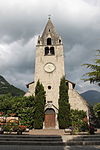
5897 Upload a file Église réformée Saint-Maurice Église réformée Saint-Maurice No images A G Avenue du Cloître Aigle
46° 18′ 57.49″ N, 6° 58′ 26.26″ E Kartographer map based on OpenStreetMap.View all coordinates using: OpenStreetMapinfo


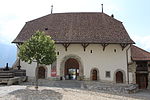
5889 Upload a file Château d'Aigle No images A G Chemin du Château Aigle
46° 18′ 54.22″ N, 6° 58′ 34.36″ E Kartographer map based on OpenStreetMap.View all coordinates using: OpenStreetMapinfo


8694 Upload a file Musée de la vigne, du vin et de l'étiquette (Château d'Aigle) No images A S Chemin du Château Aigle
46° 18′ 53.96″ N, 6° 58′ 34.54″ E Kartographer map based on OpenStreetMap.View all coordinates using: OpenStreetMapinfo


5890 Upload a file Maison de la Dîme Maison de la Dîme No images A G Chemin du Château Aigle
46° 18′ 53.75″ N, 6° 58′ 32.05″ E Kartographer map based on OpenStreetMap.View all coordinates using: OpenStreetMapinfo


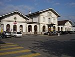
5893 Upload a file Gare CFF Gare CFF No images B G Rue de la Gare Aigle
46° 19′ 00.48″ N, 6° 57′ 49.64″ E Kartographer map based on OpenStreetMap.View all coordinates using: OpenStreetMapinfo


14544 Upload a file Ancien Hôtel Beau-Site No images B G Rue de la Gare 38 Aigle
46° 19′ 02.15″ N, 6° 57′ 50.85″ E Kartographer map based on OpenStreetMap.View all coordinates using: OpenStreetMapinfo


5894 Upload a file Maison Dr. Paul Anex No images B G Chemin des Noyers 7 Aigle
46° 19′ 14.93″ N, 6° 58′ 11.63″ E Kartographer map based on OpenStreetMap.View all coordinates using: OpenStreetMapinfo


14548 Upload a file Maison Farel No images B G Rue Farel 10 Aigle
46° 19′ 04″ N, 6° 58′ 07.47″ E Kartographer map based on OpenStreetMap.View all coordinates using: OpenStreetMapinfo


14545 Upload a file Maison avec galeries No images B G Rue de Jérusalem 1–26 Aigle
46° 19′ 07.72″ N, 6° 58′ 08.04″ E Kartographer map based on OpenStreetMap.View all coordinates using: OpenStreetMapinfo


14549 Upload a file Maison avec dépendance et parc No images B G Rue du Cloître 28–30 Aigle
46° 18′ 55.78″ N, 6° 58′ 25.07″ E Kartographer map based on OpenStreetMap.View all coordinates using: OpenStreetMapinfo


5892 Upload a file Église catholique Saint-Maurice et Saint-Nicolas-de-Flue No images B G Rue du Rhône Aigle
46° 19′ 02.64″ N, 6° 58′ 02.78″ E Kartographer map based on OpenStreetMap.View all coordinates using: OpenStreetMapinfo


14543 Upload a file Cure catholique No images B G Rue du Rhône 4 Aigle
46° 19′ 00.54″ N, 6° 58′ 02.68″ E Kartographer map based on OpenStreetMap.View all coordinates using: OpenStreetMapinfo


14546 Upload a file Cure réformée No images B G Avenue du Cloître 23 Aigle
46° 18′ 58.11″ N, 6° 58′ 26.03″ E Kartographer map based on OpenStreetMap.View all coordinates using: OpenStreetMapinfo


5891 Upload a file Collège secondaire No images B G Rue du Collège 12 Aigle
46° 19′ 07.39″ N, 6° 58′ 15.1″ E Kartographer map based on OpenStreetMap.View all coordinates using: OpenStreetMapinfo


9092 Upload a file Arsenal No images B G Rue du Molage Aigle
46° 19′ 10.16″ N, 6° 57′ 46.04″ E Kartographer map based on OpenStreetMap.View all coordinates using: OpenStreetMapinfo


14547 Upload a file Villa Jaquerod No images B G Avenue des Ormonts 14 Aigle
46° 19′ 03.15″ N, 6° 58′ 22.39″ E Kartographer map based on OpenStreetMap.View all coordinates using: OpenStreetMapinfo


5948 Upload a file Fortifications de l'Arzillier Fortifications de l'Arzillier No images A G Bex
46° 13′ 25.93″ N, 7° 00′ 26.32″ E Kartographer map based on OpenStreetMap.View all coordinates using: OpenStreetMapinfo


5946 Upload a file Clocher de l'église Clocher de l'église No images A G Rue du Midi Bex
46° 15′ 04.46″ N, 7° 00′ 44.42″ E Kartographer map based on OpenStreetMap.View all coordinates using: OpenStreetMapinfo


10498 Upload a file Pont sur le Rhône, Route de Saint-Maurice/Route du Chablais Pont sur le Rhône, Route de Saint-Maurice/Route du Chablais No images A G Route de Saint-Maurice Bex
46° 13′ 24.71″ N, 7° 00′ 12.96″ E Kartographer map based on OpenStreetMap.View all coordinates using: OpenStreetMapinfo


5945 Upload a file Complex salifère Complex salifère No images A X Route de Gryon Bex
46° 15′ 38.84″ N, 7° 01′ 45.34″ E Kartographer map based on OpenStreetMap.View all coordinates using: OpenStreetMapinfo


14567 Upload a file Abri-sous-roche des Mûriers, occupation du Néolithique, de l'âge du Bronze et de l'époque romaine Abri-sous-roche des Mûriers, occupation du Néolithique, de l'âge du Bronze et de l'époque romaine No images B F Chemin des Mûriers Bex
46° 14′ 21.3″ N, 7° 00′ 22.14″ E Kartographer map based on OpenStreetMap.View all coordinates using: OpenStreetMapinfo


10572 Upload a file Jardin alpin "La Thomasia" Jardin alpin "La Thomasia" No images B G Pont de Nant Bex
46° 15′ 05.48″ N, 7° 06′ 38.47″ E Kartographer map based on OpenStreetMap.View all coordinates using: OpenStreetMapinfo


5949 Upload a file Gare CFF Gare CFF No images B G Avenue de la Gare 68 Bex
46° 15′ 05.18″ N, 7° 00′ 02.74″ E Kartographer map based on OpenStreetMap.View all coordinates using: OpenStreetMapinfo


14571 Upload a file Château Feuillet et son parc Château Feuillet et son parc No images B G Rue du Midi 3 Bex
46° 15′ 00.91″ N, 7° 00′ 47.87″ E Kartographer map based on OpenStreetMap.View all coordinates using: OpenStreetMapinfo


14572 Upload a file Château Grenier, sa dépendance et son parc Château Grenier, sa dépendance et son parc No images B G Route de Gryon 4–6 Bex
46° 15′ 00.76″ N, 7° 01′ 18.4″ E Kartographer map based on OpenStreetMap.View all coordinates using: OpenStreetMapinfo


14569 Upload a file Ancienne église libre Ancienne église libre No images B G Rue du Midi Bex
46° 14′ 59.89″ N, 7° 00′ 44.05″ E Kartographer map based on OpenStreetMap.View all coordinates using: OpenStreetMapinfo


5951 Upload a file Ancienne maison du directeur des salines Ancienne maison du directeur des salines No images B G Route des Dévens, Les Dévens Bex
46° 16′ 12.37″ N, 7° 01′ 02.35″ E Kartographer map based on OpenStreetMap.View all coordinates using: OpenStreetMapinfo


5947 Upload a file Ancien Hôtel des Bains Ancien Hôtel des Bains No images B G Avenue de la Gare 10–14 Bex
46° 15′ 08.07″ N, 7° 00′ 40.53″ E Kartographer map based on OpenStreetMap.View all coordinates using: OpenStreetMapinfo


14564 Upload a file Maison grise du naturaliste Emmanuel Thomas Maison grise du naturaliste Emmanuel Thomas No images B G Route des Dévens, Les Dévens Bex
46° 16′ 10.17″ N, 7° 01′ 03.21″ E Kartographer map based on OpenStreetMap.View all coordinates using: OpenStreetMapinfo


14568 Upload a file Maison Maison No images B G Les Dévens Bex
46° 16′ 11.05″ N, 7° 00′ 56.94″ E Kartographer map based on OpenStreetMap.View all coordinates using: OpenStreetMapinfo


14570 Upload a file Église catholique Église catholique No images B G Rue du Stand Bex
46° 14′ 51.87″ N, 7° 00′ 46.72″ E Kartographer map based on OpenStreetMap.View all coordinates using: OpenStreetMapinfo


10671 Upload a file Musée de la mine de sel de Bex Musée de la mine de sel de Bex No images B S Route des Mines de Sel 53 Bex
46° 16′ 40.28″ N, 7° 01′ 35.81″ E Kartographer map based on OpenStreetMap.View all coordinates using: OpenStreetMapinfo


5950 Upload a file Hôtel de Ville Hôtel de Ville No images B G Rue Centrale 8 Bex
46° 15′ 04.22″ N, 7° 00′ 49.47″ E Kartographer map based on OpenStreetMap.View all coordinates using: OpenStreetMapinfo


14565 Upload a file Maison Rouge des naturalistes Abraham et Emmanuel Thomas Maison Rouge des naturalistes Abraham et Emmanuel Thomas No images B G Route des Dévens, Les Dévens Bex
46° 16′ 10.49″ N, 7° 01′ 02.36″ E Kartographer map based on OpenStreetMap.View all coordinates using: OpenStreetMapinfo


14566 Upload a file Tour de Duin Tour de Duin No images B F/G Route de Châtel Bex
46° 14′ 28.72″ N, 7° 01′ 15.78″ E Kartographer map based on OpenStreetMap.View all coordinates using: OpenStreetMapinfo


5994 Upload a file Église réformée Saint-Nicolas No images B G Rue de l’Ouchettaz Chessel
46° 20′ 58.6″ N, 6° 53′ 39.29″ E Kartographer map based on OpenStreetMap.View all coordinates using: OpenStreetMapinfo


14608 Upload a file Église réformée Saint-Jean Église réformée Saint-Jean No images B G Le Vieux-Chemin 7 Gryon
46° 16′ 24.6″ N, 7° 03′ 46.22″ E Kartographer map based on OpenStreetMap.View all coordinates using: OpenStreetMapinfo


14944 Upload a file Ensemble de remuage No images B G Taveyanne Gryon
46° 18′ 12.28″ N, 7° 07′ 20.82″ E Kartographer map based on OpenStreetMap.View all coordinates using: OpenStreetMapinfo


6214 Upload a file Chalets d’Aï No images B G Les Chamois Leysin
46° 21′ 52.74″ N, 7° 00′ 25.99″ E Kartographer map based on OpenStreetMap.View all coordinates using: OpenStreetMapinfo


6216 Upload a file Grand Hôtel (ancien Hôtel de la Source) No images B G Chemin de la Source Leysin
46° 20′ 42.79″ N, 7° 00′ 25.56″ E Kartographer map based on OpenStreetMap.View all coordinates using: OpenStreetMapinfo


6215 Upload a file Clinique "Manufacture" du Dr. Rollier No images B G Belvédère Leysin
46° 20′ 37.39″ N, 7° 00′ 34.27″ E Kartographer map based on OpenStreetMap.View all coordinates using: OpenStreetMapinfo


6217 Upload a file Église réformée Saint-Théodule Église réformée Saint-Théodule No images B G Rue Louis-Favez Leysin
46° 20′ 30.01″ N, 7° 00′ 45.4″ E Kartographer map based on OpenStreetMap.View all coordinates using: OpenStreetMapinfo


14696 Upload a file Ferme L’Essert No images B G Chemin de l’Essert 2 Noville
46° 22′ 59.81″ N, 6° 52′ 50.25″ E Kartographer map based on OpenStreetMap.View all coordinates using: OpenStreetMapinfo


14694 Upload a file Cure No images B G Place de la Cure 2 Noville
46° 22′ 51.03″ N, 6° 53′ 55.44″ E Kartographer map based on OpenStreetMap.View all coordinates using: OpenStreetMapinfo


6331 Upload a file Église réformée Saint-Maurice Église réformée Saint-Maurice No images B G Place de la Cure Noville
46° 22′ 51.67″ N, 6° 53′ 55.01″ E Kartographer map based on OpenStreetMap.View all coordinates using: OpenStreetMapinfo


14695 Upload a file Grange (ancien rural de la cure) No images B G Au village Noville
46° 22′ 52.03″ N, 6° 53′ 56.08″ E Kartographer map based on OpenStreetMap.View all coordinates using: OpenStreetMapinfo


6356 Upload a file Saint-Triphon et Charpigny (site de hauteur, époque préhistorique/Moyen Age) Saint-Triphon et Charpigny (site de hauteur, époque préhistorique/Moyen Age) No images A F Chemin du Lessus Ollon
46° 17′ 42″ N, 6° 58′ 32.12″ E Kartographer map based on OpenStreetMap.View all coordinates using: OpenStreetMapinfo


14702 Upload a file Château de la Roche Château de la Roche No images B G Chemin du Château Ollon
46° 17′ 47.1″ N, 6° 59′ 48.26″ E Kartographer map based on OpenStreetMap.View all coordinates using: OpenStreetMapinfo


14700 Upload a file Cure No images B G Chemin de la Cure 1 Ollon
46° 17′ 48.81″ N, 6° 59′ 38.81″ E Kartographer map based on OpenStreetMap.View all coordinates using: OpenStreetMapinfo


6360 Upload a file Hôtel de Ville No images B G Place de l’Hôtel de Ville 3 Ollon
46° 17′ 49.09″ N, 6° 59′ 42.68″ E Kartographer map based on OpenStreetMap.View all coordinates using: OpenStreetMapinfo


6362 Upload a file Église réformée Saint-Victor Église réformée Saint-Victor No images B G Place de l’Hôtel de Ville Ollon
46° 17′ 49.66″ N, 6° 59′ 40.25″ E Kartographer map based on OpenStreetMap.View all coordinates using: OpenStreetMapinfo


14701 Upload a file Église réformée Église réformée No images B G Huémoz Ollon


6379 Upload a file Pont des Planches Pont des Planches No images A G Rue de la Gare Ormont-Dessous
46° 21′ 19.91″ N, 7° 03′ 18.72″ E Kartographer map based on OpenStreetMap.View all coordinates using: OpenStreetMapinfo


14707 Upload a file Ruines du château d'Aigremont No images B F/G Ormont-Dessous
46° 21′ 47.16″ N, 7° 04′ 51.31″ E Kartographer map based on OpenStreetMap.View all coordinates using: OpenStreetMapinfo


6380 Upload a file Grenier-vestiaire No images B G Au Meleret, Cergnat Ormont-Dessous
46° 21′ 29.92″ N, 7° 02′ 43.87″ E Kartographer map based on OpenStreetMap.View all coordinates using: OpenStreetMapinfo


6381 Upload a file Maison de l’Aigle noir No images B G Au Pertuit, Cergnat Ormont-Dessous
46° 21′ 17.68″ N, 7° 02′ 10.41″ E Kartographer map based on OpenStreetMap.View all coordinates using: OpenStreetMapinfo


6382 Upload a file Église réformée Saint-Maurice No images B G Au Pertuit, Cergnat Ormont-Dessous
46° 21′ 27.94″ N, 7° 02′ 41.35″ E Kartographer map based on OpenStreetMap.View all coordinates using: OpenStreetMapinfo


10601 Upload a file Église réformée Saint-Théodule Église réformée Saint-Théodule No images A G Vers-l’Église Ormont-Dessus
46° 21′ 13.07″ N, 7° 07′ 54.26″ E Kartographer map based on OpenStreetMap.View all coordinates using: OpenStreetMapinfo


6386 Upload a file Scierie No images A G Les Planches Ormont-Dessus
46° 21′ 17.89″ N, 7° 07′ 41.27″ E Kartographer map based on OpenStreetMap.View all coordinates using: OpenStreetMapinfo


6385 Upload a file Alpage des Traverses: Marnex - Métreille - La Dix - La Première No images B G Ormont-Dessus
46° 22′ 12.14″ N, 7° 08′ 46.43″ E Kartographer map based on OpenStreetMap.View all coordinates using: OpenStreetMapinfo


14709 Upload a file Archives communales No images A S Vers l’Église Ormont-Dessus
46° 21′ 13.78″ N, 7° 07′ 55.19″ E Kartographer map based on OpenStreetMap.View all coordinates using: OpenStreetMapinfo


14708 Upload a file Musée des Ormonts No images A G Vers l’Église Ormont-Dessus
46° 21′ 13.68″ N, 7° 07′ 55.38″ E Kartographer map based on OpenStreetMap.View all coordinates using: OpenStreetMapinfo


14710 Upload a file Cure No images A G Route de Vers l’Église Ormont-Dessus
46° 21′ 13.81″ N, 7° 07′ 53.36″ E Kartographer map based on OpenStreetMap.View all coordinates using: OpenStreetMapinfo


14730 Upload a file Ferme du Grand Clos No images B G Route du Village 36 Rennaz
46° 22′ 26.14″ N, 6° 55′ 08.67″ E Kartographer map based on OpenStreetMap.View all coordinates using: OpenStreetMapinfo


6427 Upload a file Château du Grand-Clos avec fontaine No images B G Route du Village 32 Rennaz
46° 22′ 26.89″ N, 6° 55′ 09.93″ E Kartographer map based on OpenStreetMap.View all coordinates using: OpenStreetMapinfo


6432 Upload a file Gare CFF No images B G Rue de la Gare 1 Roche
46° 21′ 31.39″ N, 6° 55′ 37.56″ E Kartographer map based on OpenStreetMap.View all coordinates using: OpenStreetMapinfo


6431 Upload a file Ancien relais du Grand St. Bernard No images B G Rue du Saint-Bernard 5 Roche
46° 21′ 34.78″ N, 6° 55′ 56.17″ E Kartographer map based on OpenStreetMap.View all coordinates using: OpenStreetMapinfo


14731 Upload a file Musée suisse de l'orgue No images B S Rue du Saint-Bernard 5 Roche
46° 21′ 35.03″ N, 6° 55′ 55.92″ E Kartographer map based on OpenStreetMap.View all coordinates using: OpenStreetMapinfo


6551 Upload a file Écluse de la Joux-Verte No images B G Villeneuve
46° 23′ 03.37″ N, 6° 58′ 09.98″ E Kartographer map based on OpenStreetMap.View all coordinates using: OpenStreetMapinfo


14764 Upload a file Archives communales No images B S Avenue des Comtes de Savoie 2 Villeneuve
46° 23′ 55.18″ N, 6° 55′ 32.91″ E Kartographer map based on OpenStreetMap.View all coordinates using: OpenStreetMapinfo


6552 Upload a file Hôtel de Ville (ancienne chapelle de l'Hôpital) Hôtel de Ville (ancienne chapelle de l'Hôpital) No images B G Place de la Gare 5 Villeneuve
46° 23′ 54.82″ N, 6° 55′ 35.72″ E Kartographer map based on OpenStreetMap.View all coordinates using: OpenStreetMapinfo


6555 Upload a file Église réformée Saint-Paul Église réformée Saint-Paul No images B G Place du Temple Villeneuve
46° 23′ 46.36″ N, 6° 55′ 30.94″ E Kartographer map based on OpenStreetMap.View all coordinates using: OpenStreetMapinfo


6554 Upload a file Scex du Châtelard (site préhistorique) No images B F Villeneuve
46° 23′ 52.12″ N, 6° 56′ 00.1″ E Kartographer map based on OpenStreetMap.View all coordinates using: OpenStreetMapinfo


6553 Upload a file Remparts No images B G Rue des Fortifications Villeneuve
46° 23′ 45.79″ N, 6° 55′ 33.84″ E Kartographer map based on OpenStreetMap.View all coordinates using: OpenStreetMapinfo