Category:Wrington
Jump to navigation
Jump to search
village and civil parish in Somerset, England, UK  | |||||
| Upload media | |||||
| Instance of | |||||
|---|---|---|---|---|---|
| Location | North Somerset, Somerset, South West England, England | ||||
 | |||||
Subcategories
This category has the following 6 subcategories, out of 6 total.
Media in category "Wrington"
The following 200 files are in this category, out of 430 total.
(previous page) (next page)-
 11 miles to Bristol - geograph.org.uk - 4251838.jpg 640 × 480; 63 KB
-
 A bear at the window - geograph.org.uk - 5881412.jpg 1,704 × 2,304; 1.6 MB
-
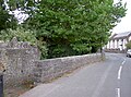
 A bridge too leafy - geograph.org.uk - 5178071.jpg 2,304 × 1,704; 2.72 MB
-
 A cat and mouse tale - geograph.org.uk - 5889447.jpg 1,704 × 2,304; 1.73 MB
-
 A clue to the steamy past - geograph.org.uk - 5888232.jpg 1,704 × 2,304; 1.97 MB
-
 A conference of fairies^ - geograph.org.uk - 5178057.jpg 1,704 × 2,304; 2.47 MB
-
 A growing maize field - geograph.org.uk - 4984126.jpg 800 × 600; 139 KB
-
 A guiding light - geograph.org.uk - 4667241.jpg 1,704 × 2,304; 1.71 MB
-
 A juicy and fruitful future - geograph.org.uk - 5881475.jpg 2,304 × 1,704; 1.68 MB
-
 A learned lion^ - geograph.org.uk - 5889429.jpg 2,304 × 1,704; 1.32 MB
-
 A little achievement - geograph.org.uk - 5891327.jpg 1,704 × 2,304; 1.21 MB
-
 A low approach - geograph.org.uk - 4667246.jpg 2,304 × 1,704; 1.12 MB
-
 A path in the woods - geograph.org.uk - 5178064.jpg 2,304 × 1,704; 1.57 MB
-
 A perennial mosaic - geograph.org.uk - 5888166.jpg 1,704 × 2,304; 1.83 MB
-
 A place to stop a while - geograph.org.uk - 5889476.jpg 1,704 × 2,304; 1.74 MB
-
 A short change of address - geograph.org.uk - 5888188.jpg 2,304 × 1,704; 1.61 MB
-
 A short walk to Lawrence Road - geograph.org.uk - 5881392.jpg 1,704 × 2,304; 1.88 MB
-
 A Tee-junction in the Congresbury Yeo River - geograph.org.uk - 4702627.jpg 3,128 × 2,346; 2.18 MB
-
 A tree that plays games - geograph.org.uk - 5882455.jpg 2,304 × 1,704; 1.43 MB
-
 A very small warning - geograph.org.uk - 5889465.jpg 2,304 × 1,704; 1.63 MB
-
 A view across the Mendips - geograph.org.uk - 4772221.jpg 2,304 × 1,704; 1.09 MB
-
 A38 approaching Perry Bridge - geograph.org.uk - 5295579.jpg 2,236 × 1,240; 466 KB
-
 A38 Bristol Airport - geograph.org.uk - 4600361.jpg 640 × 428; 43 KB
-
 A38 heading north - geograph.org.uk - 3455989.jpg 640 × 480; 64 KB
-

-

-
 A38 junction with New Road - geograph.org.uk - 2383839.jpg 640 × 480; 123 KB
-
 A38 road sign - geograph.org.uk - 5446032.jpg 640 × 480; 120 KB
-
 A38 towards Bristol - geograph.org.uk - 3455983.jpg 640 × 480; 72 KB
-
 A38 towards Bristol - geograph.org.uk - 3455998.jpg 640 × 480; 77 KB
-
 A38 towards Bristol - geograph.org.uk - 3456567.jpg 640 × 480; 75 KB
-
 A38 towards Bristol - geograph.org.uk - 4251811.jpg 640 × 480; 98 KB
-
 A38 towards Bristol - geograph.org.uk - 4251822.jpg 640 × 480; 86 KB
-
 Airport entrance sculpture - geograph.org.uk - 4667258.jpg 1,704 × 2,304; 1.37 MB
-
 Alburys, Wrington - geograph.org.uk - 950296.jpg 640 × 480; 56 KB
-
 All Saints - West window - geograph.org.uk - 5883387.jpg 1,704 × 2,304; 1.25 MB
-
 All Saints and the war memorial - geograph.org.uk - 5881992.jpg 1,704 × 2,304; 1.43 MB
-
 All Saints lych gate - geograph.org.uk - 5881997.jpg 2,304 × 1,704; 1.61 MB
-
 An elegant bus shelter - geograph.org.uk - 5888193.jpg 2,304 × 1,704; 1.61 MB
-
 An ivy boltmark - geograph.org.uk - 2803382.jpg 1,704 × 2,304; 2.11 MB
-
 An old line - geograph.org.uk - 5888229.jpg 2,304 × 1,704; 1.54 MB
-
 An old sign at the top of Station Road - geograph.org.uk - 5890123.jpg 1,704 × 2,304; 1.36 MB
-
 An unexpected backslash - geograph.org.uk - 5889462.jpg 2,304 × 1,704; 1.63 MB
-
 Apex where two field edge boundaries meet - geograph.org.uk - 5034453.jpg 3,648 × 2,048; 3.19 MB
-

-
 Apron, Bristol International Airport - geograph.org.uk - 5616403.jpg 5,184 × 3,456; 6.13 MB
-
 Arable land, Wrington - geograph.org.uk - 1051837.jpg 640 × 480; 74 KB
-
 Ascending Red Hill - geograph.org.uk - 3456545.jpg 640 × 480; 66 KB
-
 Back up to Long Lane - geograph.org.uk - 5882448.jpg 2,304 × 1,704; 1.59 MB
-
 Barley Wood Walled Garden - geograph.org.uk - 4422039.jpg 3,965 × 1,717; 2.59 MB
-
 Barley Wood, from the east - geograph.org.uk - 1051856.jpg 640 × 480; 89 KB
-

-
 Beam Bridge - geograph.org.uk - 5888135.jpg 2,304 × 1,704; 1.78 MB
-
 Benchmark by the bin - geograph.org.uk - 5881884.jpg 1,704 × 2,304; 1.26 MB
-
 Benchmark on Station Road - geograph.org.uk - 5888120.jpg 2,304 × 1,704; 1.66 MB
-
 Benchmark on the wall - geograph.org.uk - 5888123.jpg 2,304 × 1,704; 1.67 MB
-
 Blanked off on Station Road - geograph.org.uk - 5889463.jpg 1,704 × 2,304; 2 MB
-
 Branches Cross - geograph.org.uk - 426071.jpg 640 × 480; 135 KB
-
 Bridge near Beam Mill - geograph.org.uk - 5889473.jpg 2,304 × 1,704; 1.72 MB
-
 Bridge on Silver Street - geograph.org.uk - 5881886.jpg 2,304 × 1,704; 1.78 MB
-
 Bristol Airport , Airport Parking - geograph.org.uk - 4361078.jpg 4,608 × 3,456; 7.65 MB
-
 Bristol Airport , Airport Scenery - geograph.org.uk - 5844507.jpg 6,000 × 4,000; 5.56 MB
-
 Bristol Airport , Airport Scenery - geograph.org.uk - 5844508.jpg 6,000 × 4,000; 6.52 MB
-
 Bristol Airport , Gates - geograph.org.uk - 5844498.jpg 5,312 × 2,988; 5.73 MB
-
 Bristol Airport , Gates - geograph.org.uk - 5844500.jpg 5,312 × 2,988; 5.5 MB
-
 Bristol Airport , Gates - geograph.org.uk - 5844505.jpg 6,000 × 4,000; 6.44 MB
-
 Bristol Airport , Grass - geograph.org.uk - 5844506.jpg 6,000 × 4,000; 5.33 MB
-
 Bristol Airport , Taxiway - geograph.org.uk - 5844502.jpg 6,000 × 4,000; 5.55 MB
-
 Bristol Airport - geograph.org.uk - 5078182.jpg 3,264 × 2,448; 683 KB
-
 Bristol Airport - geograph.org.uk - 5311313.jpg 1,280 × 851; 312 KB
-
 Bristol Airport - geograph.org.uk - 5311362.jpg 1,280 × 851; 325 KB
-
 Bristol airport - geograph.org.uk - 5483511.jpg 1,783 × 960; 202 KB
-
 Bristol airport - geograph.org.uk - 5506961.jpg 3,071 × 1,881; 895 KB
-
 Bristol Airport Apron - geograph.org.uk - 5796634.jpg 1,971 × 1,424; 377 KB
-
 Bristol Airport on a foggy night - geograph.org.uk - 5743300.jpg 3,388 × 2,110; 1,012 KB
-
 Bristol Airport Signage - geograph.org.uk - 5078629.jpg 3,264 × 2,448; 1.91 MB
-
 Bristol Airport terminal - geograph.org.uk - 4334093.jpg 1,920 × 1,440; 483 KB
-
 Bristol Airport terminal - geograph.org.uk - 4334101.jpg 1,920 × 1,440; 550 KB
-
 Bristol Airport Terminal Building - geograph.org.uk - 5689356.jpg 1,600 × 1,067; 1.28 MB
-
 Bristol Bulldog, Gromit No. 77 - geograph.org.uk - 3791160.jpg 477 × 638; 82 KB
-
 Bristol International Airport , Airport Scenery - geograph.org.uk - 4155529.jpg 4,288 × 2,848; 4.35 MB
-
 Bristol International Airport , BMI Regional Jet - geograph.org.uk - 4155527.jpg 4,608 × 3,456; 7.5 MB
-
 Bristol International Airport , Easyjet Airbus A320 - geograph.org.uk - 4155525.jpg 4,608 × 3,456; 7.01 MB
-
 Bristol International Airport , Parking Gates - geograph.org.uk - 4155523.jpg 4,608 × 3,456; 7.36 MB
-
 Bristol International Airport , Ryanair Jet - geograph.org.uk - 4155530.jpg 4,288 × 2,848; 4.94 MB
-
 Bristol International Airport , Tarmac ^ Planes - geograph.org.uk - 4155526.jpg 4,366 × 3,274; 4.13 MB
-
 Bristol International Airport , Taxiway - geograph.org.uk - 4155531.jpg 2,848 × 4,288; 4.74 MB
-
 Bristol International Airport , Terminal Building - geograph.org.uk - 4155528.jpg 4,608 × 3,456; 7.48 MB
-
 Broad Street Wrington Somerset, UK. - panoramio.jpg 2,448 × 1,624; 2.13 MB
-
 Broad Street, Wrington (geograph 7394359).jpg 3,452 × 2,056; 521 KB
-
 Brockley Combe - geograph.org.uk - 2422560.jpg 640 × 453; 86 KB
-
 Brockley Combe - geograph.org.uk - 3755335.jpg 2,304 × 1,704; 1.66 MB
-
 Brockley Combe's boundary - geograph.org.uk - 3749870.jpg 2,304 × 1,704; 1.52 MB
-
 Bullhouse Lane - geograph.org.uk - 5881425.jpg 1,704 × 2,304; 2.14 MB
-
 Bumps in the field by Winters Lane - geograph.org.uk - 2422604.jpg 640 × 365; 63 KB
-
 Burnett Industrial Estate - geograph.org.uk - 5891306.jpg 2,304 × 1,704; 1.3 MB
-
 Bus stand at Bristol Airport - geograph.org.uk - 5195845.jpg 480 × 640; 54 KB
-
 Bust of Hannah More - geograph.org.uk - 4986294.jpg 600 × 800; 72 KB
-
 Bust of John Locke - geograph.org.uk - 4986288.jpg 768 × 1,024; 129 KB
-
 Can't see the wood for the trees - geograph.org.uk - 3755331.jpg 1,704 × 2,304; 2.47 MB
-
 Car parks at Bristol Airport - geograph.org.uk - 5295983.jpg 3,062 × 1,761; 967 KB
-

-
 Cattle grazing, Wrington - geograph.org.uk - 950310.jpg 640 × 480; 62 KB
-
 Cattle, North Hill - geograph.org.uk - 2422799.jpg 640 × 479; 84 KB
-
 Cereal crop behind Sutton Farm - geograph.org.uk - 5034452.jpg 3,648 × 2,048; 1.74 MB
-
 Chancellor's Cottage, Redhill - geograph.org.uk - 5027119.jpg 2,065 × 1,212; 487 KB
-
 Church Lane - Redhill - geograph.org.uk - 4422033.jpg 4,608 × 2,937; 5.09 MB
-
 Church Walk - geograph.org.uk - 5882003.jpg 2,304 × 1,704; 1.76 MB
-
 Cleeve, bluebell wood - geograph.org.uk - 62547.jpg 640 × 440; 172 KB
-
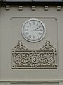 Clock on the corner - geograph.org.uk - 5889439.jpg 1,704 × 2,304; 995 KB
-
 Cole Motors Ltd., Red Hill - geograph.org.uk - 3456563.jpg 640 × 480; 73 KB
-
 Converted water-mill, Wrington - geograph.org.uk - 1051956.jpg 640 × 480; 55 KB
-
 Cook's Bridle Path - geograph.org.uk - 1298894.jpg 640 × 438; 72 KB
-
 Cook's Bridle Path - geograph.org.uk - 2422564.jpg 480 × 640; 134 KB
-
 Coombehead Farm - geograph.org.uk - 2422544.jpg 640 × 480; 119 KB
-
 Cottages on Red Hill - geograph.org.uk - 3456535.jpg 640 × 480; 70 KB
-
 Court Farm, Wrington - geograph.org.uk - 1051984.jpg 640 × 480; 66 KB
-
 Croquet at Wrington - geograph.org.uk - 5882026.jpg 2,304 × 1,704; 1.42 MB
-
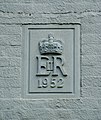
 Date on a downpipe - geograph.org.uk - 5891315.jpg 1,704 × 2,304; 1.2 MB
-
 Date stone - geograph.org.uk - 1438766.jpg 538 × 640; 103 KB
-
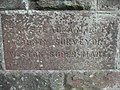 Dedication stone on bridge - geograph.org.uk - 357283.jpg 640 × 480; 162 KB
-
 Dial House - geograph.org.uk - 5888214.jpg 2,304 × 1,704; 1.32 MB
-
 Disused quarry, Wrington - geograph.org.uk - 1051869.jpg 640 × 480; 155 KB
-
 Doorsteppers are not welcome^ - geograph.org.uk - 5890153.jpg 1,704 × 2,304; 1.62 MB
-
 Downside , Cooks Bridle Path - geograph.org.uk - 3510334.jpg 4,288 × 2,848; 6.17 MB
-
 Downside , Downside Road - geograph.org.uk - 3509823.jpg 4,288 × 2,848; 5.41 MB
-
 Downside , Downside Road - geograph.org.uk - 3513812.jpg 4,288 × 2,848; 5.84 MB
-
 Downside , Grassy Field - geograph.org.uk - 3509274.jpg 4,288 × 2,848; 6.39 MB
-
 Downside , Grassy Field - geograph.org.uk - 3513813.jpg 4,288 × 2,848; 5.23 MB
-
 Downside , Grassy Field ^ Cattle - geograph.org.uk - 3509820.jpg 4,288 × 2,848; 5.59 MB
-
 Downside Road - geograph.org.uk - 1298858.jpg 640 × 480; 103 KB
-
 Downside Road - geograph.org.uk - 1298896.jpg 640 × 480; 94 KB
-
 Downside Road - geograph.org.uk - 1298904.jpg 640 × 480; 91 KB
-
 Downside Road - geograph.org.uk - 1298929.jpg 640 × 464; 108 KB
-
 Downside Road - geograph.org.uk - 1298933.jpg 640 × 348; 69 KB
-
 EasyJet aircraft at Bristol Airport - geograph.org.uk - 5464831.jpg 4,000 × 3,000; 2.93 MB
-
 EasyJet aircraft at Bristol Airport - geograph.org.uk - 5479797.jpg 3,787 × 2,705; 2.38 MB
-
 Easyjets at Bristol Airport - geograph.org.uk - 4767885.jpg 1,920 × 1,212; 274 KB
-
 Edge of the airfield - geograph.org.uk - 3738069.jpg 3,264 × 2,448; 1.6 MB
-
 Edge of the Combe - geograph.org.uk - 3749866.jpg 2,304 × 1,704; 1.66 MB
-
 Edge of Wrington Warren - geograph.org.uk - 901751.jpg 480 × 640; 146 KB
-
 Enemy tank in the combe - geograph.org.uk - 5178070.jpg 2,304 × 1,704; 1.71 MB
-
 Faint arrows - geograph.org.uk - 2803411.jpg 2,304 × 1,704; 1.58 MB
-

-
 Farmhouse on New Rd, near Butcombe Court - geograph.org.uk - 2265148.jpg 4,000 × 3,000; 3.43 MB
-
 Farmland at Redhill - geograph.org.uk - 5027176.jpg 1,532 × 914; 267 KB
-
 Farmland near Lye Cross - geograph.org.uk - 5027107.jpg 2,395 × 1,000; 586 KB
-
 Farmland north of the A38 - geograph.org.uk - 3456001.jpg 640 × 480; 63 KB
-
 Farmland, Havyatt Farm - geograph.org.uk - 3455985.jpg 640 × 480; 67 KB
-
 Farmland, Lye Cross - geograph.org.uk - 3456022.jpg 640 × 480; 77 KB
-
 Farmland, Red Hill - geograph.org.uk - 3456558.jpg 640 × 480; 93 KB
-
 Field beside Cook's Bridle Path - geograph.org.uk - 2422569.jpg 640 × 480; 122 KB
-
 Field boundary, North Hill - geograph.org.uk - 2422626.jpg 640 × 422; 94 KB
-
 Field by the A38 - geograph.org.uk - 4506769.jpg 1,920 × 1,118; 633 KB
-
 Field by Winters Lane - geograph.org.uk - 2422908.jpg 640 × 420; 87 KB
-
 Field Entrance A38 Bristol Airport - geograph.org.uk - 4600373.jpg 640 × 428; 85 KB
-
 Field on North Hill - geograph.org.uk - 2422826.jpg 640 × 443; 92 KB
-
 Field, Blackmoor - geograph.org.uk - 2419073.jpg 640 × 461; 81 KB
-
 Fire Service training - geograph.org.uk - 2062478.jpg 640 × 285; 43 KB
-
 Font and window - geograph.org.uk - 5883520.jpg 1,704 × 2,304; 1.27 MB
-
 Footpath across a meadow - geograph.org.uk - 901759.jpg 640 × 480; 102 KB
-
 Footpath stile, Wrington - geograph.org.uk - 1051874.jpg 640 × 480; 149 KB
-
 For leaf litter - geograph.org.uk - 5178065.jpg 2,304 × 1,704; 1.73 MB
-
 From Alburys to Ladywell - geograph.org.uk - 5881466.jpg 2,304 × 1,704; 1.55 MB
-

-
 Gate to All Saints - geograph.org.uk - 5881964.jpg 2,304 × 1,704; 1.64 MB
-
 Gated track off the A38 - geograph.org.uk - 3456572.jpg 640 × 480; 108 KB
-
 Goblin Combe - geograph.org.uk - 2422785.jpg 640 × 384; 56 KB
-
 Goblin Combe - geograph.org.uk - 980847.jpg 640 × 480; 134 KB
-
 Goblin Combe cliffs - geograph.org.uk - 901736.jpg 640 × 480; 109 KB
-
 Going Round The Bend - geograph.org.uk - 4143013.jpg 2,826 × 1,854; 2.41 MB
-
 Gone and hardly a trace left - geograph.org.uk - 5888131.jpg 1,704 × 2,304; 2.48 MB
-
 Grass is always greener - geograph.org.uk - 1022837.jpg 640 × 480; 96 KB
-
 Grazing off the A38 - geograph.org.uk - 3456579.jpg 869 × 716; 114 KB
-
 Grazing, Perry Bridge - geograph.org.uk - 3455987.jpg 640 × 480; 72 KB
-
 Guarding the gate - geograph.org.uk - 2836979.jpg 2,304 × 1,704; 1.56 MB
-
 Haistone Cottages and Footpath - geograph.org.uk - 2383872.jpg 640 × 480; 143 KB
-
 Hanging out the window - geograph.org.uk - 5888204.jpg 1,704 × 2,304; 1.66 MB
-
 Havyat Road - geograph.org.uk - 4251808.jpg 640 × 480; 63 KB
-
 Havyatt Green - geograph.org.uk - 3455982.jpg 640 × 480; 79 KB
-
 Havyatt Green - geograph.org.uk - 5295225.jpg 2,286 × 1,270; 633 KB
-
 Havyatt Green - geograph.org.uk - 5295229.jpg 3,072 × 2,048; 1.48 MB
-
 Havyatt Green - geograph.org.uk - 5295311.jpg 3,072 × 2,048; 1.29 MB
-
 Havyatt Green Farm - geograph.org.uk - 5483459.jpg 1,598 × 828; 221 KB
-
 High Street, at Maines Batch - geograph.org.uk - 5221915.jpg 1,024 × 831; 161 KB
-
 House at Branches Cross - geograph.org.uk - 4422041.jpg 3,313 × 2,454; 3.28 MB
-
 House on Silver Street - geograph.org.uk - 5222088.jpg 1,024 × 905; 157 KB
-
 How Somerset marks the bridges - geograph.org.uk - 5890145.jpg 2,304 × 1,704; 1.61 MB
-
 Interior of Wrington church - geograph.org.uk - 4986282.jpg 800 × 600; 114 KB
-
 Interior of Wrington church - geograph.org.uk - 4986283.jpg 600 × 800; 109 KB
-
 Into the great grey yonder - geograph.org.uk - 4668602.jpg 2,304 × 1,704; 953 KB
-
 John Locke House - geograph.org.uk - 5882432.jpg 2,304 × 1,704; 1.57 MB
-
 Just the one lion - geograph.org.uk - 5888161.jpg 1,704 × 2,304; 1.83 MB
-
 Kings wood, Somerset.jpg 5,136 × 3,414; 10.32 MB
-
 Lane at Scars Farm - geograph.org.uk - 5446048.jpg 640 × 480; 208 KB
-
 Lane ends at the A38 - geograph.org.uk - 5446041.jpg 640 × 480; 191 KB
-
 Late night arrivals, Bristol Airport - geograph.org.uk - 5382693.jpg 3,264 × 2,448; 1.08 MB
-
 Leftover from the times of steam - geograph.org.uk - 5889475.jpg 1,704 × 2,304; 2.1 MB
-
 Linden Lea - geograph.org.uk - 5222106.jpg 1,024 × 854; 207 KB
-
 Lining up for the sun - geograph.org.uk - 4668593.jpg 2,304 × 1,704; 1.2 MB


.jpg)


