Category:Woodgreen
Jump to navigation
Jump to search
village in Hampshire, England, United Kingdom  | |||||
| Upload media | |||||
| Instance of | |||||
|---|---|---|---|---|---|
| Located in protected area | |||||
| Location | New Forest, Hampshire, South East England, England | ||||
 | |||||
English: Woodgreen is a village and civil parish within the New Forest district of Hampshire in England. In the 2001 UK Census the parish was home to 537 people in 220 households. Its nearest railway station is Dean railway station.
Subcategories
This category has the following 3 subcategories, out of 3 total.
B
- St Boniface's Church, Woodgreen (11 F)
G
- Godshill Inclosure (8 F)
W
- Woodgreen Methodist Church (7 F)
Media in category "Woodgreen"
The following 124 files are in this category, out of 124 total.
-
 A road triangle at Woodgreen but no sign of a red one - geograph.org.uk - 2876889.jpg 3,445 × 2,609; 1.79 MB
-

-
 Avon valley from Castle Hill - geograph.org.uk - 5046522.jpg 2,179 × 949; 445 KB
-
 Black Swan River Avon Woodgreen Hampshire - geograph.org.uk - 273357.jpg 640 × 480; 151 KB
-
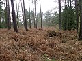 Bracken, Godshill Wood - geograph.org.uk - 2774714.jpg 640 × 481; 83 KB
-
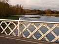
 Breamore Great Bridge - geograph.org.uk - 4200988.jpg 1,024 × 768; 173 KB
-

-
-
 Brook Lane, Woodgreen - geograph.org.uk - 354957.jpg 640 × 480; 145 KB
-
 Car park near Castle Hill - geograph.org.uk - 5046544.jpg 3,072 × 2,048; 1.41 MB
-
 Castle Hill, fly-tipping - geograph.org.uk - 4175097.jpg 1,024 × 768; 302 KB
-
 Castle Hill, hillside - geograph.org.uk - 4175144.jpg 768 × 1,024; 285 KB
-
 Castle Hill, spring - geograph.org.uk - 4175079.jpg 1,024 × 768; 318 KB
-
 Cottage and garage in Woodgreen - geograph.org.uk - 5838027.jpg 1,989 × 1,488; 1.97 MB
-
 Cottage at Woodgreen - geograph.org.uk - 5046583.jpg 2,854 × 1,657; 973 KB
-
 Cottage at Woodgreen Hampshire - geograph.org.uk - 273337.jpg 640 × 480; 158 KB
-
 Cottage in Woodgreen - geograph.org.uk - 5838023.jpg 2,028 × 1,508; 1.86 MB
-

-
 Enjoying a Canter - geograph.org.uk - 2847127.jpg 640 × 480; 74 KB
-
 Faraway Alpacas - geograph.org.uk - 734988.jpg 640 × 480; 85 KB
-
 Fence, Woodgreen - geograph.org.uk - 5046591.jpg 3,072 × 2,048; 1.34 MB
-
 Foal, Woodgreen - geograph.org.uk - 5047933.jpg 1,728 × 1,146; 417 KB
-
 Furry cow, Millersford Bottom, New Forest - geograph.org.uk - 277070.jpg 480 × 640; 106 KB
-
 Gate in the Inclosure - geograph.org.uk - 2847130.jpg 640 × 480; 99 KB
-
 George V postbox, Woodgreen - geograph.org.uk - 1014574.jpg 640 × 480; 73 KB
-
 Godshill Inclosure - geograph.org.uk - 4174899.jpg 768 × 1,024; 325 KB
-
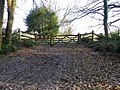
 Godshill Inclosure, gates - geograph.org.uk - 4174922.jpg 1,024 × 768; 309 KB
-
 Godshill Inclosure, path - geograph.org.uk - 4174930.jpg 768 × 1,024; 302 KB
-
 Godshill Inclosure, path junction - geograph.org.uk - 4174994.jpg 1,024 × 768; 327 KB
-
 Godshill Wood, forestry road - geograph.org.uk - 4175048.jpg 768 × 1,024; 271 KB
-
 Godshill Wood, woodland - geograph.org.uk - 4175065.jpg 1,024 × 768; 331 KB
-
 Godshill, footbridge - geograph.org.uk - 4150172.jpg 1,024 × 768; 255 KB
-
 Godshill, postbox № SP6 260, Castle Hill - geograph.org.uk - 2171414.jpg 640 × 480; 101 KB
-
 It's a Labrador Thing - geograph.org.uk - 2847136.jpg 640 × 480; 107 KB
-
 Kings Bush Farm (Woodgreen charity).jpg 3,024 × 3,024; 2.7 MB
-
 Lady's Mile - geograph.org.uk - 5820730.jpg 1,600 × 1,200; 706 KB
-
 Lane near Woodgreen - geograph.org.uk - 5046571.jpg 3,072 × 2,048; 1.46 MB
-
 Lane towards Hale - geograph.org.uk - 3364726.jpg 640 × 427; 110 KB
-
 Lane, Castle Hill - geograph.org.uk - 5046431.jpg 1,920 × 1,280; 861 KB
-
 Lane, Castle Hill - geograph.org.uk - 5046493.jpg 3,072 × 2,048; 1.64 MB
-
 Lane, Woodgreen - geograph.org.uk - 5046586.jpg 3,072 × 2,048; 1.25 MB
-
 Main entrance of Woodgreen animal shelter Kings Bush Farm.jpg 3,024 × 3,024; 2.28 MB
-
 Meadow west of Woodgreen - geograph.org.uk - 5048212.jpg 3,072 × 2,048; 1.38 MB
-
 Millersford Bottom, footbridge - geograph.org.uk - 4150150.jpg 1,024 × 768; 156 KB
-
 Millersford, grassland - geograph.org.uk - 4150103.jpg 1,024 × 768; 193 KB
-
 Muddy path towards Millers Ford - geograph.org.uk - 3364758.jpg 640 × 427; 113 KB
-

-
 No longer the Woodgreen Post Office - geograph.org.uk - 5815631.jpg 1,955 × 1,425; 1.15 MB
-
 Nr Woodgreen, Hampshire - geograph.org.uk - 2476453.jpg 1,800 × 1,200; 227 KB
-

-
 Old watermeadows - geograph.org.uk - 273664.jpg 640 × 480; 160 KB
-
 On the road to Breamore - geograph.org.uk - 5048150.jpg 3,072 × 1,679; 1.17 MB
-
 One horse-powered mower, Woodgreen - geograph.org.uk - 354965.jpg 640 × 480; 139 KB
-
 Palomino pony, Woodgreen Common - geograph.org.uk - 2484650.jpg 640 × 480; 85 KB
-
 Picket Well - geograph.org.uk - 291579.jpg 480 × 640; 147 KB
-
 Plaque, Breamore Great Bridge - geograph.org.uk - 5048491.jpg 3,072 × 2,048; 1.37 MB
-
 Ponies, Woodgreen - geograph.org.uk - 5048127.jpg 2,355 × 1,766; 721 KB
-
 Postbox beside River Avon at Breamore - geograph.org.uk - 2295626.jpg 1,600 × 1,200; 509 KB
-
 Puffing up the hill - geograph.org.uk - 2387519.jpg 640 × 480; 107 KB
-
 Pylon line, Woodgreen - geograph.org.uk - 5048198.jpg 3,072 × 2,048; 1.04 MB
-
 River Avon from Castle Hill - geograph.org.uk - 5046511.jpg 2,166 × 1,040; 517 KB
-
 River Avon near Breamore - geograph.org.uk - 5048230.jpg 1,920 × 1,208; 887 KB
-
 River Avon near Breamore - geograph.org.uk - 5048667.jpg 3,072 × 2,048; 1.33 MB
-
 Road south of Godshill Wood - geograph.org.uk - 4972602.jpg 640 × 427; 86 KB
-
 Road through Godshill Inclosure - geograph.org.uk - 5821568.jpg 1,600 × 1,200; 678 KB
-
 Sheep grazing Woodgreen Hampshire - geograph.org.uk - 273341.jpg 640 × 480; 105 KB
-

-
 Sign for Woodgreen Village Hall - geograph.org.uk - 354987.jpg 640 × 480; 81 KB
-
-
 St Boniface Church, Woodgreen - geograph.org.uk - 5047571.jpg 2,997 × 1,844; 1.07 MB
-
 Straight road through Godshill Inclosure - geograph.org.uk - 4972594.jpg 640 × 427; 101 KB
-
 Sunset over Avon Flood Plain - geograph.org.uk - 420178.jpg 640 × 480; 33 KB
-
 Thatched cottage beside Woodgreen Common - geograph.org.uk - 5819919.jpg 1,600 × 1,200; 706 KB
-

-
 The Horse and Groom, Woodgreen - geograph.org.uk - 354974.jpg 640 × 480; 103 KB
-
 The summit of Castle Hill. - geograph.org.uk - 2877888.jpg 640 × 480; 362 KB
-
 Track, Castle Hill - geograph.org.uk - 5046257.jpg 3,072 × 2,048; 1.41 MB
-
 Tree on the green, Woodgreen - geograph.org.uk - 4972577.jpg 640 × 427; 75 KB
-
 Un-named road through Godshill Inclosure - geograph.org.uk - 2876874.jpg 3,482 × 2,459; 1.88 MB
-
 View from Deadman Hill - geograph.org.uk - 2042087.jpg 640 × 480; 98 KB
-
 Viewpoint, Castle Hill - geograph.org.uk - 5046532.jpg 3,072 × 2,048; 1.38 MB
-
 Viewpoint, Castle Hill - geograph.org.uk - 5046536.jpg 3,072 × 2,048; 1.4 MB
-
 Walkers in Godshill Woods - geograph.org.uk - 2774758.jpg 640 × 480; 115 KB
-
 Woodgreen - geograph.org.uk - 5046865.jpg 2,990 × 1,891; 1.34 MB
-
 Woodgreen - geograph.org.uk - 5047543.jpg 3,072 × 2,048; 1.57 MB
-
 Woodgreen Cemetery - geograph.org.uk - 4175188.jpg 1,024 × 768; 201 KB
-
 Woodgreen Charity Shop.jpg 2,511 × 2,511; 1.23 MB
-
 Woodgreen Common (geograph 5046665).jpg 1,920 × 1,191; 905 KB
-
 Woodgreen Common - geograph.org.uk - 1524834.jpg 640 × 425; 187 KB
-
 Woodgreen common - geograph.org.uk - 4972588.jpg 640 × 427; 90 KB
-
 Woodgreen Community Shop - geograph.org.uk - 4175251.jpg 1,024 × 747; 128 KB
-
 Woodgreen Reading Room - geograph.org.uk - 5048141.jpg 3,072 × 2,048; 1.16 MB
-
 Woodgreen residents - geograph.org.uk - 121193.jpg 640 × 640; 197 KB
-
 Woodgreen Village Hall - geograph.org.uk - 4175235.jpg 1,024 × 758; 126 KB
-
 Woodgreen, Castle Hill - geograph.org.uk - 4175029.jpg 768 × 1,024; 267 KB
-
 Woodgreen, Castle Hill Car Park - geograph.org.uk - 4174959.jpg 1,024 × 768; 187 KB
-
 Woodgreen, former gravel pit - geograph.org.uk - 4175221.jpg 1,024 × 768; 292 KB
-
 Woodgreen, gates - geograph.org.uk - 4174941.jpg 1,024 × 768; 312 KB
-
 Woodgreen, Hampshire.jpg 640 × 481; 113 KB
-
 Woodgreen, Horse ^ Groom - geograph.org.uk - 4175631.jpg 1,024 × 768; 160 KB
-
 Woodgreen, minor road - geograph.org.uk - 4175012.jpg 1,024 × 768; 242 KB
-
 Woodgreen, permissive footpath - geograph.org.uk - 4175628.jpg 1,024 × 768; 183 KB
-
 Woodgreen, phone box and bus shelter - geograph.org.uk - 2171397.jpg 640 × 480; 106 KB
-
 Woodgreen, ponies - geograph.org.uk - 4175629.jpg 1,024 × 768; 170 KB
-
 Woodgreen, riverbank - geograph.org.uk - 4175131.jpg 1,024 × 768; 265 KB
-
 Woodgreen, sheep grazing - geograph.org.uk - 4175292.jpg 1,024 × 768; 189 KB
-
 Woodgreen, street furniture - geograph.org.uk - 4175630.jpg 1,024 × 768; 128 KB
-

-

-

-
 Woodland, Castle Hill - geograph.org.uk - 5046411.jpg 3,072 × 2,048; 1.38 MB
-
 Cattle Woodgreen Hampshire - geograph.org.uk - 273345.jpg 640 × 480; 124 KB
-
 Fence construction - geograph.org.uk - 273533.jpg 640 × 480; 132 KB
-
 Footbridge over drain - geograph.org.uk - 273369.jpg 640 × 480; 212 KB
-

-
 Forest grazing Woodgreen Hampshire - geograph.org.uk - 273332.jpg 640 × 480; 107 KB
-

-
-
 Moot Lane Woodgreen Hampshire - geograph.org.uk - 273349.jpg 640 × 480; 200 KB
-
 Rubble dump in the woods - geograph.org.uk - 514506.jpg 640 × 480; 197 KB
-
 Seating at Castle Hill - geograph.org.uk - 354951.jpg 640 × 480; 165 KB
-

-

-
 Woodgreen Village Hall - geograph.org.uk - 354979.jpg 640 × 480; 86 KB


.jpg)


.jpg)


