Category:Womersley
Jump to navigation
Jump to search
village in United Kingdom  | |||||
| Upload media | |||||
| Instance of | |||||
|---|---|---|---|---|---|
| Location | Selby, North Yorkshire, Yorkshire and the Humber, England | ||||
 | |||||
English: Womersley is a village in the Selby District, in the English county of North Yorkshire. It is near the town of Doncaster.
Polski: Womersley – wieś w Anglii, w hrabstwie North Yorkshire, w dystrykcie Selby. Leży 34 km na południe od miasta York i 251 km na północ od Londynu.
Subcategories
This category has the following 2 subcategories, out of 2 total.
G
- Gale Common ash tip (3 F)
S
Media in category "Womersley"
The following 200 files are in this category, out of 280 total.
(previous page) (next page)-
 'Parked' - geograph.org.uk - 2226215.jpg 3,296 × 2,472; 2.47 MB
-
 A corner of Womersley Church - geograph.org.uk - 3799462.jpg 881 × 1,280; 338 KB
-

-
 A19 Selby Road at Lake Bridge - geograph.org.uk - 5709737.jpg 1,600 × 1,065; 392 KB
-
 A19 Selby Road at Old Lake Bridge - geograph.org.uk - 5718054.jpg 1,600 × 1,065; 411 KB
-
 A19 towards Doncaster - geograph.org.uk - 2593675.jpg 1,600 × 1,200; 474 KB
-
 A19 towards Doncaster - geograph.org.uk - 2593678.jpg 1,600 × 1,200; 487 KB
-
 A19, Selby Road towards Askern - geograph.org.uk - 5718050.jpg 1,600 × 1,065; 560 KB
-
 Access barred to the Womersley Park hardstanding - geograph.org.uk - 4282297.jpg 1,024 × 768; 178 KB
-
 After the race - geograph.org.uk - 6354007.jpg 1,024 × 252; 98 KB
-
 Alongside the railway at Cow Lane crossing - geograph.org.uk - 4745839.jpg 1,024 × 768; 353 KB
-
 Approaching Cow Lane level crossing - geograph.org.uk - 3793930.jpg 1,280 × 1,111; 299 KB
-

-
 Bank Wood Road towards Darington - geograph.org.uk - 2602610.jpg 1,600 × 1,200; 658 KB
-
 Bank Wood Road towards Darrington - geograph.org.uk - 2602604.jpg 1,600 × 1,200; 626 KB
-
 Bank Wood Road towards Womersley - geograph.org.uk - 5029310.jpg 1,200 × 799; 417 KB
-
 Bankwood Road, Womersley - geograph.org.uk - 3860676.jpg 1,024 × 768; 114 KB
-
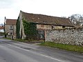
 Barn at Grove Farm - geograph.org.uk - 4826267.jpg 1,024 × 768; 186 KB
-
 Barn with a dilapidated roof, Womersley - geograph.org.uk - 3860682.jpg 1,024 × 768; 188 KB
-
 Barn, Grove Farm - geograph.org.uk - 2602585.jpg 1,600 × 1,200; 449 KB
-
 Behind the hedge on Highfield Lane - geograph.org.uk - 4745924.jpg 1,024 × 768; 224 KB
-
 Bench mark with bolt, Womersley Church - geograph.org.uk - 3799460.jpg 1,280 × 960; 241 KB
-
 Bench mark, Low Farm, Womersley - geograph.org.uk - 3799476.jpg 1,280 × 960; 308 KB
-
 Benchmark on the gatepost at Low Farm - geograph.org.uk - 3618017.jpg 1,600 × 1,200; 893 KB
-
 Benchmark on the gatepost at Park Farm - geograph.org.uk - 3618011.jpg 1,600 × 1,200; 855 KB
-
 Birdspring Farm - geograph.org.uk - 2226239.jpg 2,199 × 1,648; 760 KB
-
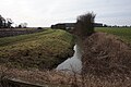
 Birka Drain - geograph.org.uk - 2225875.jpg 2,472 × 3,296; 2.01 MB
-
 Birka Drain, Oak Plantation - geograph.org.uk - 5029381.jpg 1,200 × 799; 482 KB
-
 Blocked entrance to former Womersley Quarry - geograph.org.uk - 3860617.jpg 1,024 × 768; 139 KB
-
 Blocked former quarry entrance, Bank Wood Road - geograph.org.uk - 4282305.jpg 1,024 × 768; 172 KB
-
 Blowell Drain near South End - geograph.org.uk - 5709789.jpg 1,600 × 1,065; 540 KB
-
 Booty Lane - geograph.org.uk - 1369972.jpg 640 × 480; 56 KB
-
 Booty Lane, looking north-east - geograph.org.uk - 3861912.jpg 1,024 × 768; 143 KB
-
 Bradley Drain - geograph.org.uk - 4746022.jpg 1,024 × 768; 223 KB
-
 Bridge over Womersley Beck - geograph.org.uk - 4745238.jpg 1,024 × 768; 238 KB
-
 Bridleway at Stapleton Cottages - geograph.org.uk - 5029307.jpg 1,200 × 799; 382 KB
-
 Brown Ings wood alongside Highfield Lane - geograph.org.uk - 4133939.jpg 1,024 × 676; 191 KB
-
 Brown Ings Wood and Birdspring Wood - geograph.org.uk - 4745227.jpg 1,024 × 768; 265 KB
-
 Brown Ings Wood and Womersley Beck - geograph.org.uk - 4748400.jpg 1,024 × 768; 206 KB
-
 Brown Ings Wood, Wormersley - geograph.org.uk - 1594743.jpg 640 × 480; 153 KB
-
 Churchfield Lane - geograph.org.uk - 4281508.jpg 1,024 × 768; 128 KB
-
 Churchfield Lane leaving Womersley - geograph.org.uk - 6120341.jpg 4,000 × 3,000; 3.08 MB
-
 Churchfield Lane south of Womersley - geograph.org.uk - 5786023.jpg 4,775 × 3,560; 5.42 MB
-
 Churchfield Lane towards Womersley - geograph.org.uk - 2602590.jpg 1,600 × 1,200; 687 KB
-
 Conveyor through the fence - geograph.org.uk - 3792035.jpg 1,280 × 960; 310 KB
-
 Corner of a ploughed field - geograph.org.uk - 3860573.jpg 1,024 × 768; 154 KB
-

-
 Cow Lane - geograph.org.uk - 4745896.jpg 1,024 × 768; 180 KB
-
 Cow Lane at its junction with Main Street in Womersley - geograph.org.uk - 6120338.jpg 4,000 × 3,000; 2.94 MB
-
 Cow Lane Level Crossing - geograph.org.uk - 1594737.jpg 640 × 480; 96 KB
-
 Cow Lane level crossing - geograph.org.uk - 3793918.jpg 1,280 × 960; 472 KB
-
 Cow Lane, Womersley - geograph.org.uk - 2143833.jpg 800 × 600; 300 KB
-
 Cow Lane, Womersley heading towards Glebe Farm - geograph.org.uk - 6120336.jpg 4,000 × 3,000; 3.39 MB
-
 Cyclist passing the former Womersley Station - geograph.org.uk - 3861230.jpg 1,024 × 768; 159 KB
-
 Dawland House Farm - geograph.org.uk - 280176.jpg 640 × 480; 110 KB
-
-
 Drainage ditch, west side of Fulham Lane - geograph.org.uk - 3861304.jpg 1,024 × 768; 154 KB
-
 East long Fulham Lane , Womersley - geograph.org.uk - 2143536.jpg 800 × 600; 229 KB
-

-
 Farm track leading to Lake Bridge (A19) - geograph.org.uk - 5709731.jpg 1,600 × 1,065; 591 KB
-
 Farm track running south from Fulham Lane - geograph.org.uk - 2476833.jpg 1,600 × 1,200; 384 KB
-

-
 Farmland alongside Bank Wood Road - geograph.org.uk - 4133961.jpg 1,024 × 615; 120 KB
-
 Farmland at Pontefract Gate, west of Womersley - geograph.org.uk - 4282314.jpg 1,024 × 768; 123 KB
-
 Farmland east of Churchfield Lane - geograph.org.uk - 4281519.jpg 1,024 × 768; 127 KB
-
 Farmland east of Womersley Grange - Grange Farm - geograph.org.uk - 3861919.jpg 1,024 × 768; 136 KB
-
 Farmland near Grange Farm - geograph.org.uk - 2476827.jpg 1,600 × 1,200; 446 KB
-
 Farmland near Spring Lodge - geograph.org.uk - 2476388.jpg 1,600 × 1,200; 355 KB
-
 Farmland near Womersley - geograph.org.uk - 2602588.jpg 1,600 × 1,200; 533 KB
-
 Farmland off Bank Wood Road - geograph.org.uk - 2602608.jpg 1,600 × 1,200; 523 KB
-
 Farmland off the A19 - geograph.org.uk - 2593677.jpg 1,600 × 1,200; 435 KB
-
 Farmland towards Hodgsoncroft Wood - geograph.org.uk - 2476835.jpg 1,600 × 1,200; 331 KB
-
 Field of sheep, east of Churchfield Lane - geograph.org.uk - 4282283.jpg 1,024 × 615; 138 KB
-
 Fields off the A19 Selby Road - geograph.org.uk - 1429016.jpg 640 × 480; 50 KB
-
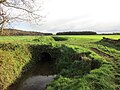
 Footbridge at the corner of Birdspring Wood - geograph.org.uk - 4748406.jpg 1,024 × 768; 373 KB
-
 Footbridge at western edge of Birdspring Wood - geograph.org.uk - 2225502.jpg 2,448 × 3,264; 2.75 MB
-
 Footbridge on the edge of Oak Plantation - geograph.org.uk - 4859300.jpg 640 × 480; 124 KB
-
 Footbridge over a drain - geograph.org.uk - 4745266.jpg 1,024 × 768; 261 KB
-
 Footbridge over Birka Drain, Oak Plantation - geograph.org.uk - 5029375.jpg 1,200 × 799; 502 KB
-
 Footbridge over drain - geograph.org.uk - 5709782.jpg 1,600 × 1,065; 939 KB
-
 Footbridge over drainage ditch - geograph.org.uk - 2225847.jpg 2,448 × 3,264; 2.93 MB
-
 Footbridge over the Womersley Beck - geograph.org.uk - 3799486.jpg 1,280 × 960; 620 KB
-
 Footbridge over Womersley Beck - geograph.org.uk - 2225468.jpg 2,448 × 3,264; 1.73 MB
-
 Footbridge over Womersley Beck - geograph.org.uk - 4745254.jpg 1,024 × 768; 242 KB
-
 Footpath along the wood edge - geograph.org.uk - 2225540.jpg 2,448 × 3,264; 3.33 MB
-
 Footpath alongside Belt Plantation - geograph.org.uk - 2225864.jpg 2,448 × 3,264; 3.16 MB
-
 Footpath alongside Belt Plantation - geograph.org.uk - 5029358.jpg 1,200 × 799; 556 KB
-
 Footpath alongside Belt Plantation - geograph.org.uk - 5029361.jpg 1,200 × 799; 530 KB
-
 Footpath alongside Birdspring Wood - geograph.org.uk - 4745094.jpg 1,024 × 768; 336 KB
-
 Footpath alongside Birdspring Wood - geograph.org.uk - 4745104.jpg 1,024 × 768; 314 KB
-
 Footpath and footbridge by Birdspring Wood - geograph.org.uk - 4745088.jpg 1,024 × 768; 276 KB
-
 Footpath at Womersley Park - geograph.org.uk - 5029320.jpg 1,200 × 799; 554 KB
-
 Footpath between the houses - geograph.org.uk - 4745917.jpg 1,024 × 768; 218 KB
-
 Footpath from Womersley. - geograph.org.uk - 4859304.jpg 640 × 480; 131 KB
-
 Footpath leading to South End - geograph.org.uk - 5709785.jpg 1,600 × 1,065; 587 KB
-
 Footpath off Bank Wood Road, Womersley - geograph.org.uk - 5029317.jpg 1,200 × 799; 454 KB
-
 Footpath off Park Lane, Womersley - geograph.org.uk - 2602600.jpg 1,600 × 1,200; 835 KB
-
 Former level crossing - geograph.org.uk - 4745142.jpg 1,024 × 768; 292 KB
-
 Fulham House , Nr Whitley - geograph.org.uk - 246764.jpg 640 × 480; 79 KB
-
 Fulham House Farm - geograph.org.uk - 4746029.jpg 1,024 × 768; 169 KB
-
 Fulham Lane - geograph.org.uk - 3794030.jpg 1,280 × 960; 194 KB
-
 Fulham Lane approaching Wheatcroft Wood - geograph.org.uk - 3861295.jpg 1,024 × 768; 132 KB
-
 Fulham Lane at the 7 metre spot height - geograph.org.uk - 3861905.jpg 1,024 × 768; 162 KB
-
 Fulham Lane heading east - geograph.org.uk - 2476843.jpg 1,600 × 1,200; 445 KB
-
 Fulham Lane heading west - geograph.org.uk - 2476829.jpg 1,600 × 1,200; 309 KB
-
 Gale Common Ash Disposal Site - geograph.org.uk - 4745987.jpg 1,024 × 768; 176 KB
-
 Galecommon Lane - geograph.org.uk - 3793922.jpg 1,280 × 960; 458 KB
-
 Glebe Farm, Cow Lane, Womersley - geograph.org.uk - 262533.jpg 640 × 480; 92 KB
-
 Glebe Farm, Womersley - geograph.org.uk - 3618031.jpg 1,600 × 1,200; 608 KB
-
 Grand Central train at Cow Lane crossing - geograph.org.uk - 4748362.jpg 1,024 × 768; 262 KB
-
 Grange Farm - geograph.org.uk - 274562.jpg 640 × 480; 92 KB
-
 Grange Farm - geograph.org.uk - 3861899.jpg 1,024 × 768; 160 KB
-
 Grange Farm, Womersley - geograph.org.uk - 3793997.jpg 1,280 × 960; 196 KB
-
 Grange Farm, Womersley - geograph.org.uk - 4746040.jpg 1,024 × 768; 158 KB
-
 Greening field east of Churchfield Lane - geograph.org.uk - 4281511.jpg 1,024 × 768; 148 KB
-
 Grove Farm, south-east of Womersley - geograph.org.uk - 4281515.jpg 1,024 × 768; 159 KB
-
 Grove Wood - geograph.org.uk - 3861286.jpg 1,024 × 768; 276 KB
-
 Heading for Womersley - geograph.org.uk - 2225484.jpg 3,244 × 1,632; 1.24 MB
-
 Highfield House Farm - geograph.org.uk - 2593672.jpg 1,600 × 1,200; 396 KB
-
 Highfield Lane - geograph.org.uk - 1428992.jpg 640 × 480; 87 KB
-
 Highfield Lane - geograph.org.uk - 2602594.jpg 1,600 × 1,200; 576 KB
-
 Highfield Lane at Grove Wood - geograph.org.uk - 3861242.jpg 1,024 × 768; 200 KB
-
 Highfield Lane at Grove Wood - geograph.org.uk - 6120342.jpg 4,000 × 3,000; 4.74 MB
-

-
 Highfield Lane heading towards the A19 - geograph.org.uk - 6120350.jpg 4,000 × 3,000; 5.38 MB
-
 Highfield Lane near Womersley - geograph.org.uk - 3793983.jpg 1,280 × 960; 335 KB
-
 Highfield Lane near Womersley - geograph.org.uk - 4133927.jpg 1,024 × 711; 276 KB
-
 Highfield Lane near Womersley - geograph.org.uk - 4133941.jpg 1,024 × 636; 175 KB
-
 Highfield Lane passes through Ox Stocking wood - geograph.org.uk - 4133931.jpg 1,024 × 768; 274 KB
-
 Highfield Lane railway crossing Womersley - geograph.org.uk - 4133947.jpg 1,024 × 663; 217 KB
-
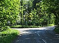
 Highfield Lane, Junction with the A19. - geograph.org.uk - 254843.jpg 640 × 480; 137 KB
-
 Highfield Lane, Womersley - geograph.org.uk - 3860701.jpg 1,024 × 768; 162 KB
-
 Highfield Lane. - geograph.org.uk - 280178.jpg 640 × 480; 150 KB
-

-
 Home Farm, Womersley - geograph.org.uk - 4746076.jpg 1,024 × 768; 123 KB
-
 House on the corner of Cow Lane - geograph.org.uk - 4745920.jpg 1,024 × 768; 155 KB
-
 Ivy in woodland, west of Churchfield Lane - geograph.org.uk - 4282273.jpg 1,024 × 768; 275 KB
-
 Ivy-clad tree, Bank Wood Road - geograph.org.uk - 4282323.jpg 1,024 × 768; 145 KB
-
 Ivy-covered trees, east of Churchfield Lane - geograph.org.uk - 4282266.jpg 1,024 × 768; 161 KB
-

-
 Junction of Highfield Lane and Fulham Lane - geograph.org.uk - 3861271.jpg 1,024 × 768; 188 KB
-
 Large means this, slow means that - geograph.org.uk - 3861221.jpg 1,024 × 768; 172 KB
-
 Linecroft Wood - geograph.org.uk - 4748402.jpg 1,024 × 768; 212 KB
-
 Looking North along the A19, Selby Road - geograph.org.uk - 2143443.jpg 800 × 600; 323 KB
-
 Looking north-west from Fulham Lane - geograph.org.uk - 3793991.jpg 1,280 × 960; 299 KB
-
 Looking south-east from Womersley level crossing - geograph.org.uk - 3793972.jpg 1,280 × 960; 349 KB
-

-
 Low Farmhouse, Womersley - geograph.org.uk - 3799480.jpg 1,280 × 960; 292 KB
-
 Main Street, Womersley - geograph.org.uk - 1407544.jpg 640 × 480; 102 KB
-
 Main Street, Womersley - geograph.org.uk - 1407550.jpg 640 × 480; 86 KB
-
 Main Street, Womersley - geograph.org.uk - 3799470.jpg 1,280 × 960; 425 KB
-
 Manor Farm - geograph.org.uk - 2602602.jpg 1,600 × 1,200; 487 KB
-
 Manor Farm Bank Wood road Womersley - geograph.org.uk - 4133954.jpg 1,024 × 768; 191 KB
-
 Medieval cross and village pump - geograph.org.uk - 3792949.jpg 960 × 1,280; 404 KB
-
 Minor road towards Womersley - geograph.org.uk - 2602586.jpg 1,600 × 1,200; 529 KB
-
 Moated Manor House Field. - geograph.org.uk - 274545.jpg 640 × 480; 79 KB
-
 My digging days are over - geograph.org.uk - 4745131.jpg 1,024 × 768; 410 KB
-
 Near Grange Farm - geograph.org.uk - 3794002.jpg 1,280 × 960; 506 KB
-
 Nearly the end of the track - geograph.org.uk - 3792031.jpg 1,280 × 960; 251 KB
-
 Newly ploughed field, east of Churchfield Lane - geograph.org.uk - 4282291.jpg 1,024 × 768; 142 KB
-
 Northfield Lane - geograph.org.uk - 3793913.jpg 1,280 × 960; 169 KB
-
 Northfield Lane - geograph.org.uk - 3860599.jpg 1,024 × 768; 127 KB
-
 Northfield Lane at Springlodge level crossing - geograph.org.uk - 6120333.jpg 4,000 × 3,000; 2.95 MB
-
 Northfield Lane at the 16 metre spot height - geograph.org.uk - 3860625.jpg 1,024 × 768; 111 KB
-
 Northfield Lane near to Spring Lodge - geograph.org.uk - 6120329.jpg 4,000 × 3,000; 3.56 MB
-
 Northfield Lane towards Womersley - geograph.org.uk - 2476389.jpg 1,600 × 1,200; 353 KB
-
 Northfields - geograph.org.uk - 3792945.jpg 1,280 × 960; 249 KB
-
 Oak Plantation - geograph.org.uk - 280172.jpg 640 × 480; 59 KB
-
 Old Quarry ^ Belt Plantation - geograph.org.uk - 2225834.jpg 2,692 × 1,811; 1.51 MB
-
 Ordnance Survey Cut Mark - geograph.org.uk - 4964763.jpg 499 × 640; 139 KB
-
 Ox Stocking Wood - geograph.org.uk - 1594746.jpg 640 × 480; 149 KB
-
 Park Lane, Womersley - geograph.org.uk - 2143831.jpg 800 × 600; 237 KB
-
 Park Lane, Womersley - geograph.org.uk - 2602598.jpg 1,600 × 1,200; 605 KB
-
 Path enters Oak Plantation - geograph.org.uk - 5029364.jpg 1,200 × 799; 607 KB
-
 Path leading towards Little Smeaton - geograph.org.uk - 5029354.jpg 1,200 × 799; 477 KB
-
 Pipes across Womersley Beck - geograph.org.uk - 4745233.jpg 1,024 × 768; 262 KB
-
 Ploughed field and ash heap - geograph.org.uk - 3792039.jpg 1,280 × 960; 345 KB
-
 Post Office House - geograph.org.uk - 3793945.jpg 1,280 × 930; 246 KB
-
 Power lines cross Bank Wood road near Womersley - geograph.org.uk - 4133957.jpg 1,024 × 767; 137 KB
-
 Public footpath at Bell Lands Wood - geograph.org.uk - 1369989.jpg 640 × 480; 110 KB
-
 Quad bike track, west of Northfield Lane - geograph.org.uk - 3860639.jpg 1,024 × 768; 152 KB
-
 Railway line east of Northfield Lane - geograph.org.uk - 3860660.jpg 1,024 × 768; 155 KB
-
 Roadside pump at Womersley - geograph.org.uk - 3792948.jpg 960 × 1,280; 399 KB
-
 Roadside tree, Booty Lane - geograph.org.uk - 3861924.jpg 1,024 × 768; 130 KB
-
 Roadside trees, Booty Lane - geograph.org.uk - 3861923.jpg 1,024 × 768; 117 KB
-
 Secured property - geograph.org.uk - 4748435.jpg 1,024 × 768; 304 KB
-

-
 Slag heap - geograph.org.uk - 1978093.jpg 800 × 600; 101 KB
-
 Southern edge of Ricketcroft Wood - geograph.org.uk - 3861298.jpg 1,024 × 768; 152 KB
-
 Spoil heap from Kellingley Colliery - geograph.org.uk - 1589690.jpg 640 × 480; 78 KB
-
 Spring Lodge Level Crossing - geograph.org.uk - 1588972.jpg 640 × 480; 69 KB
-
 Spring Lodge level crossing - geograph.org.uk - 2164088.jpg 602 × 450; 93 KB
-

-
 Springlodge Crossing on Northfield Lane - geograph.org.uk - 3792935.jpg 1,280 × 960; 175 KB
-
 St. Martin's church, Womersley - geograph.org.uk - 4746063.jpg 1,024 × 768; 192 KB
-
 St. Martin's church, Womersley, interior - geograph.org.uk - 4746066.jpg 1,024 × 768; 150 KB
-
 Station House and former station, Womersley - geograph.org.uk - 2225881.jpg 2,485 × 1,632; 869 KB
-
 Station Road Level Crossing - geograph.org.uk - 1594739.jpg 640 × 480; 78 KB
-
 Stile at Belt Plantation - geograph.org.uk - 5029357.jpg 1,200 × 799; 635 KB
-
 Stocking Green Farm, Highfield Lane. - geograph.org.uk - 280173.jpg 640 × 480; 123 KB


_-_geograph.org.uk_-_5709731.jpg)


