Category:Wolverton maps of Queens published in 1891
Jump to navigation
Jump to search
Maps from: Wolverton, Chester. Atlas of Queens Co. Long Island New York. (New York: Chester Wolverton, 1891), comprising double-plate maps of Queens County, the City of Brooklyn, and Long Island, respectively, 31 section maps of Queens (30 double plates and one single plate), and title page and table-of-contents page.
Online at The New York Public Library Digital Collections website, Atlas of Queens Co., Long Island….
Media in category "Wolverton maps of Queens published in 1891"
The following 21 files are in this category, out of 21 total.
-

-
 LIRR 1891 City Line station.jpg 300 × 220; 26 KB
-
 LIRR 1891 Corona station.jpg 433 × 411; 70 KB
-
 LIRR 1891 Creedmoor station.jpg 627 × 448; 76 KB
-
 LIRR 1891 Fresh Pond station.jpg 502 × 408; 64 KB
-
 LIRR 1891 Long Island City.jpg 2,524 × 1,536; 860 KB
-
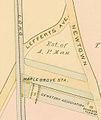 LIRR 1891 Maple Grove station.jpg 547 × 651; 75 KB
-
 LIRR 1891 Union Course station.jpg 523 × 435; 80 KB
-

-

-

-

-

-
 Plate 33- Town of North Hempstead. - Part of Flushing Village. NYPL1523103.tiff 6,001 × 4,002; 68.74 MB
-

-

-

-

-

-
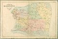 QueensCountyNY1891.jpg 760 × 514; 60 KB
-
 Table of Contents- Village Plans - Towns. NYPL1523071.tiff 3,816 × 4,330; 47.93 MB


