Category:Windpark Sohl
Jump to navigation
Jump to search
| Object location | | View all coordinates using: OpenStreetMap |
|---|
| Upload media | |||||
| Instance of | |||||
|---|---|---|---|---|---|
| Location |
| ||||
| Owned by | |||||
 | |||||
Media in category "Windpark Sohl"
The following 6 files are in this category, out of 6 total.
-
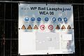 Windpark Sohl - Baustellenschild.JPG 5,184 × 3,456; 2.23 MB
-
 Windpark Sohl - Flächenverbrauch - 1.JPG 5,184 × 3,456; 9.01 MB
-
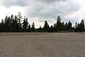 Windpark Sohl - Flächenverbrauch - 2.JPG 5,184 × 3,456; 8.13 MB
-
 Windpark Sohl - Flächenverbrauch - 3.JPG 5,184 × 3,456; 5.74 MB
-
 Windpark Sohl - Flächenverbrauch - 4.JPG 5,184 × 3,456; 9.26 MB
-
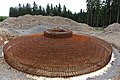 Windpark Sohl - Fundament.JPG 5,184 × 3,456; 9.21 MB


