Category:Windermere, Cumbria (town)
Jump to navigation
Jump to search
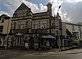
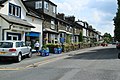
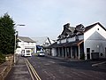
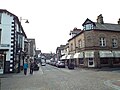
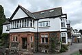
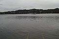
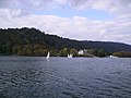
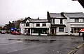
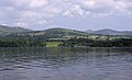
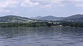
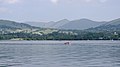
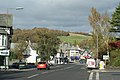
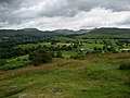
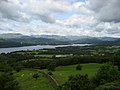
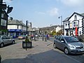
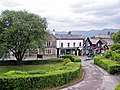
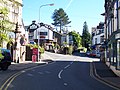
English: Windermere is a town and civil parish in Cumbria, England. It lies about half a mile away from the lake, Windermere. Although the town Windermere does not touch the lake, it has now grown together with the older lakeside town of Bowness-on-Windermere, though the two retain distinguishable town centres. There are a number of museums, but the main attraction for the tourists is the lake itself that touches Bowness at the bottom of the hill (about a twenty minute walk from the top of Windermere town). Here there is a beautiful view of the mountains. Boats from the piers in Bowness sail around the lake, many calling at Ambleside or at Lakeside where there is a restored railway.
日本語: ウィンダミア(Windermere)は、 イングランド、カンブリア州の都市。湖水地方最大の湖であるウィンダミア湖 (w:Windermere) の湖畔に位置し、湖水地方の玄関口となる都市である。
Română: Windermere este un oraş în comitatul Cumbria, regiunea North West, Anglia. Oraşul se află în districtul South Lakeland.
town in Cumbria, United Kingdom  | |||||
| Upload media | |||||
| Instance of | |||||
|---|---|---|---|---|---|
| Located in protected area | |||||
| Location | Windermere and Bowness, South Lakeland, Cumbria, North West England, England | ||||
| Population |
| ||||
| Different from | |||||
 | |||||
Subcategories
This category has the following 12 subcategories, out of 12 total.
B
- Booths Windermere (8 F)
H
- Holbeck Ghyll (1 F)
L
- Lakeland Plastics, Windermere (20 F)
- Windermere Library (5 F)
M
- Millerground, Cumbria (2 F)
P
- Windermere police station (6 F)
W
- Windermere war memorial (4 F)
- Windermere Hotel, Windermere (8 F)
- Windermere railway station (50 F)
Media in category "Windermere, Cumbria (town)"
The following 167 files are in this category, out of 167 total.
-
 2 St Martin's Pl, Bowness-on-Windermere.jpg 3,512 × 2,508; 1.32 MB
-
 A mobile ticket machine - geograph.org.uk - 3153766.jpg 600 × 800; 245 KB
-
 A Victorian letter box - geograph.org.uk - 3202577.jpg 600 × 800; 240 KB
-
 Ambleside Road (A591), Windermere - geograph.org.uk - 4000403.jpg 640 × 480; 362 KB
-
 Architectural Design Ltd, Windermere - geograph.org.uk - 5568265.jpg 640 × 480; 92 KB
-
 Ascent of Orrest Head, Windermere - geograph.org.uk - 1544692.jpg 640 × 427; 82 KB
-
 Barclays Bank, Windermere - geograph.org.uk - 1553081.jpg 640 × 480; 76 KB
-
 Barclays Bank, Windermere - geograph.org.uk - 5453520.jpg 3,648 × 2,432; 3.8 MB
-
 Beech Street, Windermere - geograph.org.uk - 1554706.jpg 640 × 480; 70 KB
-
 Benchmark on Windermere Post Office - geograph.org.uk - 3378030.jpg 2,048 × 1,536; 625 KB
-
 Broad Street Windermere - geograph.org.uk - 3786790.jpg 640 × 427; 155 KB
-
 Broad Street, Windermere - geograph.org.uk - 2373912.jpg 640 × 480; 91 KB
-
 Broad Street, Windermere - geograph.org.uk - 3291326.jpg 640 × 480; 134 KB
-
 Broad Street, Windermere - geograph.org.uk - 6011732.jpg 1,280 × 850; 458 KB
-
 Bus Leaving Windermere Station - geograph.org.uk - 4005138.jpg 640 × 427; 294 KB
-
 Carver Church, Windermere - geograph.org.uk - 4156750.jpg 640 × 480; 110 KB
-
 Carver Memorial Chapel, Windermere.jpg 1,600 × 1,067; 496 KB
-
 Church Street (A591) Windermere - geograph.org.uk - 4000357.jpg 640 × 480; 301 KB
-
 Crescent Road - geograph.org.uk - 3140372.jpg 800 × 600; 121 KB
-
 Crescent road from Main Road, Windermere - geograph.org.uk - 6011724.jpg 1,280 × 851; 502 KB
-
 Crescent Road, Windermere - geograph.org.uk - 1554707.jpg 640 × 480; 72 KB
-
 Crescent Road, Windermere - geograph.org.uk - 4697127.jpg 640 × 480; 74 KB
-
 Crescent Road, Windermere - geograph.org.uk - 4697130.jpg 640 × 480; 71 KB
-
 Cross Street, Windermere - geograph.org.uk - 4731540.jpg 640 × 480; 59 KB
-
 Dießen am Ammersee, Partnerschaften, 1.jpeg 2,704 × 3,600; 4.28 MB
-

-
 Elleray Wood and Orrest Head Footpath.JPG 2,304 × 1,728; 1.57 MB
-
 Ellerthwaite Lodge - geograph.org.uk - 5453516.jpg 3,648 × 2,432; 3.19 MB
-
 Ellerthwaite Square Windermere - geograph.org.uk - 3291320.jpg 640 × 480; 126 KB
-
 Ellerthwaite Square, Windermere - geograph.org.uk - 4005111.jpg 640 × 481; 274 KB
-
 English Road Trip (202752431).jpeg 1,800 × 1,200; 276 KB
-
 Ferry crabbing across Windermere - geograph.org.uk - 1597249.jpg 640 × 426; 34 KB
-
 Ferry House, Windermere - geograph.org.uk - 888432.jpg 640 × 480; 70 KB
-
 Foot Passengers, Windermere Ferry - geograph.org.uk - 1022684.jpg 640 × 432; 69 KB
-
 Footpath Junction - geograph.org.uk - 1544734.jpg 640 × 427; 67 KB
-
 Footpath passing Goodly Dale Cottages - geograph.org.uk - 4304912.jpg 2,048 × 1,536; 1.55 MB
-
 Footpath to Causeway Farm - geograph.org.uk - 1399516.jpg 640 × 480; 96 KB
-
 Gate on Orrest Head - geograph.org.uk - 1212551.jpg 640 × 480; 137 KB
-
 Gate on Orrest Head, Windermere - geograph.org.uk - 1544701.jpg 640 × 427; 83 KB
-
 Goodly Dale, Windermere (geograph 3709202).jpg 800 × 637; 129 KB
-
 House at the corner of Promenade and Rectory Rd, Windermere, England.jpg 4,825 × 3,098; 8.84 MB
-

-
 Huddlestons Butchers Ltd, Windermere - geograph.org.uk - 6011729.jpg 1,280 × 866; 353 KB
-
-
 Ladyholme Community Centre 21 Lake Rd.jpg 3,909 × 2,752; 1.41 MB
-
 Windermere-Seeblick-1989-gje.jpg 2,717 × 1,546; 1.93 MB
-
 Lake District Backpackers - geograph.org.uk - 1573889.jpg 480 × 640; 84 KB
-
 Lake District National Park banner.jpg 4,125 × 589; 1.36 MB
-
 Lake Road - geograph.org.uk - 4005075.jpg 640 × 480; 322 KB
-

-
 Lake Road and Carver Church, Windermere - geograph.org.uk - 4731556.jpg 640 × 480; 115 KB
-
 Lake Windermere DSCN0673 WC.jpg 3,648 × 2,736; 2.93 MB
-
 Lake Windermere MMB 23.jpg 4,137 × 2,758; 3.77 MB
-
 Lake Windermere MMB 53.jpg 4,152 × 2,142; 3.11 MB
-
 Lake Windermere MMB 54.jpg 4,104 × 2,490; 3.62 MB
-
 Lake Windermere MMB 55.jpg 4,156 × 2,493; 3.29 MB
-
 Lake Windermere MMB 56.jpg 4,125 × 2,289; 3.69 MB
-
 Lake Windermere MMB 57.jpg 4,074 × 2,274; 2.95 MB
-
 Lake Windermere MMB 58.jpg 4,074 × 2,571; 3.46 MB
-

-
 Lakes Hotel - panoramio.jpg 2,273 × 1,666; 1.31 MB
-
 Laurel Cottage, Windermere, England.jpg 4,534 × 3,134; 9.15 MB
-
 M Local, Windermere - geograph.org.uk - 4287210.jpg 2,048 × 1,536; 881 KB
-
 Main Road in Windermere - geograph.org.uk - 1578709.jpg 640 × 423; 72 KB
-
 Main Road in Windermere - geograph.org.uk - 1578714.jpg 640 × 427; 62 KB
-
 Main Road, Windermere - geograph.org.uk - 1553079.jpg 640 × 480; 76 KB
-
 Main Road, Windermere - geograph.org.uk - 2660364.jpg 640 × 428; 282 KB
-
 Main Road, Windermere - geograph.org.uk - 4697133.jpg 640 × 480; 75 KB
-
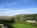
 Meadows at Orrest Head - geograph.org.uk - 792302.jpg 640 × 616; 126 KB
-
 Memorial stones on Orrest Head - geograph.org.uk - 1212547.jpg 640 × 480; 134 KB
-
 National Westminster Bank, Windermere - geograph.org.uk - 4132471.jpg 2,048 × 1,536; 664 KB
-
 NatWest Bank, Windermere - geograph.org.uk - 2660363.jpg 640 × 480; 279 KB
-
 NatWest Bank, Windermere - geograph.org.uk - 4784587.jpg 3,264 × 2,448; 1.52 MB
-
 New Road, Windermere - geograph.org.uk - 1549089.jpg 640 × 428; 80 KB
-
 Orrest Head - geograph.org.uk - 1341271.jpg 640 × 163; 35 KB
-
 Orrest Head - geograph.org.uk - 27555.jpg 621 × 400; 99 KB
-
 Orrest Head, Windermere - geograph.org.uk - 1544712.jpg 640 × 480; 46 KB
-
 Orrest Head.JPG 2,304 × 1,728; 1.33 MB
-
 Orresthead 0141.jpg 600 × 400; 116 KB
-
 Park Avenue, Windermere - geograph.org.uk - 4731542.jpg 640 × 480; 71 KB
-
 Park Road, Windermere - geograph.org.uk - 5751177.jpg 640 × 432; 104 KB
-
 Partnerstädte.jpg 2,362 × 1,772; 2.94 MB
-
 Path from Orrest Head - geograph.org.uk - 1398774.jpg 640 × 480; 129 KB
-
 Public toilets in Broad Street - geograph.org.uk - 1578717.jpg 640 × 427; 100 KB
-
 Public toilets, Broad Street, Windermere - geograph.org.uk - 4287213.jpg 2,048 × 1,536; 1.06 MB
-
 Queen's Drive, Windermere - geograph.org.uk - 3709253.jpg 800 × 717; 133 KB
-

-
 Roof tops of Windermere - geograph.org.uk - 4132472.jpg 2,048 × 1,536; 693 KB
-
 Sainsbury's Local, Windermere - geograph.org.uk - 5174388.jpg 2,000 × 1,500; 366 KB
-
 School Knott Tarn - geograph.org.uk - 75682.jpg 640 × 480; 91 KB
-
 Sign for Windermere Town Centre - geograph.org.uk - 4132481.jpg 2,048 × 1,536; 725 KB
-
 SignInWindermere.JPG 5,444 × 3,649; 5.47 MB
-
 St Cuthbert's Catholic Primary School, Windermere (geograph 4880006).jpg 640 × 480; 333 KB
-
 St Martin and St Mary Primary School (geograph 4880007).jpg 640 × 427; 293 KB
-
 Stone wall, Windermere, England.jpg 5,472 × 3,648; 20.87 MB
-
 Taste of Cumbria - geograph.org.uk - 1554708.jpg 640 × 480; 67 KB
-
 The Coppice Guest House - geograph.org.uk - 5453512.jpg 3,648 × 2,432; 4.64 MB
-
 The Elleray - geograph.org.uk - 2903935.jpg 1,600 × 1,200; 435 KB
-
 The Elleray, Cross Street, Windermere - geograph.org.uk - 3291304.jpg 640 × 480; 131 KB
-
 The former Embassy Ballroom, Windermere - geograph.org.uk - 5453518.jpg 3,648 × 2,432; 4.04 MB
-

-
 The Lamplighter Dining Rooms - geograph.org.uk - 5453521.jpg 3,648 × 2,432; 4.17 MB
-
 The Lighthouse Cafe and Bar - geograph.org.uk - 1553082.jpg 480 × 640; 63 KB
-
 The Lighthouse cafe, Windermere - geograph.org.uk - 3153789.jpg 800 × 600; 250 KB
-
 The NatWest Bank, Windermere - geograph.org.uk - 3153771.jpg 800 × 600; 314 KB
-

-
 The Priory, Windermere.jpg 640 × 640; 384 KB
-

-
 The Spinney, Windermere, England.jpg 4,308 × 3,648; 7.93 MB
-
 The Stables, Bank Road - geograph.org.uk - 4880009.jpg 640 × 480; 423 KB
-
 The Way to Orrest Head - geograph.org.uk - 1398768.jpg 640 × 480; 85 KB
-
 Thresher, Crescent Road, Windermere - geograph.org.uk - 3291328.jpg 628 × 470; 161 KB
-
 Victor Krylov in Windermere.jpg 1,588 × 1,176; 440 KB
-
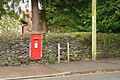 Victorian Postbox in Windermere - geograph.org.uk - 1549166.jpg 640 × 427; 117 KB
-
 View from Braithwaite Road, Windermere (27th September 2020).jpg 5,152 × 3,864; 5.66 MB
-
 View North from Orrest Head - geograph.org.uk - 1398805.jpg 640 × 480; 70 KB
-
 View North West from Orrest Head - geograph.org.uk - 1398781.jpg 640 × 480; 59 KB
-
 View South West from Orrest Head - geograph.org.uk - 1398790.jpg 640 × 480; 75 KB
-
 Wall near Heaning - geograph.org.uk - 151299.jpg 640 × 480; 121 KB
-
 Wall Near Mislet - geograph.org.uk - 151269.jpg 640 × 480; 108 KB
-

-
 Willowsmere Guest House - geograph.org.uk - 242435.jpg 640 × 480; 36 KB
-
 Windermere - 1983 - geograph.org.uk - 2240275.jpg 2,272 × 1,514; 547 KB
-
 Windermere - 29215387702.jpg 2,723 × 1,814; 4.67 MB
-
 Windermere - geograph.org.uk - 3410381.jpg 2,560 × 1,920; 617 KB
-
 Windermere - geograph.org.uk - 4341863.jpg 640 × 479; 82 KB
-
 Windermere - Main Road.jpg 640 × 428; 72 KB
-
 Windermere at dusk - panoramio.jpg 1,920 × 1,080; 712 KB
-
 Windermere at dusk.jpg 1,950 × 1,300; 1.98 MB
-
 Windermere Community Church, Park Road - geograph.org.uk - 4005102.jpg 640 × 480; 237 KB
-
 Windermere fire station - geograph.org.uk - 1908402.jpg 640 × 427; 243 KB
-
 Windermere from Orrest Head Lake District England.jpg 1,078 × 840; 132 KB
-
 Windermere Methodist Church - geograph.org.uk - 1554704.jpg 640 × 480; 64 KB
-
 Windermere MMB 01.jpg 3,723 × 2,592; 4.73 MB
-
 Windermere Post Office - geograph.org.uk - 3140380.jpg 800 × 600; 149 KB
-
 Windermere Post Office - geograph.org.uk - 3786759.jpg 640 × 427; 148 KB
-
 Windermere Post Office - geograph.org.uk - 3786764.jpg 427 × 640; 126 KB
-
 Windermere Post Office, Crescent Road - geograph.org.uk - 4005117.jpg 640 × 481; 278 KB
-
 Windermere Roundabout - geograph.org.uk - 3140310.jpg 800 × 600; 110 KB
-
 Windermere Suites - geograph.org.uk - 5453515.jpg 3,648 × 2,432; 2.97 MB
-
 Windermere Telephone Exchange - geograph.org.uk - 2304600.jpg 3,072 × 2,304; 1.77 MB
-
 Windermere town centre - geograph.org.uk - 4834798.jpg 640 × 431; 87 KB
-
 Windermere United Reformed Church - geograph.org.uk - 122653.jpg 640 × 480; 106 KB
-
 Windermere Youth Hostel - geograph.org.uk - 11815.jpg 640 × 480; 91 KB
-
 Windermere, Barclays Bank - geograph.org.uk - 4413894.jpg 3,049 × 2,155; 2.43 MB
-
 Windermere, Church Street (A591) - geograph.org.uk - 4000312.jpg 640 × 480; 329 KB
-

-
 Windermere, The Lighthouse - geograph.org.uk - 4413909.jpg 2,246 × 2,995; 1.46 MB
-
 Windermere, The Queens pub and restaurant - geograph.org.uk - 4413926.jpg 2,913 × 2,083; 2.13 MB
-
 Windermere, Victoria Street - geograph.org.uk - 4005119.jpg 640 × 480; 255 KB
-
 WindermereCumbria1.JPG 2,032 × 1,524; 1.07 MB
-
 WindermereCumbria2.JPG 2,032 × 1,524; 986 KB
-
 WindermereCumbria4.JPG 2,032 × 1,524; 933 KB
-
 WindermereCumbria5.JPG 2,032 × 1,524; 1,010 KB
-
 WindermereCumbria6.JPG 2,032 × 1,524; 918 KB
-
 Winter on Orrest Head - geograph.org.uk - 1109745.jpg 640 × 429; 105 KB
-
 Wynlass Ghyll, Windermere - panoramio.jpg 1,600 × 900; 477 KB
-
 Ye Olde Bath House on Lake Road - geograph.org.uk - 3153794.jpg 800 × 600; 299 KB
-
 Ye Olde Bath House, Windermere (geograph 3734158).jpg 799 × 800; 159 KB
-
 Barn Borrans lane - geograph.org.uk - 186655.jpg 640 × 480; 76 KB
-
 Country Road near Windermere - geograph.org.uk - 151298.jpg 640 × 480; 69 KB
-
 Crags near School Knott Tarn - geograph.org.uk - 1418973.jpg 640 × 480; 73 KB
-
 From Ings Road - geograph.org.uk - 735720.jpg 640 × 480; 68 KB
-
 Grove Farm - geograph.org.uk - 151297.jpg 640 × 480; 78 KB
-
 Horses Near Hag End - geograph.org.uk - 151337.jpg 640 × 480; 67 KB
-
 Lakeside from Gummer's How - geograph.org.uk - 342495.jpg 640 × 480; 95 KB
-
 St Anne's Cottages, Grassgarth - geograph.org.uk - 151468.jpg 640 × 480; 106 KB


,_Windermere_-_geograph.org.uk_-_4000403.jpg)


_Windermere_-_geograph.org.uk_-_4000357.jpg)


.jpeg)


.jpg)

.jpg)


.jpg)
.jpg)


.jpg)


_-_geograph.org.uk_-_4000312.jpg)


.jpg)


