Category:Wind River Range
Jump to navigation
Jump to search
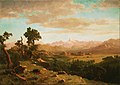
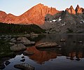
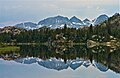
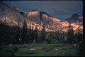
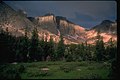
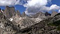
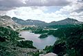
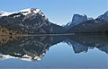
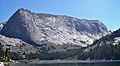
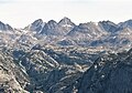
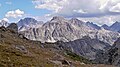
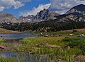
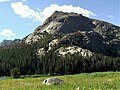
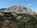
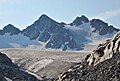
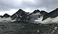
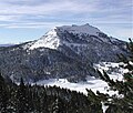
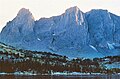
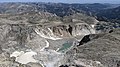
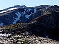
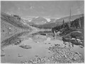
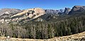
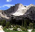
Wind River Range, a glaciated sub-range of the Rocky Mountains, Wyoming.
mountain range of the Rocky Mountains in western Wyoming in the United States  | |||||
| Upload media | |||||
| Instance of | |||||
|---|---|---|---|---|---|
| Location | Wyoming | ||||
| Width |
| ||||
| Length |
| ||||
| Mountain range | |||||
| Highest point | |||||
| Area |
| ||||
| Elevation above sea level |
| ||||
 | |||||
Subcategories
This category has the following 12 subcategories, out of 12 total.
A
C
- Cathedral Peak (Wyoming) (2 F)
F
- Fremont Peak (Wyoming) (13 F)
G
H
L
- Lizard Head Peak (1 F)
R
U
- Union Pass (Wyoming) (6 F)
- Union Peak (Wyoming) (2 F)
W
Pages in category "Wind River Range"
This category contains only the following page.
Media in category "Wind River Range"
The following 148 files are in this category, out of 148 total.
-
 Wpdms nasa topo wind river range.jpg 335 × 280; 30 KB
-
 2008 06 27 bos-sfo 12 (2617740292).jpg 2,336 × 3,504; 5.37 MB
-
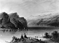
 Albert Bierstadt - Island Lake, Wind River Range, Wyoming.jpg 4,000 × 2,651; 6.27 MB
-
 Albert Bierstadt - The Rocky Mountains, Lander's Peak.jpg 3,789 × 2,269; 1.94 MB
-
 Albert Bierstadt - View from the Wind River Mountains, Wyoming.jpg 1,504 × 928; 417 KB
-
 Alfred Jacob Miller - Lake Scene - Wind River Mts - Walters 371940146.jpg 1,800 × 1,304; 1.3 MB
-
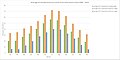 Avg temp air monthly TC1989-2016.jpg 1,087 × 541; 86 KB
-
 Avg yearly air temp TC1989-2016.jpg 1,088 × 542; 132 KB
-
 Bair Peak.jpg 2,375 × 1,763; 1.29 MB
-
 Albert Bierstadt - Wind River Country - Google Art Project.jpg 6,263 × 4,436; 9.45 MB
-
 Bollinger Peak.jpg 3,907 × 3,253; 2.51 MB
-
 Bonneville Basin Mount Bonneville.jpg 800 × 536; 218 KB
-
 Bow Mountain.jpg 2,856 × 1,867; 1.44 MB
-
 Cirque of the Towers - Wyoming.jpg 1,024 × 683; 774 KB
-
 Cirque of the Towers, Wind River Range (1229096839).jpg 1,536 × 1,024; 324 KB
-
 Cirque of the Towers, Wyoming.jpg 1,607 × 901; 502 KB
-
 Cirque of the Towers.jpg 1,400 × 930; 1.47 MB
-
 CirqueTowersWY.jpg 1,042 × 600; 106 KB
-
 Cook Lake Bridger Wilderness.jpg 750 × 510; 48 KB
-
 Crystal Blue (8572260258).jpg 14,677 × 3,776; 16.1 MB
-
 East from the Cirque (8557542551).jpg 4,769 × 2,234; 3.43 MB
-
 East Temple Peak.jpg 3,036 × 1,872; 1.32 MB
-
 Elk Grazing-Albert Bierstadt.jpg 420 × 256; 33 KB
-
 Flagstone Peak.jpg 1,596 × 890; 452 KB
-
 Fremont Peak (Wind River Range).jpg 2,000 × 3,021; 1,006 KB
-

-
 FremontPeak-WindRiverRange-WyomingUSA-DrDennisBogdan-1971.jpg 1,890 × 1,260; 494 KB
-
 FremontPeak2-WindRiverRange-WyomingUSA-DrDennisBogdan-1971.jpg 2,520 × 1,680; 1.05 MB
-
 FremontPeak3-WindRiverRange-WyomingUSA-DrDennisBogdan-1971.jpg 702 × 1,341; 163 KB
-
 Grave Lake and Mount Hooker Wyoming 1983 a.JPG 1,575 × 1,043; 1.08 MB
-
 Green River Basin geologic structure map.png 624 × 549; 206 KB
-
 Green River Lakes Reflection.jpg 2,516 × 1,612; 696 KB
-
 Green River Lakes, Bridger.jpg 2,675 × 1,383; 776 KB
-
 GreenLakesWY.jpg 890 × 600; 96 KB
-
 Harrower Peak.jpg 4,108 × 2,507; 2.47 MB
-
 Haystack Mountain, Steeple Peak, East Temple Peak.jpg 5,778 × 2,989; 4 MB
-
 Haystack Mountain, West face.jpg 2,813 × 1,537; 1.04 MB
-
 Haystack Mountain.jpg 1,780 × 1,332; 882 KB
-
 Haystack, East Temple, Temple Peak, Schiestler.jpg 4,050 × 1,414; 1.19 MB
-
 Henderson Peak.jpg 1,643 × 1,153; 703 KB
-
 High Rockies SRTM30.JPG 500 × 607; 64 KB
-
 Hobbs Peak.jpg 2,288 × 1,708; 839 KB
-
 ISS-31 Wild fires in the southwestern United States.jpg 4,288 × 2,848; 1.59 MB
-
 James Smillie - The Rocky Mountains, Lander's Peak.jpg 3,811 × 2,546; 3.11 MB
-
 Ladd Peak.jpg 1,691 × 949; 499 KB
-
 Le Tour du monde-06-p356.jpg 1,551 × 1,170; 799 KB
-
 Lizard Head Peak, Wyo.jpg 3,563 × 2,547; 2.67 MB
-
 Lizard Head Peak, Wyoming.jpg 2,258 × 1,424; 1.15 MB
-
 Mammoth Glacier.jpg 7,222 × 3,854; 20.1 MB
-
 Mitchell Peak, NW aspect.jpg 1,920 × 1,080; 946 KB
-
 Mitchell Peak, Wyoming.jpg 1,558 × 1,080; 428 KB
-
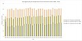
 Monthly precipitation TownsendCreek1980-2016.jpg 1,087 × 541; 65 KB
-
 Moon over Klondike Peak.jpg 1,600 × 1,200; 304 KB
-
 Mount Geikie, Wind River Range.jpg 1,835 × 1,187; 558 KB
-
 Mount Helen, WY.jpg 2,059 × 2,026; 917 KB
-
 Mount Lester, Wind River Range.jpg 4,493 × 2,603; 3.4 MB
-
 Mount Sacagawea WY.jpg 1,779 × 1,379; 1.05 MB
-
 Mount Sacagawea, Fremont Peak.jpg 5,760 × 3,842; 7.88 MB
-
 Mount Sacagawea, Wyoming.jpg 1,834 × 1,760; 1.07 MB
-
 Mount Warren, WY.jpg 1,457 × 1,059; 244 KB
-
 Mount Washakie.jpg 2,816 × 2,112; 963 KB
-
 Mount Whitecap and Ladd Peak.jpg 1,582 × 1,392; 530 KB
-
 Mount Woodrow Wilson, nw.jpg 2,220 × 1,300; 706 KB
-
 Mount Woodrow Wilson, Wyoming.jpg 2,828 × 1,926; 2.03 MB
-
 Mount Woodrow Wilson.jpg 2,457 × 1,637; 988 KB
-
 Mt. Bonneville, Bridger-Teton NF.jpg 2,026 × 1,488; 992 KB
-
 Overhanging Tower, Wyoming.jpg 1,611 × 940; 427 KB
-
 Payson Peak, Wind River Range.jpg 2,006 × 1,486; 834 KB
-
 Pingora Peak and Lonesome Lake.jpg 1,999 × 1,277; 472 KB
-
 Pingora Peak.jpg 1,277 × 1,999; 730 KB
-
 Popo Agie Wilderness Wind River Range.jpg 425 × 301; 31 KB
-
 Ranchlands.jpg 614 × 247; 162 KB
-

-

-
 Rig wind river.jpg 741 × 835; 298 KB
-
 Schiestler Peak in Wyoming.jpg 1,920 × 1,080; 1,003 KB
-
 Schiestler Peak, Wyoming.jpg 1,382 × 1,038; 482 KB
-
 Schiestler Peak.jpg 1,589 × 1,199; 809 KB
-
 Seedskadee nwr sunset.jpg 4,288 × 2,848; 6.53 MB
-
 Sharks Nose.jpg 2,127 × 1,986; 890 KB
-
 Slide Lake Bridger Wilderness.jpg 750 × 526; 82 KB
-
 Source of the Popo Agie, Wind River Mountains. Fremont County, Wyoming. - NARA - 516960.jpg 3,000 × 1,793; 1.02 MB
-
 Sourdough Glacier with Klondike Peak.jpg 1,799 × 1,032; 484 KB
-
 Spider Peak, Wyoming.jpg 3,497 × 3,107; 2.3 MB
-
 Spider Peak.jpg 3,216 × 4,288; 6.2 MB
-
 Split Mountain (Wyoming).jpg 3,903 × 2,419; 2.36 MB
-
 Squaretop Mountain blue sky.jpg 2,592 × 1,944; 1,003 KB
-
 Squaretop Mountain in WY.jpg 4,638 × 2,929; 4.9 MB
-
 Squaretop Mountain, WY.jpg 5,677 × 3,697; 7.46 MB
-
 Squaretop Mountain.jpg 5,661 × 3,827; 7.02 MB
-
 Squaretop.jpg 1,960 × 1,119; 660 KB
-
 Steeple Peak, East Temple Peak.jpg 2,110 × 1,435; 821 KB
-
 Steeple Peak, southwest aspect.jpg 2,223 × 2,703; 1.21 MB
-
 Sundance Pinnacle, Wyoming.jpg 1,920 × 1,080; 672 KB
-
 Temple Peak (12,977 feet).jpg 2,314 × 1,110; 655 KB
-
 Temple Peak and East Temple Peak.jpg 3,571 × 1,610; 1.83 MB
-
 The awakening of the desert (1912) (14591975130).jpg 2,768 × 1,472; 963 KB
-
 The Cirque of the Towers (8538787361).jpg 10,129 × 2,239; 17.74 MB
-

-
 TitcombLakesWY.jpg 977 × 600; 123 KB
-
 Torrey Peak, Wyoming.jpg 2,324 × 2,071; 1.27 MB
-
 Townsend yearly precipitation.jpg 1,088 × 542; 96 KB
-
 Twin Peaks and Mammoth Glacier.jpg 3,847 × 2,582; 1.71 MB
-
 Twin Peaks, Wyoming.jpg 1,878 × 1,101; 477 KB
-
 Two Ocean Mountain, Wyoming.jpg 1,359 × 1,160; 468 KB
-
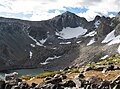
 Upper Fremont Glacier.jpg 712 × 478; 53 KB
-
 War Bonnet Peak.jpg 1,806 × 1,613; 794 KB
-
 Warrior Peaks.jpg 2,160 × 1,416; 1.36 MB
-
 Watch Tower, Block Tower, Sharks Nose, and Overhanging Tower.jpg 1,752 × 1,238; 461 KB
-
 Watch Tower, Block Tower, Sharks Nose, Overhanging Tower.jpg 2,385 × 1,436; 571 KB
-

-
 WhiskeyMountainWY FromS.JPG 4,000 × 3,000; 4.63 MB
-
 White Rock, Bridger Wilderness.jpg 2,472 × 1,753; 906 KB
-
 Wind River Glacier WY.jpg 3,840 × 2,160; 2.61 MB
-
 Wind River Mountains as Viewed from Seedskadee NWR (24415093942).jpg 4,288 × 2,214; 4.6 MB
-
 Wind River Mtn Range Wyoming Topo Rainbow Zebra 1326.png 4,898 × 3,891; 19.08 MB
-
 Wind River Mtn Range Wyoming Topo Rainbow Zebra 2142.png 4,898 × 3,891; 21.55 MB
-
 Wind River Peak 2010.jpg 4,000 × 3,000; 9.42 MB
-
 Wind River Peak Base.jpg 4,000 × 3,000; 4.97 MB
-
 Wind River Peak, Wyoming. A.D. Wilson in picture - NARA - 517694.jpg 3,000 × 2,279; 1.53 MB
-
 Wind River Peak, Wyoming. A.D. Wilson in picture - NARA - 517694.tif 3,000 × 2,279; 6.52 MB
-
 Wind River Peak. Fremont County, Wyoming - NARA - 517204.jpg 3,000 × 1,788; 1.4 MB
-
 Wind River Peak. Fremont County, Wyoming - NARA - 517204.tif 3,000 × 1,788; 5.12 MB
-
 Wind River Peak.JPG 3,872 × 2,592; 4.19 MB
-
 Wind River Range - Bridger Wilderness.jpg 4,649 × 2,242; 3.45 MB
-
 Wind River Range and Sagebrush Steppe (31668155805).jpg 5,312 × 2,988; 3.74 MB
-
 Wind River Range Gannett Peak Green River Basin Wy PICT0033 19941023.jpg 2,520 × 1,680; 2.18 MB
-
 Wind River Range July 2017 1.jpg 4,032 × 3,024; 4.03 MB
-
 Wind River Range July 2017 10.jpg 10,211 × 2,525; 16.48 MB
-
 Wind River Range July 2017 11.jpg 7,936 × 2,609; 15.87 MB
-
 Wind River Range July 2017 12.jpg 9,461 × 2,435; 18.32 MB
-
 Wind River Range July 2017 13.jpg 5,491 × 2,600; 10.54 MB
-
 Wind River Range July 2017 14.jpg 10,842 × 2,610; 20.28 MB
-
 Wind River Range July 2017 2.jpg 12,165 × 2,472; 26.54 MB
-
 Wind River Range July 2017 3.jpg 9,819 × 2,597; 22.95 MB
-
 Wind River Range July 2017 4.jpg 7,083 × 2,451; 15.7 MB
-
 Wind River Range July 2017 5.jpg 11,776 × 2,457; 22 MB
-
 Wind River Range July 2017 6.jpg 5,989 × 2,629; 13.1 MB
-
 Wind River Range July 2017 7.jpg 11,705 × 2,581; 20.71 MB
-
 Wind River Range July 2017 8.jpg 6,033 × 2,626; 11.12 MB
-
 Wind River Range July 2017 9.jpg 5,732 × 2,567; 10.02 MB
-
 Wind River Range.jpg 2,861 × 1,915; 1.97 MB
-
 Wind Rivers WY.JPG 1,632 × 1,232; 564 KB
-
 WindRiverRangeWY.jpg 938 × 600; 112 KB
-
 Wolfs Head, Cirque of the Towers.jpg 898 × 831; 272 KB
-
 Wyo Range 2017-09-27.jpg 7,417 × 2,477; 3.03 MB
-
 Wyoming New Fork Lakes.jpg 2,048 × 1,536; 1.71 MB
-
 Wyoming. Lake d'Amalia, Wind River Mountains-LCCN2008678243.jpg 7,415 × 5,621; 7.2 MB

.jpg)


.jpg)


.jpg)


.jpg)


_(14760686806).jpg)


.jpg)


.jpg)

_(14591975130).jpg)


.jpg)


.jpg)


.jpg)
.jpg)