Category:Wigginton, Hertfordshire
Jump to navigation
Jump to search
English: Wigginton (Wigentone - 1086) is a large village running north-south and perched at on the edge of the Chiltern Hills in the county of Hertfordshire and aside the border with Buckinghamshire. The nearest towns are Tring in Hertfordshire (1.5m NW) and across the other side of the A41, Chesham (6m S) and Wendover (6m W), both in Buckinghamshire.
village and civil parish in the Dacorum district in the county of Hertfordshire  | |||||
| Upload media | |||||
| Instance of | |||||
|---|---|---|---|---|---|
| Location | Dacorum, Hertfordshire, East of England, England | ||||
| Population |
| ||||
| Area |
| ||||
 | |||||
Subcategories
This category has the following 5 subcategories, out of 5 total.
B
R
Media in category "Wigginton, Hertfordshire"
The following 200 files are in this category, out of 206 total.
(previous page) (next page)-
 "Windbush" - geograph.org.uk - 154971.jpg 480 × 640; 86 KB
-
 2000 years of travel through the Gap - geograph.org.uk - 1284277.jpg 640 × 480; 157 KB
-
 58 Miles to Braunston - geograph.org.uk - 1448174.jpg 480 × 640; 242 KB
-
 A 4251 approaching Tring - geograph.org.uk - 2394784.jpg 1,600 × 1,200; 513 KB
-
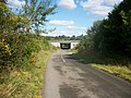
 A41 - Ridgeway footpath bridge - geograph.org.uk - 3010248.jpg 640 × 480; 75 KB
-
 A41 - Tring junction bridge - geograph.org.uk - 3010255.jpg 640 × 480; 68 KB
-
 A41 at Crawley's Lane bridge - geograph.org.uk - 3008826.jpg 640 × 480; 59 KB
-

-
 A41 Bridge over Crawley's Lane - geograph.org.uk - 3155113.jpg 4,000 × 3,000; 2.65 MB
-

-
 A41 near Tring - geograph.org.uk - 185609.jpg 640 × 480; 100 KB
-
 A41 near Tring - geograph.org.uk - 185615.jpg 640 × 480; 101 KB
-
 A41 panorama near New Ground - geograph.org.uk - 3008828.jpg 640 × 480; 49 KB
-
 A41 seen from the Ridgeway footpath bridge - geograph.org.uk - 2585094.jpg 3,648 × 2,736; 1.39 MB
-
 A41 west of the Ridgeway bridge - geograph.org.uk - 3010250.jpg 640 × 480; 69 KB
-
 A4251 (former A41) near Wiggington - geograph.org.uk - 5011474.jpg 640 × 480; 105 KB
-
 A4251 at Wigginton - geograph.org.uk - 2395122.jpg 1,600 × 1,200; 585 KB
-
 A4251 nearing Cow Lane - geograph.org.uk - 4871641.jpg 640 × 481; 81 KB
-
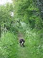 Along the Ridgeway path at Wigginton - geograph.org.uk - 1284117.jpg 480 × 640; 92 KB
-
 Angler on the summit - geograph.org.uk - 2154232.jpg 640 × 386; 192 KB
-
 At Cow Roast Lock - geograph.org.uk - 4979807.jpg 4,608 × 3,456; 4.33 MB
-
 Autorama, Cow Roast - geograph.org.uk - 5643117.jpg 2,048 × 1,536; 1.48 MB
-
 Beech Park - geograph.org.uk - 1992002.jpg 720 × 540; 115 KB
-
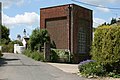 Believed to be pumping station - geograph.org.uk - 844454.jpg 640 × 427; 85 KB
-
 Bottom House Lane - geograph.org.uk - 3155125.jpg 4,000 × 3,000; 3 MB
-
 Bridle-footpath crossroads, Wigginton - geograph.org.uk - 28841.jpg 480 × 640; 186 KB
-
 Buildings at New Ground - geograph.org.uk - 2154221.jpg 640 × 310; 151 KB
-
 Bumble-bee on Great Bindweed (Calystegia sepium) - geograph.org.uk - 3049721.jpg 1,000 × 1,333; 856 KB
-

-
 Car breakers and Scrapyard - geograph.org.uk - 1991986.jpg 640 × 480; 75 KB
-
 Champneys - geograph.org.uk - 1986713.jpg 480 × 640; 106 KB
-
 Champneys - geograph.org.uk - 1986846.jpg 480 × 640; 66 KB
-
 Champneys - geograph.org.uk - 1986851.jpg 480 × 640; 100 KB
-
 Chesham Road approaching Wigginton Bottom - geograph.org.uk - 3155104.jpg 4,000 × 3,000; 2.75 MB
-
 Chesham Road by the entrance to Champney's - geograph.org.uk - 3948182.jpg 2,560 × 1,920; 2.03 MB
-
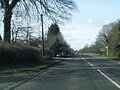
 Chesham Road in Wigginton - geograph.org.uk - 5282988.jpg 800 × 585; 169 KB
-
 Chesham Road, Heath End - geograph.org.uk - 3948730.jpg 2,560 × 1,920; 1.55 MB
-
 Chesham Road, Wigginton Bottom - geograph.org.uk - 3948729.jpg 2,560 × 1,920; 1.9 MB
-
 Chicane at entry to Wigginton - geograph.org.uk - 2403140.jpg 3,648 × 2,736; 3.65 MB
-
 Chiltern Way - geograph.org.uk - 1566875.jpg 640 × 480; 121 KB
-
 Chiltern Way - geograph.org.uk - 1566887.jpg 640 × 480; 85 KB
-
 Chiltern Way at Wigginton - geograph.org.uk - 2403408.jpg 3,648 × 2,736; 2.99 MB
-
 Closed pub on Tring Road, Cow Roast - geograph.org.uk - 5643325.jpg 2,048 × 1,536; 1.03 MB
-
 Cottages on Chesham Road, Heath End - geograph.org.uk - 3948206.jpg 2,560 × 1,920; 1.99 MB
-
 Countryside by A4251 at Wigginton - geograph.org.uk - 2395134.jpg 1,600 × 1,200; 538 KB
-
 Cow Roast inn, detail - geograph.org.uk - 5677837.jpg 5,202 × 3,465; 3.41 MB
-
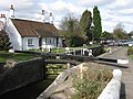
 Cow Roast Lock - geograph.org.uk - 109148.jpg 640 × 474; 127 KB
-
 Cow Roast Lock - geograph.org.uk - 4979806.jpg 4,608 × 3,456; 4.32 MB
-
 Cow Roast lock - geograph.org.uk - 5643327.jpg 2,048 × 1,536; 1.28 MB
-
 Cowroast (Summit) Lock 46 Grand Union Canal - geograph.org.uk - 3564374.jpg 2,081 × 1,408; 855 KB
-
 Cowroast Lock Cottage - geograph.org.uk - 4979814.jpg 4,608 × 3,456; 4.07 MB
-
 Crawley's Lane - geograph.org.uk - 1986704.jpg 480 × 640; 67 KB
-
 Crawley's Lane goes under the A41 - geograph.org.uk - 3001039.jpg 800 × 600; 133 KB
-
 Daffodils on the approach road to Tring - geograph.org.uk - 4869728.jpg 2,769 × 2,077; 1.68 MB
-
 Depot - geograph.org.uk - 4769194.jpg 640 × 426; 31 KB
-
 Entrance to Champneys - geograph.org.uk - 5282983.jpg 800 × 432; 120 KB
-
 Entrance to Wigginton - geograph.org.uk - 3844817.jpg 640 × 480; 93 KB
-
 Express train seen from canal bank - geograph.org.uk - 4157567.jpg 3,648 × 2,736; 2.4 MB
-
 Farmhouse, Wigginton Bottom - geograph.org.uk - 106766.jpg 640 × 480; 86 KB
-
 Field and trees - geograph.org.uk - 4014774.jpg 640 × 480; 120 KB
-
 Field of poppies - geograph.org.uk - 2459379.jpg 1,333 × 1,000; 1.31 MB
-
 Fields near Heath End - geograph.org.uk - 2362896.jpg 2,592 × 1,944; 1.55 MB
-
 Footbridge over the A41 - geograph.org.uk - 184047.jpg 640 × 480; 119 KB
-
 Footpath to Hill Green Farm - geograph.org.uk - 3547974.jpg 1,024 × 802; 202 KB
-
 Former KX300 Telephone Kiosk in Chesham Road, Wigginton - geograph.org.uk - 5325885.jpg 1,944 × 2,592; 972 KB
-
 Front of converted stables - geograph.org.uk - 2063761.jpg 2,160 × 1,604; 1,015 KB
-
 Garage on Tring Road, Cow Roast - geograph.org.uk - 5643326.jpg 2,048 × 1,536; 1.48 MB
-
 GOC Tring 010 Cattle (18036541648).jpg 3,840 × 2,887; 3.14 MB
-
 GOC Tring 016 Wigginton view (17601783864).jpg 4,288 × 3,216; 4.27 MB
-
 GOC Tring 019 Fox Road, Wigginton (17634121764).jpg 3,966 × 2,982; 3.34 MB
-
 GOC Tring 021 Ladderstile and Westwood Cottage, Wigginton (17634126404).jpg 4,288 × 3,216; 4.32 MB
-
 Grand Union canal above Cow Roast lock - geograph.org.uk - 5677842.jpg 5,202 × 3,465; 3.7 MB
-

-

-
 Grand Union Canal, Cow Roast Lock No 46 - geograph.org.uk - 1514928.jpg 640 × 480; 181 KB
-

-

-

-
 Grim's Ditch Path - geograph.org.uk - 188679.jpg 480 × 640; 112 KB
-
 Hemp Lane at the junction of Chesham Road, Wigginton - geograph.org.uk - 3948634.jpg 2,560 × 1,920; 2.01 MB
-
 Hemp Lane before Wigginton - geograph.org.uk - 3948632.jpg 2,560 × 1,920; 1.92 MB
-

-
 Hemp Lane bridge, A41 - geograph.org.uk - 3008837.jpg 640 × 480; 78 KB
-
 Hemp Lane in Wigginton - geograph.org.uk - 5284064.jpg 800 × 592; 187 KB
-
 Hemp Lane towards the A41 flyover - geograph.org.uk - 3001030.jpg 800 × 600; 94 KB
-
 Hemp Lane, near Wigginton, looking East - geograph.org.uk - 106843.jpg 640 × 480; 153 KB
-
 Hemp Lane, Wigginton - geograph.org.uk - 3948156.jpg 2,560 × 1,920; 2.02 MB
-
 Hemp Lane, Wigginton - geograph.org.uk - 3948728.jpg 2,560 × 1,920; 1.94 MB
-
 High Ridgeway Bridge - geograph.org.uk - 3049700.jpg 1,333 × 1,000; 1.25 MB
-
 Highfield Road - geograph.org.uk - 1986666.jpg 480 × 640; 105 KB
-
 Horse shelter - geograph.org.uk - 3995543.jpg 640 × 428; 98 KB
-
 Horseblock Lane - geograph.org.uk - 3137510.jpg 4,000 × 3,000; 3.16 MB
-
 Horseblock Lane - geograph.org.uk - 3844823.jpg 640 × 480; 99 KB
-
 Horseblock Lane - geograph.org.uk - 4014796.jpg 640 × 480; 169 KB
-
 House near Tinkers lane - geograph.org.uk - 130825.jpg 475 × 640; 64 KB
-
 House on A4251 at Wigginton - geograph.org.uk - 2395129.jpg 1,600 × 1,200; 579 KB
-
 Junction on road to Wiggington - geograph.org.uk - 4014752.jpg 640 × 480; 86 KB
-
 Keepers Lodge - geograph.org.uk - 3995558.jpg 640 × 480; 115 KB
-
 Lane at Chesham Lodge - geograph.org.uk - 5282979.jpg 800 × 547; 139 KB
-

-
-
 Lay-by on the northbound A41 - geograph.org.uk - 3008824.jpg 640 × 480; 72 KB
-
 Layby on the A41, Wigginton - geograph.org.uk - 6179667.jpg 1,872 × 1,204; 1.42 MB
-
 Lock at Cow Roast, Grand Union Canal - geograph.org.uk - 649057.jpg 640 × 480; 92 KB
-

-
 Looking south along Shootersway - geograph.org.uk - 3001048.jpg 800 × 600; 204 KB
-
 Looking south down Bottom House Lane - geograph.org.uk - 3001033.jpg 800 × 600; 113 KB
-
 Meadow near Wigginton - geograph.org.uk - 184050.jpg 640 × 480; 79 KB
-
 Milestone 58 - geograph.org.uk - 4797567.jpg 4,000 × 3,000; 2.24 MB
-
 Muddy lanes, Wigginton Bottom - geograph.org.uk - 106845.jpg 640 × 480; 131 KB
-
 New Ground Bridge, near Tring - geograph.org.uk - 106774.jpg 640 × 480; 135 KB
-
 New Ground Farm - geograph.org.uk - 4348661.jpg 640 × 375; 40 KB
-
 New Ground Farm from Grand Union Canal towing path - geograph.org.uk - 5677845.jpg 5,202 × 3,465; 3.51 MB
-
 North side of St Bartholomew, Wigginton - geograph.org.uk - 5687129.jpg 640 × 480; 106 KB
-
 OS Triangulation Pillar at Wigginton - geograph.org.uk - 185093.jpg 640 × 480; 127 KB
-
 Ox eye daisy - geograph.org.uk - 184085.jpg 640 × 480; 80 KB
-
 Pond at T junction - geograph.org.uk - 2006830.jpg 3,648 × 2,736; 5.22 MB
-
 Poppies near Keeper's Lodge, Tring - geograph.org.uk - 2459396.jpg 1,474 × 1,000; 1.33 MB
-
 Pyramid orchid at Dunsley roundabaout - geograph.org.uk - 4553313.jpg 640 × 480; 138 KB
-
 Rear of cottages at Heath End - geograph.org.uk - 1998713.jpg 1,440 × 897; 446 KB
-
 Ridgeway by Langton Wood - geograph.org.uk - 575970.jpg 640 × 480; 114 KB
-
 Ridgeway natural tunnel - geograph.org.uk - 3052079.jpg 1,000 × 1,333; 1.5 MB
-
 Ridgeway over the A41 - geograph.org.uk - 575960.jpg 640 × 480; 89 KB
-
 Road junction near Newsetts Wood - geograph.org.uk - 130822.jpg 640 × 480; 94 KB
-
 Rossway Home Farm - geograph.org.uk - 2063774.jpg 1,860 × 1,372; 451 KB
-
 Rossway Lane, south of Tinker's Lodge - geograph.org.uk - 130819.jpg 480 × 640; 114 KB
-
 Rossway Stable Block - geograph.org.uk - 2063755.jpg 2,160 × 1,594; 1.07 MB
-
 Roundabout at junction of A4251 and A41, Tring - geograph.org.uk - 2394797.jpg 1,600 × 1,200; 539 KB
-
 Roundabout for the new A41, Tring - geograph.org.uk - 5639581.jpg 2,048 × 1,536; 1.26 MB
-
 Roundabout on A41, Tring - geograph.org.uk - 2395285.jpg 1,600 × 1,175; 176 KB
-
 Slow going north of Hemp Lane - geograph.org.uk - 3010245.jpg 640 × 480; 82 KB
-
 Snowdrop bedecked verge - geograph.org.uk - 130828.jpg 640 × 480; 147 KB
-

-
 St Bartholomew's, Wigginton from The Twist - geograph.org.uk - 4310417.jpg 1,318 × 1,000; 1.5 MB
-
 St Bartholomew, Wigginton - Chancel - geograph.org.uk - 5055083.jpg 1,000 × 667; 338 KB
-
 St Bartholomew, Wigginton - Corbel - geograph.org.uk - 5055137.jpg 858 × 1,000; 281 KB
-
 St Bartholomew, Wigginton - Corbel - geograph.org.uk - 5055140.jpg 704 × 1,000; 293 KB
-
 St Bartholomew, Wigginton - Corbel - geograph.org.uk - 5055143.jpg 892 × 1,000; 312 KB
-
 St Bartholomew, Wigginton - East end - geograph.org.uk - 5055075.jpg 1,000 × 698; 326 KB
-
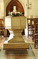 St Bartholomew, Wigginton - Font - geograph.org.uk - 5055103.jpg 655 × 1,000; 296 KB
-
 St Bartholomew, Wigginton - geograph.org.uk - 5055070.jpg 1,000 × 672; 321 KB
-
 St Bartholomew, Wigginton - geograph.org.uk - 5687131.jpg 640 × 480; 92 KB
-
 St Bartholomew, Wigginton - geograph.org.uk - 5687136.jpg 640 × 480; 102 KB
-
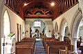
 St Bartholomew, Wigginton - North arcade - geograph.org.uk - 5055079.jpg 1,000 × 645; 302 KB
-
 St Bartholomew, Wigginton - Opus sectile - geograph.org.uk - 5055147.jpg 891 × 1,000; 497 KB
-
 St Bartholomew, Wigginton - Opus sectile - geograph.org.uk - 5055148.jpg 972 × 1,000; 556 KB
-
 St Bartholomew, Wigginton - Organ - geograph.org.uk - 5055152.jpg 644 × 1,000; 359 KB
-
 St Bartholomew, Wigginton - Organ - geograph.org.uk - 5055156.jpg 1,000 × 651; 376 KB
-
 St Bartholomew, Wigginton - Organ - geograph.org.uk - 5055157.jpg 667 × 1,000; 382 KB
-
 St Bartholomew, Wigginton - Pulpit - geograph.org.uk - 5055159.jpg 705 × 1,000; 228 KB
-
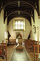
 St Bartholomew, Wigginton - Sanctuary - geograph.org.uk - 5055088.jpg 1,000 × 667; 323 KB
-
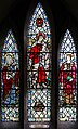
 St Bartholomew, Wigginton - Stained glass window - geograph.org.uk - 5055105.jpg 995 × 1,000; 644 KB
-
 St Bartholomew, Wigginton - Stained glass window - geograph.org.uk - 5055108.jpg 558 × 1,000; 447 KB
-
 St Bartholomew, Wigginton - Stained glass window - geograph.org.uk - 5055110.jpg 496 × 1,000; 389 KB
-
 St Bartholomew, Wigginton - Stained glass window - geograph.org.uk - 5055111.jpg 603 × 1,000; 397 KB
-
 St Bartholomew, Wigginton - Stained glass window - geograph.org.uk - 5055114.jpg 516 × 1,000; 294 KB
-
 St Bartholomew, Wigginton - Stained glass window - geograph.org.uk - 5055117.jpg 472 × 1,000; 267 KB
-
 St Bartholomew, Wigginton - Stained glass window - geograph.org.uk - 5055119.jpg 476 × 1,000; 323 KB
-
 St Bartholomew, Wigginton - Stained glass window - geograph.org.uk - 5055123.jpg 526 × 1,000; 310 KB
-
 St Bartholomew, Wigginton - Stained glass window - geograph.org.uk - 5055125.jpg 496 × 1,000; 252 KB
-
 St Bartholomew, Wigginton - Stained glass window - geograph.org.uk - 5055129.jpg 780 × 1,000; 489 KB
-
 St Bartholomew, Wigginton - Stained glass window - geograph.org.uk - 5055133.jpg 642 × 1,000; 496 KB
-
 St Bartholomew, Wigginton - Stained glass window - geograph.org.uk - 5055134.jpg 656 × 1,000; 504 KB
-
 St Bartholomew, Wigginton - West end - geograph.org.uk - 5055091.jpg 1,000 × 720; 341 KB
-
 St Bartholomew, Wigginton - West end - geograph.org.uk - 5055093.jpg 1,000 × 651; 310 KB
-
 St Bartholomew, Wigginton - West end - geograph.org.uk - 5055097.jpg 668 × 1,000; 278 KB
-

-

-

-
 St Bartholomews Church in Wigginton - geograph.org.uk - 5284057.jpg 800 × 586; 136 KB
-
 Straight ahead on the A41 - geograph.org.uk - 3010256.jpg 640 × 480; 67 KB
-
 Strong shadows on The Ridgeway - geograph.org.uk - 4310421.jpg 1,000 × 1,333; 1.56 MB
-
 Sweeping fields near Wigginton - geograph.org.uk - 130816.jpg 640 × 480; 66 KB
-
 The A41 towards Tring - geograph.org.uk - 5284073.jpg 800 × 562; 112 KB
-
 The A4251 approaching Tring - geograph.org.uk - 2394788.jpg 1,600 × 1,200; 513 KB
-
 The Cow Roast Inn, Tring Road - geograph.org.uk - 5677836.jpg 5,202 × 3,465; 2.81 MB
-
 The Grand Union Canal, Cow Roast - geograph.org.uk - 5643328.jpg 1,960 × 1,412; 831 KB
-
 The Greyhound Public House, Wigginton - geograph.org.uk - 4952608.jpg 3,571 × 2,678; 2.46 MB
-
 The old A41, Cow Roast - geograph.org.uk - 5643116.jpg 2,048 × 1,536; 948 KB
-
 The Ridgeway - geograph.org.uk - 4730176.jpg 640 × 480; 50 KB
-
 The Ridgeway - geograph.org.uk - 4730179.jpg 640 × 480; 102 KB
-
 The Ridgeway - geograph.org.uk - 4730181.jpg 640 × 480; 88 KB
-
 The Ridgeway Footbridge over the A41 - geograph.org.uk - 1281205.jpg 640 × 384; 121 KB
-
 The Ridgeway near Wigginton - geograph.org.uk - 184038.jpg 480 × 640; 214 KB
-
 The Ridgeway off The Twist - geograph.org.uk - 999654.jpg 480 × 640; 202 KB
-
 The Ridgeway path climbs the hill - geograph.org.uk - 1284248.jpg 640 × 480; 44 KB
-
 Trig pillar near Langton Wood north of Wigginton - geograph.org.uk - 3050812.jpg 1,000 × 1,333; 1.57 MB
-
 Tring down empties geograph-2764834-by-Ben-Brooksbank.jpg 2,340 × 1,381; 2.22 MB
-
 Tring down stopping train from Euston geograph-2811176-by-Ben-Brooksbank.jpg 2,391 × 1,452; 1.22 MB
-
 Tring Lodge, Rossway - geograph.org.uk - 154963.jpg 640 × 480; 91 KB
-
 Tring number 10000 geograph-2388354-by-Ben-Brooksbank.jpg 2,394 × 1,450; 1,009 KB
-
 Valley with cornfield - geograph.org.uk - 1998659.jpg 1,080 × 810; 265 KB
-
 View down to Cow Roast - geograph.org.uk - 2007021.jpg 2,048 × 1,536; 1.45 MB
-
 View from Icknield Way over A41 - geograph.org.uk - 2877591.jpg 500 × 333; 99 KB
-
 View from the Ridgeway High Bridge - geograph.org.uk - 3049703.jpg 1,000 × 1,333; 1.17 MB
-
 View over the A41 - geograph.org.uk - 2613331.jpg 3,010 × 2,036; 4.63 MB
-
 View over Tring rugby pitches to Pitstone Hill - geograph.org.uk - 3050798.jpg 1,333 × 1,000; 1.15 MB
-
 Wick Lane at the junction of Chesham Road - geograph.org.uk - 3948170.jpg 2,560 × 1,920; 1.99 MB
-
 Wigginton Bottom - geograph.org.uk - 106751.jpg 640 × 480; 79 KB
-
 Wigginton Bottom in Summer - geograph.org.uk - 188678.jpg 640 × 480; 111 KB


_motorway_-_geograph.org.uk_-_3010254.jpg)


_near_Wiggington_-_geograph.org.uk_-_5011474.jpg)


_-_geograph.org.uk_-_3049721.jpg)


_Lock_46_Grand_Union_Canal_-_geograph.org.uk_-_3564374.jpg)


.jpg)
.jpg)
.jpg)
.jpg)


