Category:Widworthy
Jump to navigation
Jump to search
village and civil parish in East Devon, Devon, England  | |||||
| Upload media | |||||
| Instance of | |||||
|---|---|---|---|---|---|
| Location | East Devon, Devon, South West England, England | ||||
| Population |
| ||||
| Area |
| ||||
 | |||||
Subcategories
This category has the following 3 subcategories, out of 3 total.
Media in category "Widworthy"
The following 130 files are in this category, out of 130 total.
-
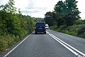
 A35 - geograph.org.uk - 3040744.jpg 640 × 373; 67 KB
-
 A35 approaching "The Belt", Widworthy Park - geograph.org.uk - 3252230.jpg 1,024 × 768; 588 KB
-
 A35 east of Wilmington - geograph.org.uk - 3251996.jpg 1,024 × 768; 505 KB
-
 A35 towards Axminster - geograph.org.uk - 6263633.jpg 1,024 × 684; 347 KB
-
 A35 towards Axminster - geograph.org.uk - 6263664.jpg 1,024 × 684; 267 KB
-
 A35 towards Axminster - geograph.org.uk - 6263669.jpg 1,024 × 684; 277 KB
-
 A35 towards Axminster - geograph.org.uk - 6263675.jpg 1,024 × 684; 265 KB
-

-
 Barn near Greenfields - geograph.org.uk - 443447.jpg 640 × 480; 79 KB
-
 Barns at Cookshayes Farm - geograph.org.uk - 4428928.jpg 1,600 × 1,200; 1.56 MB
-
 Bend, A35 - geograph.org.uk - 3040739.jpg 640 × 430; 88 KB
-
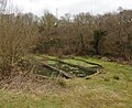
 Bridleway to the former Sutton Quarries - geograph.org.uk - 4428902.jpg 1,600 × 1,200; 1.42 MB
-
 Castle Hill, Widworthy - geograph.org.uk - 4428800.jpg 1,600 × 1,200; 1.55 MB
-
 Castle Hill, Widworthy - geograph.org.uk - 4428805.jpg 1,600 × 1,200; 1.56 MB
-
 Cattle on Widworthy Hill - geograph.org.uk - 3106187.jpg 640 × 455; 74 KB
-
 Colyton Cross - geograph.org.uk - 3105181.jpg 640 × 471; 98 KB
-
 Colyton Cross - geograph.org.uk - 3105334.jpg 640 × 480; 96 KB
-
 Duncroft Plantation and valley of Offwell Brook - geograph.org.uk - 4428925.jpg 1,600 × 1,200; 1.32 MB
-
 Entrance to Parehayne - geograph.org.uk - 3108766.jpg 640 × 480; 104 KB
-
 Farm building at Widworthy - geograph.org.uk - 4991037.jpg 1,024 × 768; 143 KB
-
 Farm Buildings at Three Ways - geograph.org.uk - 6222398.jpg 640 × 427; 102 KB
-
 Field access track, Widworthy Hill - geograph.org.uk - 3106587.jpg 640 × 460; 76 KB
-
 Field at Halshayne - geograph.org.uk - 443554.jpg 640 × 480; 85 KB
-
 Fields and woods in Widworthy Park - geograph.org.uk - 4428795.jpg 1,600 × 1,200; 1.47 MB
-
 Footbridge over Offwell Brook - geograph.org.uk - 4429148.jpg 1,600 × 1,200; 1.86 MB
-
 Footpath from Castle Hill into Wilmington (2) - geograph.org.uk - 4428792.jpg 1,600 × 1,200; 1.61 MB
-
 Footpath from Wilmington to Castle Hill - geograph.org.uk - 4428779.jpg 1,200 × 1,600; 1.51 MB
-
 Footpath into Wilmington from Castle Hill (1) - geograph.org.uk - 4428787.jpg 1,600 × 1,200; 1.69 MB
-
 Ford and footbridge over Offwell Brook - geograph.org.uk - 4429141.jpg 1,600 × 1,200; 2.1 MB
-
 Ford on Offwell Brook - geograph.org.uk - 5714225.jpg 1,024 × 748; 295 KB
-
 Ford over Offwell Brook near Smallicombe Farm - geograph.org.uk - 2909148.jpg 1,024 × 768; 298 KB
-
 Graveyard at St Cuthbert's church, Widworthy - geograph.org.uk - 5714043.jpg 1,024 × 768; 206 KB
-
 Green field at Greenfields - geograph.org.uk - 441581.jpg 640 × 480; 94 KB
-
 Halshayne - geograph.org.uk - 443476.jpg 640 × 480; 110 KB
-
 Halshayne Manor Farm - geograph.org.uk - 5714046.jpg 1,024 × 768; 273 KB
-
 Halshayne Manor Farm - geograph.org.uk - 5714190.jpg 1,024 × 768; 201 KB
-
 Herding sheep at Slade Farm - geograph.org.uk - 2909084.jpg 640 × 480; 117 KB
-
 Homebush Cross - geograph.org.uk - 3106956.jpg 480 × 640; 109 KB
-
 Homebush Cross - geograph.org.uk - 5887878.jpg 1,024 × 768; 310 KB
-
 Homebush Cross at the road split in Homebush Wood - geograph.org.uk - 4530794.jpg 3,456 × 4,608; 6.15 MB
-
 Houses set well back from A35, Wilmington - geograph.org.uk - 4428775.jpg 1,600 × 1,200; 1.38 MB
-
 Houses Wilmington - geograph.org.uk - 4604479.jpg 640 × 428; 64 KB
-
 Lane at Widworthy - geograph.org.uk - 445620.jpg 640 × 480; 122 KB
-
 Lane past Greenfields - geograph.org.uk - 443459.jpg 640 × 480; 113 KB
-
 Lane through the woods - geograph.org.uk - 443443.jpg 480 × 640; 128 KB
-
 Lane to Widworthy - geograph.org.uk - 443423.jpg 640 × 480; 165 KB
-
 Lych gate at St Cuthbert's Church - geograph.org.uk - 4991028.jpg 1,024 × 768; 257 KB
-
 Magnolia in bloom at Slade - geograph.org.uk - 4428915.jpg 1,600 × 1,200; 1.6 MB
-
 Maize Field at Stockers Farm - geograph.org.uk - 6222427.jpg 640 × 427; 96 KB
-
 Maize on Widworthy Hill - geograph.org.uk - 3106302.jpg 640 × 420; 93 KB
-
 Maize on Widworthy Hill - geograph.org.uk - 3106402.jpg 640 × 444; 99 KB
-
 Maize, Widworthy Park - geograph.org.uk - 3105680.jpg 480 × 640; 88 KB
-
 Maize, Widworthy Park - geograph.org.uk - 3106382.jpg 640 × 432; 103 KB
-
 Marsh Copse - geograph.org.uk - 443437.jpg 480 × 640; 143 KB
-
 Moisture-loving plants and reeds by the Offwell Brook - geograph.org.uk - 4429164.jpg 1,600 × 1,200; 1.95 MB
-
 New Road - geograph.org.uk - 3106167.jpg 640 × 480; 94 KB
-
 New Road Cross - geograph.org.uk - 3105840.jpg 640 × 480; 105 KB
-
 New Road Cross, Widworthy - geograph.org.uk - 4428857.jpg 1,600 × 1,200; 1.8 MB
-
 New Road, Widworthy - geograph.org.uk - 4428808.jpg 1,600 × 1,200; 1.71 MB
-
 Old stone buildings at Cookshayes Farm - geograph.org.uk - 4428930.jpg 1,600 × 1,200; 1.69 MB
-
 Old Telephone Exchange Wilmington - geograph.org.uk - 4604471.jpg 640 × 428; 54 KB
-
 On Widworthy Hill - geograph.org.uk - 3106752.jpg 640 × 419; 70 KB
-
 Orchard at the southern end of Sutton Barton - geograph.org.uk - 4428908.jpg 1,600 × 1,200; 1.54 MB
-
 Outbuildings at Lucehayne - geograph.org.uk - 5714205.jpg 1,024 × 768; 162 KB
-
 Outbuildings at Slade Farm - geograph.org.uk - 5714223.jpg 1,024 × 788; 162 KB
-
 Outbuildings at Sutton Barton - geograph.org.uk - 5714219.jpg 1,024 × 805; 171 KB
-
 Outbuildings at Sutton Barton - geograph.org.uk - 5714222.jpg 1,024 × 768; 114 KB
-
 Parehayne Hill - geograph.org.uk - 3108750.jpg 640 × 480; 112 KB
-
 Parehayne Woods - geograph.org.uk - 5273793.jpg 1,024 × 768; 315 KB
-
 Pond at Wilmington Trout Farm - geograph.org.uk - 5713718.jpg 1,024 × 840; 264 KB
-
 Redundant gate near Sutton Tip - geograph.org.uk - 4428868.jpg 1,600 × 1,200; 1.53 MB
-
 Reservoir at New Road Cross, Widworthy - geograph.org.uk - 4428854.jpg 1,600 × 1,067; 419 KB
-
 Road along the valley side to Stockers Farm - geograph.org.uk - 4428932.jpg 1,600 × 1,200; 1.6 MB
-
 Road by Home Bush - geograph.org.uk - 3106799.jpg 640 × 480; 154 KB
-
 Road junction at New Road Cross - geograph.org.uk - 4530790.jpg 4,608 × 3,456; 3.99 MB
-
 Road Junction on Widworthy Hill - geograph.org.uk - 6220355.jpg 640 × 427; 82 KB
-
 Road near Widworthy - geograph.org.uk - 3105820.jpg 640 × 480; 94 KB
-
 Road on Widworthy Hill - geograph.org.uk - 3106563.jpg 640 × 480; 100 KB
-
 Road on Widworthy Hill - geograph.org.uk - 3106701.jpg 640 × 480; 84 KB
-
 Road on Widworthy Hill - geograph.org.uk - 3106718.jpg 640 × 480; 123 KB
-
 Road past Widworthy Park - geograph.org.uk - 3105560.jpg 480 × 640; 129 KB
-
 Road past Widworthy Park - geograph.org.uk - 3105818.jpg 640 × 459; 80 KB
-
 Road past Widworthy recycling centre - geograph.org.uk - 3105662.jpg 640 × 477; 88 KB
-
 Road past Widworthy recycling centre - geograph.org.uk - 3105748.jpg 640 × 410; 60 KB
-
 Road Through Mountain Copse - geograph.org.uk - 6220339.jpg 640 × 427; 130 KB
-
 Road to Sutton Thorn - geograph.org.uk - 3105819.jpg 640 × 480; 82 KB
-
 Road to Sutton Thorn - geograph.org.uk - 3106502.jpg 480 × 640; 110 KB
-
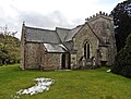 St Cuthbert's church, Widworthy - geograph.org.uk - 5714038.jpg 1,024 × 778; 213 KB
-
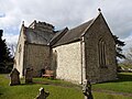 St Cuthbert's church, Widworthy - geograph.org.uk - 5714041.jpg 1,024 × 768; 178 KB
-
 Stockers Farm - geograph.org.uk - 6222432.jpg 640 × 427; 82 KB
-
 Stoneyhouse Lane - geograph.org.uk - 3106530.jpg 640 × 480; 124 KB
-
 Stoneyhouse Lane, Sutton Barton - geograph.org.uk - 4428899.jpg 1,200 × 1,600; 1.8 MB
-
 Sutton Barton - geograph.org.uk - 5714218.jpg 1,024 × 768; 185 KB
-
 Sutton Barton - geograph.org.uk - 6221113.jpg 640 × 427; 78 KB
-
 Sutton Barton Farm. - geograph.org.uk - 6221156.jpg 640 × 427; 66 KB
-

-
 Sutton Barton, south of Widworthy - geograph.org.uk - 4428896.jpg 1,600 × 1,200; 1.61 MB
-
 Suttons Cross - geograph.org.uk - 3105824.jpg 640 × 480; 107 KB
-
 Suttons Cross - geograph.org.uk - 3105836.jpg 640 × 460; 90 KB
-
 Suttons Cross - geograph.org.uk - 5714215.jpg 1,024 × 768; 303 KB
-
 Suttonthorn Covert - geograph.org.uk - 3106820.jpg 480 × 640; 107 KB
-
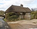 Thatched cottage, Widworthy - geograph.org.uk - 5714210.jpg 1,024 × 800; 206 KB
-
 The A35 at Wilmington Bridge - geograph.org.uk - 6220336.jpg 640 × 427; 83 KB
-
 The Offwell valley - geograph.org.uk - 2909158.jpg 1,024 × 768; 234 KB
-
 The road through Slade - geograph.org.uk - 4428910.jpg 1,600 × 1,200; 1.69 MB
-
 The road to Colyton through Sutton Thorn - geograph.org.uk - 4530796.jpg 4,608 × 3,456; 5.12 MB
-
 The valley of the Offwell Brook - geograph.org.uk - 4428913.jpg 1,600 × 1,200; 1.39 MB
-
 The valley of the Offwell Brook - geograph.org.uk - 4428937.jpg 1,600 × 1,200; 1.72 MB
-
 The White Hart, Wilmington - geograph.org.uk - 5735338.jpg 1,024 × 768; 166 KB
-
 Tiny stream at Slade - geograph.org.uk - 4428919.jpg 1,600 × 1,200; 2.11 MB
-
 Track into Widworthy Park - geograph.org.uk - 4428875.jpg 1,600 × 1,200; 1.76 MB
-
 Track through wood near New Road Cross - geograph.org.uk - 4428864.jpg 1,200 × 1,600; 1.98 MB
-
 Track to Greenfields - geograph.org.uk - 5714199.jpg 1,024 × 768; 312 KB
-
 Track to Greenfields Court - geograph.org.uk - 6220343.jpg 640 × 427; 111 KB
-
 Track to Rull House - geograph.org.uk - 6222403.jpg 640 × 427; 118 KB
-
 Tree at Blamphayne Cross - geograph.org.uk - 4428939.jpg 1,200 × 1,600; 1.72 MB
-
 Triffords Farm - geograph.org.uk - 1586423.jpg 640 × 480; 112 KB
-
 Turning for Offwell - geograph.org.uk - 5714213.jpg 1,024 × 768; 234 KB
-
 Widworthy Court - geograph.org.uk - 4428813.jpg 1,600 × 1,200; 1.51 MB
-
 Widworthy Hill - geograph.org.uk - 3106766.jpg 640 × 396; 54 KB
-

-
 Widworthy, by Homebush Cross - geograph.org.uk - 290355.jpg 427 × 640; 307 KB
-
 Widworthy, Homebush Cross - geograph.org.uk - 290344.jpg 640 × 427; 266 KB
-
 Widworthy, near Widworthy Hill - geograph.org.uk - 290351.jpg 640 × 427; 264 KB
-
 Wilmington Trout Farm - geograph.org.uk - 5713710.jpg 1,024 × 768; 266 KB
-
 Wilmington Water Treatment Works - geograph.org.uk - 5714022.jpg 1,024 × 768; 174 KB
-
 Woodland and road to Suttons Cross - geograph.org.uk - 4428866.jpg 1,200 × 1,600; 1.89 MB
-
 Woodland at Suttons Cross - geograph.org.uk - 4428881.jpg 1,600 × 1,200; 2.08 MB
-
 Woodland on the boundary of Widworthy Park - geograph.org.uk - 4428870.jpg 1,600 × 1,200; 1.67 MB
-
 Yardbury Hill Road - geograph.org.uk - 3108771.jpg 480 × 640; 124 KB


_-_geograph.org.uk_-_4428792.jpg)

_-_geograph.org.uk_-_4428787.jpg)


