Category:Whittier Narrows
Jump to navigation
Jump to search
narrow of water between Puente Hills and Montebello Hills flowing into Los Angeles Basin.  | |||||
| Upload media | |||||
| Instance of | |||||
|---|---|---|---|---|---|
| Location | California, Pacific States Region | ||||
| Mountain range | |||||
| Elevation above sea level |
| ||||
 | |||||
Subcategories
This category has the following 2 subcategories, out of 2 total.
1
D
Media in category "Whittier Narrows"
The following 71 files are in this category, out of 71 total.
-
 01 Whittier Narrows Recreation Area, South El Monte.jpg 800 × 600; 305 KB
-
 02 A Lake Near The Entrance Of Whittier Narrows Park.jpg 800 × 600; 267 KB
-
 03 Poor One-legged Lame Duck.jpg 800 × 600; 302 KB
-
 04 Brown Ducks (1).jpg 800 × 600; 286 KB
-
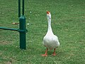
 05 White Geese (1).jpg 800 × 600; 272 KB
-
 06 Brown Ducks (2).jpg 800 × 600; 276 KB
-
 07 White Geese (2).jpg 800 × 600; 276 KB
-
 08 White Geese (3).jpg 800 × 600; 302 KB
-
 09 White Geese (4).jpg 800 × 600; 315 KB
-
 10 White Geese (5) - Everywhere In The Park.jpg 800 × 600; 280 KB
-
 11 Pigeons See Here Their Feeding Place, Too.jpg 800 × 600; 332 KB
-
 12 Feeding Banned Due To Overpopulation.jpg 800 × 600; 320 KB
-
 13 Brown Goose.jpg 800 × 600; 297 KB
-
 14 White Geese (6) - Sleeping.jpg 800 × 600; 301 KB
-
 15 Angler On Lakeside.jpg 800 × 600; 226 KB
-
 16 Brown Ducks (3) - Tidying Itself Up.jpg 800 × 600; 269 KB
-
 17 Brown Ducks (4) - Job Done! How Do I Look.jpg 800 × 600; 276 KB
-
 18 Fishie In The Shallow Water.jpg 800 × 600; 291 KB
-
 19 Breath Holding Contest Between Duck & Goose (1).jpg 800 × 600; 269 KB
-
 20 Breath Holding Contest Between Duck & Goose (2).jpg 800 × 600; 262 KB
-
 21 Brown Ducks (5) - Ducklings Led By Mom.jpg 800 × 600; 212 KB
-
 22 A View Of The Lake Near Park Entrance.jpg 1,600 × 1,200; 905 KB
-
 23 A Small Birdie Roaming Along Lakeside.jpg 800 × 600; 280 KB
-
 24 Geese Approaching Shore As They Saw Park Visitors Restart Feeding.jpg 800 × 600; 268 KB
-
 25 A Show Of The Big Face.jpg 800 × 600; 231 KB
-
 26 Even Bigger.jpg 800 × 600; 309 KB
-
 27 I'm Big-headed, Too!.jpg 800 × 600; 282 KB
-
 28 I'm The King! Ha!.jpg 800 × 600; 289 KB
-
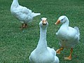
 29 All Geese Racing Toward Feeders.jpg 800 × 600; 283 KB
-
 30 Brown Ducks (6) - 4 Ducklings.jpg 800 × 600; 223 KB
-
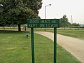 31 Dogs Must Be Kept On Leash.jpg 800 × 600; 260 KB
-
 32 Lots Of Goose Feathers On Grass.jpg 800 × 600; 253 KB
-
 33 White Geese (7) - A Cocky One.jpg 800 × 600; 273 KB
-
 34 White Geese (8) - Front Shot.jpg 800 × 600; 248 KB
-
 35 Soprano.jpg 800 × 600; 271 KB
-
 36 Proud Residents Of This Park.jpg 800 × 600; 290 KB
-
 37 3 Fellows.jpg 800 × 600; 287 KB
-
 38 Model Boat Regulations @ Legg Lake. Long Gone By Year 2021.jpg 800 × 600; 248 KB
-
 39 Overturned Radio Control Speedboat On Legg Lake.jpg 800 × 600; 227 KB
-
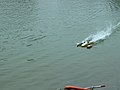
 40 Red RC Speedboat In Action.jpg 800 × 600; 250 KB
-
 41 Trail Of Splashes.jpg 800 × 600; 299 KB
-
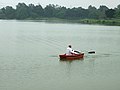
 42 Retrieving Rowboat.jpg 800 × 600; 257 KB
-
 43 Docked White RC Speedboat.jpg 800 × 600; 253 KB
-
 44 Docked Red RC Speedboat.jpg 800 × 600; 276 KB
-
 45 Docked White & Yellow Speedboat.jpg 800 × 600; 256 KB
-
 46 A 3-hull RC Speedboat Ready 2 Go.jpg 800 × 600; 250 KB
-
 47 3-hull RC Speedboat Flying Away.jpg 800 × 600; 347 KB
-
 48 Simply Speedy.jpg 800 × 600; 243 KB
-
 49 Returning 2 Shore.jpg 800 × 600; 239 KB
-
 50 Almost Took Off.jpg 800 × 600; 246 KB
-
 51 Drawing A Circle On The Lake (1).jpg 800 × 600; 250 KB
-
 52 Drawing A Circle On The Lake (2).jpg 800 × 600; 256 KB
-
 53 Uh-oh! Too Fast! Up Side Down Again! Gotta Get It Back.jpg 800 × 600; 241 KB
-
 54 Accident RC Speedboat Recovered.jpg 800 × 600; 529 KB
-
 55 Bringing Accident RC Boat Back.jpg 800 × 600; 253 KB
-
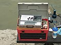 56 Model Boat Fan's Toolbox On Table.jpg 800 × 600; 236 KB
-
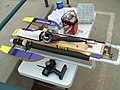 57 Accident Boat Now Sitting On Table.jpg 800 × 600; 276 KB
-
 58 Docked White & Purple RC Speedboat.jpg 800 × 600; 267 KB
-
 59 Self-made Model Boat Retriever.jpg 800 × 600; 279 KB
-
 60 Ducks Resting On Floating Rotten Tree.jpg 800 × 600; 231 KB
-
 62 A Rental 4-wheeler.jpg 800 × 600; 282 KB
-
 63 Squarrel Hole.jpg 800 × 600; 271 KB
-
 64 Fountain On Lake.jpg 800 × 600; 516 KB
-
 65 Paddle Boat.jpg 800 × 600; 283 KB
-
 66 An Artificial Creek.jpg 800 × 600; 276 KB
-
 67 Creek Source Under Big Rocks.jpg 800 × 600; 293 KB
-

-
 USGS Shakemap - 1987 Whittier Narrows earthquake.jpg 1,692 × 2,120; 1.83 MB
-
 Whittier Narrows Basin.JPG 2,272 × 1,704; 1.82 MB
-
 Whittier Narrows Dam Aerial.JPG 1,847 × 1,207; 911 KB
-
 Whittier Narrows dam project (copy), 1957 (EXM-N-12231-007~1).jpg 5,368 × 5,368; 9.16 MB


.jpg)
.jpg)
.jpg)
.jpg)
.jpg)
.jpg)
_-_Everywhere_In_The_Park.jpg)


_-_Sleeping.jpg)

_-_Tidying_Itself_Up.jpg)
_-_Job_Done!_How_Do_I_Look.jpg)

.jpg)
.jpg)
_-_Ducklings_Led_By_Mom.jpg)


_-_4_Ducklings.jpg)


_-_A_Cocky_One.jpg)
_-_Front_Shot.jpg)


.jpg)
.jpg)


,_1957_(EXM-N-12231-007~1).jpg)